Hillsborough, California
| Hillsborough, California | ||
|---|---|---|
| Town in California | ||
| Town of Hillsborough | ||
| ||
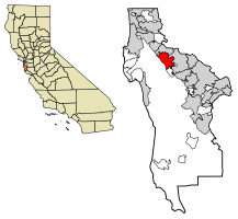 Location of Hillsborough in San Mateo County, California. | ||
 Hillsborough, California Location in the United States | ||
| Coordinates: 37°33′37″N 122°21′23″W / 37.56028°N 122.35639°WCoordinates: 37°33′37″N 122°21′23″W / 37.56028°N 122.35639°W | ||
| Country | United States | |
| State | California | |
| County | San Mateo | |
| Incorporated | May 5, 1910[1] | |
| Area[2] | ||
| • Total | 6.19 sq mi (16.03 km2) | |
| • Land | 6.19 sq mi (16.03 km2) | |
| • Water | 0.00 sq mi (0.00 km2) 0% | |
| Elevation[3] | 322 ft (98 m) | |
| Population (2010)[4] | ||
| • Total | 10,825 | |
| • Estimate (2016)[5] | 11,431 | |
| • Density | 1,846.69/sq mi (713.00/km2) | |
| Time zone | UTC-8 (Pacific) | |
| • Summer (DST) | UTC-7 (PDT) | |
| ZIP code | 94010 | |
| Area code | 650 | |
| FIPS code | 06-33798 | |
| GNIS feature IDs | 1659735, 2412752 | |
| Website |
www | |

Hillsborough is an incorporated town in San Mateo County, California, in the San Francisco Bay Area. It is located 17 miles (27 km) south of San Francisco on the San Francisco Peninsula, bordered by Burlingame to the north, San Mateo to the east, Highlands-Baywood Park to the south, and Interstate 280 to the west. The population was 11,273 as of 2013.
History
Hillsborough is located on the Rancho San Mateo Mexican land grant which was purchased by William Davis Merry Howard, son of a wealthy Hillsborough, New Hampshire, shipping magnate, in 1846. Howard settled his family in this area, which attracted wealthy San Franciscans. Hillsborough is near Burlingame. In 1910, Hillsborough residents voted to incorporate.[6]
Geography and environment
Hillsborough is located at 37°33′37″N 122°21′23″W / 37.560199°N 122.356277°W.[7]
According to the United States Census Bureau, the town has a total area of 6.2 square miles (16 km2), all of it land. The area's considerably winding, hilly topography, and impossibility of a grid layout make Hillsborough notoriously challenging to navigate. Many lots include fairly steep slopes, particularly the western side of the town, with the landscape generally flattening to the east as it descends from the 280 freeway to El Camino Real and the towns of Burlingame and San Mateo.
Two prominent streams drain the mostly wooded slopes of Hillsborough: San Mateo Creek and Cherry Creek. In both cases the upper watersheds are closed-canopy California oak woodlands, with dominant trees of Coast Live Oak, Pacific Madrone and California Bay.
The upper drainage area of San Mateo Creek in Hillsborough contains significant serpentinite outcrops, which are known habitats for several rare plant species including the San Mateo woolly sunflower.[8] Other common plants include toyon, gooseberry, lupine, monkeyflower and coffeeberry. Commonly observed mammals include California mule deer, raccoons, opossum, coyotes, rabbits, squirrels, and skunks.
Hillsborough is bordered by Burlingame to the north, San Mateo to the east, Highlands-Baywood Park to the south, and Interstate 280 to the west.
Hillsborough's landscape is dominated by large homes; the town zoning and subdivision ordinances require a 2,500-square-foot (230 m2) minimum house size and minimum lot size of 0.5 acres (2,000 m2).[9] As a result, there are no apartments, condominiums or townhouses in the city limits; however, it is not unusual for the homes along the eastern edge of Hillsborough to face condominiums in neighboring Burlingame, sharing the ZIP code 94010.
The town has no commercial zoning and thus no businesses within the town limits; the only non-residential properties are the town's four public and three private schools, town and county government facilities, a golf course, a country club, and small parks.
Demographics
| Historical population | |||
|---|---|---|---|
| Census | Pop. | %± | |
| 1920 | 931 | — | |
| 1930 | 1,891 | 103.1% | |
| 1940 | 2,747 | 45.3% | |
| 1950 | 3,552 | 29.3% | |
| 1960 | 7,554 | 112.7% | |
| 1970 | 8,753 | 15.9% | |
| 1980 | 10,372 | 18.5% | |
| 1990 | 10,667 | 2.8% | |
| 2000 | 10,825 | 1.5% | |
| 2010 | 10,825 | 0.0% | |
| Est. 2016 | 11,431 | [5] | 5.6% |
| U.S. Decennial Census[10] | |||
2010
The 2010 United States Census[11] reported that Hillsborough had a population of 10,825. The population density was 1,748.9 people per square mile (675.3/km²). The racial makeup of Hillsborough was 7,178 (66.3%) White, 42 (0.4%) African American, 7 (0.1%) Native American, 3,044 (28.1%) Asian, 23 (0.2%) Pacific Islander, 109 (1.0%) from other races, and 422 (3.9%) from two or more races. Hispanic or Latino of any race were 373 persons (3.4%).
The Census reported that 10,825 people (100% of the population) lived in households, as no other type of residence exists in Hillsborough.
There were 3,693 households, out of which 1,445 (39.1%) had children under the age of 18 living in them, 2,804 (75.9%) were opposite-sex married couples living together, 220 (6.0%) had a female householder with no husband present, 114 (3.1%) had a male householder with no wife present. There were 66 (1.8%) unmarried opposite-sex partnerships, and 34 (0.9%) same-sex married couples or partnerships. 451 households (12.2%) were made up of individuals and 309 (8.4%) had someone living alone who was 65 years of age or older. The average household size was 2.93. There were 3,138 families (85.0% of all households); the average family size was 3.18.
The population was spread out with 2,877 people (26.6%) under the age of 18, 466 people (4.3%) aged 18 to 24, 1,600 people (14.8%) aged 25 to 44, 3,667 people (33.9%) aged 45 to 64, and 2,215 people (20.5%) who were 65 years of age or older. The median age was 47.5 years. For every 100 females, there were 94.8 males. For every 100 females age 18 and over, there were 91.9 males.
There were 3,912 housing units at an average density of 632.0 per square mile (244.0/km²), of which 3,490 (94.5%) were owner-occupied, and 203 (5.5%) were occupied by renters. The homeowner vacancy rate was 1.3%; the rental vacancy rate was 4.2%. 10,206 people (94.3% of the population) lived in owner-occupied housing units and 619 people (5.7%) lived in rental housing units.
2000
As of the census[12] of 2000, there were 10,825 people, 3,689 households, and 3,161 families residing in the town. The population density was 1,738.7 people per square mile (670.9/km²). There were 3,804 housing units at an average density of 611.0 per square mile (235.8/km²).
There were 3,689 households out of which 36.3% had children under the age of 18 living with them, 78.6% were married couples living together, 4.9% had a female householder with no husband present, and 14.3% were non-families. 11.1% of all households were made up of individuals and 7.3% had someone living alone who was 65 years of age or older. The average household size was 2.93 and the average family size was 3.14.
In the town the population was spread out with 25.1% under the age of 18, 4.4% from 18 to 24, 19.7% from 25 to 44, 32.2% from 45 to 64, and 18.6% who were 65 years of age or older. The median age was 46 years. For every 100 females, there were 94.6 males. For every 100 females age 18 and over, there were 91.6 males.
The median income for a household in the town was $193,157, and the median income for a family was $200,000. Full-time male workers have a median income of $100,000+ versus $55,882 for full-time female workers. The per capita income for the town was $98,643. About 1.8% of families and 2.8% of the population were below the poverty line, including 2.7% of those under age 18 and 0.8% of those age 65 or over. According to The Best Places to Live 2007 in Money Magazine, Hillsborough's $263,456 median household income is the highest in the country.
Politics
In 2017, Hillsborough had 7,538 registered voters. Of those, 2,622 (34.8%) were registered Republicans, 2,507 (33.3%) were registered Democrats, and 2,157 (28.6%) had declined to state a political party.[13]
In the state legislature, Hillsborough is in the 13th Senate District, represented by Democrat Jerry Hill, and in the 22nd Assembly District, represented by Democrat Kevin Mullin.[14]
In the United States House of Representatives, Hillsborough is in California's 14th congressional district, represented by Democrat Jackie Speier.[15]
Schools
Hillsborough has its own highly regarded and -ranked public elementary and middle school system, but no public high school. High school-aged children can attend one of several schools in the San Mateo Union High School District, generally assigned by residential address. The town is also home to a small number of independent schools. The Hillsborough school district is ranked as the #1 school district in California and one of the top ten school districts in the country.
- The Nueva School, a nationally recognized independent school serving gifted and talented students.
- Crocker Middle School, a public middle school, located on Ralston Avenue, named after William H. Crocker.
- West Elementary School, a public elementary school, located on Barbara Way.
- South Elementary School, a public elementary, at 303 El Cerrito.
- North Elementary School, a public elementary, at 545 Eucalyptus Avenue.
- The Bridge School, a school serving students with physical and speech impairments.
- Crystal Springs Uplands School, a college preparatory middle and high school.
Landmarks
Primarily a residential suburb of San Francisco, Hillsborough has many mansions and other points of interest within the town's borders dating from the early 20th century.
- Carolands — Built by Harriet Pullman Carolan, heiress to the Pullman railway. At 65,000 ft² (6,000 m²), it is one of the largest residences in the United States and is placed on the National Register of Historic Places.
- ′The Flintstone House′ (a.k.a. the Adobe/Dome/Bubble/Marshmallow/Gumby house) — designed by architect William Nicholson and built in 1976 using sprayed concrete over balloon-shaped forms, now painted a deep/burnt orange color reminiscent of the Golden Gate Bridge's distinctive hue. The house can be seen to the east from the Doran Memorial Bridge, northbound on Highway 280 between the Bunker Hill and Hayne/Black Mountain exits.
- Skyfarm — Built by William H. Crocker, namesake of Crocker middle school, and grandson of Charles Crocker of California's Big Four railroad magnates. Designed by Arthur Brown, Jr., and opened in 1930. Home since the 1960s to The Nueva School.
- Tobin Clark Estate – Originally designed by the noted architect David Adler for Mrs. Celia Tobin Clark, one of the Peninsula’s most prominent families of the early 20th Century
- Uplands — Built by Templeton Crocker, as a gift to his fiancée Helène Irwin, heiress to the C&H Sugar family fortune. Designed by Willis Polk; opened in 1912, with interior of 35,000 ft² (3,250 m²). Home since the 1950s to Crystal Springs Uplands School.
- Western White House — Commissioned by George Randolph Hearst, son of William Randolph Hearst and now privately owned. It, like Hearst Castle was designed by Julia Morgan.[16]
- Junípero Serra statue — Overlooking Highway 280, the statue was built in honor of Father Junípero Serra.
Climate
December is the coolest month with an average high of 60 degrees, and September is the warmest month with an average high of 78 degrees. Hillsborough has a Mediterranean climate (Köppen climate classification Csa), with the vast majority of the precipitation from the months of November to April. On average, Hillsborough receives 17 inches (430 mm) of rain. With coastal mountains to the west of Hillsborough, it is blocked in the winter from much of the rainfall over Half Moon Bay, and in the summer it is blocked from virtually all the fog of the coast. Hillsborough receives an average of 307 days of sunshine annually, with 52 days of recordable precipitation per year.
Notable people
- Roxy Bernstein – sports broadcaster
- Pat Burrell – baseball player
- Alyssa Campanella – Miss California USA 2011
- Sam Chavez – professional golfer
- Jenny Craig – weight loss guru, founder of Jenny Craig, Inc.
- William H. Crocker – founder and president of Crocker National Bank, member of committee that built San Francisco Opera House and Veterans Building
- Bing Crosby – singer, actor, raised his second family in Hillsborough
- Nathaniel Crosby – U.S. Amateur golf champion, son of Bing Crosby
- Eric Dane – actor
- Andre Ethier—baseball player
- Kathy Garver – actress
- Marjorie Gestring – diver, youngest Olympian to win gold medal
- Michael Grimes – managing director at Morgan Stanley
- Patty Hearst – heiress of Hearst newspaper fortune
- William Randolph Hearst I – newspaper publisher, politician, builder of Hearst Castle
- Rickey Henderson – Hall of Fame baseball player
- Charles B. Johnson – former chairman at Franklin Templeton Investments
- Brigitte Lin – Taiwanese actress
- Phyllis Welch MacDonald - actress
- Greg Maddux – Hall of Fame baseball pitcher
- David Marquardt – co-founder of venture capital firm August Capital
- Timothy Francis McCarthy – Former President of Charles Schwab
- Larry Probst – chairman and former CEO of Electronic Arts (EA)
- Alicia Silverstone – actress
- J.T. Snow – baseball player
- Jackie Speier – U.S. Representative from 12th district
- Lucio Tan – businessman
- Bud Tribble – vice president of software technology at Apple Inc., among founders of NeXT, Inc.
- Marshall Tuck – politician
- Troy Tulowitzki – baseball player
- George Tupou V – King of Tonga
- Salote Mafile'o Pilolevu Tuita – Tongan princess, only daughter of former King Tāufaʻāhau Tupou IV[17]
- Siosa'ia Ma'ulupekotofa Tuita – Tongan diplomat and Consul General of San Francisco, husband of Salote Mafile'o Pilolevu Tuita
- Martin Yan – chef, star of TV show "Yan Can Cook," lives with family in Hillsborough
- Jimmy Kimmel – Comedian
Further reading
- Dwyer, Michael Middleton. Carolands. Redwood City, CA: San Mateo County Historical Association, 2006. ISBN 0-9785259-0-6
References
- ↑ "California Cities by Incorporation Date". California Association of Local Agency Formation Commissions. Archived from the original (Word) on November 3, 2014. Retrieved August 25, 2014.
- ↑ "2016 U.S. Gazetteer Files". United States Census Bureau. Retrieved Jul 19, 2017.
- ↑ "Hillsborough". Geographic Names Information System. United States Geological Survey. Retrieved December 3, 2014.
- ↑ "Hillsborough (town) QuickFacts". United States Census Bureau. Retrieved April 7, 2015.
- 1 2 "Population and Housing Unit Estimates". Retrieved June 9, 2017.
- ↑ "Hillsborough history summary". Hillsborough.net. 1910-05-05. Retrieved 2009-08-09.
- ↑ "US Gazetteer files: 2010, 2000, and 1990". United States Census Bureau. 2011-02-12. Retrieved 2011-04-23.
- ↑ Environmental Impact Report for the Hillsborough Highlands Estates, Earth Metrics Report 7803, California State Clearinghouse, November, 1989
- ↑ "Hillsborough City Council Minutes, February 13, 2006 – page 3". Retrieved 2009-08-09.
- ↑ "Census of Population and Housing". Census.gov. Archived from the original on May 12, 2015. Retrieved June 4, 2015.
- ↑ "2010 Census Interactive Population Search: CA – Hillsborough town". U.S. Census Bureau. Retrieved July 12, 2014.
- ↑ "American FactFinder". United States Census Bureau. Retrieved 2008-01-31.
- ↑ CA Secretary of State – Report of Registration – February 10, 2017
- ↑ "Statewide Database". UC Regents. Retrieved November 21, 2014.
- ↑ "California's 14th Congressional District - Representatives & District Map". Civic Impulse, LLC. Retrieved March 13, 2013.
- ↑ Inman, Bradley (April 9, 1995). "The Other White House". SFGate/Examiner. Retrieved September 24, 2014.
- ↑ "Tongans mourn passing of king". San Mateo Daily Journal. 2012-03-20. Retrieved 2012-03-31.
External links
| Wikisource has original text related to this article: |
Municipalities and communities of San Mateo County, California, United States | ||
|---|---|---|
| Cities and towns | 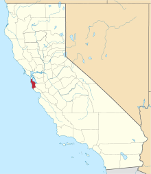 | |
| CDPs | ||
| Unincorporated communities | ||
| Ghost towns | ||
| Bodies of water |
|  |
|---|---|---|
| Counties | ||
| Major cities | ||
| Cities and towns 100k–250k | ||
| Cities and towns 50k–99k | ||
| Cities and towns 25k-50k | ||
| Cities and towns 10k–25k |
| |
| Sub-regions | ||