Saratoga, California
| City of Saratoga | ||
|---|---|---|
| City | ||
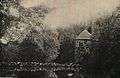
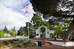 Memorial Arch in downtown Saratoga | ||
| ||
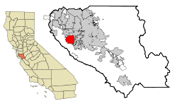 Location in Santa Clara County and the state of California | ||
| Coordinates: 37°16′21″N 122°1′10″W / 37.27250°N 122.01944°WCoordinates: 37°16′21″N 122°1′10″W / 37.27250°N 122.01944°W | ||
| Country |
| |
| State |
| |
| County | Santa Clara | |
| Incorporated | October 22, 1956[1] | |
| Government | ||
| • Mayor | Mary-Lynne Bernald[2] | |
| • Vice Mayor | Manny Cappello[2] | |
| • Council Member | Howard Miller[2] | |
| • Council Member | Emily Lo[2] | |
| • Council Member | Rishi Kumar[2] | |
| Area[3] | ||
| • Total | 12.48 sq mi (32.32 km2) | |
| • Land | 12.48 sq mi (32.32 km2) | |
| • Water | 0.00 sq mi (0.00 km2) 0% | |
| Elevation[4] | 423 ft (129 m) | |
| Population (2010) | ||
| • Total | 29,926 | |
| • Estimate (2016)[5] | 30,767 | |
| • Density | 2,465.50/sq mi (951.95/km2) | |
| Time zone | UTC−8 (Pacific) | |
| • Summer (DST) | UTC−7 (PDT) | |
| ZIP codes | 95070–95071 | |
| Area codes | 408/669 | |
| FIPS code | 06-70280 | |
| GNIS feature IDs | 1656315, 2411832 | |
| Website |
www | |
| Reference no. | 435[6] | |
Saratoga (/ˌsærəˈtoʊɡə/; SARR-ə-TOH-gə)[7] is a city in Santa Clara County, California, United States. It is located on the west side of the Santa Clara Valley, directly west of San Jose, in the San Francisco Bay Area. The population was 29,926 at the 2010 census. Located on the Western edge of the Silicon Valley, Saratoga is known locally for its suburban small-town feel, wineries, and high-end restaurants. Major attractions of Saratoga include Villa Montalvo, Hakone Gardens, and the Mountain Winery.
The 2016 Coldwell Banker Home Listing Report listed Saratoga as the most expensive housing market in the United States.[8] In 2010 Bloomberg Businessweek named Saratoga the most expensive suburb in California.[9] According to CNN Money 70.42% of Saratoga households have an income greater than $100,000.[10] Saratoga also was ranked by Forbes in 2009 as one of America's top 20 most-educated small towns.[11] Bloomberg Businessweek also named Saratoga's zip code 95070 the 18th richest zip code in America in 2011.[12] In 2018, data from the American Community Survey revealed that Saratoga was the 8th wealthiest city in the United States.[13]
History
This area was earlier inhabited by the Ohlone Native Americans. European settlers imposed a displacement and created a settlement of what is now Saratoga in 1847, when William Campbell (father of Benjamin Campbell, the founder of nearby Campbell, California), constructed a sawmill about 2.5 miles (4.0 km) southeast of the present downtown area. An early map noted the area as Campbell's Gap. In 1851 Martin McCarthy, who had leased the mill, built a toll road down to the Santa Clara Valley, and founded what is now Saratoga as McCarthysville.[14] The toll gate was located at the present-day intersection of Big Basin Way and 3rd St., giving the town its first widely used name: Toll Gate. In 1867 the town received a post office under the name of McCarthysville.
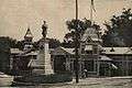
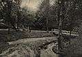
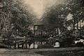
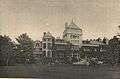
- Saratoga in 1906

Industry soon sprang up and at its pinnacle the town had a furniture factory, grist mill, tannery, and a paper factory. To commemorate this newfound productivity the town was renamed again in 1863 as Bank Mills. In the 1850s Jud Caldwell discovered springs which were called Pacific Congress Springs because the water had a mineral content similar to Congress Springs, in Saratoga Springs, New York. In 1865 the town received its final name, Saratoga, after the city in New York. At the same time a resort hotel called Congress Hall was constructed at the springs, named after the famous resort Congress Hall at Saratoga Springs, New York. California's Congress Hall attracted tourists to the area until it burned down in 1903.[14] These events would eventually lead to Saratoga being listed as a California Historical Landmark in 1950.[6]

Saratoga became agricultural, as did much of the rest of the valley; a few vineyards and orchards from this period remain today. After World War II the town quickly became urbanized, and it incorporated in 1956 mostly to avoid being annexed to San Jose. A slogan during the campaign to incorporate the city of Saratoga was "Keep it rural," according to historian Willys I. Peck. Today the city serves as a bedroom community for upper-middle class Silicon Valley tech workers.
Government
Local
Saratoga is a general law city under California law, meaning that the organization and powers of the city are established by state law. It has a council-manager form of government.
The city council is made up of five members elected by the public. The council appoints a mayor and vice-mayor from its membership, with the vice-mayor serving in the absence of the mayor. The mayor has no veto power, but acts as chairman for council meetings, and serves as a visible head of government. Council members serve four-year terms, with the election of two and three members staggered every two years.,
The city manager is the administrative head of the government, and also serves as city treasurer. The manager's duties include preparing financial reports, submitting an annual budget, managing city employees, seeing that city ordinances are enforced, supervising city property, and investigating complaints against the city. The manager also appoints the city clerk.
In addition to the council and manager, the city has a number of commissions that serve to advise the council on various issues. Commission members are appointed by the council, and serve a maximum of two four year terms. Currently, the city has commissions for finance, youth issues, heritage preservation, the library, parks and recreation, planning, and traffic safety.
State and federal representation
In the California State Legislature, Saratoga is in the 15th Senate District, represented by Democrat Jim Beall, and in the 28th Assembly District, represented by Democrat Evan Low.[15]
In the United States House of Representatives, Saratoga is in California's 18th congressional district, represented by Democrat Anna Eshoo.[16]
Geography
Saratoga is bordered by Cupertino and San Jose to the north, a small portion of Campbell and Los Gatos to the east, and Monte Sereno to the southeast. Saratoga is located at 37°16′21″N 122°01′10″W / 37.272443°N 122.019538°W.[17] According to the United States Census Bureau, the city has a total area of 12.4 square miles (32 km2), all of it land. Within its borders, Saratoga includes lush redwood forests, foothills suitable for wine grapes and sunny valley floor once covered with prune and apricot orchards, now with suburban homes, schools and churches.

Neighborhoods in Saratoga include Brookview and Pride's Crossing in the north part of the city, Blue Hills and Greenbrier in the northwest area, and Congress Springs in the southwestern corner of Saratoga. The Golden Triangle, a name invented by real estate agents, is an area bounded by Saratoga Avenue, Saratoga-Sunnyvale Road and Cox Avenue. The Golden Triangle consists mostly of four-bedroom ranch homes (values ranging between 1 and 3 million dollars) on quarter acre lots gradually being replaced by Mediterranean custom designs. Northeast of the Golden Triangle is a neighborhood known as Saratoga Woods, a small community located behind Prospect High School north of Cox. Bellgrove Circle is a popular neighborhood located next to highway 85. The land of Bellgrove Circle, once used as a vineyard, was previously owned by Paul Masson Winery and is east of Saratoga Avenue and north of Rt 85. Kentfield is south of Rt 85 and also east of Saratoga Avenue. Parker Ranch is a very affluent neighborhood with 1-acre (4,000 m2) minimum lots, west of Saratoga-Sunnyvale Road and up into the hills. The downtown area along Big Basin Way is known as the Village.
Demographics
| Historical population | |||
|---|---|---|---|
| Census | Pop. | %± | |
| 1880 | 297 | — | |
| 1960 | 14,861 | — | |
| 1970 | 26,810 | 80.4% | |
| 1980 | 29,261 | 9.1% | |
| 1990 | 28,061 | −4.1% | |
| 2000 | 29,843 | 6.4% | |
| 2010 | 29,926 | 0.3% | |
| Est. 2016 | 30,767 | [5] | 2.8% |
| U.S. Decennial Census[18] | |||
2010
The 2010 United States Census[19] reported that Saratoga had a population of 29,926. The population density was 2,416.9 people per square mile (933.2/km²). The racial makeup of Saratoga was 16,125 (53.9%) White, 94 (0.3%) African American, 41 (0.1%) Native American, 12,376 (41.4%) Asian, 23 (0.1%) Pacific Islander, 202 (0.7%) from other races, and 1,065 (3.6%) from two or more races. Hispanic or Latino of any race were 1,034 persons (3.5%).
The Census reported that 29,727 people (99.3% of the population) lived in households, 34 (0.1%) lived in non-institutionalized group quarters, and 165 (0.6%) were institutionalized.
There were 10,734 households, out of which 4,024 (37.5%) had children under the age of 18 living in them, 7,893 (73.5%) were opposite-sex married couples living together, 608 (5.7%) had a female householder with no husband present, 213 (2.0%) had a male householder with no wife present. There were 159 (1.5%) unmarried opposite-sex partnerships, and 44 (0.4%) same-sex married couples or partnerships. 1,740 households (16.2%) were made up of individuals and 1,115 (10.4%) had someone living alone who was 65 years of age or older. The average household size was 2.77. There were 8,714 families (81.2% of all households); the average family size was 3.11.
The population was spread out with 7,173 people (24.0%) under the age of 18, 1,390 people (4.6%) aged 18 to 24, 4,678 people (15.6%) aged 25 to 44, 10,598 people (35.4%) aged 45 to 64, and 6,087 people (20.3%) who were 65 years of age or older. The median age was 47.8 years. For every 100 females, there were 95.7 males. For every 100 females age 18 and over, there were 92.6 males.
There were 11,123 housing units at an average density of 898.3 per square mile (346.8/km²), of which 9,258 (86.2%) were owner-occupied, and 1,476 (13.8%) were occupied by renters. The homeowner vacancy rate was 0.7%; the rental vacancy rate was 4.3%. 26,201 people (87.6% of the population) lived in owner-occupied housing units and 3,526 people (11.8%) lived in rental housing units.
|
In 2011 Bloomberg Businessweek reported that the average household income was $237,804 with an average household net worth of $1,516,018.[12]
2000
As of the census[21] of 2000, there are 29,843 people, 10,450 households, and 8,600 families residing in the city. The population density is 951.5/km² (2,465.3/mi²). There are 10,649 housing units at an average density of 339.5/km² (879.7/mi²). The racial makeup of the city is 67.39% White, 0.39% African American, 0.15% Native American, 29.08% Asian, 0.08% Pacific Islander, 0.57% from other races, and 2.33% from two or more races. 3.14% of the population are Hispanic or Latino of any race.
There were 10,450 households out of which 38.7% had children under the age of 18 living with them, 75.0% were married couples living together, 4.9% had a female householder with no husband present, and 17.7% were non-families. 14.3% of all households were made up of individuals and 7.6% had someone living alone who was 65 years of age or older. The average household size was 2.83 and the average family size was 3.13. The population-age distribution is as follows: 26.0% under the age of 18, 4.0% from 18 to 24, 23.8% from 25 to 44, 29.9% from 45 to 64, and 16.3% who were 65 years of age or older. The median age was 43 years. For every 100 females, there were 96.5 males. For every 100 females age 18 and over, there were 92.6 males.
According to a 2007 estimate the median income for a household in the city was $137,270, and the median income for a family was $159,765.[22] Males had a median income of $75,000 versus $66,240 for females. The per capita income for the city was $65,400. About 1.8% of families and 2.8% of the population were below the poverty line, including 3.2% of those under age 18 and 2.6% over 64.
Politics
According to the California Secretary of State, as of February 10, 2017, Saratoga has 20,163 registered voters. Of those, 7,433 (36.9%) are registered Democrats, 5,426 (26.9%) are registered Republicans, and 6,806 (33.8%) have declined to state a political party.[23]
Transportation
Saratoga has several major roads including Saratoga-Sunnyvale Road, Saratoga-Los Gatos Road (Highway 9), Cox Avenue, Saratoga Avenue, Fruitvale Avenue, Pierce Road, Quito Road and Congress Springs Road. The West Valley Freeway (Highway 85) was completed in 1994 and passes through northeast Saratoga. Highway 85 has one onramp/offramp within the city, at Saratoga Avenue; while the original plans for the freeway also included exits at Quito Road and Prospect Avenue, objections by residents kept those interchanges from being constructed. Street signs are brown in color.
Union Pacific Railroad operates freight through the region. The rail line travels parallel to Route 85. Passenger trains operated from 1908 to 1964, delivering commuters to San Francisco in 90 minutes. Saratoga has no passenger train service: it has minimal bus service.
Saratoga also has a zoning code aimed at preserving a semi-rural appearance. Saratoga emphasizes its semi-rural appearance by foregoing street lights and sidewalks on most residential streets. This, in addition to the excellent schools, causes Saratoga to have high housing costs.
The Blue Hills neighborhood of Saratoga has many hiking trails for use by residents that are owned by the City of Saratoga.
2012 rape case
Saratoga drew notoriety for the rape and the subsequent suicide of then-15-year-old Saratoga High School student Audrie Pott in September 2012. The three teenagers charged with sexually assaulting Pott pleaded guilty and served time in juvenile hall for the sexual assault.[24][25][26]
Sister cities
Notable people
- Kerri Walsh, Gold Medal Olympic Athlete in Beach Volleyball
- Joe Murray, an Emmy-winning animator, best known as the creator of Rocko's Modern Life and Camp Lazlo.
- Vienna Teng, Singer
- Devon Graye, Actor who plays Luke in the Nickelodeon movie Merry Christmas, Drake & Josh
- Joan Fontaine, Actress
- Olivia de Havilland, Actress
- Sam Liccardo, San Jose Mayor
- Patrick Marleau, San Jose Sharks player
- James Rumbaugh, Computer scientist
- Abijah McCall, orchardist and inventor of the Fresno Scraper
- Sarah Brown, California artist and daughter of abolitionist John Brown
- Beth Lisick, spoken-word artist, leader of the band The Beth Lisick Ordeal, and author[27]
- Lance Guest, Actor
- Anil Kumar, Inside Trader
- Dan Rusanowsky, San Jose Sharks Radio Play-by-Play Broadcaster
- Steven Spielberg, Filmmaker
- Laney Diggs, professional figure skater
- Michael Burry, American physician and hedge fund manager
- James Williamson, electronics engineer and guitarist of the Stooges
- Stephanie Elam, News Anchor (CNN; NBC)
- Dan Janjigian, actor and bobsledder
Attractions

- Villa Montalvo and Villa Montalvo Arboretum, home of the Montalvo Center for the Arts
- Savannah-Chanelle Vineyards
- Hakone Gardens, a Japanese garden where scenes from the movie Memoirs of a Geisha were filmed
- Madronia Cemetery, final resting place of Mary Ann Day Brown
- Mountain Winery, a seasonal concert venue
- Sanborn County Park, a 3,688 acres (14.92 km2) park
Education
Various public school districts serve Saratoga. At elementary level (grades K to 8) these include Saratoga Union School District, Campbell Union School District, Cupertino Union School District and Moreland School District. High school districts that serve Saratoga include the Los Gatos-Saratoga Joint Union High School District, Fremont Union High School District and Campbell Union High School District. In fact, the famous film-maker Steven Spielberg graduated from Saratoga High, having attended it for his senior year. These districts provide a number of high schools including Saratoga High School, Monta Vista High School (located in Cupertino but servicing a portion of Saratoga), Lynbrook High School (located in San Jose but servicing a portion of Saratoga as well), Prospect High School and Westmont High School (located in San Jose but servicing a portion of Saratoga).
Private schools in the area include Challenger School, Saint Andrew's School, and Sacred Heart School.
West Valley Community College provides college-level education in the district whilst the Santa Clara County Library District operates the Saratoga Library.[28]
References
- ↑ "California Cities by Incorporation Date" (Word). California Association of Local Agency Formation Commissions. Retrieved August 25, 2014.
- 1 2 3 4 5 "City Council". City of Saratoga. Retrieved December 18, 2016.
- ↑ "2016 U.S. Gazetteer Files". United States Census Bureau. Retrieved Jun 28, 2017.
- ↑ "Saratoga". Geographic Names Information System. United States Geological Survey. Retrieved April 15, 2015.
- 1 2 "Population and Housing Unit Estimates". Retrieved June 9, 2017.
- 1 2 "Saratoga". Office of Historic Preservation, California State Parks. Retrieved 2012-10-14.
- ↑ OED
- ↑ Martin, Emmie (September 8, 2016). "The 25 most expensive housing markets in the US". Business Insider. Retrieved July 30, 2017.
- ↑ "Most Expensive Suburbs 2010". Bloomberg. Retrieved July 30, 2017.
- ↑ "Six-figure zip codes". CNN Money. Retrieved July 30, 2017.
- ↑ Detwiler, Jacqueline (January 5, 2009). "In Depth: America's Most Educated Small Towns". Forbes. Retrieved July 30, 2017.
- 1 2 "America's Richest Zip Codes 2011". Bloomberg. December 7, 2011. Retrieved July 30, 2017.
- ↑ "The 10 wealthiest cities in the United States". Tribune Media.
- 1 2 Erwin G. Gudde, William T. Bright (2004). California Place Names: The Origin and Etymology of Current Geographical Names. University of California Press. p. 351. ISBN 978-0-520-24217-3. Retrieved 2010-10-30.
- ↑ "Statewide Database". UC Regents. Retrieved December 14, 2014.
- ↑ "California's 18th Congressional District - Representatives & District Map". Civic Impulse, LLC.
- ↑ "US Gazetteer files: 2010, 2000, and 1990". United States Census Bureau. 2011-02-12. Retrieved 2011-04-23.
- ↑ "Census of Population and Housing". Census.gov. Retrieved June 4, 2015.
- ↑ "2010 Census Interactive Population Search: CA - Saratoga city". U.S. Census Bureau. Retrieved July 12, 2014.
- ↑ "Bay Area Census - City of Saratoga". bayareacensus.ca.gov. Retrieved July 30, 2017.
- ↑ "American FactFinder". United States Census Bureau. Retrieved 2008-01-31.
- ↑ "American FactFinder". Factfinder.census.gov. Retrieved 2012-03-03.
- ↑ Report of Registration as of February 10, 2017 : Registration by Political Subdivision by County, elections.cdn.sos.ca.gov
- ↑ Sanchez, Kris (January 15, 2014). "3 Boys Plead Guilty to Sexually Assaulting Audrie Pott". NBC Bay Area. Retrieved July 30, 2017.
- ↑ Benz, Kellie Ann (July 29, 2017). "Audrie Pott: Settlement remains unfulfilled in wrongful death case". The Mercury News. Retrieved July 30, 2017.
- ↑ "Audrie Pott Foundation". Audrie Pott Foundation. Retrieved July 30, 2017.
- ↑ "Beth Lisick website". bethlisick.com. Retrieved July 30, 2017.
- ↑ "Saratoga Library". Santa Clara County Library District. Retrieved July 30, 2017.
External links
| Wikimedia Commons has media related to Saratoga, California. |
- Official website

- Saratoga News
- Saratoga Community Home Page
- Saratoga Historical Foundation
- Saratoga Timeline
Municipalities and communities of Santa Clara County, California, United States | ||
|---|---|---|
| Cities and towns | 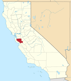 | |
| CDPs | ||
| Unincorporated communities | ||
| CCDs | ||
| Ghost towns | ||
| Bodies of water |
|  |
|---|---|---|
| Counties | ||
| Major cities | ||
| Cities and towns 100k–250k | ||
| Cities and towns 50k–99k | ||
| Cities and towns 25k-50k | ||
| Cities and towns 10k–25k |
| |
| Sub-regions | ||