Danville, California
| Town of Danville | |
|---|---|
| Town in California | |
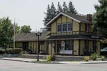
 Clock Tower Square in downtown Danville | |
|
Motto(s): "Small town atmosphere, outstanding quality of life."[1] "Heart of the San Ramon Valley."[1] | |
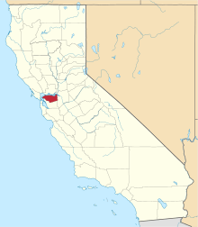
 Location of Danville in Contra Costa County, California. | |
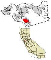
 Town of Danville Location in the United States | |
| Coordinates: 37°49′18″N 122°00′00″W / 37.82167°N 122.00000°WCoordinates: 37°49′18″N 122°00′00″W / 37.82167°N 122.00000°W | |
| Country | United States |
| State | California |
| County | Contra Costa |
| Incorporated | July 1, 1982[2] |
| Government | |
| • Mayor | Newell Arnerich[3] |
| • State senator | Steve Glazer (D)[4] |
| • Assemblymember | Catharine Baker (R)[5] |
| • United States representatives | Mark DeSaulnier (D) and Eric Swalwell (D)[6] |
| Area[7] | |
| • Total | 18.08 sq mi (46.82 km2) |
| • Land | 18.08 sq mi (46.82 km2) |
| • Water | 0.00 sq mi (0.00 km2) 0% |
| Elevation[8] | 358 ft (109 m) |
| Population (2010) | |
| • Total | 42,039 |
| • Estimate (2016)[9] | 44,631 |
| • Density | 2,468.94/sq mi (953.27/km2) |
| Time zone | UTC-8 (Pacific) |
| • Summer (DST) | UTC-7 (PDT) |
| ZIP codes | 94506, 94526 |
| Area code | 925 |
| FIPS code | 06-17988 |
| GNIS feature IDs | 277497, 2412403 |
| Website |
www |
The Town of Danville[10] is located in the San Ramon Valley in Contra Costa County, California. It is one of the incorporated municipalities in California that uses "town" in its name instead of "city". The population was 44,631 in 2016.
Danville hosts a farmer's market each Saturday next to the San Ramon Valley Museum.[11]
The Iron Horse Regional Trail runs through Danville. It was first a railroad that has been converted to an 80-foot (24 m) wide corridor of bike and hike trails as well as controlled intersections. Extending from Pleasanton to Concord, the trail passes through Danville.[12]
Danville is also home to the Village Theatre and Art Gallery, hosting children's theatre, Broadway shows and art discussions.[13]
History
For over 130 years, Danville's history has been one of change and growth.[14] Often referred to as the "Heart of the San Ramon Valley," Danville was first populated by Native Americans who lived next to the creeks and camped on Mount Diablo in the summer. Later it was part of Mission San Jose's grazing land and a Mexican land grant called Rancho San Ramon.
Initially a farming community, the Town of Danville switched from wheat to fruits and nuts after the Southern Pacific Railroad built a spur line through the area in 1891. It developed as a residential suburb starting in 1947 when the first sizable housing tracts were constructed and its population boomed in the 1970s and 1980s.[15]
The Danville Post Office opened in 1860 with hotel owner Henry W. Harris as the first postmaster.[16] Harris reported in 1862 that there were 20 people living in the town proper, with 200 ballots cast in the last general election. Hearing stories of the prosperity to be found in California, people from the mid-west and east began to settle in Danville and the surrounding valleys. Most new residents had been farmers and observed that the valley land was fertile and the weather benign, altogether an ideal place to settle. The 1869 census counted nearly 1800 people in the combined Danville and Lafayette areas. They acquired land from other owners and established their own ranches, farms and other businesses.[1]
Settlers raised cattle and sheep and grew wheat, barley and onions. Later the farms produced hay, a wide variety of fruit crops (apples, plums, pears), walnuts and almonds. In the 1800s horses and wagons hauled these products north to the docks at Pacheco and Martinez, following Road No. 2, which wound by San Ramon Creek and was almost impassable in the rainy season.
Churches, schools, farmers unions and fraternal lodges began as the community evolved. The Union Academy, a private high school begun by the Cumberland Presbyterian Church, served the County from 1859 to 1868, when it burned down. Danville Presbyterian Church was dedicated in 1875, after Protestants voted on what denomination it should be. The new building was described as the handsomest church building in the County by the writers of the day.[1]
In 1873, Danville Grange No. 85 was chartered with Charles Wood elected as the first Worthy Master. The Grange began as a family farmers union and included all the Valley "movers and shakers." It served as the focal point for community social, educational and political activity for years and still meets at its Hall on Diablo Road.[1]
A remarkable number of early Danville buildings remain today such as the houses belonging to the Boone, Osborn, Young, Spilker, Podva, Vecki, Root, Elliott and Hartz families. The original 1874 Grange Hall exists as well, and the original Danville Hotel remains downtown and is currently being renovated as of 2014. Many of the early pioneer names appear on the streets and schools, including Baldwin, Harlan, Wood, Love, Hemme, Boone, Bettencourt and Meese.[1]
When the Southern Pacific Railroad came to the Valley in 1891, Danville changed dramatically. The farmers built warehouses and shipped crops by rail in any kind of weather, and the residents traveled to and from Danville with an ease they had not experienced before.[1]
John Hartz sold 8.65 acres (3.50 ha) of his land for the Danville Depot and granted land access to the station. He then subdivided and sold lots east of the station, shifting the town's focus from Front Street to Hartz Avenue. Eventually, a bank, drug store, saloon, doctor's office and Chinese laundry joined the houses lining the street. The Danville Hotel originally sat across from the station and was moved to face Hartz avenue in 1927.[17]
The twentieth century found Danville affected by the wars, the Spanish flu, the depression and new immigrants. The Valley became a melting pot of Chinese, Portuguese, German, and Japanese immigrants. They often began working in the hay fields or as cooks and gardeners, later becoming blacksmiths, landowners, teachers and storekeepers.
Residents worked diligently to improve their community. In 1910 a public high school district was organized and San Ramon Valley Union High School was built; a library supervised by Lillian Close opened in 1913 with 104 books; St. Isidore's Catholic Church was first established at Hartz and Linda Mesa in 1910; and an Improvement League spearheaded the first streetlights and paved roads in 1915.
Danville continued to be farm country well into the 1940s. The whole Valley had 2,120 people in 1940, growing to 4,630 by 1950. Developments such as Montair and Cameo Acres were built, the water and sewer districts extended their boundaries, and the new I-680 freeway which sliced through Danville in the mid-1960s altered Danville permanently.
The Valley population leaped from 12,700 in 1960 to 15,900 in 1970, to 21,100 in 1975 to 26,500 in 1980. The 1980 census showed that 82 percent of Danville's 26,500 had arrived after 1970. In 2000, Danville's population reached 40,484. Many newly successful individuals particularly from the booming Silicon Valley looked to San Ramon Valley as a safe area with great schools, leading to a large increase of Danville residents.[1]
In 1982, Danville citizens voted to incorporate their community.[1]
Geography
Adjoining towns and cities are San Ramon to the south, Diablo, and Alamo to the north. Walnut Creek is 9 miles (14 km) north, while Pleasanton is about 12 miles (19 km) south.
Interstate 680 serves as the main means of transport out of the town.
According to the United States Census Bureau, the town has a total area of 18.0 square miles (47 km2), all of it land.
Danville is set in a narrow section of the San Ramon Valley with the Las Trampas Ridge to the west and the Diablo Range to the east. The most prominent landmark of Danville is the backdrop of Mount Diablo, which stands to the east at 3,849 feet (1,173 m) and provides a picturesque backdrop for Danville and neighboring towns and cities. Sycamore Creek drains some of the Mount Diablo slopes and flows through Danville.
Places adjacent to Danville, California | |
|---|---|
Climate
Extreme temperatures range from 115 °F (46 °C), recorded in 1950, to 18 °F (-8 °C), recorded in 1990.[18]
| Climate data for Danville, California | |||||||||||||
|---|---|---|---|---|---|---|---|---|---|---|---|---|---|
| Month | Jan | Feb | Mar | Apr | May | Jun | Jul | Aug | Sep | Oct | Nov | Dec | Year |
| Average high °F (°C) | 56 (13) |
61 (16) |
66 (19) |
71 (22) |
77 (25) |
83 (28) |
89 (32) |
88 (31) |
86 (30) |
77 (25) |
64 (18) |
56 (13) |
73 (23) |
| Average low °F (°C) | 39 (4) |
42 (6) |
44 (7) |
46 (8) |
50 (10) |
54 (12) |
57 (14) |
57 (14) |
55 (13) |
50 (10) |
43 (6) |
39 (4) |
48 (9) |
| Average precipitation inches (mm) | 2.87 (72.9) |
2.98 (75.7) |
2.36 (59.9) |
1.01 (25.7) |
0.48 (12.2) |
0.09 (2.3) |
0 (0) |
0.05 (1.3) |
0.22 (5.6) |
0.85 (21.6) |
1.84 (46.7) |
2.58 (65.5) |
15.33 (389.4) |
| Source: [19] | |||||||||||||
Demographics
| Historical population | |||
|---|---|---|---|
| Census | Pop. | %± | |
| 1960 | 3,585 | — | |
| 1970 | 14,059 | 292.2% | |
| 1980 | 26,446 | 88.1% | |
| 1990 | 31,306 | 18.4% | |
| 2000 | 41,715 | 33.2% | |
| 2010 | 42,039 | 0.8% | |
| Est. 2016 | 44,631 | [9] | 6.2% |
| source:[20][21] | |||
According to Business Insider, Danville's 94506 is the 14th wealthiest zip code in America.[22] Danville is one of the wealthiest suburbs of Oakland and San Francisco.[23] Danville also ranks as the 2nd highest-income place in the United States with a population of at least 40,000. It is home to some of the most expensive real estate in the San Francisco Bay Area and the United States. According to CNN Money, Danville's 94506 also has the fourth highest percentage of six-figure income earners in the nation, with 78% of Danville households having at least a six-figure income.[24]
2010
The 2010 United States Census[25] reported that Danville had a population of 42,039. The population density was 2,331.9 people per square mile (900.3/km²). The racial makeup of Danville was 34,942 (83.1%) White, 372 (0.9%) African American, 67 (0.2%) Native American, 4,417 (10.5%) Asian, 68 (0.2%) Pacific Islander, 509 (1.2%) from other races, and 1,664 (4.0%) from two or more races. Hispanic or Latino of any race were 2,879 persons (6.8%).
The Census reported that 41,796 people (99.4% of the population) lived in households, 56 (0.1%) lived in non-institutionalized group quarters, and 187 (0.4%) were institutionalized.
There were 15,420 households, out of which 6,034 (39.1%) had children under the age of 18 living in them, 10,389 (67.4%) were opposite-sex married couples living together, 1,140 (7.4%) had a female householder with no husband present, 449 (2.9%) had a male householder with no wife present. There were 452 (2.9%) unmarried opposite-sex partnerships, and 84 (0.5%) same-sex married couples or partnerships. 2,801 households (18.2%) were made up of individuals and 1,365 (8.9%) had someone living alone who was 65 years of age or older. The average household size was 2.71. There were 11,978 families (77.7% of all households); the average family size was 3.10.
The population was spread out with 11,196 people (26.6%) under the age of 18, 2,117 people (5.0%) aged 18 to 24, 8,050 people (19.1%) aged 25 to 44, 14,628 people (34.8%) aged 45 to 64, and 6,048 people (14.4%) who were 65 years of age or older. The median age was 44.5 years. For every 100 females, there were 93.5 males. For every 100 females age 18 and over, there were 90.3 males.
There were 15,934 housing units at an average density of 883.8 per square mile (341.3/km²), of which 15,420 were occupied, of which 13,020 (84.4%) were owner-occupied, and 2,400 (15.6%) were occupied by renters. The homeowner vacancy rate was 0.8%; the rental vacancy rate was 5.3%. 36,137 people (86.0% of the population) lived in owner-occupied housing units and 5,659 people (13.5%) lived in rental housing units.
|
2000
As of the census[27] of 2000, there were 41,715 people, 14,816 households, and 11,867 families residing in the town. The population density was 2,305.6 people per square mile (890.3/km²). There were 15,130 housing units at an average density of 836.2 per square mile (322.9/km²). The racial makeup of the town was 86.30% White, 0.92% Black or African American, 0.21% Native American, 9.00% Asian, 0.12% Pacific Islander, 0.91% from other races, and 2.55% from two or more races. 4.66% of the population were Hispanic or Latino of any race.
There were 14,816 households out of which 42.2% had children under the age of 18 living with them, 70.7% were married heterosexual couples living together, 7.1% had a female householder with no husband present, and 19.9% were non-families. 15.5% of all households were made up of individuals and 5.6% had someone living alone who was 65 years of age or older. The average household size was 2.78 and the average family size was 3.13.
In the town the population was spread out with 28.6% under the age of 18, 4.2% from 18 to 24, 27.7% from 25 to 44, 29.3% from 45 to 64, and 10.3% who were 65 years of age or older. The median age was 40 years. For every 100 females, there were 94.1 males. For every 100 females age 18 and over, there were 90.6 males.
The median income for a household in the city was $129,515, and the median income for a family was $148,013.[28] Males had a median income of $120,203 versus $75,706 for females. The per capita income for the city was $62,537. About 2.4% of families and 3.6% of the population were below the poverty line, including 3.5% of those under age 18 and 4.3% of those age 65 or over.
Politics
The town of Danville is by far the most Republican political subdivision in heavily Democratic Contra Costa County as well as the entire East Bay. According to the California Secretary of State, as of February 10, 2017, Danville has 29,698 registered voters. Of those, 11,444 (38.5%) are registered Republicans, 10,307 (34.7%) are registered Democrats, and 6,763 (22.8%) have declined to state a political party.[29]
Danville is one of the few remaining cities or towns in the San Francisco Bay Area to have a plurality of Republican registered voters. The others include the affluent towns of Atherton and Hillsborough.
| Year | Democratic | Republican |
|---|---|---|
| 2016[30] | 58.8% 13,969 | 35.2% 8,360 |
| 2012[31] | 49.9% 11,870 | 48.4% 11,521 |
| 2008[32] | 55.3% 13,628 | 43.6% 10,744 |
| 2004[33] | 47.2% 11,106 | 52.0% 12,235 |
| 2000[34] | 43.6% 9,543 | 53.6% 11,734 |
| 1996[35] | 40.6% 8,210 | 52.2% 10,551 |
| 1992[36] | 33.8% 6,591 | 43.8% 8,540 |
| 1988[37] | 31.4% 4,887 | 67.7% 10,538 |
| 1984[38] | 23.8% 3,505 | 75.3% 11,080 |
Government
The Town of Danville is governed by a five-person Town Council. Council members terms are four years. Each year, in December, the council selects a new mayor to take office in January. The current (as of 2018) Mayor of Danville is Newell Arnerich.[1]
Danville has its own police department, which consists of 42 full-time employees, including 30 Officers and 12 civilian support staff. In addition, it has 8 Reserve officers and 32 volunteers. Allen Shields is the current chief.[1]
The San Ramon Valley Fire Protection District (SRVFPD) provides fire protection for Danville. A Special District, it covers 155 square miles includes the following communities: Alamo, Blackhawk, Diablo, the City of San Ramon, the southern boundary of Morgan Territory and the Tassajara Valley, all located in Contra Costa County.[1]
Points of interest
- Museums and historic sites
- Eugene O'Neill National Historic Site - Tao House.
- Museum of the San Ramon Valley (located in the restored 1891 Southern Pacific depot)
- Blackhawk Museum
- Parks
|
|
Kids Interests
- Sweet Street Candy Shop
- Blackhawk Shopping Plaza
Education
- Public schools
Danville Schools are included in the San Ramon Valley Unified School District.
|
|
- Private schools
- San Ramon Valley Christian Academy (Christian)
- St. Isidore's School (Roman Catholic)
- The Athenian School (non-denominational)
- Libraries
The Danville Library of the Contra Costa County Library is located in Danville.[39]
Seasonal events
- The Kiwanis Fourth of July parade attracts over 40,000 people each year
- Hot Summer Nights, which is held the third Thursday on Hartz Avenue in Downtown Danville in July and August, features hundreds of vintage pre-1960s automobiles on display with live music.
- The Fall Arts Festival in late October draws craftspeople and artists with their works of highest quality.
- Annual Christmas Tree lighting
Notable people
- Larry Allen – football player, 14-year NFL career, member of Super Bowl XXX champion Dallas Cowboys
- D'Arcy Carden - actress, The Good Place
- Leroy Chiao – astronaut[40]
- E-40 – rapper[41]
- Elizabeth Emken – politician
- Zach Ertz - tight end for NFL's Philadelphia Eagles; attended Monte Vista High School
- Duane Kuiper - Major League Baseball player and broadcaster
- Jason Lucash – inventor of Origaudio[42]
- Mark Madsen - NBA player and coach; attended San Ramon Valley High School
- Judah Miller - screenwriter and producer
- Murray Miller - screenwriter and producer
- Sara Jane Moore – attempted to assassinate President Gerald Ford[43]
- Bob Myers - general manager of NBA champion Golden State Warriors; born in Danville
- Vince Neil - vocalist of Motley Crue
- Jeff Newman - MLB All-Star baseball player and manager
- Evan O'Dorney – winner of 80th Scripps National Spelling Bee in 2007[44]
- Eugene O'Neill – only Nobel Prize-winning American playwright; wrote the three plays now generally considered his best work while living at Tao House (now the Eugene O'Neill National Historic Site) between 1937 and 1944
- Greg Papa - broadcaster for Oakland Raiders
- A. J. Puckett - baseball player for Chicago White Sox; born in Danville
- Nate Schierholtz - baseball player for Washington Nationals; attended San Ramon Valley High School
- Adam Schiff - U.S. Representative, attended Monte Vista High School
- Russell Simpson - actor
- Gale Storm – actress, star of TV series My Little Margie and The Gale Storm Show
- Chesley B. "Sully" Sullenberger – pilot of US Airways Flight 1549 who made an emergency water landing in the Hudson River and is credited with saving the lives of all 155 crew and passengers[45]
- Nancy Tellem (born 1952), chief media officer and executive chairwoman of Eko
- Christy Turlington - supermodel, attended Monte Vista High School
- Dana Vollmer – Olympic swimmer, 2004, 2012 and 2016 gold medalist
- Joey Wagman - baseball pitcher
- Andre Ward – professional boxer[46]
- Randy Winn - MLB outfielder 1998-2010; attended San Ramon Valley High School
- Chris Wondolowski - soccer player for San Jose Earthquakes and United States men's national soccer team; born in Danville
- Kevin Woo - vocalist for band U-KISS; born in Danville
- David Zuckerman - writer, producer of Family Guy; born in Danville
References
Notes
- 1 2 3 4 5 6 7 8 9 10 11 12 "Town of Danville". Archived from the original on April 24, 2017. Retrieved April 23, 2017.
- ↑ "California Cities by Incorporation Date". California Association of Local Agency Formation Commissions. Archived from the original (Word) on November 3, 2014. Retrieved March 27, 2013.
- ↑ "Town Council". Town of Danville. Archived from the original on January 19, 2015. Retrieved February 4, 2015.
- ↑ "Senators". State of California. Archived from the original on April 24, 2013. Retrieved March 21, 2013.
- ↑ "Members Assembly". State of California. Archived from the original on April 24, 2013. Retrieved March 21, 2013.
- ↑ "California's 15th Congressional District - Representatives & District Map". Civic Impulse, LLC. Retrieved September 27, 2014.
- ↑ "2016 U.S. Gazetteer Files". United States Census Bureau. Archived from the original on August 24, 2017. Retrieved July 19, 2017.
- ↑ "Danville". Geographic Names Information System. United States Geological Survey. Retrieved February 4, 2015.
- 1 2 "Population and Housing Unit Estimates". Archived from the original on May 29, 2017. Retrieved June 9, 2017.
- ↑ "Danville Municipal Code 1-10.1". Archived from the original on February 6, 2010. Retrieved December 7, 2007.
- ↑ "Danville Farmers' Market". Archived from the original on October 12, 2007. Retrieved December 3, 2007.
- ↑ "Iron Horse Regional Trail." East Bay Regional Parks District. Undated. Archived November 12, 2012, at the Wayback Machine. Accessed 2018-03-10
- ↑ "The Village Theater". Archived from the original on November 29, 2007. Retrieved December 3, 2007.
- ↑ "Archived copy". Archived from the original on December 14, 2009. Retrieved 2011-06-27.
- ↑ "A Town is Born". Archived from the original on August 30, 2007. Retrieved December 3, 2007.
- ↑ Durham, David L. (1998). California's Geographic Names: A Gazetteer of Historic and Modern Names of the State. Clovis, Calif.: Word Dancer Press. p. 622. ISBN 1-884995-14-4.
- ↑ http://www.ci.danville.ca.us/Planning/Development_Applications/Danville_Hotel/%20The%20Danville%20Hotel%5Bpermanent+dead+link%5D
- ↑ "Monthly Averages for Danville, CA (94506)". The Weather Channel. Archived from the original on July 20, 2014. Retrieved February 29, 2012.
- ↑ "Monthly Averages for Danville, CA (94506)". Weather.com. Archived from the original on July 20, 2014. Retrieved February 11, 2013.
- ↑ "CENSUS OF POPULATION AND HOUSING (1790-2000)". U.S. Census Bureau. Archived from the original on July 8, 2010. Retrieved July 30, 2010.
- ↑ Area reported as Alamo-Danville during the 1970 census, which recorded a population of 14,059. (The separate communities of Alamo and Danville were not returned separately by the census).
2011 estimate Archived February 1, 2015, at the Wayback Machine. - ↑ "The 15 Wealthiest Zip Codes In America". Business Insider. Archived from the original on March 26, 2017. Retrieved March 25, 2017.
- ↑ "California Towns Top the Nation in Per Capita Spending on Clothing on Pinpoint Demographics — 2011 List". pr.com. Archived from the original on May 24, 2017. Retrieved May 1, 2018.
- ↑ "Six-figure zip codes". CNN Money. Retrieved August 7, 2018.
- ↑ "2010 Census Interactive Population Search: CA - Danville town". U.S. Census Bureau. Archived from the original on September 4, 2015. Retrieved July 12, 2014.
- ↑ "Demographic Profile Bay Area Census". Archived from the original on March 30, 2006.
- ↑ "American FactFinder". United States Census Bureau. Archived from the original on September 11, 2013. Retrieved 2008-01-31.
- ↑ Bureau, U.S. Census. "American FactFinder - Community Facts". factfinder.census.gov. Retrieved May 1, 2018.
- ↑ "CA Secretary of State – Report of Registration – February 10, 2017" (PDF). ca.gov. Archived (PDF) from the original on May 12, 2017. Retrieved May 1, 2018.
- ↑ http://elections.cdn.sos.ca.gov/sov/2016-general/ssov/pres-by-political-districts.pdf
- ↑ http://elections.cdn.sos.ca.gov/sov/2012-general/ssov/pres-by-political-districts.pdf
- ↑ http://elections.cdn.sos.ca.gov/sov/2008-general/ssov/5-pres-by-political-districts.pdf
- ↑ http://elections.cdn.sos.ca.gov/sov/2004-general/ssov/pres_general_ssov_all.pdf
- ↑ http://elections.cdn.sos.ca.gov/sov/2000-general/ssov/pol-dis.pdf
- ↑ http://elections.cdn.sos.ca.gov/sov/1996-general/ssov/president-pol-district.pdf
- ↑ http://elections.cdn.sos.ca.gov/sov/1992-general/ssov/ssov-complete.pdf
- ↑ https://archive.org/details/statementofvote81988cali
- ↑ https://archive.org/details/statementofvote61984cali
- ↑ "Danville Library Archived October 12, 2011, at Wikiwix." Contra Costa County Library. Retrieved on April 1, 2010.
- ↑ "Leroy Chiao Biography on NASA". Archived from the original on December 29, 2007. Retrieved December 3, 2007.
- ↑ ["http://www.pressdemocrat.com/news/1860666-181/five-things-to-know-about?sba=AAS" ""Five things to know about rapper E-40""] Check
|url=value (help). Archived from the original on May 1, 2018. Retrieved December 16, 2017. - ↑ Keene, Lauren (May 7, 2011). "UCD graduate, partner win $150,000 investment on 'Shark Tank'". The Davis Enterprise.
- ↑ "Don't Blame It On Danville". Archived from the original on June 3, 2006. Retrieved 2007-12-03.
- ↑ Coile, Zachary (June 1, 2007). "Danville boy wins Scripps Spelling Bee". San Francisco Chronicle. Archived from the original on May 27, 2011. Retrieved February 11, 2013.
- ↑ Branch, Kirsten (September 27, 2010). "CityRead 2010 Features Capt. 'Sully' Sullenberger's Book, 'Highest Duty'" Archived June 18, 2012, at the Wayback Machine.. Patch Media.
- ↑ Tafur, Vic (May 21, 2014). "Andre Ward's toughest fights are outside the ring". San Francisco Chronicle. Archived from the original on October 2, 2016. Retrieved September 30, 2016.
Sources
External links
| Bodies of water |
|  |
|---|---|---|
| Counties | ||
| Major cities | ||
| Cities and towns 100k–250k | ||
| Cities and towns 50k–99k | ||
| Cities and towns 25k-50k | ||
| Cities and towns 10k–25k |
| |
| Sub-regions | ||