Mesa, Arizona
| Mesa, Arizona | ||
|---|---|---|
| City | ||
| City of Mesa | ||
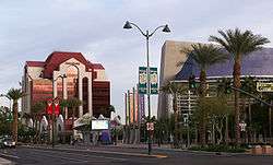 Mesa Bank and Mesa Arts Center building in downtown Mesa | ||
| ||
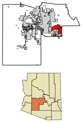 Location of Mesa in Maricopa County, Arizona | ||
 Mesa Location in the United States | ||
| Coordinates: 33°24′54″N 111°49′53″W / 33.41500°N 111.83139°WCoordinates: 33°24′54″N 111°49′53″W / 33.41500°N 111.83139°W | ||
| Country | United States | |
| State | Arizona | |
| County | Maricopa | |
| Founded | 1878 | |
| Government | ||
| • Mayor | John Giles (R) | |
| Area[1] | ||
| • City | 138.63 sq mi (359.05 km2) | |
| • Land | 137.88 sq mi (357.10 km2) | |
| • Water | 0.75 sq mi (1.95 km2) | |
| Elevation | 1,243 ft (378 m) | |
| Population (2010)[2] | ||
| • City | 439,041 | |
| • Estimate (2017)[3] | 496,401 | |
| • Rank | US: 36th | |
| • Density | 3,514.66/sq mi (1,357.01/km2) | |
| • Urban | 3,629,114 (US: 12th) | |
| • Metro | 4,574,531 (US: 12th) | |
| Time zone | UTC−7 (MST (no DST)) | |
| ZIP codes | 85200-85299 | |
| Area code(s) | 480 602 | |
| FIPS code | 04-46000 | |
| Website |
www | |
Mesa (/ˈmeɪsə/ MAY-sə) is a city in Maricopa County, in the U.S. state of Arizona. It is a suburb located about 20 miles (32 km) east of Phoenix. Mesa is the central city of the East Valley section of the Phoenix Metropolitan Area. It is bordered by Tempe on the west, the Salt River Pima-Maricopa Indian Community on the north, Chandler and Gilbert on the south along with Queen Creek, and Apache Junction on the east.
Mesa is the third-largest city in Arizona, after Phoenix and Tucson, and the 36th-largest city in the US. The city is home to 439,041 people as of 2010 according to the Census Bureau. Mesa is home to numerous higher education facilities including the Polytechnic campus of Arizona State University.
History
The history of Mesa dates back at least 2,000 years to the arrival of the Hohokam people. The Hohokam, whose name means "All Used Up" or "The Departed Ones", built the original canal system. The canals were the largest and most sophisticated in the prehistoric New World. Some were up to 90 feet (27 m) wide and 10 feet (3.0 m) deep at their head gates, extending for as far as 16 miles (26 km) across the desert. By A.D. 1100 water could be delivered to an area over 110,000 acres (450 km2), transforming the Sonoran Desert into an agricultural oasis. By A.D. 1450, the Hohokam had constructed hundreds of miles of canals many of which are still in use today.[4]
After the disappearance of the Hohokam and before the arrival of the early settlers little is known, as explorers did not venture into this area. By the late 19th century near present-day Mesa, U.S. Army troops subdued the Apache opening the way for settlement.[5]
Mormon pioneer Daniel Webster Jones led an expedition to found a Mormon settlement in Arizona. Leaving St. George, Utah in March 1877, Jones and others arrived at Lehi, an area within the northern edge of present-day Mesa. Jones had been asked by Mormon officials to direct a party of people in establishing a settlement in Arizona. This settlement was initially known as Jonesville and Fort Utah and did not receive the name of Lehi until 1883, when it was adopted on the suggestion of Brigham Young, Jr.[6]
At the same time, another group dubbed the First Mesa Company arrived from Utah and Idaho. Their leaders were named Francis Martin Pomeroy, Charles Crismon, George Warren Sirrine and Charles I. Robson. Rather than accepting an invitation to settle at Jones' Lehi settlement, they moved to the top of the mesa that serves as the city's namesake. They dug irrigation canals, some of which were over the original Hohokam canals, and by April 1878, water was flowing through them.[7] The Second Mesa Company arrived in 1879 and settled to the west of where the First Mesa Company settled in 1880, due to lack of available farmland. This settlement was called Stringtown.[8]
On July 17, 1878, Mesa City was registered as a 1-square-mile (2.6 km2) townsite. The first school was built in 1879. In 1883, Mesa City was incorporated with a population of 300 people. Dr. A. J. Chandler, who would later go on to found the city of Chandler, worked on widening the Mesa Canal in 1895 to allow for enough flow to build a power plant. In 1917, the city of Mesa purchased the utility company. The revenues from the company provided enough for capital expenditures until the 1960s. During the Great Depression, WPA funds provided paved streets, a new hospital, a new town hall and a library.[9]
With the opening of Falcon Field and Williams Field in the early 1940s, more military personnel began to move into the Mesa area. With the advent of air conditioning and the rise of tourism, population growth exploded in Mesa as well as the rest of the Phoenix area. Industry—especially early aerospace companies—grew in the 1950s and 1960s. As late as 1960, half of the residents of Mesa made a living with agriculture, but this has declined substantially as Mesa's suburban growth continued on track with the rest of the Phoenix metro area.[10]
In 1990, the Census Bureau reported city's population as 10.9% Hispanic and 84.9% non-Hispanic white.[11]
Geography
Defining east and west Mesa
Due to Mesa's extremely long east to west travel distance, in excess of 18 miles (29 km)[12] and large land area 133.13 square miles (344.8 km2), locations in Mesa are often referred to as residing within either East Mesa or West Mesa.[13][14][15]
Commonly accepted boundaries
Center Street
Mesa employs a grid system for street numbering that is different from that used in Phoenix and other portions of the metropolitan area. Center Street, running north to south, bisects Mesa into eastern and western halves and serves as the east and west numbering point of origin within Mesa. Streets west of Center St., such as W. University Drive or W. Main St. are considered to be in West Mesa, whereas streets east of Center St., such as E. University or E. Main St., are considered to be in East Mesa.[16]
Mesa Drive
Mesa Drive, running north to south and bisecting Mesa into east and west sections, is located 0.5 miles (800 m) east of Center Street, and serves as the zip code boundary between the 85281, 85201, 85202, and 85210 zip codes of Western Mesa and the 85203, 85204, 85205, 85206, 85207, 85208, 85209, 85212, 85213, 85215, 85220, and 85242 zip codes of Eastern Mesa.[17]
Country Club Drive
Country Club Drive, running north to south and bisecting Mesa into east and west sections, is located 0.5 miles (800 m) west of Center St, and serves as the jurisdictional boundary between Arizona's 5th and 6th congressional districts.[18] Note that this same road (as Arizona Avenue) serves as the official east and west numbering point of origin within the city of Chandler, located south of Mesa.
Climate
Located in the Sonoran Desert, Mesa has a hot desert climate (Köppen: BWh), with mild winters and very hot summers. The hottest month is July, with an average high of 106 °F (41 °C) and an average low of 77 °F (25 °C). The coldest month is December , with an average high of 67 °F (19 °C) and an average low of 41 °F (5 °C).[19]
| Climate data for Mesa, Arizona | |||||||||||||
|---|---|---|---|---|---|---|---|---|---|---|---|---|---|
| Month | Jan | Feb | Mar | Apr | May | Jun | Jul | Aug | Sep | Oct | Nov | Dec | Year |
| Record high °F (°C) | 89 (32) |
95 (35) |
99 (37) |
106 (41) |
118 (48) |
116 (47) |
119 (48) |
115 (46) |
113 (45) |
107 (42) |
97 (36) |
86 (30) |
119 (48) |
| Average high °F (°C) | 67 (19) |
71 (22) |
77 (25) |
85 (29) |
94 (34) |
104 (40) |
106 (41) |
104 (40) |
99 (37) |
89 (32) |
75 (24) |
67 (19) |
87 (30) |
| Average low °F (°C) | 41 (5) |
45 (7) |
49 (9) |
54 (12) |
61 (16) |
70 (21) |
77 (25) |
76 (24) |
70 (21) |
59 (15) |
47 (8) |
40 (4) |
57 (14) |
| Record low °F (°C) | 15 (−9) |
19 (−7) |
24 (−4) |
30 (−1) |
37 (3) |
43 (6) |
54 (12) |
51 (11) |
40 (4) |
30 (−1) |
22 (−6) |
17 (−8) |
15 (−9) |
| Average precipitation inches (mm) | 1.01 (25.7) |
1.03 (26.2) |
1.19 (30.2) |
0.33 (8.4) |
0.17 (4.3) |
0.06 (1.5) |
0.89 (22.6) |
1.14 (29) |
0.89 (22.6) |
0.81 (20.6) |
0.77 (19.6) |
0.98 (24.9) |
9.27 (235.6) |
| Source: The Weather Channel[19] | |||||||||||||
Demographics
| Historical population | |||
|---|---|---|---|
| Census | Pop. | %± | |
| 1900 | 722 | — | |
| 1910 | 1,692 | 134.3% | |
| 1920 | 3,036 | 79.4% | |
| 1930 | 3,711 | 22.2% | |
| 1940 | 7,224 | 94.7% | |
| 1950 | 16,790 | 132.4% | |
| 1960 | 33,772 | 101.1% | |
| 1970 | 63,049 | 86.7% | |
| 1980 | 152,404 | 141.7% | |
| 1990 | 288,104 | 89.0% | |
| 2000 | 396,375 | 37.6% | |
| 2010 | 439,041 | 10.8% | |
| Est. 2017 | 496,401 | [3] | 13.1% |
| U.S. Decennial Census[20] | |||
According to the 2010 Census, the racial composition of Mesa was as follows:[21]
- White: 77.1% (Non-Hispanic Whites: 64.3%)
- Hispanic or Latino (of any race): 26.5%
- Black or African American: 3.5%
- Two or more races: 3.4%
- Native American: 2.4%
- Asian: 1.9% (0.5% Filipino, 0.3% Chinese, 0.3% Vietnamese, 0.3% Indian, 0.1% Korean, 0.1% Japanese)
- Native Hawaiian and Other Pacific Islander: 0.4%
- Some other race: 5.8%
As of the census of 2010, there were 439,041 people, 146,643 households, and 99,863 families residing in the city. The population density was 3,171.3 people per square mile (1,224.4/km²). There were 175,701 housing units at an average density of 1,405.7 per square mile (542.8/km²).
The racial make-up of the city was 81.6% White, 2.4% Black or African American, 2.2% Native American, 2.00% Asian, 0.10% Pacific Islander, 9.3% from other races, and 1.30% from two or more races. 24.0% of the population were Hispanic or Latino of any race.
There were 146,643 households out of which 33.4% had children under the age of 18 living with them, 52.7% were married couples living together, 10.6% had a female householder with no husband present, and 31.9% were non-families. 24.2% of all households were made up of individuals and 9.1% had someone living alone who was 65 years of age or older. The average household size was 2.68 and the average family size was 3.20.
The age distribution was 27.3% under 18, 11.2% from 18 to 24, 29.7% from 25 to 44, 18.4% from 45 to 64, and 13.3% who were 65 or older. The median age was 32 years. For every 100 females, there were 98.2 males. For every 100 females age 18 and over, there were 95.6 males.
The median income for a household in the city was $42,817, and the median income for a family was $49,232. Males had a median income of $35,960 versus $27,005 for females. The per capita income for the city was $19,601. About 6.2% of families and 8.9% of the population were below the poverty line, including 10.7% of those under age 18 and 7.1% of those age 65 or over. Mesa's residents exhibit a great deal of economic diversity, with low-income areas constructed somewhat close to high-scale neighborhoods with expensive custom homes. The neighborhood "Marlborough Mesa" has won a community award.
Economy
Top employers
According to the City's 2015 Comprehensive Annual Financial Report,[22] the top employers in the city are:
| # | Employer | # of employees |
|---|---|---|
| 1 | Banner Health System | 9,573 |
| 2 | Mesa Public Schools | 8,500 |
| 3 | Boeing | 4,700 |
| 4 | City of Mesa | 3,545 |
| 5 | Walmart | 2,507 |
| 6 | Gilbert Public Schools | 1,300 |
| 7 | Fry's Food and Drug | 1,087 |
| 8 | Mesa Community College | 1,002 |
| 9 | The Home Depot | 963 |
| 10 | Maricopa County Government | 902 |
Cultural attractions
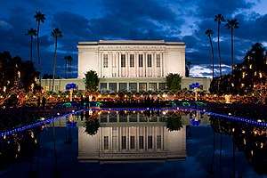
- Mesa Arizona Temple, a large LDS temple, where an Easter Pageant is held every spring
- HoHoKam Park of the Cactus League, home of the Oakland Athletics and former home of the Chicago Cubs during spring training, the WAC Baseball Tournament and former summer home to the now defunct Mesa Miners professional baseball team of the Golden Baseball League
- Sloan Park, opened in 2014 as the new Cactus League spring training home of the Chicago Cubs
- Mesa Arts Center
- Mesa Amphitheater
- Museums
- i.d.e.a. Museum formerly Arizona Museum for Youth
- Commemorative Air Force Arizona Wing Aircraft Museum, located at Falcon Field – B-17 Sentimental Journey
- Mesa Contemporary Arts Museum, Mesa Arts Center
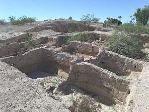
- Archeological sites
- Mesa Grande Ruins
- Park of the Canals
- Public libraries
- Main Library (MN)
- Dobson Ranch Branch (DR)
- Mesa Express Library (MEL)
- Red Mountain Branch (RM)
- Water parks
- Golfland Sunsplash waterpark on U.S. 60
- The only highrise in Mesa is the Bank of America (formerly Western Savings) building near Fiesta Mall.
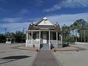
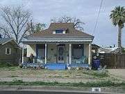
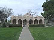
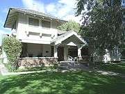
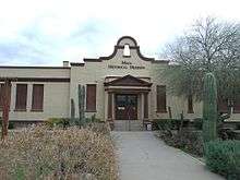
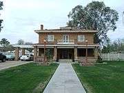
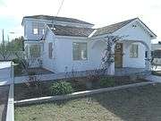
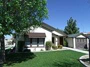
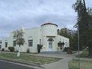
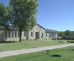
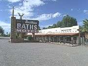
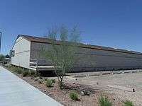
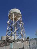
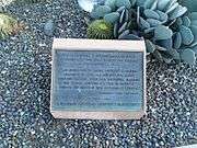
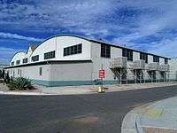
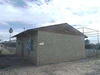
Historic properties in Mesa
Numerous properties in the city are considered to be historical and have been included either in the National Register of Historic Places[23] or the listings of the Mesa Historic Properties. The following are images of some of these properties with a short description.
(NRHP = National Register of Historic Places)
(MHP = Mesa Historic Properties)[24]


(NRHP = National Register of Historic Places)
(MHP = Mesa Historic Properties)
-1.JPG)
_Sealed_entrance-5.JPG)
-2.JPG)
_Tony_the_Marine_-3.JPG)
Parks and recreation
Mesa has over 2,280 acres of parkland in the city limits. Its largest is Red Mountain Park which spans 1,146 acres. It includes a lake, playgrounds, a basketball court and a cement volleyball court.[25]
Golf
Mesa is home to numerous championship golf courses, including the original course in town, Mesa Country Club.[26] This course was founded in the late 1940s by the original leaders of the town, and "Country Club Drive", the most prominent street in Mesa, was at one point the modest entrance to the club.
West Mesa
The Fiesta Mall is located in West Mesa, and owned by Westcor. Its anchors are Sears and Best Buy. It is located near several shopping centers, Mesa's Bank of America,[27] and other retail stores, banks, and restaurants. An expansion of the mall has been planned.[28]
Mesa Riverview is a new outdoor destination retail center in the northwestern corner of the city, near Loop 202 and Dobson Road. At build-out the center will include 1,300,000 square feet (120,000 m2) of retail space.[29] Its anchors include Bass Pro Shops, Cinemark Theaters, Wal-Mart, and Home Depot.
East Mesa
Located in East Mesa is Superstition Springs Business Park.[30] It includes the Superstition Springs Center, a shopping mall owned by Westcor. It features an outdoor amphitheatre and fountain which convert to a stage. Anchor stores at the mall are Dillard's, JCPenney, Macy's, and Sears. Mission Community Church, previously known as Superstition Springs Community Church, was initially named after this business park.[31]
Special Olympics
Mesa is a delegation of Special Olympics Arizona. This team includes track & field, kayaking, swimming, basketball, bowling, and golf.
Education
Almost all of the city of Mesa is served by public schools operated by Mesa Public Schools; however, a small southern portion is served by the Gilbert Public Schools and the Queen Creek Unified School District, and a small western portion is served by the Tempe Elementary School District and the Tempe Union High School District.
Mesa is home to Mesa Community College, the largest of the Maricopa Community Colleges, which enrolls over 24,000 full and part-time students. The Polytechnic campus of Arizona State University lies in southeast Mesa. This satellite campus enrolls over 6,000 undergraduate and graduate students in scientific and engineering fields. A. T. Still University operates an Osteopathic Medical School in Mesa. The aviation school CAE Global Academy Phoenix is located in Mesa.
After launching a higher education initiative in 2012, Mesa became home to branch campuses of five private, liberal arts instituations: Albright College, Westminster College, Benedictine University, Upper Iowa University and Wilkes University.[32] Two have since left (Albright College and Westminster College), while a third, Wilkes University, recently announced it would move entirely online.[33]
Transportation

Several area freeways serve the Mesa area, such as U.S. Route 60, locally known as the Superstition Freeway, which runs between Apache Junction and Phoenix. It is also served by SR 87 and bypass loops Loop 101, which skirts the western city limits as the Price Freeway, and Loop 202, which bypasses the city on the north and east. Public transportation is provided by Valley Metro with Sunday service available on Routes 40-Apache/Main, 61-Southern, 96-Dobson, 108-Elliot, 112-Country Club/Arizona, 156-Chandler/Williams Field, and 184-Power; until July 2008, Mesa was the largest U.S. city with no public transit service on Sundays.
Mesa is connected to the Valley Metro Rail. The light rail in Mesa spans about four miles from Sycamore/Main St in the west of the city, through downtown to Mesa Dr/Main St.
Air service in the city is provided by two airports. Falcon Field, located in the northeastern part of the area, was established as a training field for British RAF pilots during World War II and was transferred to the city at the end of the war. Falcon Field has 605 aircraft based there.[34] Boeing builds the AH-64 Apache attack helicopter at a facility adjoining Falcon Field. Phoenix-Mesa Gateway Airport is located in the far southeastern area of the city, and provides alternate but limited air service when compared to Sky Harbor International Airport. Phoenix-Mesa Gateway was formerly Williams Gateway Airport, and before that, Williams Air Force Base, which closed in 1993. Williams Gateway was announced as a new Focus City for Allegiant Air. Service started October 25, 2007.
Notable people
- Tom Linton, Jim Adkins, Rick Burch, Zach Lind – musicians, part of the band from Mesa, Jimmy Eat World[35]
- Travis Alexander – murder victim
- Beau Allred – professional baseball pitcher [36]
- Janice Merrill Allred – author[37]
- Helen Andelin – author
- Authority Zero – punk rock band[35]
- John Beck – professional football player
- Mike Brown – professional basketball coach[38]
- Marcus Brunson – professional sprinter
- Austin Gibbs – musician[39]
- Max Hall – professional football player
- Mickey Hatcher – professional baseball player
- Carl Hayden – Arizona senator, and its first representative in the House; died in Mesa on January 25, 1972[40]
- Todd Heap – professional football player
- Jamar Hunt – professional football player[41]
- Misty Hyman – Olympic gold medalist in swimming
- Julie Ertz – world champion soccer player
- Rudy Lavik – college basketball coach
- Mike Lee – United States Senator
- Albie Lopez – professional baseball player[42]
- Brad Mills – professional baseball pitcher
- Carolyn Morris – professional baseball player (A.A.G.P.B.L.) [43]
- Buck Owens – singer, member of the Country Music Hall of Fame
- John Jacob Rhodes – politician, House Minority Leader of the U.S. House of Representatives
- John Jacob Rhodes III – politician, former member of the U.S. House of Representatives
- Larry Schweikart – author
- Jake Shears – lead male singer for the pop band Scissor Sisters
- Jack Taylor – mayor of Mesa from 1966 to 1972; thereafter a member, consecutively, of both houses of the Arizona State Legislature; interred at Mesa City Cemetery[44]
- Lynn Toler – judge for Divorce Court
- Don Taylor Udall – state legislator and judge
- Brooke White – singer-songwriter and fifth place finalist on the seventh season of American Idol
- Danny White – professional football player, Arizona Athlete of the Century (20th)
- Wilford "Whizzer" White – professional football player
- Roger L. Worsley – educator, formerly with Mesa High School and Mesa Community College
Sister cities
Mesa has five sister cities, as designated by Sister Cities International:


See also
References
- ↑ "2016 U.S. Gazetteer Files". United States Census Bureau. Retrieved July 18, 2017.
- ↑ "American FactFinder". United States Census Bureau. Retrieved June 18, 2012.
- 1 2 "American FactFinder". Retrieved May 26, 2018.
- ↑ "A Brief History of Mesa, Arizona: Hohokam", Mesalibrary.org, City of Mesa Library, July 2003, archived from the original on March 7, 2012, retrieved March 13, 2012
- ↑ Bourke, John, Battle With The Apache, 1872
- ↑ Jenson, Andrew (1941), Encyclopedic History of the Church of Jesus Christ of Latter-day Saints, Salt Lake City: Deseret News Publishing Company, p. 426
- ↑ "A Brief History of Mesa, Arizona: First Mesa Company", Mesalibrary.org, City of Mesa Library, July 2003, archived from the original on October 7, 2011, retrieved March 13, 2012
- ↑ "A Brief History of Mesa, Arizona: Second Mesa Company", Mesalibrary.org, City of Mesa Library, July 2003, archived from the original on October 7, 2011, retrieved March 13, 2012
- ↑ "A Brief History of Mesa, Arizona: Mesa City – 1878 to Depression", Mesalibrary.org, City of Mesa Library, July 2003, archived from the original on March 7, 2012, retrieved March 13, 2012
- ↑ "A Brief History of Mesa, Arizona: World War II to Present", Mesalibrary.org, City of Mesa Library, July 2003, archived from the original on March 7, 2012, retrieved March 13, 2012
- ↑ "Race and Hispanic Origin for Selected Cities and Other Places: Earliest Census to 1990". U.S. Census Bureau. Archived from the original on August 6, 2012.
- ↑ Yahoo maps
- ↑ "Search: west mesa", City of Mesa – Search Page, Mesaaz.gov, retrieved July 2, 2010
- ↑ "West Mesa Park-and-ride Project No. 06-045-001", Transportation Advisory Board Report (PDF), City of Mesa, April 21, 2009, archived from the original (PDF) on July 21, 2011
- ↑ "West Mesa crime spree ends in arrest", Mesaaz.gov, City of Mesa, Mesa Police Department – Press Release Archive, archived from the original on May 28, 2010, retrieved July 2, 2010
- ↑ http://maps.yahoo.com/#mvt=m&lat=33.414824&lon=-111.831545&zoom=15&q1=mesa%2C%20az%5Bunreliable+source?%5D
- ↑ "Mesa ZIP codes" (PDF), mesaaz.gov, City of Mesa, October 15, 2009, archived from the original (PDF) on February 27, 2012, retrieved March 13, 2012
- ↑ "Arizona's 5th Congressional District & Map", govtrack.us, GovTrack, January 3, 2011, retrieved March 13, 2012
- 1 2 Monthly Averages for Mesa, AZ (85202), Weather.com, retrieved March 13, 2012
- ↑ "Census of Population and Housing". Census.gov. Archived from the original on May 12, 2015. Retrieved June 4, 2016.
- ↑ Factfinder2.census.gov, United States Census Bureau, archived from the original on May 20, 2011
- ↑ "City of Mesa 2015 Comprehensive Annual Financial Report" (PDF). City of Mesa. p. 151. Retrieved March 24, 2016.
- ↑ National Register of Historic Places
- ↑ Mesa Historic Properties Archived June 14, 2013, at WebCite
- ↑ "Red Mountain Park" Archived September 1, 2013, at the Wayback Machine. City of Mesa, Arizona. Retrieved on July 9, 2013.
- ↑ Mesa Country Club
- ↑ Boyle, Tim (April 2001), A Big Bang in Downtown, or The History of the Financial Plaza, retrieved March 13, 2012
- ↑ Fiesta Mall – Center Redevelopment, archived from the original on December 20, 2008, retrieved April 6, 2008
- ↑ Mesa Riverview – Center Information, archived from the original on March 12, 2008, retrieved April 6, 2008
- ↑ "Superstition Springs Business Park Trades for $13.98M". AZ Big Media. Retrieved June 4, 2015.
- ↑ "Our History". Mission Community Church. Retrieved June 4, 2015.
- ↑ Higher Education Initiative Archived July 8, 2014, at the Wayback Machine.
- ↑ http://www.azcentral.com/story/news/local/mesa-education/2017/03/20/higher-education-mesa-gilbert-benedictine-university-upper-iowa-mesa-community-college/99278534/
- ↑ "Airport Information – KFFZ: Falcon Field Airport, Mesa, Arizona, USA", airnav.com, AirNav, LLC
- 1 2 Leatherman, Benjamin (August 6, 2014). "The 15 Biggest Rock Stars Who Live in Arizona". Phoenix New Times. Archived from the original on August 8, 2014. Retrieved September 15, 2014.
- ↑ "98 players born in Arizona". Baseball-Reference.com. Archived from the original on July 5, 2014. Retrieved December 30, 2016.
- ↑ Steenblik, Rachel Hunt; Wheelwright, Hannah (2015). Mormon Feminism: Essential Writings. Oxford University Press. p. 196. ISBN 9780190248031.
- ↑ "NBA Coach Mike Brown Began Career at MCC". Alumni & Friends. Mesa Community College Alumni Association. Retrieved February 10, 2017.
- ↑ "Austin Gibbs Releases His Monumental 'EP' through 101 Distribution". PR Web. April 30, 2009. Archived from the original on October 5, 2012. Retrieved September 16, 2014.
- ↑ "HAYDEN, Carl Trumbull, (1877–1972)". United States Congress. Archived from the original on February 26, 2014. Retrieved September 6, 2014.
- ↑ "87 Jamar Hunt". University of Texas, El Paso. Archived from the original on October 19, 2012. Retrieved December 30, 2016.
- ↑ "Albie Lopez". Baseball-Reference.com. Archived from the original on July 3, 2014. Retrieved December 30, 2016.
- ↑ "Carolyn Morris". Baseball-Reference.com. Archived from the original on November 8, 2012. Retrieved December 30, 2016.
- ↑ "Jerald Jackson Taylor". apnewsarchive.com. April 3, 1995. Retrieved July 31, 2015.
http://lodge9.azfop.com/files/2018/06/Statement-from-Mesa-FOP.pdf
Bibliography
External links
- Official government website
- Mesa Arizona Convention and Visitors Bureau – Tourism
- Mesa news, sports and things to do from The Mesa Republic newspaper
- Mesa Public Library
- Mesa Chamber of Commerce