El Mirage, Arizona
| El Mirage, Arizona | ||
|---|---|---|
| City | ||
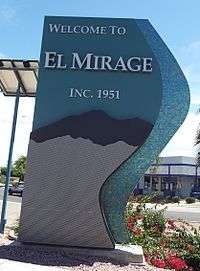 Entrance to the town of El Mirage. | ||
| ||
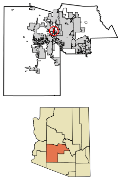 Location of El Mirage in Maricopa County, Arizona. | ||
 El Mirage, Arizona Location in the United States | ||
| Coordinates: 33°36′32″N 112°19′29″W / 33.60889°N 112.32472°WCoordinates: 33°36′32″N 112°19′29″W / 33.60889°N 112.32472°W | ||
| Country | United States | |
| State | Arizona | |
| County | Maricopa | |
| Government | ||
| • Council/Manager | Lana Mook/James P. Shano (interim) | |
| Area[1] | ||
| • Total | 9.95 sq mi (25.77 km2) | |
| • Land | 9.89 sq mi (25.61 km2) | |
| • Water | 0.06 sq mi (0.16 km2) | |
| Elevation | 1,145 ft (349 m) | |
| Population (2010)[2] | ||
| • Total | 31,797 | |
| • Estimate (2016)[3] | 35,043 | |
| • Density | 3,543.99/sq mi (1,368.41/km2) | |
| Time zone | UTC-7 (MST (no DST)) | |
| ZIP code | 85335 | |
| Area code(s) | 623 | |
| FIPS code | 04-22220 | |
| Website | cityofelmirage.org | |

El Mirage is a city in Maricopa County, Arizona, United States. According to the 2010 census, the population of the city is 31,797.[2]
Geography
El Mirage is located at 33°36′32″N 112°19′29″W / 33.60889°N 112.32472°W (33.608988, -112.324654).[4]
According to the United States Census Bureau, the city has a total area of 9.7 square miles (25 km2), all of it land.
Demographics
| Historical population | |||
|---|---|---|---|
| Census | Pop. | %± | |
| 1960 | 1,723 | — | |
| 1970 | 3,258 | 89.1% | |
| 1980 | 4,307 | 32.2% | |
| 1990 | 5,001 | 16.1% | |
| 2000 | 7,609 | 52.1% | |
| 2010 | 31,797 | 317.9% | |
| Est. 2016 | 35,043 | [3] | 10.2% |
| U.S. Decennial Census[5] | |||
As of the census of 2000, there were 7,609 people, 2,121 households, and 1,737 families residing in the city. The population density was 786.8 people per square mile (303.8/km²). There were 3,162 housing units at an average density of 326.9 per square mile (126.3/km²). The racial makeup of the city was 66.26% White, 3.29% Black or African American, 0.85% Native American, 0.38% Asian, 0.05% Pacific Islander, 26.18% from other races, and 2.98% from two or more races. 66.82% of the population were Hispanic or Latino of any race.
There were 2,121 households out of which 48.8% had children under the age of 18 living with them, 55.3% were married couples living together, 17.7% had a female householder with no husband present, and 18.1% were non-families. 13.0% of all households were made up of individuals and 3.7% had someone living alone who was 65 years of age or older. The average household size was 3.59 and the average family size was 3.87.
In the city, the population was spread out with 36.8% under the age of 18, 14.1% from 18 to 24, 28.6% from 25 to 44, 13.8% from 45 to 64, and 6.6% who were 65 years of age or older. The median age was 25 years. For every 100 females, there were 105.5 males. For every 100 females age 18 and over, there were 105.0 males.
The median income for a household in the city was $33,813, and the median income for a family was $33,468. Males had a median income of $25,176 versus $19,192 for females. The per capita income for the city was $10,342. About 12.6% of families and 15.9% of the population were below the poverty line, including 14.2% of those under age 18 and 22.0% of those age 65 or over.
El Mirage is near Luke U.S. Air Force Base, the largest Fighter Pilot Training Base in the North Atlantic Treaty Organization (NATO), and can boast that it has the highest paid city manager per capita in the Phoenix, Arizona metropolitan area
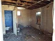
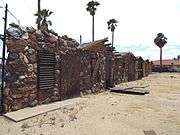
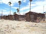
Historic structures of El Mirage


References
- ↑ "2016 U.S. Gazetteer Files". United States Census Bureau. Retrieved July 18, 2017.
- 1 2 "American FactFinder". United States Census Bureau. Retrieved June 18, 2014.
- 1 2 "Population and Housing Unit Estimates". Retrieved June 9, 2017.
- ↑ "US Gazetteer files: 2010, 2000, and 1990". United States Census Bureau. February 12, 2011. Retrieved April 23, 2011.
- ↑ "Census of Population and Housing". Census.gov. Retrieved June 4, 2016.
- http://peopleofelmirage.com/wp-content/uploads/2010/04/City-Manager-Salary.pdf Surprise Time Newspaper-City Managers Salary
