Glendale, Arizona
| Glendale, Arizona | ||
|---|---|---|
| City | ||
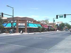 Downtown Glendale, Arizona as viewed from the intersections of Glendale Ave. and 58th Ave. | ||
| ||
 Location of Glendale in Maricopa County, Arizona | ||
 Glendale, Arizona Location in the United States | ||
| Coordinates: 33°32′19″N 112°11′11″W / 33.53861°N 112.18639°WCoordinates: 33°32′19″N 112°11′11″W / 33.53861°N 112.18639°W | ||
| Country | United States | |
| State | Arizona | |
| County | Maricopa | |
| Government | ||
| • Mayor | Jerry Weiers (Non-Partisan) | |
| Area[1] | ||
| • Total | 59.75 sq mi (154.76 km2) | |
| • Land | 59.36 sq mi (153.75 km2) | |
| • Water | 0.39 sq mi (1.00 km2) | |
| Elevation[2] | 1,152 ft (351 m) | |
| Population (2010)[3] | ||
| • Total | 226,721 | |
| • Estimate (2016)[4] | 245,895 | |
| • Rank | US: 89th | |
| • Density | 4,142.16/sq mi (1,599.30/km2) | |
| Demonym(s) | Glendalian | |
| Time zone | UTC-7 (MST (no DST)) | |
| ZIP code | 85301-85318 | |
| Area code(s) | 623 and 602 | |
| FIPS code | 04-27820 | |
| Website |
www | |

Glendale /ˈɡlɛndeɪl/ is a city in Maricopa County, Arizona, United States, located about nine miles (14 km) northwest from Downtown Phoenix. According to the 2010 census, the population of the city is 226,721.[3]
History
In the late 1800s what is now known as Glendale, Arizona, was all desert. William John Murphy, a native of New Hartford, New York, who resided in the town of Flagstaff in what was then known as the territory of Arizona, was in charge of building a 40-mile-long (64 km) Arizona Canal from Granite Reef to New River for the Arizona Canal Company. In 1885, he completed the canal, which would bring water to the desert land.[5] Murphy was deep in debt, since he had agreed to be paid in Arizona Canal Company stock and bonds and land instead of cash.[6]
In 1887, Murphy formed the Arizona Improvement Company. His objective was to sell the land and water rights south of the canal. Murphy had to raise capital from out of state sources in order to meet payroll and construction expenses.[6] Murphy decided to refer to this land as "Glendale". In order to develop and interest potential investors and settlers in this new town, Murphy decided to provide a better way of access from Phoenix to Glendale and ending in the town of Peoria by building an 18-mile-long (29 km) diagonal road which he named Grand Avenue.
In 1891, Burgess Hadsell worked with Murphy to bring 70 Brethren and River Brethren families to Glendale to form a temperance colony. Soon settlers, attracted by the town's ban on alcoholic beverages, continued to arrive. In 1895, Murphy platted the original town site and amended the plat to include a town park and some business lots. It was bounded by Lamar Road on the south, 55th Avenue on the east, Myrtle Avenue on the north, and 59th Avenue on the west.[7] The construction of a railroad from Prescott to Phoenix was made possible with an exchange of the right-of-way made by Murphy along Grand Avenue.[5] The railroad allowed Glendale settlers to transport goods to the north and easily receive building materials.
The construction and commercial applications of the Beet Sugar Factory in 1906, also contributed to the growth of Glendale. Though the operations of the factory only lasted until 1913, it played an important role in the increase of immigrant and migrant settlers in the city.[8]
Geography
Glendale is located at 33°32′19″N 112°11′11″W / 33.53861°N 112.18639°W (33.538654, −112.186261).[9]
Climate
| Climate data for Phoenix Int'l, Arizona (1981–2010 normals,[lower-alpha 1] extremes 1895–present)[lower-alpha 2] | |||||||||||||
|---|---|---|---|---|---|---|---|---|---|---|---|---|---|
| Month | Jan | Feb | Mar | Apr | May | Jun | Jul | Aug | Sep | Oct | Nov | Dec | Year |
| Record high °F (°C) | 88 (31) |
92 (33) |
100 (38) |
105 (41) |
114 (46) |
122 (50) |
121 (49) |
117 (47) |
116 (47) |
107 (42) |
96 (36) |
87 (31) |
122 (50) |
| Mean maximum °F (°C) | 78.7 (25.9) |
82.8 (28.2) |
90.0 (32.2) |
98.6 (37) |
105.9 (41.1) |
112.5 (44.7) |
114.4 (45.8) |
112.5 (44.7) |
108.6 (42.6) |
100.1 (37.8) |
88.1 (31.2) |
77.1 (25.1) |
115.2 (46.2) |
| Average high °F (°C) | 67.2 (19.6) |
70.7 (21.5) |
76.9 (24.9) |
85.2 (29.6) |
94.8 (34.9) |
103.9 (39.9) |
106.1 (41.2) |
104.4 (40.2) |
99.8 (37.7) |
88.5 (31.4) |
75.5 (24.2) |
66.0 (18.9) |
86.6 (30.3) |
| Daily mean °F (°C) | 56.4 (13.6) |
59.7 (15.4) |
65.2 (18.4) |
72.7 (22.6) |
82.1 (27.8) |
90.8 (32.7) |
94.8 (34.9) |
93.6 (34.2) |
88.4 (31.3) |
76.7 (24.8) |
64.1 (17.8) |
55.4 (13) |
75.1 (23.9) |
| Average low °F (°C) | 45.6 (7.6) |
48.7 (9.3) |
53.5 (11.9) |
60.2 (15.7) |
69.4 (20.8) |
77.7 (25.4) |
83.5 (28.6) |
82.7 (28.2) |
76.9 (24.9) |
64.8 (18.2) |
52.7 (11.5) |
44.8 (7.1) |
63.4 (17.4) |
| Mean minimum °F (°C) | 36.2 (2.3) |
39.4 (4.1) |
43.2 (6.2) |
49.5 (9.7) |
58.0 (14.4) |
68.4 (20.2) |
73.7 (23.2) |
73.7 (23.2) |
67.1 (19.5) |
53.6 (12) |
40.8 (4.9) |
34.6 (1.4) |
33.5 (0.8) |
| Record low °F (°C) | 16 (−9) |
24 (−4) |
25 (−4) |
35 (2) |
39 (4) |
49 (9) |
63 (17) |
58 (14) |
47 (8) |
34 (1) |
27 (−3) |
22 (−6) |
16 (−9) |
| Average precipitation inches (mm) | 0.91 (23.1) |
0.92 (23.4) |
0.99 (25.1) |
0.28 (7.1) |
0.11 (2.8) |
0.02 (0.5) |
1.05 (26.7) |
1.00 (25.4) |
0.64 (16.3) |
0.58 (14.7) |
0.65 (16.5) |
0.88 (22.4) |
8.03 (204) |
| Average snowfall inches (cm) | trace | trace | 0.0 (0) |
0.0 (0) |
0.0 (0) |
0.0 (0) |
0.0 (0) |
0.0 (0) |
0.0 (0) |
0.0 (0) |
0.0 (0) |
trace | trace |
| Average precipitation days (≥ 0.01 in) | 4.1 | 4.4 | 3.9 | 1.7 | 1.0 | 0.5 | 4.2 | 5.0 | 2.8 | 2.5 | 2.6 | 3.9 | 36.6 |
| Average relative humidity (%) | 50.9 | 44.4 | 39.3 | 27.8 | 21.9 | 19.4 | 31.6 | 36.2 | 35.6 | 36.9 | 43.8 | 51.8 | 36.6 |
| Mean monthly sunshine hours | 256.0 | 257.2 | 318.4 | 353.6 | 401.0 | 407.8 | 378.5 | 360.8 | 328.6 | 308.9 | 256.0 | 244.8 | 3,871.6 |
| Percent possible sunshine | 81 | 84 | 86 | 90 | 93 | 95 | 86 | 87 | 89 | 88 | 82 | 79 | 87 |
| Source: NOAA (relative humidity and sun 1961–1990)[10][11][12], Weather.com[13] | |||||||||||||
According to the United States Census Bureau, the city has a total area of 55.8 square miles (145 km2), of which, 55.7 square miles (144 km2) of it is land and 0.1 square miles (0.26 km2) of it (0.13%) is water.
Demographics
| Historical population | |||
|---|---|---|---|
| Census | Pop. | %± | |
| 1910 | 1,000 | — | |
| 1920 | 2,737 | 173.7% | |
| 1930 | 3,665 | 33.9% | |
| 1940 | 4,855 | 32.5% | |
| 1950 | 8,179 | 68.5% | |
| 1960 | 15,893 | 94.3% | |
| 1970 | 36,228 | 127.9% | |
| 1980 | 97,172 | 168.2% | |
| 1990 | 147,864 | 52.2% | |
| 2000 | 218,812 | 48.0% | |
| 2010 | 226,721 | 3.6% | |
| Est. 2016 | 245,895 | [4] | 8.5% |
| U.S. Decennial Census[14] | |||
As of the census of 2000, there were 218,812 people, 75,700 households, and 54,352 families residing in the city. The population density was 3,929.5 people per square mile (1,517.3/km²). There were 79,667 housing units at an average density of 1,430.7 per square mile (552.4/km²). The racial makeup of the city was 75.54% White, 4.70% Black or African American, 1.45% Native American, 2.74% Asian, 0.13% Pacific Islander, 11.97% from other races, and 3.47% from two or more races. 24.84% of the population were Hispanic or Latino of any race.
There were 75,700 households out of which 39.9% had children under the age of 18 living with them, 53.5% were married couples living together, 12.8% had a female householder with no husband present, and 28.2% were non-families. 21.3% of all households were made up of individuals and 5.8% had someone living alone who was 65 years of age or older. The average household size was 2.85 and the average family size was 3.33.
In the city, the population was spread out with 30.1% under the age of 18, 10.8% from 18 to 24, 31.9% from 25 to 44, 19.9% from 45 to 64, and 7.4% who were 65 years of age or older. The median age was 31 years. For every 100 females, there were 99.6 males. For every 100 females age 18 and over, there were 97.1 males.
The median income for a household in the city was $45,015, and the median income for a family was $51,162. Males had a median income of $35,901 versus $27,736 for females. The per capita income for the city was $19,124. About 8.8% of families and 11.9% of the population were below the poverty line, including 15.3% of those under age 18 and 9.5% of those age 65 or over.
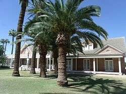
Notable attractions
- Adobe Mountain Desert Park
- Glendale Chocolate Festival (every February)[15]
- Glendale Folk & Heritage Festival[16]
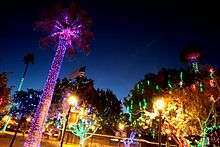
- Glendale Glitters (every December)[15]
- Glendale Jazz and Blues Festival[15]
- Historic Manistee Ranch
- Historic Sahuaro Ranch
- Cerreta Candy Co. factory tour[17]
- Downtown Glendale featuring antique shops and restaurants
- Deer Valley Rock Art Center
- State Farm Stadium
- Gila River Arena
- Brelby Theatre Company
- Spotlight Youth Theatre
- Elsie McCarthy Sensory Garden
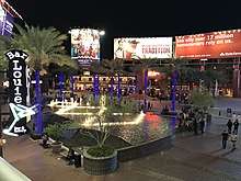
- Westgate Entertainment District
Sports

.jpg)
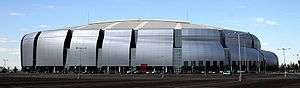
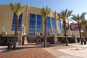
Glendale is the site of two major sports venues: State Farm Stadium and Gila River Arena. Both venues are part of the Glendale Sports and Entertainment District development plan, meant to spur growth in the sparsely inhabited Yucca district. Both venues are owned by the City of Glendale.
State Farm Stadium is the home field of the Arizona Cardinals of the NFL. The team formerly played at Sun Devil Stadium on the campus of Arizona State University in nearby Tempe, until they moved in 2006. Designed by architect Peter Eisenman, the stadium was featured on The History Channel TV series, Modern Marvels because of its roll-out natural grass field. The stadium hosted Super Bowls XLII in 2008 and XLIX in 2015. On January 18, 2009, it hosted the NFC Championship Game as the Arizona Cardinals defeated the Philadelphia Eagles 32–25 for the franchise's first ever Super Bowl berth.
The stadium is also used for college football and other events. The stadium hosts the annual Tostitos Fiesta Bowl bowl game. The BCS National Championship college football championship game also circulates to Glendale. The 2011 BCS National Championship Game was held in Glendale on January 10, 2011. The Auburn Tigers defeated the Oregon Ducks 22-19. The 26th annual WrestleMania event was held at State Farm Stadium on March 28, 2010. Soccer is also hosted at the stadium, with an International Champions Cup match between Real Madrid and the Los Angeles Galaxy taking place on August 1, 2013. The stadium is one of the sites where Copa America Centenario matches were held in June 2016.
Gila River Arena (formerly Glendale Arena, then Jobing.com Arena) and Westgate City Center is adjacent to University of Phoenix Stadium, and is the home of the Arizona Coyotes of the National Hockey League (NHL). It was also the home of the now defunct Arizona Sting of the National Lacrosse League (NLL). The inaugural Street League Skateboarding event was held in the summer of 2010 in Glendale at the Gila River Arena. This street skateboarding competition returns to Glendale annually.
In 2009, the Los Angeles Dodgers and the Chicago White Sox of Major League Baseball began to share the new Camelback Ranch-Glendale spring training complex and stadium in Phoenix owned and operated by the City of Glendale.
Education
There are a number of higher education campuses in Glendale. Glendale Community College and Glendale Community College North, just across the border in northwestern Phoenix, are members of the Maricopa County Community College District, while Arizona State University has its Thunderbird School of Global Management in Glendale and its West campus just across the border from Glendale in west Phoenix. Midwestern University is a graduate college of medicine located in Glendale.
Many school districts serve the city of Glendale.
The following school districts serve the city:
- Unified school districts
- Deer Valley Unified School District
- Dysart Unified School District
- Peoria Unified School District (headquartered in Glendale)[18]
- High school districts
- Glendale Union High School District
- Phoenix Union High School District
- Tolleson Union High School District
- Elementary school districts
- Alhambra Elementary School District
- Glendale Elementary School District
- Pendergast Elementary School District
- Washington Elementary School District
Transportation
The city of Glendale has a roughly average percentage of households without a car. In 2015, 8.4 percent of Glendale households lacked a car, and increased slightly to 9 percent in 2016. The national average was 8.7 percent in 2016. Glendale averaged 1.72 cars per household in 2016, compared to a national average of 1.8.[19]
Notable people
- Prince Amukamara – professional football player
- Eddie Bonine – professional baseball player
- Jan Brewer – Arizona Governor
- Elijah Burke – TNA wrestler
- Danny Cruz – professional soccer player
- Nick Evans – professional baseball player
- Trent Franks – former United States congressman
- Lauren Froderman – winner of So You Think You Can Dance (Season 7)
- Jennie Garth – actress
- Benson Henderson – former UFC lightweight champion[20]
- Job for a Cowboy – death metal band formed in Glendale in 2003
- Paul LoDuca – professional baseball player
- Craig Mabbitt – lead vocalist of band Escape The Fate
- Michael McDowell – NASCAR driver
- Evan Mecham – Arizona Governor
- Lou Novikoff – professional baseball player
- Sterling Ridge – Arizona legislator
- Marty Robbins – Grammy-winning country musician and auto racer
- Nate Ruess – lead singer of Fun
- Jason Zumwalt – actor
Culture
Arizona's Antique Capital
Glendale bills itself as "Arizona's Antique Capital", with support for its claim from both Sunset magazine (2004) and a 1998 article in USA Today. Glendale is home to the popular Arrowhead Towne Center mall in the northwest part of the city. Glendale also is home to Midwestern University, metropolitan Phoenix's first medical school, as well as a major post-graduate international business school: the Thunderbird School of Global Management.
An extension of Valley Metro Rail service is planned to serve the city, opening in 2026,[21] reprising a role played by the Phoenix Street Railway between 1911 and 1926.
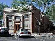
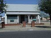
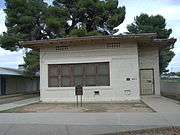
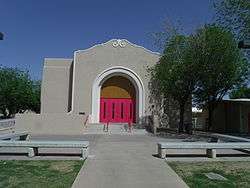
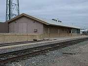
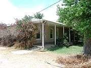
Historic buildings
There are numerous properties in the city of Glendale which are considered to be historical and have been included either in the National Register of Historic Places[22] or the listings of the Glendale Arizona Historical Society. At the end of the article are some of these properties with a short description of the same.
(NRHP = National Register of Historic Places)[22]
(GAHS=Glendale Arizona Historical Society-listed)
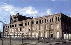

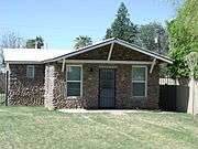
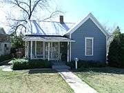
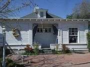


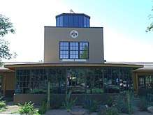
Catlin Court Historic District
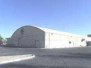
Thunderbird 1 Army Air Field
Sister cities
Glendale has one sister city:
See also
- List of historic properties in Glendale, Arizona
- Adobe Mountain Desert Park
- William John Murphy – Founder of Glendale
- Catlin Court Historic District
- USS Arizona salvaged artifacts
- List of people from the Phoenix metropolitan area
- Glendale Memorial Park Cemetery
Notes
- ↑ Mean monthly maxima and minima (i.e. the highest and lowest temperature readings during an entire month or year) calculated based on data at said location from 1981 to 2010.
- ↑ Official records for Phoenix kept at downtown August 1895 to September 1953, and at Sky Harbor Int'l since October 1953. For more information see ThreadEx.
References
- ↑ "2016 U.S. Gazetteer Files". United States Census Bureau. Retrieved July 18, 2017.
- ↑ U.S. Geological Survey Geographic Names Information System: Glendale, Arizona
- 1 2 "American FactFinder". United States Census Bureau. Retrieved June 18, 2012.
- 1 2 "Population and Housing Unit Estimates". Retrieved June 9, 2017.
- 1 2 Founder of Glendale
- 1 2 The First Five: A Brief History of the Salt River Project
- ↑ https://www.glendaleaz.com/economicdevelopment/documents/CCMP.pdf
- ↑ Industry Came to Glendale
- ↑ "US Gazetteer files: 2010, 2000, and 1990". United States Census Bureau. February 12, 2011. Retrieved April 23, 2011.
- ↑ "NowData - NOAA Online Weather Data". National Oceanic and Atmospheric Administration. Retrieved 22 March 2018.
- ↑ "Station Name: AZ Phoenix Sky Harbor INTL AP". National Oceanic and Atmospheric Administration. Retrieved 22 March 2018.
- ↑ "WMO Climate Normals for PHOENIX/SKY HARBOR INTL, AZ 1961–1990". National Oceanic and Atmospheric Administration. Retrieved 23 March 2018.
- ↑ "Monthly Averages for Phoenix, AZ – Temperature and Precipitation". The Weather Channel. Retrieved 2009-05-07.
- ↑ "Census of Population and Housing". Census.gov. Retrieved June 4, 2016.
- 1 2 3 Glendale, AZ – Events and Festivals
- ↑ http://archive.azcentral.com/thingstodo/events/articles/20130320glendale-folk-heritage-festival-event.html
- ↑ Cerreta Candy Co. Factory Tour
- ↑ "District Overview" Archived July 30, 2012, at the Wayback Machine.
- ↑ "Car Ownership in U.S. Cities Data and Map". Governing. Retrieved May 4, 2018.
- ↑ "Benson Henderson". UFC. Archived from the original on August 19, 2014. Retrieved September 5, 2014.
- ↑ Providing Public Transportation Alternatives for the Greater Phoenix Metro Area | Valley Metro | Archived May 18, 2011, at the Wayback Machine.
- 1 2 National Register of Historic Places
- ↑ http://www.sister-cities.org/interactive-map/Glendale,%20Arizona
External links
Places adjacent to Glendale, Arizona | |
|---|---|