Safford, Arizona micropolitan area
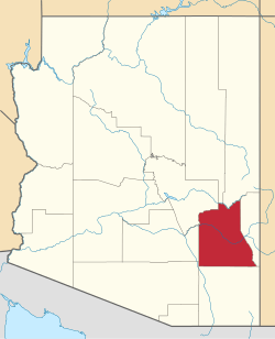
The Safford Micropolitan Statistical Area, as defined by the United States Census Bureau, is an area consisting of one county in eastern Arizona, anchored by the city of Safford.
As of 2010, the United States Census Bureau estimates that the μSA had a population of 37,220.[1]
Before 2013, Safford micropolitan statistical area also contained Greenlee County, Arizona. In 2013, the United States Office of Management and Budget removed Greenlee county from the micropolitan area's definition.[2]
Counties
Communities
- Places with 5,000-9,999 inhabitants
- Safford (Principal city)
- Places with 1,000 to 4,999 inhabitants
- Other places
Demographics
As of the census[3] of 2000 including both Graham and Greenlee counties, there were 42,036 people, 13,233 households, and 9,883 families residing within the μSA. The racial makeup of the μSA was 68.54% White, 1.59% African American, 12.24% Native American, 0.48% Asian, 0.04% Pacific Islander, 14.70% from other races, and 2.40% from two or more races. Hispanic or Latino of any race were 30.30% of the population.
The median income for a household in the μSA was $34,526, and the median income for a family was $38,970. Males had a median income of $34,738 versus $22,036 for females. The per capita income for the μSA was $13,977.
See also
References
- ↑ "State & County QuickFacts". United States Census Bureau. Archived from the original on July 10, 2011. Retrieved May 18, 2014.
- ↑ OMB BULLETIN NO. 13-01: Revised Delineations of Metropolitan Statistical Areas, Micropolitan Statistical Areas, and Combined Statistical Areas, and Guidance on Uses of the Delineations of These Areas. Office of Management and Budget. February 28, 2013.
- ↑ "American FactFinder". United States Census Bureau. Retrieved 2008-01-31.

Coordinates: 33°00′33″N 109°53′07″W / 33.00917°N 109.88528°W