Sierra Vista, Arizona
| Sierra Vista, Arizona | |
|---|---|
| City | |
| Nickname(s): Hummingbird Capital of the United States | |
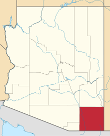
 Location of Sierra Vista in Cochise County, Arizona | |
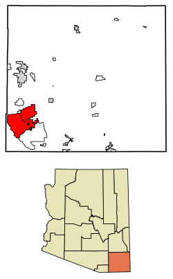
 Sierra Vista, Arizona Location in the United States | |
| Coordinates: 31°32′44″N 110°16′35″W / 31.54556°N 110.27639°WCoordinates: 31°32′44″N 110°16′35″W / 31.54556°N 110.27639°W | |
| Country | United States |
| State | Arizona |
| County | Cochise |
| Incorporated | 1956 |
| Government | |
| • Mayor | Rick Mueller |
| Area[1] | |
| • Total | 152.49 sq mi (394.96 km2) |
| • Land | 152.23 sq mi (394.28 km2) |
| • Water | 0.26 sq mi (0.68 km2) |
| Elevation | 4,633 ft (1,412 m) |
| Population (2010)[2] | |
| • Total | 43,888 |
| • Estimate (2016)[3] | 43,208 |
| • Density | 283.83/sq mi (109.59/km2) |
| Time zone | UTC−7 (MST (no DST)) |
| ZIP codes | 85600-85699 |
| Area code | 520 |
| FIPS code | 04-66820 |
| Website |
www |
Sierra Vista is a city in Cochise County, Arizona, United States. As of the 2010 census the population of the city was 43,888.[4] The city is part of the Sierra Vista-Douglas Metropolitan Area,[5] with a 2010 population of 131,346. Fort Huachuca, a U.S. Army post, is located in the northwest part of the city.
Sierra Vista, which is Spanish for "Mountain Range View", is located 75 miles (121 km) southeast of Tucson and serves as the main commercial, cultural, and recreational hub of Cochise County.
History
As evidenced by several neolithic sites[6] and known archeological sites, Paleo-Indians[7] have been in southern Arizona from at least 12,000 years ago. It was the home to a large Sobaipuri,[8] Pueblo near Fairbanks[9] which had several smaller pueblos and settlements[10] throughout the valley,[11][12] a Spanish Fort, Presidio Santa Cruz de Terrenate [10][13] between modern Huachuca City, Whetstone and Tombstone, on the Western bank of the San Pedro River.[8] along with sparse Spanish settlers supporting the route to Tucson's Mission San Xavier del Bac and Presidio San Agustín del Tucsón.[14][15][16]
Like most of Cochise County it was part of the Gadsden Purchase.[17] At the end of the Apache Wars, with the protection of Fort Huachuca[18] and the completion of the Southern Pacific and El Paso & Southwestern railroads, the San Pedro Valley began to populated by American Settlers.[19][20]
The first business that opened just outside the east gate of Fort Huachuca was a saloon and house of ill repute owned by John and Ellen Reilly opened in 1892. In 1911, Margaret Carmichael[21] bought the Reilly homestead and business. By 1913, Margaret Carmichael had leased the business back to the Reillys. Also in 1913, a group of dry land farmers settled in the local area and named their settlement Buena. Buena was located east of Garden Canyon, between Lewis Springs and Fort Huachuca East of the junction of present-day Hwy 90 and Hwy 92.[8] At this site was a post office and a school house that served children in Buena, Garden Canyon and outreaches of the local area. Oliver Fry[21] and his two oldest sons traveled from Texas on the railroad and settled on 320 acres (1.3 km2) just east of Fort Huachuca in January, 1913.[8]
By 1917, the Overton Post Office was established. This name came from the Overton Mercantile and Investment Company, who took option on the Carmichael property with plans to develop a townsite outside of Fort Huachuca. However, it is believed that the company was unable to persuade anyone to move to the area so when the option expired, the Carmichael's took back the property with a general mercantile store and the post office.
In 1918, the Carmichael's changed the name of the store and named it after the Garden Canyon Sawmill.[8] They also called their Post Office where Carmichael was the postmaster Garden Canyon.[8] In addition, the Carmichael's built a home across the street from Garden Canyon store, as well as 18 rock houses, on Garden Avenue. From 1927 to 1938, the Frys rented the Carmichael store and ran the post office. The Frys established their own General Store and the first official federally recognized Post office established in 1938 as Fry Post office, so the name of this settlement changed to Fry.[8]
When the base was reactivated in February 1, 1954 the base commander Brigadier General Emil Lenzner, pushed for incorporation as both a way to solve the on base housing problems as well as to distance themselves from reputation of "The White City" and Fry Town Settlement, hoping to encourage people to want to live off base in a more family friendly community, away from undesirables like the minorities allowed to live unsegregated in Fry Town.[8] Petitions for incorporation began to be filed in 1955 and were legally accepted in 1956 which included what had been Garden Canyon and Buena but pointedly did not include most of Fry Town as a way in part to keep a Federal Housing Authority (FHA) housing project contacts for housing off post away from the Fry Town area was used as an excuse to incorporate and begin getting a share of tax revenues without having to pay the Fry family for the parts of Fry Town considered desirable and wholesome.[8]
In 1955, the first attempt to incorporate and rename the area was rejected, as Fry opposed both incorporating and renaming the town that bore his family name. In 1956, the ballot issue failed 76 to 61. People who owned land outside of Fry's property in the area of Garden Canyon/Overton and Buena, as well as parts of Fry[8] went forward with incorporation and renaming by petition on May 26, 1956, excluding the half-square-mile owned by Fry that included the local red light district called "the White City" as well as off base housing of the African-American "Buffalo" soldier officers families,[22][23] and other minorities and groups they considered undesirable in the 1950s.[8][24][25] They were described as the "Fry People."[22]
Sierra Vista was incorporated in 1956, and has a population of over 43,000 today. The city is the economic and commercial center of Cochise County, and northern Sonora, Mexico. Sierra Vista annexed Fort Huachuca, a U.S. military base, one of the largest employers in Arizona, and the adjacent community, in 1971.
The proposed city counsel held a radio contest[22] asking for names of the proposed town. Marie Pfister the city clerk asked her friend Nola Walker to store the suggestions. When the town was approved, they called Nola for the contest winner, but without counting the votes she told them her personal entry of "Sierra Vista" was the winner. On July 13, 2006 at a special ceremony during the city's 50th anniversary, Nola was granted "clemency" for her misrepresentation of the vote.[24]
In 1961 the town grew large enough to have the name changed to a city allowing establishment of a community college.[8] In 1973 Ethel Berger became the first female mayor in Arizona.[8][24][25] In the 1970s the Art in the Park Festival was established by a committee of Army Wives, with it proceeds benefiting the Huachuca Arts Association, and college scholarships.[8][25]
Sierra Vista was the site of the first McDonald's drive thru, which opened in 1975.[26] The owner, Dave Rich, drove the innovative approach to gain the business of the soldiers from nearby Fort Huachuca. At that time, soldiers were not allowed to wear their military fatigues off of the military base.[27][8]
Known Historical Names for area:[8][22][24]
- 1878 Papingo
- 1898 Overton
- 1909 Garden Canyon
- 1915 Buena
- 1938 Parts of Frytown, Fry Township, Fry Settlement
- 1942-1945 "The White City" or "Hook"
- 1955 Town of Sierra Vista
- 1961 City of Sierra Vista
Geography
Sierra Vista is located in southwestern Cochise County at 31°32′44″N 110°16′35″W / 31.54556°N 110.27639°W (31.545498, -110.276500).[28] It is bordered on the northwest by the much smaller town of Huachuca City.
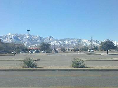
According to the United States Census Bureau, the city has a total area of 152.5 square miles (395.1 km2), of which 152.3 square miles (394.4 km2) is land and 0.27 square miles (0.7 km2) is water. It is located 4,623 feet (1,409 m) above sea level. Sierra Vista is flanked on the southwest side by the Huachuca Mountains, with Miller Peak rising to 9,466 feet (2,885 m) and Carr Peak to 9,236 feet (2,815 m), both south of the city limits. The city is accessible via Arizona State Routes 90 and 92. The San Pedro River flows just east of the city limits.
Climate
In the Köppen climate classification system, Sierra Vista falls within the typical cold semi-arid climate (BSk) of mid-altitude Arizona. Fall and spring, like most other parts of Arizona, are very dry. Winters are cool to cold with frosts which can occasionally be hard freezes; frost can be expected to stop in mid- to late April. Spring, like fall, spends about half of itself within the frost season. Summer starts off dry, but progressively gets wetter as the monsoon season approaches. The city has a fairly stable climate with very little humidity. However, the North American Monsoon can bring torrential rains during the months of July and August and will produce almost half the yearly rainfall in just those two months alone. Due to the dry climate the rest of the year and the city’s high elevation, daily winter low temperatures range from 20 to 30 °F (−6.7 to −1.1 °C) on average and up to 50 °F (10.0 °C) on rare occasions when moist fronts bring warm air from the Gulf of California. Snow is not a common sight on the streets of Sierra Vista though some years the city can receive several inches of snow and other years it will receive none. However, a snow-capped Miller Peak and Carr Peak in the Huachuca Mountains is a common sight for four to five months every year.
- The highest recorded temperature was 108 °F (42 °C) in 1989.
- The lowest recorded temperature was 3 °F (−16 °C) in 2011.[29]
- The maximum average rainfall occurs in August.
| Climate data for Sierra Vista, Arizona | |||||||||||||
|---|---|---|---|---|---|---|---|---|---|---|---|---|---|
| Month | Jan | Feb | Mar | Apr | May | Jun | Jul | Aug | Sep | Oct | Nov | Dec | Year |
| Record high °F (°C) | 81 (27) |
84 (29) |
91 (33) |
97 (36) |
102 (39) |
107 (42) |
108 (42) |
102 (39) |
99 (37) |
96 (36) |
85 (29) |
80 (27) |
108 (42) |
| Average high °F (°C) | 61.2 (16.2) |
64.4 (18) |
69.7 (20.9) |
76.9 (24.9) |
85.1 (29.5) |
92.9 (33.8) |
91.6 (33.1) |
88.7 (31.5) |
86.8 (30.4) |
78.8 (26) |
69.5 (20.8) |
61.6 (16.4) |
77.3 (25.2) |
| Average low °F (°C) | 34.2 (1.2) |
37.2 (2.9) |
41.5 (5.3) |
47.1 (8.4) |
54.9 (12.7) |
63.3 (17.4) |
66.3 (19.1) |
64.9 (18.3) |
60.3 (15.7) |
51.0 (10.6) |
40.9 (4.9) |
33.9 (1.1) |
49.6 (9.8) |
| Record low °F (°C) | 12 (−11) |
3 (−16) |
23 (−5) |
28 (−2) |
38 (3) |
46 (8) |
51 (11) |
53 (12) |
45 (7) |
30 (−1) |
19 (−7) |
15 (−9) |
4 (−16) |
| Average rainfall inches (mm) | 0.98 (24.9) |
0.70 (17.8) |
0.52 (13.2) |
0.41 (10.4) |
0.30 (7.6) |
0.51 (13) |
3.11 (79) |
3.82 (97) |
1.45 (36.8) |
0.93 (23.6) |
0.44 (11.2) |
1.03 (26.2) |
14.2 (360.7) |
| Average snowfall inches (cm) | 0.3 (0.8) |
0.2 (0.5) |
0.2 (0.5) |
0.0 (0) |
0.0 (0) |
0.0 (0) |
0.0 (0) |
0.0 (0) |
0.0 (0) |
0.0 (0) |
0.0 (0) |
0.1 (0.3) |
0.8 (2) |
| Average rainy days (≥ 0.01 in) | 4 | 4 | 2 | 2 | 1 | 2 | 11 | 12 | 5 | 3 | 2 | 4 | 52 |
| Source: National Weather Service, Tucson[30] | |||||||||||||
Parks and outdoors
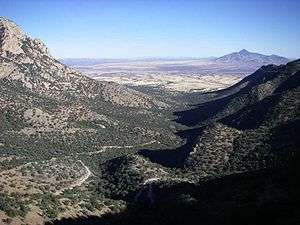
Nicknamed the "Hummingbird Capital of the United States", the city sees bird watchers from all over the world flock to the nearby Ramsey Canyon Preserve and other local canyons to observe and photograph hundreds of different bird species. Other outdoor sightseeing and recreational opportunities that are nearby include the San Pedro Riparian National Conservation Area, the Coronado National Memorial in the Huachuca Mountains, and Parker Canyon Lake. Excellent views of the clear night sky have led Sierra Vista to become the chosen center of amateur astronomy in Arizona, with more than a dozen well equipped amateur observatories in the area and a large observatory at the University of Arizona South within the city limits.
The Cove
The Sierra Vista Aquatic Center, aka "The Cove," is a 36,500-square-foot (3,390 m2) facility that contains 11,347 sq ft (1,054.2 m2) of pool water surface, which equates to over 575,000 US gallons (2,180,000 l; 479,000 imp gal) of water. The Aquatic Center boasts a 0' depth, or "beach", entry, eight 25-yard lap lanes for lap and competitive swimming, and a wave machine with several wave patterns for Open Swim. The Cove has a submersible bulkhead which makes the switch from wave pool to competitive pool possible. The Cove also has a warm water therapy pool, children's lagoon with slide, two 1 meter diving boards and one 3 meter diving board, and two enclosed water tube slides to include a 150-foot (46 m) water tube slide.[31]
Demographics
| Historical population | |||
|---|---|---|---|
| Census | Pop. | %± | |
| 1960 | 3,121 | — | |
| 1970 | 6,689 | 114.3% | |
| 1980 | 24,937 | 272.8% | |
| 1990 | 32,983 | 32.3% | |
| 2000 | 37,775 | 14.5% | |
| 2010 | 43,888 | 16.2% | |
| Est. 2016 | 43,208 | [3] | −1.5% |
| U.S. Decennial Census[32] | |||
Sierra Vista is the largest of seven incorporated cities in Cochise County, accounting for one-third of the county's population.[33] The population at the 2010 census was 43,888, up from 37,775 at the 2000 census, for a growth rate of 16.2% over the decade. Sierra Vista is the 21st largest incorporated place in Arizona as of the 2010 census.
Also indicated in the CER 2009 Economic Outlook publication, the Arizona DEC estimates the Sierra Vista Area population is approximately 75,000, which includes outlying areas of the Sierra Vista Southeast Census Designated Place, Huachuca City, Tombstone, Whetstone, Hereford and unincorporated surrounding areas. The population of the Sierra Vista Area is estimated to reach nearly 100,000 by 2028.
According to the 2000 Census figures, the Sierra Vista population consists of 14,196 households, and 9,993 families residing in the city. The population density was 246.1 people per square mile (95.0/km²). There were 15,685 housing units at an average density of 102.2 per square mile (39.5/km²). The racial makeup of the city was 73.34% White, 10.89% Black or African American, 3.57% Asian, 0.83% Native American and 0.46% Pacific Islander. 6.05% of the population is from other races, and 4.86% from two or more races. 15.8% of the population is Hispanic or Latino.
There were 14,196 households out of which 34.9% had children under the age of 18 living with them, 56.5% were married couples living together, 25.1% of all households were made up of individuals and 7.7% had someone living alone who was 65 years of age or older. The average household size was 2.48 and the average family size was 2.96.
In the city, the age distribution of the population shows 25.8% under the age of 18, 13.0% from 18 to 24, 29.2% from 25 to 44, 19.9% from 45 to 64, and 12.1% who were 65 years of age or older. The median age was 32 years. For every 100 females, there were 100.7 males. For every 100 females age 18 and over, there were 100.7 males.
The median income for a household in the city was $38,427, and the median income for a family was $44,077. Males had a median income of $30,053 versus $23,805 for females. The per capita income for the city was $18,436. About 8.0% of families and 10.5% of the population were below the poverty line, including 15.8% of those under age 18 and 4.0% of those age 65 or over.
As of the 2000 Census, of the population (37,775) 25 years and older 91.5 percent had at least a high school diploma or equivalent and an estimated 25.7 percent held a bachelor's degree or higher.[34] The CER indicates that there has been an increasing trend for residents to attain a bachelor's degree or higher making the local area competitive in today's technological working environment. The estimated population of resident's educated at a post-secondary level (some college credit or more) in Sierra Vista is estimated to be higher than county, state, and national averages.[33]
Fort Huachuca, a U.S. Army post, an active and historical military installation and a communications and information technology hub, was annexed into the city in 1971. In addition, the city has been actively working to annex Cochise County enclaves within city limits as outlined in the City Council's strategic plan "Our Future Vistas".[35]
Notable residents
- Don Frye, mixed martial arts fighter, UFC 8 and Ultimate Ultimate 2 champion.
- Yvonne Navarro, Bram Stoker Award Winning and Best Selling author of more than twenty five books and a core Buffy the Vampire Slayer novel contributors.
- Weston Ochse, Bram Stoker Award Winning and Best Selling author of more than thirty books.
- Nicole Powell, basketball player in the WNBA team New York Liberty.
- Glenn Spencer, anti-immigration activist and operator of American Border Patrol.[36]
- Audrey Sibley, Miss Arizona 2005.[37]
- Erin Nurss, Miss Arizona 2008.[38]
Government
The City of Sierra Vista is a council-manager municipality. The city council sets public policy while a professional city manager implements policy and oversees the day-to-day operation of the city.
Economy
Sierra Vista is the commercial center for Cochise County and parts of northern Mexico. Retailers such as Lowe's, Home Depot, Walmart, Target, Dillard's, Sears, and Marshalls are located in the community, along with three major supermarkets and dozens of smaller specialty shops. The Mall at Sierra Vista is a 400,000-square-foot (37,000 m2) mall located in Sierra Vista.
Sierra Vista has a substantial employment base due to Fort Huachuca — the community's major employer and primary driving economic force. Because of contracts with the Army, the professional, scientific and technical services sector is unusually large, but nearly half of all jobs in Sierra Vista are in the government sector.
Wick Communications, which publishes several dozen newspapers in some twelve states, is headquartered in Sierra Vista.
Education
The Sierra Vista Unified School District includes one high school, Buena High School, one middle school, and six elementary schools. There are also several charter and private education opportunities. Higher education is available through the University of Arizona South, Cochise Community College, the University of Phoenix, Wayland Baptist University, and Western International University.
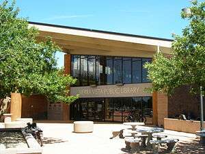
There is a 31,000-square-foot (2,900 m2) public library located within the city limits across from city hall.[39]
Culture
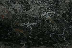
Sierra Vista has a variety of cultural and family-oriented activities throughout the year. Some of the major events include the Cochise Cowboy Poetry and Music Gathering in February, the Festival of the Southwest in the spring, Independence Day celebration, the Southwest Wings Festival in August for bird watching enthusiasts, and Arizona's longest-running holiday parade in December. During the winter months, the Sierra Vista Symphony Orchestra presents three concerts of classical and popular music, including pre-concert seminars, and puts on special fund raising events. Throughout the year, the Art Discovery Series presents plays, concerts, and musicals, and in the summer, there are regular band concerts at Veterans' Park, as well as many activities at the Sierra Vista Public Library such as a film series, lectures, readings, and other programs for children and adults. Pictographs created by Native Americans can be found in certain areas of the Huachuca Mountains.
The Gray Hawk Nature Center offering nature education programs and housing live reptile and invertebrate exhibits is located nearby on the San Pedro River.
Media
Sierra Vista is served by the Sierra Vista Herald since 1955.
In 2016 a Social Network Based News Agency was started called Sierra Vista News Network or SVNN. The Facebook page and other Networks SVNN operates include political coverage, Live Streamed High School Sports, and on demand Live News Coverage.
Television station KWBA-TV, channel 58, is licensed to Sierra Vista and serves the Tucson/Sierra Vista market.[40] The station has broadcast since 1996 and is an affiliate of The CW network. The station's transmission tower is located in the Santa Rita Mountains between Sierra Vista and Tucson. Other area television stations include KFTU-DT, channel 36, the Spanish-language UniMás affiliate, licensed to Douglas with a broadcast tower in the Mule Mountains near Sierra Vista; and formerly K33CG, channel 33, a TBN affiliate.
Radio station KZMK (K-101) serves as a Top 40 hits FM radio station covering Sierra Vista and most of Cochise County. The station provides live broadcasts for significant events occurring in and around the city.[41] Sister radio station KTAN (1420 AM) broadcasts a News Talk Information format. Both stations are owned by CCR-Sierra Vista IV, LLC., which also owns nearby Bisbee, Arizona radio station KWCD (92.3 FM), which broadcasts a Country music format.
Sports teams and events
The Cochise County Cavaliers have combined with the Bisbee Ironmen, both former members of the Arizona Football League (AzFL), to form the Cochise County Ironmen. The Ironmen began their first season of play in the in 2011.[42]
Healthcare
Canyon Vista Medical Center (CVMC) and the Raymond W. Bliss Army Health Center (located on nearby Fort Huachuca) serve the community's health care needs. Medical personnel of all major specialties are available in the area. Canyon Vista Medical Center was recently completed adjoining an existing Ambulatory Surgery and Imaging Center on SR 90. A management agreement for long term operations of the Hospital was signed with RegionalCare Hospital Partners. The US Department of Veterans Affairs opened a clinic in Sierra Vista to better serve the area's large retired military population.[43]
Regional health concerns
Residents and health professionals became concerned after observing an elevated number of leukemia and related childhood cancer cases being reported in Sierra Vista since 1995. In 2001, with seven reported cases since 1995, the Arizona Department of Health Services (ADHS) determined the number of cases was statistically elevated over the expected norm. In response, the ADHS launched an environmental review of air, drinking water and soil in the Sierra Vista area to determine if environmental exposure had placed residents at greater risk of childhood leukemia or other cancers. By October 2002, the ADHS in conjunction with the Arizona Cancer Registry, determined that, "No common environmental exposure from drinking water, ambient air or waste sites were identified that might have placed residents of the Sierra Vista area at greater risk of developing leukemia." No further action was recommended at that time.[44]
In 2003, three more cases of leukemia were reported. The Centers for Disease Control (CDC) was hesitant to investigate in depth, initially leaving the matter to state health departments, but became involved after the ADHS requested their assistance in the spring of 2003. The CDC concluded two formal studies, in 2004 and 2006, with mixed results. They did not discover any environmental causes for the increased incidence of leukemia, but they did note that they only tested four children with leukemia. They cautioned that with such a small number of study participants, "any attempt to measure associations between environmental exposure and disease would be inherently suspect and not statistically appropriate." Biological samples were tested for 128 chemicals, with results showing average or below average levels for all chemicals except tungsten, styrene and PCB-52, which were above average.[45][46][47]
There were no more reported cases in the several years following the CDC reports, bringing the occurrence statistics back in line with national averages. However, with a total of thirteen children diagnosed and another five potentially linked cases being investigated since 1995, some people still have concerns.[48][49][50][51]
Transportation
Sierra Vista is supported by a public mass transit system called Vista Transit, operated by the city.[52] There are two highways (SR 90 and SR 92) connecting Sierra Vista with neighboring communities. The city is also served by the Sierra Vista Municipal Airport (FHU) which is jointly operated by the U.S. Army as Libby Army Airfield. Currently there are no commercial flights arriving to or departing from FHU.
Major highways
Sister cities
Sierra Vista established its Sister Cities program in 1989 with Resolution 2282 in order to promote a relationship with Cananea. Sierra Vista was later twinned with Radebeul on May 22, 1998 by Resolution 3956. Sierra Vista and Radebeul currently have a foreign exchange program with each other.[53]
Picture gallery
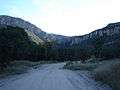 Carr Canyon in the Huachuca Mountains
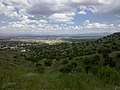 Surrounding area of Sierra Vista
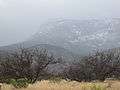 Snow-capped mountains outside Sierra Vista
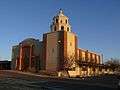 Saint Andrew the Apostle Church
References
- ↑ "2016 U.S. Gazetteer Files". United States Census Bureau. Retrieved Jul 18, 2017.
- ↑ "American FactFinder". United States Census Bureau. Retrieved 2014-07-06.
- 1 2 "Population and Housing Unit Estimates". Retrieved June 9, 2017.
- ↑ "Geographic Identifiers: 2010 Demographic Profile Data (G001): Sierra Vista city, Arizona". U.S. Census Bureau, American Factfinder. Retrieved June 12, 2014.
- ↑ Rice, Valorie H and Hammond, George W. (2013). "Arizona has a new metropolitan area: Sierra Vista-Douglas" Archived 2015-12-08 at the Wayback Machine.
- ↑ Murray Springs : a Clovis site with multiple activity areas in the San Pedro Valley, Arizona. Haynes, C. Vance, Jr., 1928-, Huckell, Bruce B. Tucson: University of Arizona Press. 2007. ISBN 9780816525799. OCLC 80019780.
- ↑ "Paleo-Indians". www.discoverseaz.com. Retrieved 2018-02-08.
- 1 2 3 4 5 6 7 8 9 10 11 12 13 14 15 16 Jackson., Price, Ethel (2003). Sierra Vista : young city with a past. Charleston, SC: Arcadia. ISBN 0738524344. OCLC 53882709.
- ↑ "Sobaipuri Archaeology, An Introduction". www.seymourharlan.com. Retrieved 2018-02-08.
- 1 2 "Fr. Kino's Visits to the San Pedro". www.saguaro-juniper.com. Retrieved 2018-02-08.
- ↑ "Quiburi". www.seymourharlan.com. Retrieved 2018-02-08.
- ↑ Seymour, Deni (Summer 2011). "1762 On the San Pedro: Reevaluating Sobaípuri-O'odham Abandonment and New Apache Raiding Corridors" The Journal of Arizona History. 52 (2):. The Journal of Arizona History. pp. 169–188.
- ↑ Sterner, Matthew A.; Majewski, Teresita (1998). "Homesteading and Ranching on Fort Huachuca's East Range: National Register of Historic Places Evaluations of Slash Z Ranch Site and Three Associated Sites". National Register of Historic Places Evaluations. Statistical Research, Inc; Tucson, AZ. Department of the Army Technical Report 98-22, DABT63-93-D-0011 Delivery Order 4.
- ↑ McCarty, Kieran. "Desert Documentary by Kieran McCarty - Chapter 20: Spanish Tucson's Last Roster". www.library.arizona.edu. Retrieved 2018-02-08.
- ↑ U.S. ARMY, FORT HUACHUCA. "Huachuca Illustrated, A Magazine of the Fort Huachuca Museum, Vol. 4 1999" (PDF)" (PDF). Retrieved October 29, 2010.
- ↑ Flint, Richard and Shirley (October 16, 2011). The Latest Word from 1540: People, Places, and Portrayals of the Coronado Expedition. University of New Mexico Press. ISBN 0826350607.
- ↑ "Milestones: 1830–1860 - Office of the Historian". history.state.gov. Retrieved 2018-02-08.
- ↑ "Huachuca Mountains". www.arizonahandbook.com. Retrieved 2018-02-08.
- ↑ "Aravaipa Canyon Wilderness Prehistory and History". Archived from the original on 2006-02-14.
- ↑ "Guided History Walk – Presidio Santa Cruz".
- 1 2 1937-, Bailey, Lynn R. (Lynn Robison), (2000). Cochise County stalwarts : a who's who of the territorial years : merchants, miners and millmen, ranchers and farmers, hostelers and restaurateurs, bankers, attorneys and judges, contractors, freighters, stage line operators and blacksmiths, saloonists and gamblers, marshals, sheriffs and constables, printers, lumbermen, postmasters, journalists, educators, politicians and promoters, and a few badmen and outlaws, who made an impact, thrown in for flavor. Chaput, Donald. Tucson, Ariz.: Westernlore Press. ISBN 0870261126. OCLC 46826073.
- 1 2 3 4 Hein, Jac (1983). Early Sierra Vista; its People and Neighbors. Sierra Vista, AZ, USA: Banner Printing Center. pp. 138–139, 172.
- ↑ Smith, Cornelius C. FORT HUACHUCA: The story of a frontier post. Superintendent of Documents, U.S. Government Printing Office, Washington, D.C. 20402: U.S Government Printing Office.
- 1 2 3 4 "Journey to Cochise County: Explore the lives and Stories of those who have make Cochise County their home". The Cochise County Historical Journal. Cochise County Historical Society along with the Smithsonian Museum to accompany the Main Street traveling exhibit "Journey Stories" February 22-April 5, 2014. 45 (1). Spring–Summer 2015.
- 1 2 3 A pictorial history of Sierra Vista, Arizona : more than a city, a way of life. Tritz, Judith,. [Place of publication not identified]: Pediment Pub. 2006. ISBN 1597250589. OCLC 74175599.
- ↑ We're Thru; Slate; December 11, 2009
- ↑ Stockmar, Steve. "How Sierra Vista McDonald's drove into history". The Sierra Vista Herald. Retrieved 2017-07-01.
- ↑ "US Gazetteer files: 2010, 2000, and 1990". United States Census Bureau. 2011-02-12. Retrieved 2011-04-23.
- ↑ New Record Low Temperature Set In Sierra Vista; The Herald; February 4, 2011
- ↑ "nws.noaa.gov". Retrieved October 7, 2015.
- ↑ "Sierra Vista Aquatic Center". Retrieved 2012-01-12.
- ↑ "Census of Population and Housing". Census.gov. Retrieved June 4, 2016.
- 1 2 Cochise: Center For Economic Research - Publications Archived 2008-07-24 at the Wayback Machine.
- ↑ 37,775
- ↑ "City of Sierra Vista, City Council, Strategic Plan". 2009-06-29. Retrieved 2009-06-29.
- ↑ "Glenn Spencer". Southern Poverty Law Center. Montgomery, AL: Southern Poverty Law Center. 2016-05-19. Retrieved 2018-02-06.
- ↑ Audrey Sibley - Miss Arizona; CMT.com; 2006
- ↑ UA Student to Promote Healthy Habits During Miss Arizona Reign; Tucson Citizen; June 24, 2008
- ↑ "SIERRAVISTA". cochiselibrary.org. Retrieved 2018-02-08.
- ↑ FCC Record for KWBA-TV
- ↑ K101 Radio station Archived 2014-07-13 at the Wayback Machine.
- ↑ Arizone Football League
- ↑ "Sierra Vista Community Based Outpatient Clinic". Archived from the original on 2010-04-09. Retrieved 2010-09-28. ; United States Department of Veterans Affairs; April 6, 2010
- ↑ 2002 Environmental Study by ADHS
- ↑ CDC Biosampling Final Report - 2006
- ↑ For the Kids - Parents, scientists investigate cancer cluster
- ↑ CDC Main catalog of Sierra Vista studies
- ↑ Cancer Wars - Leukemia cases in Sierra Vista
- ↑ Possible tungsten-leukemia link
- ↑ CDC Cluster studies
- ↑ Cochise County Health Department Archived 2010-05-27 at the Wayback Machine. Review of cluster studies; Updated January 2010
- ↑ Vista Transit
- ↑ "Sierra Vista Sister Cities Commission". Retrieved February 9, 2012.
External links
| Wikimedia Commons has media related to Sierra Vista, Arizona. |
| Wikivoyage has a travel guide for Sierra Vista. |