Macanal Formation
| Macanal Formation Stratigraphic range: Berriasian-Valanginian ~140–132 Ma | |
|---|---|
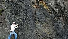 Outcrop of the Macanal Formation along the road between Bogotá and Villavicencio | |
| Type | Geological formation |
| Unit of | Cáqueza Group |
| Underlies | Las Juntas Formation |
| Overlies | Guavio Fm., Santa Rosa Fm., Ubalá Fm., Chivor Fm., Batá Fm. |
| Thickness | up to 2,935 m (9,629 ft) |
| Lithology | |
| Primary | Organic shale |
| Other | Limestone, gypsum, emeralds |
| Location | |
| Coordinates | 4°58′19″N 73°19′10″W / 4.97194°N 73.31944°WCoordinates: 4°58′19″N 73°19′10″W / 4.97194°N 73.31944°W |
| Region |
Altiplano Cundiboyacense & Tenza Valley Eastern Ranges Andes |
| Country |
|
| Type section | |
| Named for | Macanal |
| Named by | Rodríguez & Ulloa |
| Location | Macanal |
| Year defined | 1979 |
| Coordinates | 4°58′19″N 73°19′10″W / 4.97194°N 73.31944°W |
| Region | Boyacá |
| Country |
|
The Macanal Formation or Macanal Shale (Spanish: (Formación) Lutitas de Macanal, Kilm, K1m) is a fossiliferous geological formation of the Altiplano Cundiboyacense and Tenza Valley in the Eastern Ranges of the Colombian Andes. The predominantly organic shale formation dates to the Early Cretaceous period; Berriasian to Valanginian epochs and has a maximum thickness of 2,935 metres (9,629 ft). The Macanal Formation contains numerous levels of fossiliferous abundances. Bivalves, ammonites and fossil flora have been found in the formation.
The formation is a source rock for oil and gas in the Eastern Cordillera Basin and adjacent Llanos Basin foothills and provides emeralds in the vicinity of Macanal, after which the formation is named.
Etymology
The formation was defined and named in 1979 by Rodríguez and Ulloa after Macanal, Cundinamarca.[1][2] The name Macanal is either derived from the Muysccubun word Macana, meaning garrote, or from the Macana palm tree.[3][4]
Description
Lithologies

The Macanal Formation has a maximum thickness of 2,935 metres (9,629 ft), and is characterised by a sequence of micaceous organic shales,[2] with calcite veins and gypsum occurrences intercalated in the formation. The Macanal Formation contains high values of TOC.[5] In the Eastern Cordillera Basin and the adjacent foothills of the Llanos Basin, the Macanal Formation is a source rock for oil and gas.[6] In the vicinity of Macanal, the formation provides emeralds.[7][8]
Stratigraphy and depositional environment
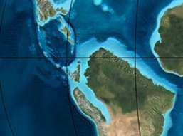
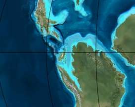
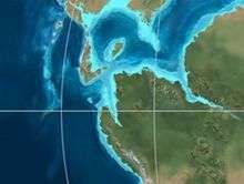
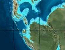
The Macanal Formation, a unit of the Cáqueza Group, concordantly overlies the Guavio, Santa Rosa, Ubalá, Chivor and Batá Formations,[9] and is concordantly overlain by the Las Juntas Formation. The age has been estimated to be Berriasian to Valanginian. Stratigraphically, the formation is time equivalent with the Mercedes, Tambor, Rosablanca, Murca and La Naveta Formations.[10] The formation has been deposited in a shallow marine environment in an enclosed basin,[5] with as provenance areas the Santander High and the Guiana Shield.[11] The Macanal Formation is part of the syn-rift sequence of eastern Colombia.[12]
Fossil content
The Macanal Formation contains numerous levels of fossiliferous abundances. Bivalves, ammonites and flora have been found in the formation.[13] Ammonites of Substeueroceras cf. mutabile, Sarasinella cf. hondana, Subalpinites sp., Berriasela sp., Neocomites cf. wichmanni, Olcostephanus sp., Olcostephanus cf. atherstoni, Favrella cf. colombiana, Acanthodiscus sp. have been registered in the formation, as well as bivalves of Corbis (Sphaera) cf. corrugata, Trigonia cf. hondana, Trigonia (Buchotrigonia) cf. abrupta, Trigonia (Notoscabrotrigonia) cf. tocaimaana, and Exogyra cf. boussingaulti.[14] Analysis of the deformation registered in ammonite fossils has helped in understanding the tectonic history of the Llanos foothills of the Eastern Ranges.[15]
Outcrops
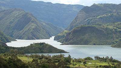
The Macanal Formation is apart from its type locality in the Batá River canyon,[16][17] found in the Cravo Sur anticline, east of the Ocetá Páramo,[18] in the Desespero Synclinal in the southern and northern parts of Labranzagrande,[19][20] around Páez and Campohermoso,[17] in the eastern part of Gama, bordering the Guavio Reservoir,[21] and in the Servitá Synclinal, west of Villavicencio.[22] The Macanal Formation crops out along the road between Bogotá and Villavicencio and is there heavily fractured and folded. The Macanal Formation is the most extensive formation around Cáqueza,[23] and Gachalá, Cundinamarca.[24]
The Pajarito Fault thrusts the Macanal Formation on top of the Fómeque Formation to the east of Lake Tota,[25] and the Chámeza Fault thrusts the Macanal Formation on top of the overlying Las Juntas Formation around Chámeza, Casanare.[26] The Ubaque Fault forms the contact between the Fómeque Formation and the Macanal Formation,[27] while the Las Mercedes Fault puts the Quetame Group in contact with the Macanal Formation near Quetame,[28] as does the San Juanito Fault.[29] The Servitá Fault forms the contact between the Guatiquía Redbeds and the Macanal Formation,[30] and the Upín Fault, part of the same system puts the Macanal Formation in contact with the Tertiary Palmichal Group.[31] At this contact, brines are extracted from the formation.[32]
Regional correlations
See also
References
- ↑ Acosta & Ulloa, 2002, p.51
- 1 2 Rodríguez & Solano, 2000, p.47
- ↑ (in Spanish) Official website Macanal
- ↑ (in Spanish) Etymology Municipalities Boyacá
- 1 2 Acosta & Ulloa, 2002, p.52
- ↑ García González et al., 2009, p.49
- ↑ Uribe, 1960, p.5
- ↑ ANM, 2015, p.1
- ↑ Terraza et al., 2013, p.110
- ↑ Villamil, 2012, p.168
- ↑ Villamil, 2012, p.165
- ↑ Schütz, 2012, p.26
- ↑ Patiño et al., 2011, p.45
- ↑ Piraquive et al., 2011, p.204
- ↑ Montaña Cárdenas, 2015, p.52
- ↑ Rodríguez & Solano, 2000, p.46
- 1 2 Plancha 210, 2010
- ↑ Plancha 172, 1998
- ↑ Plancha 193, 1992
- ↑ Pinto Valderrama et al., 2010, p.44
- ↑ Plancha 228, 1998
- ↑ Plancha 266, 1998
- ↑ Patiño et al., 2011, p.44
- ↑ Terraza et al., 2013, p.101
- ↑ Plancha 192, 1998
- ↑ Plancha 211, 2009
- ↑ Patiño et al., 2011, p.102
- ↑ Patiño et al., 2011, p.110
- ↑ Patiño et al., 2011, p.114
- ↑ Patiño et al., 2011, p.122
- ↑ Patiño et al., 2011, p.123
- ↑ Patiño et al., 2011, p.125
Bibliography
- Acosta Garay, Jorge E., and Carlos E. Ulloa Melo. 2002. Mapa Geológico del Departamento de Cundinamarca - 1:250,000 - Memoria explicativa, 1–108. INGEOMINAS. Accessed 2017-04-26.
- ANM, .. 2015. Esmeralda, 1–2. ANM.
- García González, Mario; Ricardo Mier Umaña; Luis Enrique Cruz Guevara, and Mauricio Vásquez. 2009. Informe Ejecutivo - evaluación del potencial hidrocarburífero de las cuencas colombianas, 1–219. Universidad Industrial de Santander.
- Montaña Cárdenas, Jorge Hernando. 2015. Análisis de deformaciones y modelo estructural del frente de deformación del Piedemonte Llanero de la Cordillera Oriental de Colombia (MSc. thesis), 1–57. Universidad Nacional de Colombia. Accessed 2017-08-04.
- Patiño, Alejandro; Jaime Fuquen; Julián Ramos; Andrea Pedraza; Leonardo Ceballos; Lyda Pinzón; Yadira Jerónimo; Leidy Álvarez, and Andrea Torres. 2011. Cartografía geológica de la Plancha 247 - Cáqueza - 1:100,000, . INGEOMINAS. Accessed 2017-08-04.
- Pinto Valderrama, Jorge Eduardo; José Pedro Mora Ortiz; Gloria Reátiga Tarazona; Jorge Alberto Rey Pilonieta; Silvia Johana Toloza Hormiga; Diego Andrés Torres Coronado; David Ricardo Vargas Mojica, and Cristian Julián Zafra Manrique. 2010. Geología del Piedemonte Llanero en la Cordillera Oriental, departamentos de Arauca y Casanare, 1–64. INGEOMINAS & Universidad Industrial de Santander. Accessed 2017-08-04.
- Piraquive, Alejandro; Juan Sebastián Díaz; Tomas Cuéllar; Germán Pardo, and Andreas Kammer. 2011. Reactivación Neógena de estructuras de rift del Cretácico Temprano asociadas con la Falla de Chámeza, Pajarito, Boyacá (Colombia): evidencias tectónicas y bioestratigráficas. Geología Colombiana 36. 197–216. Accessed 2017-08-04.
- Rodríguez Parra, Antonio José, and Orlando Solano Silva. 2000. Mapa Geológico del Departamento de Boyacá - 1:250,000 - Memoria explicativa, 1–120. INGEOMINAS.
- Schütz, Christian. 2012. Combined structural and Petroleum Systems Modeling in the Eastern Cordillera Basin, Colombia (MSc. thesis), 1–161. Rheinisch-Westfälische Technische Hochschule Aachen & Instituto Colombiano del Petróleo.
- Terraza, Roberto; Diana Montoya; Germán Reyes; Giovanni Moreno; Jaime Fúquen; Eliana Torres Jaimes; Myriam López Cardona; Álvaro Nivia Guevara, and Fernando Etayo Serna. 2013. Geología de la Plancha 229 - Gachalá - 1:100,000, 1–296. Servicio Geológico Colombiano. Accessed 2017-08-04.
- Uribe, Sylvano E. 1960. Las esmeraldas de Colombia. Boletín de la Sociedad Geográfica de Colombia XVIII. 1–8. Accessed 2016-07-08.
- Villamil, Tomas. 2012. Chronology Relative Sea Level History and a New Sequence Stratigraphic Model for Basinal Cretaceous Facies of Colombia, 161–216. Society for Sedimentary Geology (SEPM).
Maps
- Ulloa, Carlos E.; Álvaro Guerra, and Ricardo Escovar. 1998. Plancha 172 - Paz de Río - 1:100,000, 1. INGEOMINAS. Accessed 2017-06-06.
- Ulloa, Carlos E.; Erasmo Rodríguez, and Ricardo Escovar. 1998. Plancha 192 - Laguna de Tota - 1:100,000, 1. INGEOMINAS. Accessed 2017-06-06.
- Renzoni, Giancarlo. 1992. Plancha 193 - Yopal - 1:100,000, 1. INGEOMINAS. Accessed 2017-06-06.
- Terraza, Roberto; Giovanni Moreno; José A. Buitrago; Adrián Pérez, and Diana María Montoya. 2010. Plancha 210 - Guateque - 1:100,000, 1. INGEOMINAS. Accessed 2017-06-06.
- Ulloa, Carlos, and Erasmo Rodríguez. 2009. Plancha 211 - Tauramena - 1:100,000, 1. INGEOMINAS. Accessed 2017-06-06.
- Buitrago, José Alberto; Roberto Terraza M., and Fernando Etayo. 1998. Plancha 228 - Santafé de Bogotá Noreste - 1:100,000, 1. INGEOMINAS. Accessed 2017-06-06.
- Pulido, Orlando; Luz Stella Gómez, and Pedro Marín. 1998. Plancha 266 - Villavicencio - 1:100,000, 1. INGEOMINAS. Accessed 2017-06-06.
External links
| Wikimedia Commons has media related to Macanal Formation. |
- Gómez, J.; N.E. Montes; Á. Nivia, and H. Diederix. 2015. Plancha 5-09 del Atlas Geológico de Colombia 2015 – escala 1:500,000, 1. Servicio Geológico Colombiano. Accessed 2017-03-16.
Paleontology in Colombia | |||||||||||||
|---|---|---|---|---|---|---|---|---|---|---|---|---|---|
| Notable researchers |
|   .jpg) 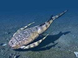 | |||||||||||
| Major fossiliferous stratigraphic units |
| ||||||||||||
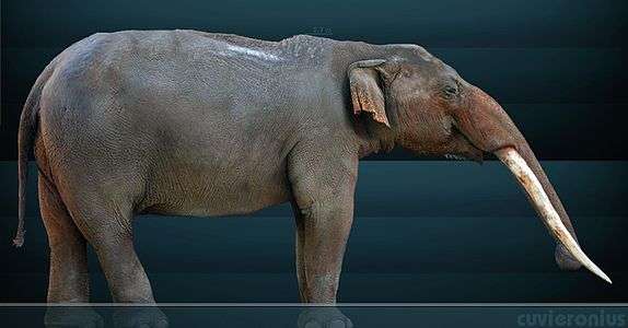
| Notable fossils | |||||||||||||
| Geology |
|  | |||
|---|---|---|---|---|---|
| History |
| ||||
| Main mining areas |
| ||||
| Individual mines | |||||
| Individual emeralds (ct) |
| ||||
| Related articles | |||||
| |||||