Arcabuco Formation
| Arcabuco Formation Stratigraphic range: Tithonian-Berriasian ~145–142 Ma | |
|---|---|
 Arcabuco Formation at the Sáchica rock shelter | |
| Type | Geological formation |
| Underlies | Rosablanca Fm., Cumbre Fm. |
| Overlies | Girón Formation |
| Thickness | 500–800 m (1,600–2,600 ft) |
| Lithology | |
| Primary | Sandstone |
| Other | Shale |
| Location | |
| Coordinates | 5°38′11″N 73°30′41″W / 5.63639°N 73.51139°WCoordinates: 5°38′11″N 73°30′41″W / 5.63639°N 73.51139°W |
| Region |
Altiplano Cundiboyacense Eastern Ranges, Andes |
| Country |
|
| Type section | |
| Named for | Arcabuco |
| Named by | Scheibe |
| Location |
Arcabuco (original) Villa de Leyva (redefined) |
| Year defined | 1938, 1985 |
| Coordinates | 5°38′11″N 73°30′41″W / 5.63639°N 73.51139°W |
| Region | Boyacá |
| Country |
|
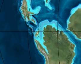
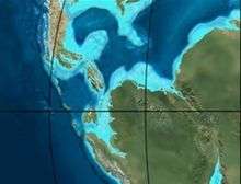 Paleogeography of Northern South America 150 Ma, by Ron Blakey | |
The Arcabuco Formation (Spanish: Formación Arcabuco, Jar, JKa) is a geological formation of the Altiplano Cundiboyacense, Eastern Ranges of the Colombian Andes. The formation consists of thick beds of light-coloured quartzitic sandstones and conglomerates with occasional shales and dates to the Late Jurassic and Early Cretaceous periods; Tithonian to Berriasian epochs. Dinosaur footprints have been found in the Arcabuco Formation near the Iguaque anticlinal outside Chíquiza, Boyacá.
Etymology
The formation was first defined by Scheibe in 1938 and named after Arcabuco, Boyacá.[1] The type section of the Arcabuco Formation was redefined in 1985 by Galvis and Rubiano around Villa de Leyva.[2]
Description
Lithologies
The Arcabuco Formation is characterised by a sequence of light- to pink-coloured fine quartzitic sandstones and conglomerates with red shales up to 50 metres (160 ft) in thickness intercalated.[1][3] In the Arcabuco Formation, in the Iguaque Anticlinal, dinosaur tracks have been found.[4] The overhanging rock shelter of Sáchica in Sáchica, Boyacá, consists of the sandstones of the Arcabuco Formation.
Stratigraphy and depositional environment
The 500 to 800 metres (1,600 to 2,600 ft) thick Arcabuco Formation unconformably overlies the Girón Formation and is overlain by the Rosablanca and Cumbre Formations.[5] The age has been estimated to be Late Jurassic to Early Cretaceous. Stratigraphically, the formation is time equivalent with the Guavio and La Naveta Formations of the eastern and southern Altiplano respectively.[1][6] The Arcabuco Formation has been deposited in a rift basin setting.[7]
Outcrops
The Arcabuco Formation is found apart from its original type locality near Arcabuco, in the anticlinal of Lake Iguaque between Villa de Leyva, Sáchica and Chíquiza, where the formation has been redefined in the Arcabuco Anticlinal.[4][8]
Regional correlations
See also
References
Bibliography
- Galvis Arenas, Beatriz Elena, and José Leonardo Valencia Escobar. 2009. Contribución en la determinación de los posibles paleoambientes de las rocas Cretáceas Tempranas sobre la vía Tunja-Villa de Leyva (entre Alto del Arrayán - Peaje Sáchica) y sectores aledaños, departamento de Boyacá, 1–127. Universidad de Caldas.
- Moreno Sánchez, Mario; Arley de Jesús Gómez Cruz, and Jorge Gómez Tapias. 2012. Reporte de huellas de dinsosaurios en el Santuario de Fauna y Flora de Iguaque, en cercanías de Chíquiza (Boyacá, Colombia). Boletín de Geología, Universidad Industrial de Santander 33. _. Accessed 2017-05-02.
- Rodríguez Parra, Antonio José, and Orlando Solano Silva. 2000. Mapa Geológico del Departamento de Boyacá - 1:250,000 - Memoria explicativa, 1–120. INGEOMINAS.
- Villamil, Tomas. 2012. Chronology Relative Sea Level History and a New Sequence Stratigraphic Model for Basinal Cretaceous Facies of Colombia, 161–216. Society for Sedimentary Geology (SEPM).
Maps
- Beltrán, Alejandro; José Alfredo Lancheros; Carolina López; Claudia Chaquea; Alejandro Patiño; Angela Guerra; Julio C. Cabrera; Claudia I. Quintero, and Simón Emilio Molano. 2008. Plancha 134 - Puerto Parra - 1:100,000, 1. INGEOMINAS. Accessed 2017-06-06.
- Angarita, Leonidas; Víctor Carrillo; Alfonso Castro; Rommel Daconte; Mario Niño; Orlando G. Pulido; J. Antonio Rodríguez; José María Royero, and Rosalba Salinas, Carlos Ulloa and Rodrigo Vargas. 2009. Plancha 135 - San Gil - 1:100,000, 1. INGEOMINAS. Accessed 2017-06-06.
- Beltrán, Alejandro; José Alfredo Lancheros; Carolina López; Claudia Chaquea; Alejandro Patiño; Angela Guerra; Julio C. Cabrera; Claudia I. Quintero, and Simón Emilio Molano. 2008. Plancha 150 - Cimitarra - 1:100,000, 1. INGEOMINAS. Accessed 2017-06-06.
- Pulido González, Orlando. 2009. Plancha 151 - Charalá - 1:100,000, 1. INGEOMINAS. Accessed 2017-06-06.
- Ulloa, Carlos E, and Erasmo Rodríguez. 2009. Plancha 170 - Vélez - 1:100,000, 1. INGEOMINAS. Accessed 2017-06-06.
- Renzoni, Giancarlo, and Humberto Rosas. 2009. Plancha 171 - Duitama - 1:100,000, 1. INGEOMINAS. Accessed 2017-06-06.
- Renzoni, Giancarlo; Humberto Rosas, and Fernando Etayo Serna. 1998. Plancha 191 - Tunja - 1:100,000, 1. INGEOMINAS. Accessed 2017-06-06.
External links
- Gómez, J.; N.E. Montes; Á. Nivia, and H. Diederix. 2015. Plancha 5-09 del Atlas Geológico de Colombia 2015 – escala 1:500,000, 1. Servicio Geológico Colombiano. Accessed 2017-03-16.
Paleontology in Colombia | |||||||||||||
|---|---|---|---|---|---|---|---|---|---|---|---|---|---|
| Notable researchers |
|   .jpg)  | |||||||||||
| Major fossiliferous stratigraphic units |
| ||||||||||||
| Notable fossils | |||||||||||||