Chipaque Formation
| Chipaque Formation Stratigraphic range: Cenomanian-Turonian ~97–90 Ma | |
|---|---|
| Type | Geological formation |
| Unit of | Villeta Group |
| Underlies |
Guadalupe Gp Arenisca Dura Fm |
| Overlies | Une Formation |
| Thickness | up to 1,700 metres (5,580 ft) |
| Lithology | |
| Primary | Organic shale |
| Other | Sandstone, limestone, siltstone |
| Location | |
| Coordinates | 4°27′07″N 74°03′20″W / 4.45194°N 74.05556°WCoordinates: 4°27′07″N 74°03′20″W / 4.45194°N 74.05556°W |
| Region |
Altiplano Cundiboyacense Eastern Ranges, Andes |
| Country |
|
| Type section | |
| Named for | Chipaque |
| Named by | Hubach |
| Location | Chipaque |
| Year defined | 1957 |
| Coordinates | 4°27′07″N 74°03′20″W / 4.45194°N 74.05556°W |
| Region | Cundinamarca, Boyacá |
| Country |
|
| Thickness at type section | 1,027 metres (3,370 ft) |
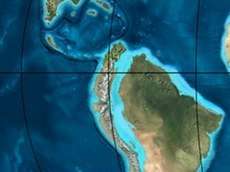
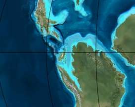
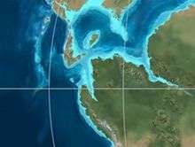
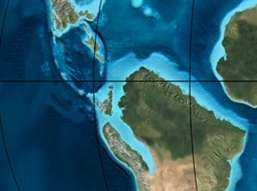 Paleogeography of Northern South America 90 Ma, by Ron Blakey | |
The Chipaque Formation (Spanish: Formación Chipaque, K2cp, Kc) is a geological formation of the Altiplano Cundiboyacense, Eastern Ranges of the Colombian Andes. The predominantly organic shale formation dates to the Late Cretaceous period; Cenomanian-Turonian epochs and has a maximum thickness of 1,700 metres (5,600 ft). The formation, rich in TOC, is an important oil and gas generating unit for the giant oilfields Cupiagua and Cusiana of the Eastern Ranges as well as in the Llanos Orientales.
Etymology
The formation was named in 1931 as group and as formation in 1957 by Hubach after Chipaque, Cundinamarca.[1]
Description
Lithologies
The Chipaque Formation with a maximum thickness of 1,700 metres (5,600 ft), is characterised by a sequence of pyritic organic shales, limestones and siltstones, with sandstone banks intercalated in the formation.[2] The Chipaque Formation contains a high density of fauna.[1] The formation is rich in TOC and one of the principal source rocks for oil and gas generation in the foothills of the Eastern Ranges,[3] sourcing fields as Cusiana, Cupiagua and many others.[4] Chipaque also sourced the oilfields of the Llanos Orientales.[5] In the Chitasugá-1 well, drilled between 1980 and 1981, from the sandstones of the Chipaque Formation half a million m³ of water were produced.[6] The sandstone beds are reservoir rocks for oil in the Eastern Ranges.[3]
Stratigraphy and depositional environment
The Chipaque Formation overlies the Une Formation and is overlain by the Guadalupe Group. The core of the Zipaquirá Anticline consists of the Chipaque Formation.[7] The age has been estimated to be Cenomanian-Turonian.[1] Stratigraphically, the formation is time equivalent with the Simijaca Formation.[8] The formation has been deposited in an open to shallow marine platform setting.[9] The deposition is represented by a maximum flooding surface and anoxic conditions.[10]
Outcrops
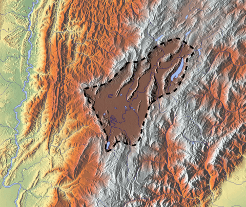
The Chipaque Formation is apart from its type locality, found in the Eastern Hills of Bogotá, the Ocetá Páramo and many other locations in the Eastern Ranges. The anticlinals of the Río Blanco-Machetá, San José and Sopó-Sesquilé are composed of the Chipaque Formation.[1]
Regional correlations
Gallery
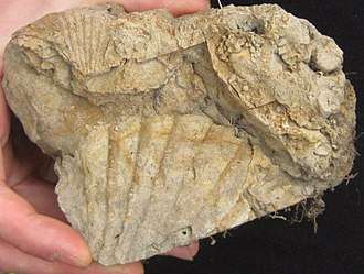 Oyster fossils from a sandstone bank of the Chipaque Formation
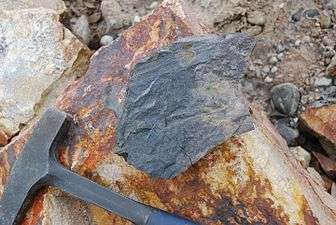 Organic shale of the Chipaque Formation
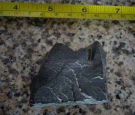 Chipaque Formation
Ocetá Páramo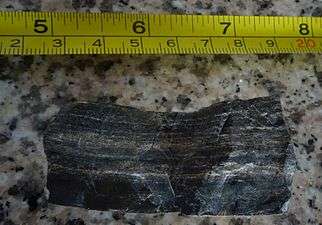 Chipaque Formation
Ocetá Páramo Banded shale of the Chipaque Formation
Ocetá Páramo
See also
References
- 1 2 3 4 Montoya Arenas & Reyes Torres, 2005, p.26
- ↑ Lobo Guerrero, 1992, p.4
- 1 2 García González et al., 2009, p.49
- ↑ Cortés et al., 2009, p.4
- ↑ García González et al., 2009, p.58
- ↑ Lobo Guerrero, 1993, p.20
- ↑ García & Jiménez, 2016, p.24
- ↑ Montoya Arenas & Reyes Torres, 2005, p.22
- ↑ García González et al., 2009, p.209
- ↑ Villamil, 2012, p.164
Bibliography
- Cortés, Martín; Diego García; Germán Bayona, and Yolima Blanco. 2009. Timing of oil generation in the Eastern flank of the Eastern Cordillera of Colombia based on kinematic models; implications in the Llanos Foothills and Foreland charge, 1–8. Asociación Colombiana de Geólogos y Geofisicos del Petróleo (ACGGP).
- García, Helbert, and Giovanny Jiménez. 2016. Structural analysis of the Zipaquirá Anticline (Eastern Cordillera, Colombia). Boletín de Ciencias de la Tierra, Universidad Nacional de Colombia 39. 21–32.
- García González, Mario; Ricardo Mier Umaña; Luis Enrique Cruz Guevara, and Mauricio Vásquez. 2009. Informe Ejecutivo - evaluación del potencial hidrocarburífero de las cuencas colombianas, 1–219. Universidad Industrial de Santander.
- Guerrero Uscátegui, Alberto Lobo. 1993. Informe sobre la Cuenca Petrolífera de la Sabana de Bogotá, Colombia, 1–29.
- Guerrero Uscátegui, Alberto Lobo. 1992. Geología e Hidrogeología de Santafé de Bogotá y su Sabana, 1–20. Sociedad Colombiana de Ingenieros.
- Montoya Arenas, Diana María, and Germán Alfonso Reyes Torres. 2005. Geología de la Sabana de Bogotá, 1–104. INGEOMINAS.
- Villamil, Tomas. 2012. Chronology Relative Sea Level History and a New Sequence Stratigraphic Model for Basinal Cretaceous Facies of Colombia, 161–216. Society for Sedimentary Geology (SEPM).
Maps
- Ulloa, Carlos E.; Álvaro Guerra, and Ricardo Escovar. 1998. Plancha 172 - Paz de Río - 1:100,000, 1. INGEOMINAS. Accessed 2017-06-06.
- Ulloa, Carlos E.; Erasmo Rodríguez, and Ricardo Escovar. 1998. Plancha 192 - Laguna de Tota - 1:100,000, 1. INGEOMINAS. Accessed 2017-06-06.
- Renzoni, Giancarlo. 1992. Plancha 193 - Yopal - 1:100,000, 1. INGEOMINAS. Accessed 2017-06-06.
- Montoya, Diana María, and Germán Reyes. 2009. Plancha 209 - Zipaquirá - 1:100,000, 1. INGEOMINAS. Accessed 2017-06-06.
- Terraza, Roberto; Giovanni Moreno; José A. Buitrago; Adrián Pérez, and Diana María Montoya. 2010. Plancha 210 - Guateque - 1:100,000, 1. INGEOMINAS. Accessed 2017-06-06.
- Ulloa, Carlos, and Erasmo Rodríguez. 2009. Plancha 211 - Tauramena - 1:100,000, 1. INGEOMINAS. Accessed 2017-06-06.
- Buitrago, José Alberto; Roberto Terraza M., and Fernando Etayo. 1998. Plancha 228 - Santafé de Bogotá Noreste - 1:100,000, 1. INGEOMINAS. Accessed 2017-06-06.
- Ulloa, Carlos E; Ricardo Escovar, and Adolfo H. Pacheco. 2009. Plancha 230 - Monterrey - 1:100,000, 1. INGEOMINAS. Accessed 2017-06-06.
- Acosta, Jorge E., and Carlos E. Ulloa. 1998. Plancha 246 - Fusagasugá - 1:100,000, 1. INGEOMINAS. Accessed 2017-06-06.
- Acosta, Jorge; Juan Carlos Calcedo, and Carlos Ulloa. 1999. Plancha 265 - Icononzo - 1:100,000, 1. INGEOMINAS. Accessed 2017-06-06.
- Pulido, Orlando; Luz Stella Gómez, and Pedro Marín. 1998. Plancha 266 - Villavicencio - 1:100,000, 1. INGEOMINAS. Accessed 2017-06-06.
- Acosta, Jorge; Pablo Caro; Jaime Fuquen, and José Osorno. 2002. Plancha 303 - Colombia - 1:100,000, 1. INGEOMINAS.
- Velandia, Francisco, and Héctor Cepeda. 2005. Planchas 171 & 191 - Geología sector del sur del municipio de Paipa (Boyacá) - 1:25,000. INGEOMINAS.
- Various, Authors. 1997. Mapa geológico de Santa Fe de Bogotá – Geological Map Bogotá – 1:50,000, 1. INGEOMINAS. Accessed 2017-03-16.
External links
| Wikimedia Commons has media related to Chipaque Formation. |
- Gómez, J.; N.E. Montes; Á. Nivia, and H. Diederix. 2015. Plancha 5-09 del Atlas Geológico de Colombia 2015 – escala 1:500,000, 1. Servicio Geológico Colombiano. Accessed 2017-03-16.