List of state highways in Oklahoma
.svg.png)   | |
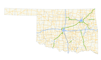 Map showing Oklahoma's numbered highways | |
| Highway names | |
|---|---|
| Interstates | Interstate nn (I-nn) |
| US Highways | U.S. Highway nn (US nn) |
| State | State Highway nn (SH-nn) |
| System links | |
|
Oklahoma State Highway System
| |
Oklahoma has a large network of numbered highways maintained by the state. These roads fall into one of three categories: Interstate highways, U.S. highways, and state highways. Interstate highways and U.S. highways are continuous with surrounding states, while state highways are not (though Oklahoma and another state's department of transportation may coordinate numbering).
The majority of the numbered highways within Oklahoma are maintained by the Oklahoma Department of Transportation. The only exceptions are sections of Interstate 44 and U.S. Highway 412, which run along turnpikes maintained by the Oklahoma Turnpike Authority. (I-44 runs along the H.E. Bailey, Turner, and Will Rogers Turnpikes; US-412 is signed along the Cimarron and Cherokee Turnpikes.)
Individual counties may establish a numbering system to apply to roads that they maintain. These highways are not listed here.
Interstate highways
U.S. highways
State highways
Oklahoma's state highways serve as the second-lowest tier on the Oklahoma road system. They are marked with a number contained inside an outline of the state, having been formerly marked inside a white circle in a black box until January 2006.[1]
SH-81 has not been issued for a state highway so that is not confused with US Highways and Interstates bearing the same number designation. SH-35 has been issued, but it is only for a short spur, far from I-35. SH-60, SH-62, SH-69, and SH-75 were once assigned but these designation have since been revoked. Other two-digit highways that have yet to be assigned include: SH-12, SH-13, SH-21, SH-41, SH-57, SH-61, SH-68, and SH-90. SH-40 was once issued, but was absorbed into U.S. Highway 177; see SH-40A. SH-41, which was an east-west route across west-central Oklahoma that began at the intersection of S.W. 29th and May Avenue in Oklahoma City and veered southwest to Mustang, Union City and Minco before continuing west through Binger, Eakly, Cordell and Sayre and then crossing the Texas border near Sweetwater, was redesignated as SH-152 over its entire length in 1955. Across the Texas Panhandle, the highway continues as TX-152 to Dumas, Texas. SH-61 had a strange east-west route across south-central Oklahoma that started at SH-13 (Now SH-3W). Where it headed south, passing through Vanoss and then to Roff, where it turned east to Fittstown. It then headed south with SH-99 until turning east again. The road turned north in Jessie. It went north until it turned back east north of Stonewall It turned east again until it ended on SH-48 in Luna.
Many Oklahoma state highways have short spur routes connecting them to towns which lay off of the main route. Many times, these bear the same number as the parent highway, with a letter suffix. Some state highway spurs and loops from US highways have designations that are drawn from the parent US Highway designation.
As higher-level roads replaced sections of some routes, those sections sometimes had their designation revoked. This led to some highways being fragmented, missing one or more sections in the middle of the road. There are also a few unrelated highways that are designated in completely different parts of the state with the same number.
- This transport-related list is incomplete; you can help by expanding it.
| Number | Length (mi)[2] | Length (km) | Southern or western terminus | Northern or eastern terminus | Formed | Removed | Notes |
|---|---|---|---|---|---|---|---|
| 209.7[3] | 337.5 | US-177/SH-199 between Mannsville and Madill | Highway 88 toward Mena, Ark. | 1968 | current | ||
| — | — | — | — | 1924 | 1933 | Became part of SH-51 | |
| — | — | — | — | 1933 | 1962 | Supplanted by I-40 | |
| 116.7[4] | 187.8 | SH-3 west of Antlers | US-64 in Warner | c. 1934 | current | ||
| 26.3[5] | 42.3 | US-60 / US-69 in Vinita | US-59 toward Chetopa, Kan. | — | — | ||
| — | — | Texas state line | Kansas state line | 1924 | 1930 | Became US-81 | |
| — | — | Goodland | US-271/SH-109 south of Hugo | 1934 | 1986 | Now OK-271A | |
| 616.0 | 991.4 | US-287/US-385 toward Campo, Colo. | Highway 32 toward Foreman, Ark. | 1937 | current | ||
| — | — | — | — | 1924 | 1931 | Became US-270 | |
| 2.22 | 3.57 | SH-3 / SH-74 in Oklahoma City | I-44 / SH-66 in Oklahoma City | c. 1979 | c. 2009 | ||
| 1.32 | 2.12 | SH-7 in Atoka | US-75 / SH-3 in Atoka | c. 1985 | current | ||
| 58.4 | 94.0 | I-40 / US-177 / US-270 / SH-3 northwest of Shawnee | SH-1 / SH-3 / SH-19 west of Ada | 1976 | current | Merges with SH-3W at either end to form SH-3 | |
| 50.6 | 81.4 | I-40/US-177/US-270/SH-3 northwest of Shawnee | SH-1/SH-3/SH-19 west of Ada | 1976 | current | Merges with SH-3E at either end to form SH-3 | |
| 41.7 | 67.1 | I-44/Norman Spur Turnpike south of Bridge Creek | Piedmont | 1941 | current | ||
| 12.01[6] | 19.33 | US-259 in Smithville | AR 4 at the Arkansas state line | 1963 | current | Formerly SH-21 | |
| — | — | — | — | 1924 | 1930 | Became US-77 | |
| 20.42[7][8] | 32.86 | US-62 in Gould | SH-6 in Eldorado | 1924 | current | ||
| 98.2[9] | 158.0 | US-283 south of Altus | US-70 in Waurika | 1924 | current | ||
| 8.00[10] | 12.87 | US-277/US-281 at Cookietown | SH-5 west of Temple | 1947 | current | ||
| 7.00[10] | 11.27 | US-70 at Taylor | SH-5A east of Cookietown | 1950 | current | ||
| 8.48[11] | 13.65 | SH-5 in Tipton | US-183 in Manitou | 1954 | current | ||
| 121.8[12] | 196.0 | TX-6 toward Quanah, Tex. | SH-152 east of Sweetwater | 1948 | current | ||
| — | — | — | — | 1924 | 1930 | ||
| 150.5[13] | 242.2 | I-44/US-277/US-281 in Lawton | US-69/US-75/SH-3 in Atoka | 1941 | current | ||
| — | — | — | — | 1924 | 1935 | ||
| — | — | — | — | 1935 | 1936 | Became SH-37 | |
| — | — | — | — | 1936 | 1937 | ||
| 1.99[14] | 3.20 | SH-81A in Duncan | SH-7 in Duncan | 1961 | current | ||
| — | — | SH-7 in Lawton | Fort Sill | 1944 | 1988 | ||
| — | — | US-77 near Turner Falls | SH-7 west of Davis | 1948 | 1956 | ||
| — | — | Dougherty | SH-7 in Davis | 1948 | 1956 | Renumbered as SH-110 | |
| 3.50[15] | 5.63 | SH-7 south of Bromide | Bromide | 1954 | current | ||
| 4[16] | 6 | SH-7 west of Sulphur | US-177 / Chickasaw Tpk. north of Sulphur | 2011[17] | current | Previously a segment of the Chickasaw Turnpike | |
| 179.1[18] | 288.2 | US-277/SH-19 north of Cyril | K-8 toward Kiowa, Kan. | 1924[19] | current | ||
| 4.78[20] | 7.69 | SH-8 north of Watonga | SH-51A west of Roman Nose State Park | 1944 | current | ||
| 1.00[21] | 1.61 | Aline | SH-8 east of Aline | — | — | ||
| 348.1[22] | 560.2 | TX-203 toward Wellington, Tex. | I-540/US-271 toward Ft. Smith, Ark. | 1924[23] | current | ||
| — | — | SH-39 in Konawa | I-40 northeast of Shawnee | 1947 | current | ||
| 4.11[24] | 6.61 | US-69 north of Canadian | SH-9 | 1950 | current | ||
| 8.50[25] | 13.68 | US-271/SH-9 east of Spiro | Fort Smith, Ark. | 1959 | current | ||
| 233.1[26] | 375.1 | SH-99 west of Herd | I-40 southeast of Gore | 1924 | current | ||
| 6.14[27][28] | 9.88 | SH-10 southeast of Braggs | SH-100 near Tenkiller Ferry Dam | 1959 | current | ||
| 4.37[29] | 7.03 | SH-10 east of Miami | Route U toward Seneca, Mo. | 1954 | current | ||
| 204.9[30] | 329.8 | US-281 north of Alva | I-244 in Tulsa | 1924 | current | ||
| 5.00[31] | 8.05 | SH-11 west of Medford | Wakita | 1956 | current | ||
| 0.100[32] | 0.161 | To be determined | To be determined | proposed | — | Gilcrease Expressway[32] | |
| — | — | SH-7 south of Mill Creek | US-177/SH-199 east of Mannsville | 1924 | 1985 | Became part of SH-1 | |
| — | — | — | — | 1924 | 1930 | Transferred to US-164 (became US-60 in 1931) | |
| — | — | US-177 south of Asher | SH-1/SH-99 in Ada | 1937 | 1976 | Became SH-3W | |
| 27.85[33] | 44.82 | US-281/SH-45 in Waynoka | US-64/US-281 in Alva | 1924 | current | ||
| 47.1 | 75.8 | SH 15 toward Follett, Tex. | US-183/US-270/SH-3 in Woodward | 1924 | current | Formerly connected to the other instance of SH-15 | |
| 62.4 | 100.4 | US-64/US-412/SH-74 south of Garber | SH-18 north of Pawnee | 1924 | current | Formerly connected to the other instance of SH-15 | |
| 4.52[34] | 7.27 | SH-15 in Woodward | Boiling Springs State Park | c. 1948 | 1956 | Became SH-34 and SH-34C | |
| 99.2 | 159.6 | SH-33/SH-99 in Drumright | SH-51 in Wagoner | 1937 | current | ||
| 99.2 | 159.6 | SH-33/SH-99 in Drumright | SH-51 in Wagoner | 1924 | 1935 | Became US-169 | |
| 20.86[35][36] | 33.57 | US-277 in Elgin | US-81 Bus. in Rush Springs | 1937 | current | ||
| — | — | — | — | 1924 | 1935 | Became US-59 | |
| 3.10[37] | 4.99 | I-35 southwest of Wynnewood | US-77 south of Wynnewood | 1983 | current | ||
| 134.4 | 216.3 | US-270 in Shawnee | K-15 toward Dexter, Kan. | 1924 | current | ||
| 0.39[38] | 0.63 | US-177 in Chickasaw National Recreation Area | Veterans' hospital | — | — | ||
| 4.63[39] | 7.45 | SH-18 south of Chandler | Sparks | 1953 | current | ||
| — | — | — | — | 1948 | 1970 | eliminated from system | |
| 171.7[40] | 276.3 | US-283/SH-6 in Blair | SH-1/SH-3 west of Ada | 1924 | current | ||
| — | — | SH-19 west of Pauls Valley | SH-7 in Hoover | 1947 | 1960 | ||
| — | — | SH-19A southwest of Pauls Valley | US-77 in Pauls Valley | 1950 | 1956 | ||
| 0.48[36] | 0.77 | SH-19 south of Alex | Alex | 1961 | current | unsigned | |
| 0.30[36] | 0.48 | SH-19 in Bradley | North of Bradley | 1961 | current | unsigned | |
| 142.7[41] | 229.7 | SH-18 south of Fairfax | Route 43 toward Southwest City, Mo. (overlapped with Arkansas Highway 43) | 1924 | current | ||
| — | — | Arkansas state line | Arkansas State Line | 1924 | 1963 | became part of SH-3, US-259, and SH-4(E) | |
| 47.4[42] | 76.3 | SH-1 in Ravia | US-70 in Bokchito | 1924 | current | ||
| SH-22S | — | — | — | — | 1937 | 1938 | |
| 35.3 | 56.8 | SH 23 toward Booker, Tex. | K-23 toward Meade, Kan. | 1958 | current | ||
| — | — | — | — | 1924 | 1931 | became part of US-270 | |
| — | — | — | — | 1935 | 1958 | renumbered as SH-123 | |
| 21.1[43] | 34.0 | SH-74 north of Maysville | SH-74 in Goldsby | 1937 | current | ||
| — | — | — | — | 1924 | 1932 | transferred to US-283 | |
| 12.07[29][44] | 19.42 | SH-2 at Pyramid Corners | US-59/US-69 in Narcissa | 1924 | current | ||
| 5.20[45] | 8.37 | SH-10 east of Grove | Route O at the Missouri state line | — | — | ||
| 7.97[46] | 12.83 | SH-31 in McCurtain | SH-9 west of Keota | 1938 | current | ||
| SH-26 | — | — | — | — | 1924 | 1930 | became part of US-177 |
| 14.7[47] | 23.7 | SH-9 west of Wetumka | US-62/SH-56 in Okemah | 1942 | current | ||
| SH-27 | — | — | — | — | 1924 | 1942 | became a part of SH-56 |
| 68.4[48] | 110.1 | US-169 southeast of Delaware | SH-20 west of Jay | 1924 | current | ||
| 4.56[49] | 7.34 | SH-66 in Foyil | SH-28 east of Foyil | 1957 | current | ||
| 58.5[50] | 94.1 | US-81 in Marlow | US-177 north of Sulphur | 1924 | current | ||
| 0.48[37] | 0.77 | Foster | SH-29 north of Foster | 1961 | current | ||
| 84.4[51] | 135.8 | US-62 in Hollis | Durham | 1936[52] | current | ||
| — | — | — | — | 1926 | 1930 | became a part of US-64 | |
| — | — | SH-48 south of Tupelo | US-59/US-271 north of Panama | 1926 | current | ||
| 4.46[24][53] | 7.18 | SH-31 north of Ashland | US-270/SH-1 north of Stuart | 1948 | current | ||
| 3.44[54] | 5.54 | Olney | SH-31 northeast of Clarita | 1986 | current | ||
| 77.3[55] | 124.4 | US-81 in Ryan | US-70 in Kingston | 1934[56] | current | ||
| — | — | — | — | 1927 | 1942 | Became a portion of SH-5 | |
| — | — | SH 33 toward Canadian, Tex. | US-75 Alt./SH-66/SH-97 in Sapulpa | 1927 | current | ||
| 2.98[45] | 4.80 | Oaks | SH-33 west of Kansas, Okla. | c. 1957[57] | 1989 | Renumbered as SH-412A | |
| — | — | SH-33 west of Locust Grove | SH-69A west of Sportsman Acres | c. 1986[58] | 1989 | renumbered as SH-412B | |
| 188.3[59] | 303.0 | SH-6 northeast of Eldorado | K-1 toward Coldwater, Kan. | 1931[60] | current | ||
| — | — | — | — | 1927 | 1930 | Became a portion of US-75 | |
| 1.00[61] | 1.61 | Willow | US-283/SH-34 east of Willow | c. 1943[62] | current | unsigned | |
| 1.03[61] | 1.66 | Brinkman | US-283 / SH-34 east of Brinkman | c. 1943[62] | current | unsigned | |
| 4.52[34] | 7.27 | SH-34 north of Woodward | Boiling Springs State Park | c. 1956[63] | current | ||
| 0.85[64] | 1.37 | Osage Hills State Park | US-60 west of Bartlesville | 1944 | current | Unsigned | |
| — | — | — | — | 1927 | 1938 | Became a portion of SH-3 | |
| 44.4[65] | 71.5 | I-44 / US-277/US-281 southwest of Randlett | I-44 / US-277/US-281 south of Lawton | c. 1926[66] | current | ||
| — | — | Cameron University | Pioneer Expressway (present-day I-44) in Lawton | c. 1953[67] | c. 1978[68] | ||
| 65.8[69] | 105.9 | US-281/SH-8 in Hinton | Sunnylane Road in Moore | 1937 | current | ||
| 12.54[6] | 20.18 | SH 37 toward Clarksville, Tex. | US-70 Byp. in Idabel | 1956 | current | Formerly numbered SH-57 | |
| — | — | — | — | 1927 | 1935 | Became a portion of SH-9 | |
| 14.76[70] | 23.75 | US-64 in Jet | SH-11 west of Medford | c. 1961[71] | current | ||
| — | — | — | — | 1927 | 1940 | Became a portion of US-287 | |
| — | — | — | — | 1941 | 1961 | Became a portion of SH-45 | |
| 68.4[72] | 110.1 | US-62/US-277/SH-9 at Tabler | US-377/SH-3E/SH-56/SH-99 southeast of Konawa | c. 1936[73] | current | ||
| — | — | — | — | 1927 | 1930 | Became a portion of US-66 | |
| — | — | US-66 in Warwick | US-60/US-77 in Ponca | 1927 | 1965 | Became US 177 | |
| 0.35[39] | 0.56 | US-177 west of Carney | Carney | 1961 | current | ||
| — | — | Texas state line west of Sweetwater | Oklahoma City | c. 1927[74] | 1954[75] | Renumbered to SH-152 | |
| 1.43[76] | 2.30 | Dill City | SH-152 north of Dill City | 1939[77] | current | ||
| — | — | — | — | 1927 | 1938 | removed from state highway system | |
| — | — | US-75/SH-3 in Coalgate | SH-2 northeast of Clayton | 1942 | current | ||
| — | — | — | — | 1927 | 1933 | Became a portion of SH-2 | |
| — | — | — | — | 1935 | 1938 | Removed from the state highway system | |
| 59.2[78] | 95.3 | US-283 north of Blair | SH-33 in Butler | 1932[79] | current | ||
| — | — | — | — | 1927 | 1928 | Became a portion of SH-48 (now SH 99) | |
| — | — | — | — | 1928 | 1932 | Became SH-74 so number could be reused for longer road | |
| 1.43 | 2.30 | SH-44 southwest of Lugert | Quartz Mountain State Park | 1950 | current | ||
| — | — | US-281/SH-14 in Waynoka | US-60/US-64/US-81 in Enid | c. 1927[74] | current | ||
| 49.3[80] | 79.3 | US-60 / US-283 / SH-51 in Arnett | US-64 west of Buffalo | 1939 | current | ||
| — | — | — | — | 1927 | 1930 | Became US-54 | |
| — | — | FM 2124 toward Allison, Tex. | SH-33 in Thomas | 1936[81] | current | ||
| — | — | — | — | 1927 | 1930 | Became a portion of SH-15 | |
| 2.15 | 3.46 | SH-47 west of Cheyenne | SH-47 west of Cheyenne | 1965[81] | current | ||
| — | — | SH-47 west of Reydon | Reydon | 1950[81] | 1954[81] | ||
| 159.5[82] | 256.7 | SH-78 north of Durant | US-64/US-412 southeast of Cleveland | 1927 | current | ||
| 9.39[15] | 15.11 | SH-78 in Milburn | SH-48 at Coleman | 1950 | current | ||
| 30.0 | 48.3 | SH-54 south of Cooperton | I-44 / US-62 / US-277 / US-281 north of Lawton | 1927 | current | ||
| 37.7[83] | 60.7 | US-183 / US-270 / SH-3 southeast of Woodward | US-64 at Camp Houston | 1927[84] | current | ||
| 0.54[34] | 0.87 | SH-50 southwest of Freedom | Alabaster Caverns State Park | 1959 | current | ||
| 4.56[34] | 7.34 | Boiling Springs State Park | SH-50 north of Mooreland | c. 1958[85] | current | Formerly part of SH-34C | |
| 332.8 | 535.6 | US-60 toward Higgins, Tex. (concurrent with US-60) | Highway 244 toward Lincoln, Ark. | 1927[86] | current | ||
| 22.40[20][21] | 36.05 | SH-8 north of Watonga | SH-58 south of Fairview | 1950 | current | ||
| 18.49[87] | 29.76 | SH-72 in Coweta | US-69 south of Wagoner | 1954 | current | ||
| — | — | SH-51 west of Stillwater | Lake Carl Blackwell | — | 2005 | ||
| — | — | SH-51 south of Sand Springs | I-244 in Tulsa | — | c. 1977 | ||
| 4.06[88] | 6.53 | Hanna | SH-9 north of Hanna | 1941 | current | ||
| 16.46[89] | 26.49 | US-266 northeast of Grayson | SH-16 west of Bald Hill | 1941 | current | ||
| — | — | — | — | 1927 | 1931 | Transferred to US-62 | |
| 87.6[90] | 141.0 | SH-5 in Walters | US-177 east of Gene Autry | 1928 | current | ||
| 1.00[91] | 1.61 | Gene Autry | SH-53 north of Gene Autry | 1973 | current | ||
| 1.01[92] | 1.63 | SH-53 east of Comanche | Comanche Lake | 1948 | 2004[93] | ||
| 9.96[11] | 16.03 | US-70 west of Grandfield | SH-5 north of Hollister | 1956[94] | current | ||
| — | — | US-62 southeast of Snyder | SH-33 east of Thomas | 1941[94] | current | ||
| 3.50[76] | 5.63 | Corn | SH-54 east of Corn | — | — | ||
| 3.27[76] | 5.26 | SH-54 west of Colony | Colony | — | — | ||
| 39.9[95] | 64.2 | SH-34 in Carter | SH-54 at Lake Valley | Error: Invalid date "1932?". | current | ||
| — | — | US-377 / SH-3E / SH-39 / SH-99 southeast of Konawa | US-62 in Okmulgee | 1929[96] | current | ||
| — | — | — | — | 1932 | 1955 | Became the southeastern SH-37 | |
| 72.7[97] | 117.0 | SH-49 east of Medicine Park | Blaine–Custer County line north of Hydro | 1945[98] | current | ||
| 105.9[20][99] | 170.4 | US-270 / US-281 / SH-3 / SH-33 west of Watonga | Kansas state line south of Attica, Kan. | c. 1931[100] | current | ||
| 5.33[20] | 8.58 | SH-51 west of Canton | SH-58 northeast of Canton | — | — | ||
| 93.0[101] | 149.7 | SH-39 north of Criner | US-270 Bus. / SH-56 in Wewoka | 1932[102] | current | ||
| 5.27[103][104] | 8.48 | US-177 / SH-59 east of Byars | SH-3W northwest of Ada | — | — | ||
| 5.69[37][103] | 9.16 | SH-19 east of Lindsay | SH-59 west of Payne | — | — | ||
| 6.93[105] | 11.15 | SH-102 west of Macomb | US-177 / SH-3W west of Chisney | — | — | ||
| — | — | — | — | 1937 | 1938 | removed from state highway system | |
| — | — | — | — | 1934 | 1941 | became a portion of SH-7 | |
| — | — | — | — | 1944 | 1968 | Turned over to Pontotoc County | |
| — | — | SH-99 west of Harden City | Harden City | 1948 | 1985 | Renumbered to SH-99A | |
| — | — | — | — | 1944 | 1961 | removed from state highway system | |
| — | — | US-69 in Kiowa | Highway 8 toward Mena, Ark. | 1935[106] | current | ||
| — | — | — | — | 1933 | 1935 | renumbered to SH-43 so the number can be reused to renumber SH 10A (now part of SH 9 and SH 71) | |
| 2.40[107] | 3.86 | SH-1 / SH-63 west of Talihina | — | — | — | Highway branches into two and has three termini | |
| 2[108] | 3 | I-35 / US-64 exit 186 | Perry | c. 1964[108] | c. 1971[109] | ||
| 11.39[28] | 18.33 | I-40 south of Muldrow | SH-101 north of Muldrow | c. 1958[85] | current | ||
| 9[110] | 14 | SH-64B north of Muldrow | US-64 southeast of Roland | c. 1973[110] | c. 1975[111] | ||
| 3.65[28] | 5.87 | US-64 north of Moffett | Toward Van Buren, Ark. | c. 1973[110] | current | ||
| — | — | US-70 south of Temple | SH-17 in Sterling | c. 1932[112] | current | ||
| 192.7[113] | 310.1 | I-40 Bus./US-81 in El Reno | US-60 northeast of White Oak | 1985[114] | current | Former US-66 | |
| — | — | SH-66 west of Wellston | SH-66 east of Wellston | 1936[114] | 1985 | renumbered to SH-66B when modern SH-66 was established | |
| — | — | SH-3 / SH-74 in Oklahoma City | I-44 / SH-66 in Oklahoma City | — | c. 1979 | ||
| 3.26[39] | 5.25 | SH-66 west of Wellston | SH-66 east of Wellston | 1985[114] | current | Established as SH-66 when US-66 was active, renumbered to SH-66B when modern SH-66 was established | |
| 9.94[115][116] | 16.00 | US-75 Alt. in Kiefer | US-64 in Bixby | 1936[117] | current | ||
| — | — | — | — | 1932 | 1970 | Turned over to Hughes County | |
| — | — | — | — | 1944 | 1987 | Became parts of SH-54A, SH-54B, and SH-183A, and the remainder turned over to Washita County | |
| 5.15[29] | 8.29 | SH-10 in Miami | US-69 east of Commerce | — | — | ||
| 4.70[118] | 7.56 | US-69 south of Pryor | Sportsman Acres | — | — | ||
| — | — | — | — | — | 1955 | Became SH-106 | |
| — | — | Lake Texoma | US-70 in Kingston | — | — | ||
| 5.71[119] | 9.19 | Lake Texoma | US-70 in Kingston | — | — | ||
| 0.32[10] | 0.51 | US-70 in Randlett | Randlett | — | — | ||
| 0.30[10] | 0.48 | US-70 in Devol | Devol | — | — | ||
| 31.87[120] | 51.29 | SH-78 south of Durant | US-70 north of Bennington | — | — | ||
| 4.56[119] | 7.34 | SH-32 west of Kingston | US-70 south of Madill | — | — | ||
| 20.92[121] | 33.67 | SH-31 in Quinton | SH-2 south of Porum | — | — | ||
| — | — | — | — | 1937 | 1938 | removed from the state highway system | |
| — | — | US-266 south of Council Hill | SH-51 in Coweta | 1935 | current | ||
| — | — | — | — | 1931 | 1933 | Became a portion of SH-22 | |
| — | — | SH-34 south of Hammon | I-40 Bus. west of Clinton | 1967 | current | ||
| — | — | — | — | 1938 | 1958 | Became a portion of SH-6 | |
| 52.5[122] | 84.5 | SH-7 west of Alpers | I-35 in Goldsby | 1937[123] | current | ||
| 91.5[124] | 147.3 | I-44/SH-3/SH-66 in Oklahoma City | SH-11 west of Deer Creek | c. 1931[102] | current | Formerly SH-44 | |
| 2.76[125] | 4.44 | I-35 in Norman | US-77 in Norman | 1936[126] | c. 2009[127] | ||
| 9.95[103] | 16.01 | SH-76 south of Blanchard | SH-74 in Goldsby | — | — | ||
| 11.59[128] | 18.65 | SH-74 in Crescent | US-77 north of Guthrie | — | — | ||
| 2.76[128] | 4.44 | Lovell | SH-74 east of Lovell | — | 2018[129] | ||
| 4.98[128] | 8.01 | SH-51 south of Marshall | SH-74 east of Marshall | — | — | ||
| 8.05[128] | 12.96 | SH-33 north of Cashion | SH-74 east of Cashion | — | — | ||
| — | — | SH-74 in Purcell | I-35 in Purcell | — | c. 1995 | date of cancellation unknown | |
| — | — | — | — | 1944 | 1947 | Renumbered to SH-75A | |
| 100 | 160 | South of Leon | SH-37 in Newcastle | — | — | ||
| — | — | Partial loop and spurs through Lake Murray State Park and road from East of Edmond to Oklahoma City | 1954 | 1965 | Section through Lake Murray State Park became SH-77D in 1960; section from SH-32 northward became SH-77 a year earlier; Section through Oklahoma City transferred to US 77 | ||
| — | — | Partial loop and spurs through Lake Murray State Park | — | 1954 | Became SH-77 | ||
| 0.47[103] | 0.76 | US-77 west of Gene Autry | Gene Autry | — | 1954 | Became part of SH-53 | |
| 0.47[103] | 0.76 | US-77/SH-39/SH-74 in Purcell | US-77/SH-39 in Purcell | — | — | Unsigned | |
| 2.55[38] | 4.10 | US-77 south of Davis | Falls Creek Baptist Conference Center | — | — | ||
| 13.75[130][131] | 22.13 | US-77 in Norman | I-240/SH-3 in Oklahoma City | 1950 | current | ||
| 30.04[91][132] | 48.34 | Partial loop and spurs through Lake Murray State Park | 1951 | current | |||
| — | — | SH 78 toward Bonham, Tex. | SH-22 east of Tishomingo | 1956 | current | ||
| — | — | — | — | 1933 | 1948 | Removed from state highway system | |
| 4.43[133] | 7.13 | SH 79 toward Byers, Tex. | US-70 in Waurika | c. 1938[134] | current | ||
| — | — | US-62 / SH-10 in Fort Gibson | SH-51 in Hulbert | 1952 | current | ||
| — | — | — | — | 1941 | 1951 | Removed from state highway system | |
| 0.85[27] | 1.37 | SH-80 in Fort Gibson | SH-80 in Fort Gibson | — | — | ||
| 0.71[14] | 1.14 | US-81 in Duncan | US-81 in Duncan | — | — | ||
| 43.2[135] | 69.5 | SH-1 / SH-63 west of Talihina | SH-9 in Stigler | 1940 | current | ||
| 99.2[136] | 159.6 | I-40 south of Vian | US-60 / US-69 east of Vinita | — | — | ||
| 0.36[118] | 0.58 | SH-82 in Langley | SH-28 at Grand River Dam | — | 2018[129] | ||
| 11.36[25] | 18.28 | US-59 north of Howe | Highway 96 toward Hartford, Ark. | — | — | ||
| 9.85[53][137] | 15.85 | SH-9 in Dustin | US-75 east of Weleetka | c. 1940[138] | current | ||
| 13.41[44][45] | 21.58 | SH-82 west of Ketchum | US-60/US-69 east of Vinita | — | — | ||
| 5.68[45] | 9.14 | SH-85 west of Bernice | SH-125 north of Monkey Island | — | — | ||
| 12.06[139][140] | 19.41 | SH-51 west of Stillwater | US-77 in Perry | — | — | ||
| 14.65[6] | 23.58 | US-259 southeast of Harris | Highway 108 toward Foreman, Ark. | — | — | ||
| — | — | Inola | US-169 south of Oologah | — | — | ||
| — | — | FM 677 toward St. Jo, Tex. | SH-53 east of Loco | 1944 | current | ||
| — | — | — | — | c. 1941 | 1960 | Split off from SH-30, became the western SH-5 | |
| 13.58[120] | 21.85 | SH 91 toward Denison, Tex. | SH-78 in Achille | — | — | ||
| 18.09[36] | 29.11 | US-62 / US-277 / SH-9 east of Chickasha | — | — | — | ||
| — | — | SH-152 in Mustang | SH-66 in Yukon | — | 2010 | ||
| 15.75[141][142] | 25.35 | US-70 east of Hugo | SH-3 in Rattan | — | — | ||
| 14.92[143] | 24.01 | US-412/SH-3 northwest of Hardesty | US-54/US-64 in Hooker | c. 1943[62] | current | ||
| 42.1[144] | 67.8 | FM 1290 toward Gruver, Tex. | Elkhart, Kan. | c. 1952[145] | current | ||
| 4.01[132] | 6.45 | West of Burneyville | SH-32 north of Burneyville | c. 1957[57] | current | ||
| 19.86[64][115][116] | 31.96 | US-75 Alt. / SH-33 / SH-66 in Sapulpa | North of Sand Springs | 1952[146] | current | ||
| — | — | US-64/US-412/SH-51 in Sand Springs | SH-97 in Sand Springs | 2003 | 2004 | ||
| 19.67[6] | 31.66 | SH-37 west of Idabel | SH-3 northwest of Glover | — | — | ||
| 0.10[6] | 0.16 | Wright City | SH-98 north of Wright City | — | — | Unsigned | |
| 241.5[147] | 388.7 | US 377 toward Whitesboro, Tex. | K-99 toward Chautauqua, Kan. | 1938 | current | Formerly SH-48 | |
| 2.26[104] | 3.64 | SH-99 south of Fittstown | Harden City | — | — | ||
| 22.46[105][137][148] | 36.15 | SH-3E east of Shawnee | SH-48 west of Bearden | — | — | ||
| — | — | SH-33/SH-99 in Drumright | SH-99 in Drumright | — | — | ||
| — | — | SH-99 in Bowlegs | SH-56 in Wewoka | 1948 | 1965 | ||
| 8.27[119] | 13.31 | SH-32 east of Lebanon | US-377 / SH-99 southwest of Madill | — | — | ||
| — | — | SH-99 north of Hominy | SH-99 north of Hominy | 1981 | 1999 | Bridge over Hominy Creek destroyed | |
| — | — | I-40 south of Webbers Falls | AR 156 toward Evansville, Ark. | 1954[149] | current | ||
| 23.11[28] | 37.19 | US-59 north of Sallisaw | Highway 220 toward Cedarville, Ark. | — | — | ||
| — | — | Wanette | SH-66, southwest of Wellston | 1955[150] | current | ||
| — | — | — | — | 1955 | 1963 | Became part of US-259 | |
| 7.02[27][87] | 11.30 | US-64/SH-72 in Haskell | SH-51B west of Porter | 1955[151] | current | ||
| — | — | SH-33 in Guthrie | SH-18 south of Agra | — | — | ||
| — | — | — | — | 1955[152] | 1994[152] | Formerly SH-70, turned over to Marshall County | |
| — | — | — | — | 1956[152] | 1961[152] | Became a portion of rerouted SH-66 and SH-77 (now part of US 77) | |
| — | — | — | — | 1972[152] | 1981[152] | Still an active state highway with no number, Lincoln Boulevard in Oklahoma City | |
| — | — | — | — | 1995[152] | Error: Invalid date "1995? (when road was complete".[152] | Temporary designation for 23rd Street while under construction in Oklahoma City | |
| — | — | US-64 east of Morrison | SH-51 east of Stillwater | — | — | ||
| — | — | US-70 in Boswell | US-70 in West Ft. Towson | — | — | ||
| 9.99[38] | 16.08 | Dougherty | SH-7 in Davis | — | — | ||
| — | — | — | — | 1957 | 1964 | Turned over to McClain County; bridge over Walnut Creek destroyed | |
| — | — | US-59 / US-271 north of Poteau | SH-9A in Arkoma | — | — | ||
| — | — | US-69 Bus. north of McAlester | US-69 in Canadian | — | — | ||
| — | — | — | — | 1957 | 1961 | Became part of US-56 | |
| — | — | US-62 in Cache | SH-152 east of Cordell | — | — | ||
| — | — | US-59/SH-10, west of Colcord | AR 12 west of Gentry, Ark. | — | — | ||
| — | — | SH-33 / SH-66 west of Sapulpa | US-75 north of Glenpool | — | — | ||
| 0.75 | 1.21 | SH-117 in Sapulpa | US-75 / SH-66 in Sapulpa | — | — | ||
| — | — | — | — | 1957 | 1979 | Became part of SH-11 | |
| 3.04[25] | 4.89 | SH-112 in Rock Island | AR 10 west of Hackett, Ark. | — | — | ||
| — | — | — | — | 1957 | 1965 | turned over to Latimer County | |
| — | — | — | — | 1957 | 1966 | Turned over to McClain County | |
| — | — | SH-11 east of Barnsdall | US-60 in Bartlesville | — | — | ||
| — | — | — | — | 1957 | 1970 | removed from system | |
| — | — | Monkey Island | US-69 / SH-10 in Miami | — | — | ||
| 9.1[153] | 14.6 | SH-76 north of Dibble | SH-24 in Washington | c. 1957[154] | c. 1966[155] | Turned over to McClain County | |
| — | — | US-59 / SH-10 / SH-20 in Jay | US-59 / SH-10 north of Jay | — | — | ||
| 9.81[25] | 15.79 | US-59 / US-270 in Heavener | AR 28 west of Bates, Ark. | — | — | ||
| — | — | — | — | 1958 | 1964 | turned over to Potowatomie County | |
| 3.00[103] | 4.83 | SH-76 in Newcastle | US-62/US-277 in Newcastle | 1957[154] | current | Removed from the state highway system in 1965 but restored in 1979 | |
| — | — | SH-31 northeast of Coalgate | US-69 southwest of Kiowa | — | — | ||
| — | — | SH-51 west of Hennessey | Kansas state line north of Manchester | — | — | ||
| 6.6 | 10.6 | SH-19 northeast of Pauls Valley | — | 1959[85] | current | ||
| — | — | — | — | 1957 | 1964 | removed from system; now SH 325 | |
| 0.4 | 0.6 | Main Street in Owasso | US-169 in Owasso | — | — | Unsigned highway | |
| 40.5 | 65.2 | Texas state line south of Guymon | Kansas state line north of Guymon | — | — | ||
| 6.31[29] | 10.15 | US-60 in Twin Bridges State Park | SH-10 east of Miami | — | — | ||
| — | — | — | — | 1959 | 1961 | transferred to rerouted US-75 | |
| — | — | — | — | 1959 | 1970 | turned over to Lincoln County | |
| — | — | US-59 south of Sallisaw | US-64 east of Gans | — | — | ||
| — | — | I-35 north of Ardmore | SH-199 east of Ardmore | — | — | ||
| — | — | — | — | 1961 | 1986 | renumbered as SH-31B | |
| — | — | US-271 southeast of Clayton | US-259 east of Octavia | — | — | ||
| — | — | I-35 west of Paoli | US-77 in Paoli | — | — | ||
| — | — | SH-9 northwest of Fort Cobb | SH-152 west of Binger | — | — | ||
| — | — | US-70 east of Sawyer | SH-3 east of Rattan | — | — | ||
| 8.0 | 12.9 | US-283 in Laverne | SH-46 north of May | — | — | ||
| — | — | US-69 north of Eufaula | I-40 west of Checotah | — | — | ||
| — | — | SH-51 east of Mannford | US-412 west of Sand Springs | — | — | ||
| 149.2[156] | 240.1 | Texas state line west of Sweetwater | I-44/SH-3 in Oklahoma City | 1954[75] | current | Formerly SH-41 | |
| 0.47 | 0.76 | US-77 in Thackerville | Interstate 35 | — | — | ||
| 16.9 | 27.2 | US-77/SH-15 south of Tonkawa | US-60/US-77/US-177, west of Ponca City | 1965[157] | current | ||
| — | — | — | — | 1971 | 2004 | removed from system | |
| — | — | — | — | 1972 | 1984 | transferred to US-177 | |
| 1.3 | 2.1 | US-62/US-64/SH-16 south of Taft | Taft | — | — | ||
| — | — | SH-74 in Covington | US-77 east of Lucien | — | — | ||
| — | — | US-64 south of Muskogee | US-62 east of Muskogee | — | — | ||
| 0.69[115] | 1.11 | SH-97 in Sapulpa | Frankoma Road in Sapulpa | — | — | ||
| 4.86 | 7.82 | I-44/US-412 east of Tulsa | SH-266 east of Mingo | — | — | ||
| 21.1 | 34.0 | US-287 southeast of Boise City | US-56 in Keyes | — | — | ||
| — | — | — | — | — | — | Now SH-98S | |
| 39.8[158] | 64.1 | SH-142 in Ardmore | SH-78 in Brown | — | — | ||
| 2.25[141] | 3.62 | US-70 in Fort Towson | Raymond Gary State Park | — | — | ||
| — | — | SH-16 in Okay | US-69 in Mazie, Oklahoma | — | — | ||
| — | — | SH-16 in Okay | SH-80 east of Mallard Bay | — | — | ||
| — | — | SH-16 north of Okay | SH-251 in Okay | — | — | ||
| — | — | SH-51/SH-251 in Wagoner | Fort Gibson Wildlife Management Area | — | — | ||
| — | — | US-69/SH-251 west of Rocky Point | Whitehorn Cove | — | — | ||
| — | — | SH-251 | Flat Rock Creek Campground | — | — | ||
| — | — | US-259 north of Broken Bow | US-259 north of Broken Bow | — | — | ||
| — | — | US-169 north of Tulsa | SH-66 in Verdigris | — | — | ||
| — | — | US-62, Harrah | US-177, east of Dale | — | — | ||
| 1.50[148] | 2.41 | US-270 in Seminole | SH-9 in Seminole | — | 2018[159] | Replaced by a realigned US-270 | |
| 1.9 | 3.1 | Goodland | US-271/SH-109 south of Hugo | — | — | ||
| — | — | US-277/US-281 west of Geronimo | Geronimo | — | — | ||
| — | — | — | — | — | — | Turned over to McCurtain County | |
| — | — | — | — | 1939 | 1955 | renumbered as SH-78 | |
| 38.7 | 62.3 | New Mexico state line west of Kenton | US-287 / US-385 / SH-3 in Boise City | — | — | ||
| 53.1 | 85.5 | SH-51 in Broken Arrow | I-40 west of Webbers Falls | 2014[160] | current | Muskogee Turnpike | |
| 33.22[161] | 53.46 | I-44/Turner Tpk. in Sapulpa | I-44/Will Rogers Tpk./US-412 in Fair Oaks | 2014[160] | current | Creek Turnpike | |
| 2.98[45] | 4.80 | Oaks | US-412 Alt. west of Kansas, Okla. | 1989 | current | Formerly SH-33C | |
| 5.33[118] | 8.58 | US-412 west of Locust Grove | SH-69A west of Sportsman Acres | 1989 | current | Formerly SH-33G | |
| 1.26[49] | 2.03 | US-412 east of Fair Oaks | Verdigris River | — | — | ||
See also
References
- ↑ McNutt, Michael (2006-01-10). "New Design to Replace Aging Highway Markers". The Oklahoman.
- ↑ Lengths to two decimal places provided by ODOT Control Section Maps. Lengths to one decimal place provided by Google Maps.
- ↑ Google (October 22, 2012). "List of state highways in Oklahoma" (Map). Google Maps. Google. Retrieved October 22, 2012.
Google (October 22, 2012). "List of state highways in Oklahoma" (Map). Google Maps. Google. Retrieved October 22, 2012. - ↑ Google (October 28, 2012). "List of state highways in Oklahoma" (Map). Google Maps. Google. Retrieved October 28, 2012.
- ↑ Google (October 30, 2012). "List of state highways in Oklahoma" (Map). Google Maps. Google. Retrieved October 30, 2012.
- 1 2 3 4 5 Oklahoma Department of Transportation (n.d.). Control Section Maps: McCurtain County (PDF) (Map). Scale not given. Oklahoma City: Oklahoma Department of Transportation. Retrieved June 28, 2010.
- ↑ Oklahoma Department of Transportation (n.d.). Control Section Maps: Harmon County (PDF) (Map) (2010–2011 ed.). Scale not given. Oklahoma City: Oklahoma Department of Transportation. Retrieved November 30, 2012.
- ↑ Oklahoma Department of Transportation (n.d.). Control Section Maps: Jackson County (PDF) (Map) (2010–2011 ed.). Scale not given. Oklahoma City: Oklahoma Department of Transportation. Retrieved November 30, 2012.
- ↑ Google (December 1, 2012). "State Highway 5" (Map). Google Maps. Google. Retrieved December 1, 2012.
- 1 2 3 4 Oklahoma Department of Transportation (n.d.). Control Section Maps: Cotton County (PDF) (Map). Scale not given. Oklahoma City: Oklahoma Department of Transportation. Retrieved January 5, 2014.
- 1 2 Oklahoma Department of Transportation (n.d.). Control Section Maps: Tillman County (PDF) (Map) (2012–2013 ed.). Scale not given. Oklahoma City: Oklahoma Department of Transportation. Retrieved 2013-12-28.
- ↑ Google (2013-05-06). "List of state highways in Oklahoma" (Map). Google Maps. Google. Retrieved 2013-05-06.
- ↑ Google (January 3, 2013). "List of state highways in Oklahoma" (Map). Google Maps. Google. Retrieved January 3, 2013.
- 1 2 Oklahoma Department of Transportation (n.d.). Control Section Maps: Stephens County (PDF) (Map) (2012–2013 ed.). Scale not given. Oklahoma City: Oklahoma Department of Transportation. Retrieved 2014-01-07.
- 1 2 Oklahoma Department of Transportation (n.d.). Control Section Maps: Johnston County (PDF) (Map) (2010–2011 ed.). Scale not given. Oklahoma City: Oklahoma Department of Transportation. Retrieved April 22, 2013.
- ↑ Official State Map (PDF) (Map) (2013–14 ed.). Oklahoma Department of Transportation. 2013. Turnpike inset. Retrieved April 23, 2013.
- ↑ Staff (August 1, 2011). "Minutes For the Regular Transportation Commission Meeting" (PDF). Oklahoma Transportation Commission. Retrieved April 22, 2013.
- ↑ Google (2012-09-18). "List of state highways in Oklahoma" (Map). Google Maps. Google. Retrieved 2012-09-18.
- ↑ Oklahoma Department of Transportation, Planning & Research Division. "Memorial Dedication & Revision History - SH-8". Retrieved 2008-05-23.
- 1 2 3 4 Oklahoma Department of Transportation (n.d.). Control Section Maps: Blaine County (PDF) (Map) (2012–2013 ed.). Scale not given. Oklahoma City: Oklahoma Department of Transportation. Retrieved January 12, 2014.
- 1 2 Oklahoma Department of Transportation (n.d.). Control Section Maps: Major County (PDF) (Map) (2012–2013 ed.). Scale not given. Oklahoma City: Oklahoma Department of Transportation. Retrieved April 22, 2013.
- ↑ Google (2012-09-10). "List of state highways in Oklahoma" (Map). Google Maps. Google. Retrieved 2012-09-10.
Google (2012-09-11). "List of state highways in Oklahoma" (Map). Google Maps. Google. Retrieved 2012-09-11.
Google (2012-09-13). "List of state highways in Oklahoma" (Map). Google Maps. Google. Retrieved 2012-09-13. - ↑ Oklahoma Department of Transportation. "Memorial Dedication and Revision History". Retrieved 2007-11-04.
- 1 2 Oklahoma Department of Transportation (n.d.). Control Section Maps: Pittsburg County (PDF) (Map) (2012–2013 ed.). Scale not given. Oklahoma City: Oklahoma Department of Transportation. Retrieved January 12, 2014.
- 1 2 3 4 Oklahoma Department of Transportation (n.d.). Control Section Maps: Le Flore County (PDF) (Map) (2012–2013 ed.). Scale not given. Oklahoma City: Oklahoma Department of Transportation. Retrieved 2013-12-28.
- ↑ Google (September 20, 2013). "State Highway 10: Bigheart to Lenapah" (Map). Google Maps. Google. Retrieved September 20, 2013.
Oklahoma Department of Transportation (n.d.). Control Section Maps: Nowata County (PDF) (Map) (2012–2013 ed.). Scale not given. Oklahoma City: Oklahoma Department of Transportation. Retrieved September 20, 2013.
Oklahoma Department of Transportation (n.d.). Control Section Maps: Craig County (PDF) (Map) (2012–2013 ed.). Scale not given. Oklahoma City: Oklahoma Department of Transportation. Retrieved September 20, 2013.
Google (September 22, 2013). "State Highway 10: Welch to Gore" (Map). Google Maps. Google. Retrieved September 22, 2013.
Google (September 22, 2013). "Gore to I-40" (Map). Google Maps. Google. Retrieved September 22, 2013. - 1 2 3 Oklahoma Department of Transportation (n.d.). Control Section Maps: Muskogee County (PDF) (Map) (2012–2013 ed.). Scale not given. Oklahoma City: Oklahoma Department of Transportation. Retrieved January 12, 2014.
- 1 2 3 4 Oklahoma Department of Transportation (n.d.). Control Section Maps: Sequoyah County (PDF) (Map) (2012–2013 ed.). Scale not given. Oklahoma City: Oklahoma Department of Transportation. Retrieved January 12, 2014.
- 1 2 3 4 Oklahoma Department of Transportation (n.d.). Control Section Maps: Ottawa County (PDF) (Map) (2012–2013 ed.). Scale not given. Oklahoma City: Oklahoma Department of Transportation. Retrieved January 12, 2014.
- ↑ Google (August 25, 2013). "List of state highways in Oklahoma" (Map). Google Maps. Google. Retrieved August 25, 2013.
Google (August 30, 2013). "Gilcrease Expressway" (Map). Google Maps. Google. Retrieved August 30, 2013. - ↑ Oklahoma Department of Transportation (n.d.). Control Section Maps: Grant County (PDF) (Map) (2012–2013 ed.). Scale not given. Oklahoma City: Oklahoma Department of Transportation. Retrieved January 12, 2014.
- 1 2 http://www.okladot.state.ok.us/cwp-8-year-plan/cwp_ffy2012-ffy2019/pdfs/cwp_ffy2012-2019.pdf
- ↑ Oklahoma Department of Transportation (n.d.). Control Section Maps: Woods County (PDF) (Map) (2012–2013 ed.). Scale not given. Oklahoma City: Oklahoma Department of Transportation. Retrieved January 13, 2014.
- 1 2 3 4 Oklahoma Department of Transportation (n.d.). Control Section Maps: Woodward County (PDF) (Map) (2012–2013 ed.). Scale not given. Oklahoma City: Oklahoma Department of Transportation. Retrieved 2014-03-23.
- ↑ Oklahoma Department of Transportation (n.d.). Control Section Maps: Comanche County (PDF) (Map) (2012–2013 ed.). Scale not given. Oklahoma City: Oklahoma Department of Transportation. Retrieved January 13, 2014.
- 1 2 3 4 Oklahoma Department of Transportation (n.d.). Control Section Maps: Grady County (PDF) (Map) (2012–2013 ed.). Scale not given. Oklahoma City: Oklahoma Department of Transportation. Retrieved January 13, 2014.
- 1 2 3 Oklahoma Department of Transportation (n.d.). Control Section Maps: Garvin County (PDF) (Map) (2012–2013 ed.). Scale not given. Oklahoma City: Oklahoma Department of Transportation. Retrieved January 13, 2014.
- 1 2 3 Oklahoma Department of Transportation (n.d.). Control Section Maps: Murray County (PDF) (Map) (2012–2013 ed.). Scale not given. Oklahoma City: Oklahoma Department of Transportation. Retrieved January 13, 2014.
- 1 2 3 Oklahoma Department of Transportation (n.d.). Control Section Maps: Lincoln County (PDF) (Map) (2012–2013 ed.). Scale not given. Oklahoma City: Oklahoma Department of Transportation. Retrieved January 13, 2014.
- ↑ Google (January 28, 2013). "State Highway 19" (Map). Google Maps. Google. Retrieved January 28, 2013.
Google (January 29, 2013). "List of state highways in Oklahoma" (Map). Google Maps. Google. Retrieved January 29, 2013. - ↑ Google (December 22, 2012). "State Highway 20" (Map). Google Maps. Google. Retrieved December 22, 2012.
- ↑ Google (December 3, 2012). "List of state highways in Oklahoma" (Map). Google Maps. Google. Retrieved December 3, 2012.
- ↑ Google (2012-09-08). "List of state highways in Oklahoma" (Map). Google Maps. Google. Retrieved 2012-09-08.
- 1 2 Oklahoma Department of Transportation (n.d.). Control Section Maps: Craig County (PDF) (Map) (2012–2013 ed.). Scale not given. Oklahoma City: Oklahoma Department of Transportation. Retrieved January 24, 2014.
- 1 2 3 4 5 Oklahoma Department of Transportation (n.d.). Control Section Maps: Delaware County (PDF) (Map) (2010–2011 ed.). Scale not given. Oklahoma City: Oklahoma Department of Transportation. Retrieved December 20, 2012.
- ↑ Oklahoma Department of Transportation (n.d.). Control Section Maps: Haskell County (PDF) (Map) (2012–2013 ed.). Scale not given. Oklahoma City: Oklahoma Department of Transportation. Retrieved January 24, 2014.
- ↑ Google (November 2, 2012). "List of state highways in Oklahoma" (Map). Google Maps. Google. Retrieved November 2, 2012.
- ↑ Google (January 13, 2013). "List of state highways in Oklahoma" (Map). Google Maps. Google. Retrieved January 13, 2013.
- 1 2 Oklahoma Department of Transportation (n.d.). Control Section Maps: Rogers County (PDF) (Map) (2012–2013 ed.). Scale not given. Oklahoma City: Oklahoma Department of Transportation. Retrieved 2013-12-28.
- ↑ Google (December 10, 2012). "List of state highways in Oklahoma" (Map). Google Maps. Google. Retrieved December 10, 2012.
- ↑ Google (September 14, 2013). "List of state highways in Oklahoma" (Map). Google Maps. Google. Retrieved September 14, 2013.
- ↑ Oklahoma Department of Transportation. "Memorial Dedication and Revision History, SH 30". Oklahoma Department of Transportation. Retrieved 2010-03-19.
- 1 2 Oklahoma Department of Transportation (n.d.). Control Section Maps: Hughes County (PDF) (Map) (2012–2013 ed.). Scale not given. Oklahoma City: Oklahoma Department of Transportation. Retrieved 2013-12-28.
- ↑ Oklahoma Department of Transportation (n.d.). Control Section Maps: Coal County (PDF) (Map) (2012–2013 ed.). Scale not given. Oklahoma City: Oklahoma Department of Transportation. Retrieved 2014-03-23.
- ↑ Google (2010-04-03). "List of state highways in Oklahoma" (Map). Google Maps. Google. Retrieved 2010-04-03.
- ↑ Oklahoma Department of Transportation. "Memorial Dedication and Revision History, SH 32". Oklahoma Department of Transportation. Retrieved 2010-03-30.
- 1 2 1958 Oklahoma Road Map (PDF) (Map). Oklahoma Department of Highways. Retrieved December 20, 2012.
- ↑ Official State Map (PDF) (Map) (1987 ed.). Oklahoma Department of Transportation. Retrieved December 20, 2012.
- ↑ Google (February 22, 2014). "List of state highways in Oklahoma" (Map). Google Maps. Google. Retrieved February 22, 2014.
Google (February 22, 2014). "List of state highways in Oklahoma" (Map). Google Maps. Google. Retrieved February 22, 2014. - ↑ Oklahoma Department of Transportation. "Memorial Dedication and Revision History, SH 34". Oklahoma Department of Transportation. Retrieved April 14, 2010.
- 1 2 Oklahoma Department of Transportation (n.d.). Control Section Maps: Greer County (PDF) (Map) (2012–2013 ed.). Scale not given. Oklahoma City: Oklahoma Department of Transportation. Retrieved 2014-03-23.
- 1 2 3 Map Showing Condition of Improvement of the State Highway System (PDF) (Map) (June 1944 ed.). Oklahoma Department of Highways. Retrieved February 21, 2014.
- ↑ Map of Oklahoma's State Highway System (PDF) (Map) (1948 ed.). Oklahoma Department of Highways. Retrieved February 21, 2014.
- 1 2 Oklahoma Department of Transportation (n.d.). Control Section Maps: Osage County (PDF) (Map) (2012–2013 ed.). Scale not given. Oklahoma City: Oklahoma Department of Transportation. Retrieved 2014-03-28.
- ↑ Google (2012-05-31). "List of state highways in Oklahoma" (Map). Google Maps. Google. Retrieved 2012-05-31.
- ↑ Oklahoma State Highway System (PDF) (Map) (1927 ed.). Oklahoma State Highway Department. Retrieved 2012-06-01.
- ↑ Highways of Oklahoma (PDF) (Map). Oklahoma Department of Highways. 1954. Lawton inset. Retrieved 2012-06-01.
- ↑ Official State Highway Map (PDF) (Map) (1979 ed.). Oklahoma Department of Highways. Retrieved 2012-06-02.
- ↑ Google (8 July 2013). "List of state highways in Oklahoma" (Map). Google Maps. Google. Retrieved 8 July 2013.
- ↑ Oklahoma Department of Transportation (n.d.). Control Section Maps: Alfalfa County (PDF) (Map) (2012–2013 ed.). Scale not given. Oklahoma City: Oklahoma Department of Transportation. Retrieved 2012-03-29.
- ↑ Oklahoma 1962 (PDF) (Map). Oklahoma Department of Highways. Retrieved 2010-07-09.
- ↑ Google (January 25, 2013). "List of state highways in Oklahoma" (Map). Google Maps. Google. Retrieved January 25, 2013.
- ↑ Map Showing Condition of the State Highway System and Landing Fields (PDF) (Map) (April 1937 ed.). Oklahoma Department of Highways.
- 1 2 Oklahoma State Highway System (PDF) (Map) (1927 ed.). Oklahoma State Highway Department. Retrieved 2009-01-28.
- 1 2 Oklahoma Department of Transportation, Planning & Research Division. "Memorial Dedication & Revision History - SH-152". Retrieved 2009-01-28.
- 1 2 3 Oklahoma Department of Transportation (n.d.). Control Section Maps: Washita County (PDF) (Map) (2010–2011 ed.). Scale not given. Oklahoma City: Oklahoma Department of Transportation. Retrieved 2012-04-28.
- ↑ Moon, Van T. (1939-07-20). "Minutes—Washita County" (PDF). Retrieved 2012-08-30.
- ↑ Google (March 3, 2014). "List of state highways in Oklahoma" (Map). Google Maps. Google. Retrieved March 3, 2014.
- ↑ Oklahoma Department of Transportation. "Memorial Dedication and Revision History, SH 44". Oklahoma Department of Transportation. Retrieved 2010-04-07.
- ↑ Google (November 2, 2012). "List of state highways in Oklahoma" (Map). Google Maps. Google. Retrieved November 2, 2012.
- 1 2 3 4 Oklahoma Department of Transportation. "Memorial Dedication and Revision History, SH 47". Oklahoma Department of Transportation. Retrieved 2010-04-16.
- ↑ Google (November 5, 2012). "List of state highways in Oklahoma" (Map). Google Maps. Google. Retrieved November 5, 2012.
- ↑ Google (July 12, 2013). "List of state highways in Oklahoma" (Map). Google Maps. Google. Retrieved July 12, 2013.
- ↑ Oklahoma Department of Transportation. "Memorial Dedication and Revision History, SH 50". Oklahoma Department of Transportation. Retrieved 2009-12-25.
- 1 2 3 1959 Oklahoma Road Map (PDF) (Map). Oklahoma Department of Highways. Retrieved February 21, 2014.
- ↑ Oklahoma Department of Transportation, Planning & Research Division. "Memorial Dedication & Revision History - SH-51". Retrieved 2007-02-19.
- 1 2 Oklahoma Department of Transportation (n.d.). Control Section Maps: Wagoner County (PDF) (Map) (2012–2013 ed.). Scale not given. Oklahoma City: Oklahoma Department of Transportation. Retrieved 2014-04-08.
- ↑ Oklahoma Department of Transportation (n.d.). Control Section Maps: McIntosh County (PDF) (Map) (2010–2011 ed.). Scale not given. Oklahoma City: Oklahoma Department of Transportation. Retrieved November 3, 2012.
- ↑ Oklahoma Department of Transportation (n.d.). Control Section Maps: Okmulgee County (PDF) (Map) (2010–2011 ed.). Scale not given. Oklahoma City: Oklahoma Department of Transportation. Retrieved November 3, 2012.
- ↑ Google (December 27, 2013). "State Highway 53" (Map). Google Maps. Google. Retrieved December 27, 2013.
- 1 2 Oklahoma Department of Transportation (n.d.). Control Section Maps: Carter County (PDF) (Map). Scale not given. Oklahoma City: Oklahoma Department of Transportation. Retrieved December 26, 2013.
- ↑ Oklahoma Department of Transportation (n.d.). Control Section Maps: Stephens County (PDF) (Map). Scale not given. Oklahoma City: Oklahoma Department of Transportation. Retrieved December 26, 2013.
- ↑ Staff (February 2, 2004). "Minutes of the Regular Transportation Commission Meeting" (PDF). Oklahoma Transportation Commission. Retrieved December 26, 2013.
- 1 2 Oklahoma Department of Transportation, Planning & Research Division. "Chronological History of State Highway 54" (PDF). Retrieved 2010-04-27.
- ↑ Google (November 6, 2012). "State Highway 55" (Map). Google Maps. Google. Retrieved November 6, 2012.
- ↑ Oklahoma Department of Transportation. "Memorial Dedication and Revision History, SH 56". Oklahoma Department of Transportation. Retrieved 2010-05-01.
- ↑ Google (October 20, 2012). "List of state highways in Oklahoma" (Map). Google Maps. Google. Retrieved October 20, 2012.
- ↑ Oklahoma Department of Transportation, Planning & Research Division. "Chronological History of State Highway 54" (PDF). Retrieved 2008-04-16.
- ↑ Google (April 5, 2013). "List of state highways in Oklahoma" (Map). Google Maps. Google. Retrieved April 5, 2013.
- ↑ Map Showing Condition of Improvement of the State Highway System (PDF) (Map) (December 1, 1931 ed.). Oklahoma Department of Highways. Retrieved 2008-04-16.
- ↑ Google (February 5, 2013). "List of state highways in Oklahoma" (Map). Google Maps. Google. Retrieved February 5, 2013.
- 1 2 Map Showing Condition of Improvement of the State Highway System (PDF) (Map). Oklahoma Department of Highways. 1932. Retrieved 2007-10-14.
- 1 2 3 4 5 6 Oklahoma Department of Transportation (n.d.). Control Section Maps: McClain County (PDF) (Map) (2012–2013 ed.). Scale not given. Oklahoma City: Oklahoma Department of Transportation. Retrieved 2013-12-28.
- 1 2 Oklahoma Department of Transportation (n.d.). Control Section Maps: Pontotoc County (PDF) (Map) (2012–2013 ed.). Scale not given. Oklahoma City: Oklahoma Department of Transportation. Retrieved April 13, 2014.
- 1 2 Oklahoma Department of Transportation (n.d.). Control Section Maps: Pottawatomie County (PDF) (Map) (2012–2013 ed.). Scale not given. Oklahoma City: Oklahoma Department of Transportation. Retrieved April 13, 2014.
- ↑ Oklahoma Department of Transportation. "Memorial Dedication and Revision History, SH 63". Oklahoma Department of Transportation. Retrieved 2010-05-04.
- ↑ Oklahoma Department of Transportation (n.d.). Control Section Maps: Latimer County (PDF) (Map). Scale not given. Oklahoma City: Oklahoma Department of Transportation. Retrieved 2010-05-04.
- 1 2 Oklahoma-1965 (PDF) (Map). Oklahoma Department of Highways. Retrieved April 15, 2014.
- ↑ 1972 Highway Map of Oklahoma (PDF) (Map). Oklahoma Department of Highways. Retrieved April 15, 2014.
- 1 2 3 Official State Highway Map (PDF) (Map) (1974 ed.). Oklahoma Department of Highways. Retrieved April 17, 2014.
- ↑ Official State Highway Map (PDF) (Map) (1976 ed.). Oklahoma Department of Highways. Retrieved April 17, 2014.
- ↑ Map Showing Condition of Improvement of the State Highway System (PDF) (Map) (August 1933 ed.). Oklahoma Department of Highways. Retrieved 2008-08-07.
- ↑ Google (December 16, 2012). "List of state highways in Oklahoma" (Map). Google Maps. Google. Retrieved December 16, 2012.
Google (December 18, 2012). "List of state highways in Oklahoma" (Map). Google Maps. Google. Retrieved December 18, 2012. - 1 2 3 Oklahoma Department of Transportation. "Memorial Dedication and Revision History, SH 66". Oklahoma Department of Transportation. Retrieved 2010-04-05.
- 1 2 3 Oklahoma Department of Transportation (n.d.). Control Section Maps: Creek County (PDF) (Map) (2012–2013 ed.). Scale not given. Oklahoma City: Oklahoma Department of Transportation. Retrieved 2014-04-17.
- 1 2 Oklahoma Department of Transportation (n.d.). Control Section Maps: Tulsa County (PDF) (Map) (2012–2013 ed.). Scale not given. Oklahoma City: Oklahoma Department of Transportation. Retrieved 2014-04-17.
- ↑ Oklahoma Department of Transportation. "Memorial Dedication and Revision History, SH 67". Oklahoma Department of Transportation. Retrieved 2010-05-12.
- 1 2 3 Oklahoma Department of Transportation (n.d.). Control Section Maps: Mayes County (PDF) (Map) (2010–2011 ed.). Scale not given. Oklahoma City: Oklahoma Department of Transportation. Retrieved December 20, 2012.
- 1 2 3 Oklahoma Department of Transportation (n.d.). Control Section Maps: Marshall County (PDF) (Map) (2012–2013 ed.). Scale not given. Oklahoma City: Oklahoma Department of Transportation. Retrieved 2014-04-17.
- 1 2 Oklahoma Department of Transportation (n.d.). Control Section Maps: Bryan County (PDF) (Map) (2012–2013 ed.). Scale not given. Oklahoma City: Oklahoma Department of Transportation. Retrieved 2014-04-18.
- ↑ Oklahoma Department of Transportation (n.d.). Control Section Maps: Pittsburg County (PDF) (Map) (2008 ed.). Scale not given. Oklahoma City: Oklahoma Department of Transportation. Retrieved 2010-03-09.
Oklahoma Department of Transportation (n.d.). Control Section Maps: Haskell County (PDF) (Map) (2008 ed.). Scale not given. Oklahoma City: Oklahoma Department of Transportation. Retrieved 2010-03-09.
Oklahoma Department of Transportation (n.d.). Control Section Maps: McIntosh County (PDF) (Map) (2008 ed.). Scale not given. Oklahoma City: Oklahoma Department of Transportation. Retrieved 2010-03-09.
Oklahoma Department of Transportation (n.d.). Control Section Maps: Muskogee County (PDF) (Map) (2008 ed.). Scale not given. Oklahoma City: Oklahoma Department of Transportation. Retrieved 2010-03-09. - ↑ Google (October 14, 2012). "List of state highways in Oklahoma" (Map). Google Maps. Google. Retrieved October 14, 2012.
- ↑ Oklahoma Department of Transportation. "Memorial Dedication and Revision History". Retrieved October 14, 2007.
- ↑ Google (October 15, 2012). "List of state highways in Oklahoma" (Map). Google Maps. Google. Retrieved October 15, 2012.
- ↑ Oklahoma Department of Transportation (n.d.). Control Section Maps: Cleveland County (PDF) (Map) (2006 ed.). Scale not given. Oklahoma City: Oklahoma Department of Transportation. Retrieved 2013-05-05.
- ↑ Staff. "Moments in History—September". Oklahoma Department of Transportation. Retrieved 2013-05-05.
- ↑ Oklahoma Department of Transportation (n.d.). Control Section Maps: Cleveland County (PDF) (Map) (2010–2011 ed.). Scale not given. Oklahoma City: Oklahoma Department of Transportation. Retrieved 2013-05-05.
- 1 2 3 4 Oklahoma Department of Transportation (n.d.). Control Section Maps: Logan County (PDF) (Map) (2012–2013 ed.). Scale not given. Oklahoma City: Oklahoma Department of Transportation. Retrieved 2014-04-19.
- 1 2 Oklahoma Transportation Commission (March 5, 2018). "Minutes for the Transportation Committee Meeting" (PDF). Retrieved June 20, 2018.
- ↑ Oklahoma Department of Transportation (n.d.). Control Section Maps: Cleveland County (PDF) (Map) (2012–2013 ed.). Scale not given. Oklahoma City: Oklahoma Department of Transportation. Retrieved 2014-04-19.
- ↑ Oklahoma Department of Transportation (n.d.). Control Section Maps: Oklahoma County (PDF) (Map) (2012–2013 ed.). Scale not given. Oklahoma City: Oklahoma Department of Transportation. Retrieved 2014-04-19.
- 1 2 Oklahoma Department of Transportation (n.d.). Control Section Maps: Love County (PDF) (Map) (2012–2013 ed.). Scale not given. Oklahoma City: Oklahoma Department of Transportation. Retrieved 2014-04-19.
- ↑ Oklahoma Department of Transportation (n.d.). Control Section Maps: Jefferson County (PDF) (Map) (2012–2013 ed.). Scale not given. Oklahoma City: Oklahoma Department of Transportation. Retrieved 2014-04-19.
- ↑ Map Showing Condition of Improvement of the State Highway System (PDF) (Map) (April 1939 ed.). Oklahoma Department of Highways. Retrieved 2010-03-17.
- ↑ Google (February 17, 2013). "List of state highways in Oklahoma" (Map). Google Maps. Google. Retrieved February 17, 2013.
- ↑ Google (February 24, 2013). "List of state highways in Oklahoma" (Map). Google Maps. Google. Retrieved February 24, 2013.
- 1 2 Oklahoma Department of Transportation (n.d.). Control Section Maps: Okfuskee County (PDF) (Map) (2012–2013 ed.). Scale not given. Oklahoma City: Oklahoma Department of Transportation. Retrieved 2013-12-28.
- ↑ Map Showing Condition of Improvement of the State Highway System (PDF) (Map) (April 1941 ed.). Oklahoma Department of Highways. Retrieved 2012-08-09.
- ↑ Oklahoma Department of Transportation (n.d.). Control Section Maps: Payne County (PDF) (Map) (2012–2013 ed.). Scale not given. Oklahoma City: Oklahoma Department of Transportation. Retrieved 2014-04-20.
- ↑ Oklahoma Department of Transportation (n.d.). Control Section Maps: Noble County (PDF) (Map) (2012–2013 ed.). Scale not given. Oklahoma City: Oklahoma Department of Transportation. Retrieved 2014-04-20.
- 1 2 Oklahoma Department of Transportation (n.d.). Control Section Maps: Choctaw County (PDF) (Map) (2012–2013 ed.). Scale not given. Oklahoma City: Oklahoma Department of Transportation. Retrieved 2014-04-18.
- ↑ Oklahoma Department of Transportation (n.d.). Control Section Maps: Pushmataha County (PDF) (Map). Scale not given. Oklahoma City: Oklahoma Department of Transportation. Retrieved 2014-04-21.
- ↑ Oklahoma Department of Transportation (n.d.). Control Section Maps: Texas County (PDF) (Map). Scale not given. Oklahoma City: Oklahoma Department of Transportation. Retrieved 2014-04-21.
- ↑ Google (2013-07-06). "List of state highways in Oklahoma" (Map). Google Maps. Google. Retrieved 2013-07-06.
- ↑ Highways of Oklahoma (PDF) (Map). Oklahoma Department of Highways. 1954. Retrieved 2008-01-19.
- ↑ Oklahoma Department of Transportation. "Memorial Dedication and Revision History, SH 97". Oklahoma Department of Transportation. Retrieved 2010-03-04.
- ↑ Google (January 7, 2013). "List of state highways in Oklahoma" (Map). Google Maps. Google. Retrieved January 7, 2013.
Google (January 8, 2013). "List of state highways in Oklahoma" (Map). Google Maps. Google. Retrieved January 8, 2013. - 1 2 Oklahoma Department of Transportation (n.d.). Control Section Maps: Seminole County (PDF) (Map) (2012–2013 ed.). Scale not given. Oklahoma City: Oklahoma Department of Transportation. Retrieved 2014-04-25.
- ↑ Oklahoma Department of Transportation, Planning & Research Division. "Memorial Dedication & Revision History - SH 100". Retrieved 2008-03-09.
- ↑ Oklahoma Department of Transportation. "Memorial Dedication and Revision History, SH 102". Oklahoma Department of Transportation. Retrieved 2010-03-17.
- ↑ Oklahoma Department of Transportation. "Memorial Dedication and Revision History, SH 104". Oklahoma Department of Transportation. Retrieved 2010-03-15.
- 1 2 3 4 5 6 7 8 Oklahoma Department of Transportation, Planning & Research Division. "Memorial Dedication & Revision History". Retrieved 2008-04-10.
- ↑ Google (November 9, 2012). "List of state highways in Oklahoma" (Map). Google Maps. Google. Retrieved November 9, 2012.
- 1 2 Oklahoma's Highways 1957 (PDF) (Map). Oklahoma Department of Highways. Retrieved November 10, 2012.
- ↑ Oklahoma 1967 (PDF) (Map). Oklahoma Department of Highways. Retrieved November 10, 2012.
- ↑ Google (February 24, 2014). "List of state highways in Oklahoma" (Map). Google Maps. Google. Retrieved February 24, 2014.
Google (March 1, 2014). "List of state highways in Oklahoma" (Map). Google Maps. Google. Retrieved March 1, 2014. - ↑ Oklahoma Department of Transportation, Planning & Research Division. "Memorial Dedication & Revision History — SH 156". Retrieved 2007-05-07.
- ↑ Google (December 28, 2012). "List of state highways in Oklahoma" (Map). Google Maps. Google. Retrieved December 28, 2012.
- ↑ Oklahoma Transportation Commission (May 7, 2018). "Minutes for the Transportation Committee Meeting" (PDF). Retrieved June 20, 2018.
- 1 2 Oklahoma Transportation Commission (2014-03-10). "Minutes for the Special Transportation Committee Meeting" (PDF). Retrieved 2014-03-26.
- ↑ Official State Map (PDF) (Map) (2011–12 ed.). Oklahoma Department of Transportation. 2011. Creek Turnpike inset. Retrieved 2013-03-22.