Achille, Oklahoma
| Achille, Oklahoma | |
|---|---|
| Town | |
 Achille, Oklahoma Location in Oklahoma  Achille, Oklahoma Achille, Oklahoma (the US) | |
| Coordinates: 33°50′0″N 96°23′14″W / 33.83333°N 96.38722°WCoordinates: 33°50′0″N 96°23′14″W / 33.83333°N 96.38722°W | |
| Country | United States |
| State | Oklahoma |
| County | Bryan |
| Government | |
| • Type | Mayor–council |
| • Mayor | David Northcutt |
| Area | |
| • Total | 0.4 sq mi (1.0 km2) |
| • Land | 0.4 sq mi (1.0 km2) |
| • Water | 0.0 sq mi (0.0 km2) |
| Elevation | 669 ft (204 m) |
| Population (2010) | |
| • Total | 492 |
| • Density | 1,230/sq mi (492/km2) |
| Time zone | UTC-6 (Central (CST)) |
| • Summer (DST) | UTC-5 (CDT) |
| ZIP code | 74720 |
| Area code(s) | 580 |
| FIPS code | 40-00100[1] |
| GNIS feature ID | 1089519[2] |
Achille is a town in Bryan County, Oklahoma, United States.[2] As of the 2010 census, the town population was 492, a 2.8 percent decrease from 506 at the 2000 census.[3] The town's name comes from a Cherokee word, atsila, meaning fire.[4]
History
The area that would become Achille was originally part of the Chickasaw Nation in Indian Territory. The Bloomfield Academy for Chickasaw girls was located 3 miles (4.8 km) southeast of present-day Achille from 1853 until 1914.[4] Cherokee refugees located to the area during the American Civil War and called it "atsila", meaning fire.[4]
The community of Achille is best known for the hiring of Bart Alsbrook, who lost his job as an Oklahoma police chief after his involvement in Neo-Nazi organizations was made public, as a member of the police department[5], and the closure of its public schools following violent threats made against a transgender student by the parents of other students. [6]
The Missouri, Oklahoma and Gulf Railroad built a line that crossed the region in 1908 and a post office was established in the community in 1910.[4] The community grew from an estimated population of 50 to 500 in 1920.[4] The town's population had declined to 294 in 1960 and reached a peak number of 506 in 2000.[4]
Geography
According to the United States Census Bureau, the town has a total area of 0.4 square miles (1.0 km2), all of it land.
Demographics
| Historical population | |||
|---|---|---|---|
| Census | Pop. | %± | |
| 1920 | 500 | — | |
| 1930 | 383 | −23.4% | |
| 1940 | 356 | −7.0% | |
| 1950 | 383 | 7.6% | |
| 1960 | 294 | −23.2% | |
| 1970 | 382 | 29.9% | |
| 2000 | 506 | — | |
| 2010 | 492 | −2.8% | |
| Est. 2015 | 510 | [7] | 3.7% |
| U.S. Decennial Census[8] | |||
As of the census of 2010, there were 492 people residing in the town.[9] The population density was 1,230 people per square mile (492/km²). There were 213 housing units at an average density of 552 per square mile (211/km²).[9] The racial makeup of the town was 71.34% White, 0.20% African American, 22.33% Native American, 0.40% Asian, 0.40% from other races, and 5.34% from two or more races. Hispanic or Latino of any race were 0.59% of the population.
There were 188 households, out of which 63 (33.5%) included children under the age of 18, 82 (43.6%) were married couples living together, 36 (19.1%) consisted of a female householder with no husband present, 16 (8.5%) consisted of a male householder with no wife present, and 54 (28.7%) were non-families.[10] Households made up of a single individual living alone accounted for 46 (24.5%) of households, and 58 (30.9%) households consisted of someone living alone who was 65 years of age or older.[10] The average household size was 2.62 and the average family size was 3.10.[10]
In the town, the population was spread out with 25% under the age of 18, 10% from 18 to 24, 27.6% from 25 to 44, 22.6% from 45 to 64, and 14.8% who were 65 years of age or older.[10] The median age was 36.8 years.[10] For every 100 females, there were 95.4 males. For every 100 females age 18 and over, there were 91.5 males.
The median income for a household in the town was $28,333,[11] and the median income for a family was $24,000. Males had a median income of $21,190 versus $14,904 for females. The per capita income for the town was $11,324. 17.4% of the population were below the poverty line.[11] 39.6% of those under the age of 18 and 9.8% are 65 or older.
Economy
The Choctaw Nation of Oklahoma headquarters, casinos, and other operations are located in nearby Durant and serve as a major employer in the region. Agriculture and tourism are both important industries.
The town is a known speed trap.[12] The town receives over 72 percent of its revenue from traffic fines.[13] In 2016, Mayor Northcutt fired Tony Porter, the Chief of Police, for misconduct after investigations found a traffic radar calibration certificate had been altered and evidence in criminal cases was poorly managed.[14]
Government
Achille's mayor is David Northcutt, who was appointed by the city council in 2013 after the previous mayor, Randy Howard, resigned.[15]
John Wigington, Achille's mayor from 1999-2001, was sentenced to 20 years in prison after pleading no contest to six counts related to the sexual abuse of children.[16]
Education
Achille served by Achille Independent School District. The district includes two schools, Achille Elementary School and Achille High School.
References
- ↑ "American FactFinder". United States Census Bureau. Archived from the original on 2013-09-11. Retrieved 2008-01-31.
- 1 2 U.S. Geological Survey Geographic Names Information System: Achille
- ↑ CensusViewer:Achille, Oklahoma
- 1 2 3 4 5 6 Wilson, Linda D. "Achille," Encyclopedia of Oklahoma History and Culture, Oklahoma Historical Society, 2009. Accessed April 15, 2015.
- ↑ http://www.kxii.com/content/news/Former-Colbert-police-chief-and-admitted-former-white-supremacist-now-an-Achille-reserve-officer--493103381.html
- ↑ https://kfor.com/2018/08/21/family-hoping-to-leave-oklahoma-after-transgender-student-receives-threats/
- ↑ "Annual Estimates of the Resident Population for Incorporated Places: April 1, 2010 to July 1, 2015". Archived from the original on 2016-06-02. Retrieved July 2, 2016.
- ↑ "Census of Population and Housing". Census.gov. Archived from the original on May 12, 2015. Retrieved June 4, 2015.
- 1 2 "2010 City Population and Housing Occupancy Status". U.S. Census Bureau. Archived from the original on July 21, 2011. Retrieved April 27, 2011.
- 1 2 3 4 5 Profile of General Population and Housing Characteristics: 2010 Demographic Profile Data, U.S. Census. (accessed via American FactFinder Archived September 11, 2013, at the Wayback Machine. search of Achille town, Oklahoma on October 18, 2013)
- 1 2 2007-2011 American Community Survey 5-Year Estimates, U.S. Census. (accessed via American FactFinder Archived September 11, 2013, at the Wayback Machine. search of Achille town, Oklahoma on October 18, 2013)
- ↑ http://www.speedtrap.org/city/8783/Achille
- ↑ http://newsok.com/article/3924572
- ↑ "Achille Police Chief Fired for Alleged Misconduct While On Duty". kten.com. 22 April 2016. Retrieved 10 September 2018.
Posted
- ↑ Maranan, Victoria. "New Achille Mayor appointed". kxii.com. Retrieved 10 September 2018.
- ↑ "Achille ex-mayor sentenced to 20 years in sex abuse of children". NewsOK.com. Retrieved 10 September 2018.
John Wigington
External links
Municipalities and communities of Bryan County, Oklahoma, United States | ||
|---|---|---|
| City | 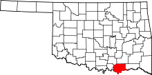 | |
| Towns | ||
| CDPs | ||
| Other unincorporated communities | ||
| Ghost towns | ||
| Achille | ||
|---|---|---|
| Bokchito | ||
| Caddo |
| |
| Colbert | ||
| Durant |
| |
| Kemp | ||
| Kenefic | ||
| Nida | ||