List of state highways in Hawaii
|
   Standard Route shields | |
| Highway names | |
|---|---|
| Interstates | Interstate Route H-X or H-X |
| US Highways | not applicable |
| State | Route X |
| System links | |
| Routes in Hawaii | |


Below is a partial list of state highways in Hawai‘i.
The current state (then territorial) highway numbering system was established in 1955. Route numbers are organized so that the initial digit corresponds to the island:
- Numbers beginning with 1 or 2: Hawaii
- Numbers beginning with 3: Maui
- Numbers beginning with 4: Molokai, Lanai
- Numbers beginning with 5: Kauai
- Numbers beginning with 6 to 9: Oahu
In general, two-digit numbers are primary highways, while secondary state highways are given three-digit numbers.
When referring to highways, Hawai'i residents usually refer to state highways by their names instead of their route numbers (e.g. Kamehameha Highway instead of Route 99).
- This transport-related list is incomplete; you can help by expanding it.
Interstate Highways in Hawaii
| Number | Length (mi)[1] | Length (km) | Southern or western terminus | Northern or eastern terminus | Formed | Removed | Notes |
|---|---|---|---|---|---|---|---|
| 27.16 | 43.71 | Route 93 in Kapolei | Route 72 in Honolulu | 1959 | current | Associated route: H-201 | |
| 8.33 | 13.41 | H-1 in Pearl City | Route 99 in Wahiawa | 1976 | current | ||
| 15.32 | 24.66 | H-1 & H-201 in Halawa | Marine Corps Base Hawaii | 1997 | current | ||
| H-4 | 6.5 | 10.5 | — | — | — | — | Was to have provided relief around the congested areas of H-1, but the idea was not popular and was never built. |
| 4.10 | 6.60 | H-1 in Halawa | H-1 in Honolulu | 1989 | current |
Routes
Hawai‘i County
- State Route 11 - Hawai‘i Belt Road: Kanoelehua Avenue, Volcano Highway, Māmalahoa Highway, Kuakini Highway, Queen Ka‘ahumanu Highway
- State Route 19 - Hawai‘i Belt Road: Bayfront Highway, Kamehameha Avenue, Māmalahoa Highway, Lindsey Road, Kawaihae Road, Queen Kaʻahumanu Highway
- State Route 130 - Keaʻau BP Road, Keaʻau-Pāhoa Road, Pāhoa BP Road, Pāhoa-Kalapana Road, Chain of Craters Road
- State Route 132 - Pāhoa-Kapoho Road[2]
- County Route 132 - Pāhoa-Kapoho Road
- State Route 137 - Kalapana-Kapoho “Red” Road
- County Route 137 - Kaimū-Kapoho “Red” Road, Kalanianaʻole Street
- State Route 139 - Old Keaʻau-Pāhoa Road
- State Route 160 - Keala o Keawe Road
- County Route 160 - Puʻuhonua Road, Nāpōʻopoʻo Road
- County Route 180 - Kalelei Road, Māmalahoa Road
- County Route 182 - Hualālai Road
- County Route 185 - Kamehameha III Road
- County Route 187 - Aliʻi Drive
- State Route 190 - Hawai‘i Belt Road: Māmalahoa Highway, Palani Road
- State Route 197 - Kealakehe Parkway
- State Route 200 - Saddle Road
- County Route 200 - Waiānuenue Avenue, Kaumana Drive
- County Route 201 - Ala Mauna Saddle Road
- State Route 220 - Honomū Road, Māmalahoa Highway, ‘Akaka Falls Road
- State Route 240 - Māmane Street, Honokaʻa-Waipiʻo Road
- State Route 250 - Kohala Mountain Road, Hāwī Road
- State Route 270 - Kawaihae Road, ‘Akoni Pule Highway
- State Route 1370 - Kalanianaʻole Street
- State Route 1970 - Kamehameha Avenue, Silva Street
- State Route 2000 - Pūʻāinakō Street, Pūʻāinakō Ext Road
Maui County
Island of Maui
- State Route 30 - High Street, Honoapi‘ilani Highway
- State Route 31 - Pi‘ilani Highway
- County Route 31 - Pi‘ilani Highway
- State Route 32 - Ka‘ahumanu Avenue, Main Street
- State Route 32A - Hobron Avenue (concurrent with State Route 361)
- State Route 32B - Wharf Street
- State Route 36 - Hāna Highway
- State Route 36A - Haleakalā Highway, Kēōlani Place
- State Route 37 - Haleakalā Highway, Kula Highway
- County Route 305 - East Waikō Road
- State Route 310 - North Kīhei Road
- State Route 311 - Maui Veterans Highway (Mokulele Highway)
- County Route 320 - West Main Street, ‘Īao Valley Road
- County Route 330 - North Market Street, Kahekili Highway
- State Route 340 - Kahekili Highway
- County Route 340 - Kahekili Highway
- State Route 350
- State Route 360 - Hāna Highway
- State Route 361 - Hobron Avenue (concurrent with State Route 32A)
- County Route 365 - Makawao Avenue, Kaupakulua Road
- County Route 366 - Ha‘ikū Road
- County Route 368 - West Kuiaha Road
- County Route 369 - East Kuiaha Road
- County Route 370 - Pūlehu Road
- County Route 371 - Hāli‘imaile Road
- County Route 372 - Ōma‘opio Road
- State Route 374 - future Kīhei-Upcountry Highway
- State Route 377 - Haleakalā Highway, Kekaulike Avenue
- State Route 378 - Haleakalā Highway
- State Route 380 - Dairy Road, Kūihelani Highway
- County Route 390 - Baldwin Avenue, Olinda Road
- County Route 394 - Pi‘iholo Road
- County Route 398 - Kokomo Road
- State Route 3000 - Lāhainā Bypass
- State Route 3400 - Kahului Beach Road, Waiehu Beach Road
- State Route 3500 - Pu‘unēnē Avenue
- State Route 3800 - future Kahului Airport Access Extension
Island of Lāna‘i
- State Route 44 - Lanai Avenue, Keomuku Highway
- State Route 440 - Airport Road, Kaumalapau Highway, Mānele Road
Island of Moloka‘i
- State Route 450 - Kamehameha V Highway
- State Route 460 - Kaunakakai Place, Maunaloa Highway
- State Route 465 - Airport Loop, Launui Street
- State Route 470 - Kalae Highway
- State Route 480 - Pu‘upe‘elua Avenue, Farrington Avenue
- County Route 481 - Pu‘upe‘elua Avenue
- County Route 490 - Lihi Pali Avenue, Pu‘u ka Pele Avenue
Kaua‘i County
- State Route 50 - Kaumuali‘i Highway, Lio Road, Kao Road, Pacific Missile Range Facility
- State Route 51 - Wa‘apa Road, Rice Street, Kapule Highway
- State Route 56 - Kūhiō Highway, Kapa‘a temporary BP Road
- State Route 58 - Nāwiliwili Road
- County Route 520 - Maluhia Road, Kōloa Tree Tunnel, Kōloa Road, Po‘ipū Road, Lāwa‘i Road, Ho‘onani Road
- County Route 530 - Kōloa Road
- State Route 540 - Halewili Road
- State Route 541 - Waialo Road
- County Route 543 - Lele Road
- State Route 550 - Kōke‘e Road, Waimea Canyon State Park
- County Route 552 - ‘Alae Road
- State Route 560 - Kūhiō Highway
- State Route 570 - Ahukini Road
- State Route 580 - Kuamo‘o Road
- County Route 581 - Kukui Street, Olohena Road, Kamalū Road
- State Route 583 - Mā‘alo Road
Honolulu City and County
- State Route 61 - Bishop Street, Pali Highway, Nu‘uanu Pali Tunnels, Kalaniana‘ole Highway, Kailua Road
- State Route 63 - Kalihi Street, Likelike Highway, Wilson Tunnels
- State Route 64 - Sand Island Access Road
- State Route 65 - Kāne‘ohe Bay Drive, Mōkapu Saddle Road, Mōkapu Boulevard
- State Route 72 - Kalaniana‘ole Highway
- State Route 76 - Fort Weaver Road, Kunia Road
- State Route 80 - Kamehameha Highway
- State Route 83 - Joseph P Leong Hale‘iwa Bypass Highway, Kamehameha Highway, Kahekili Highway, Likelike Highway
- State Route 92 - Nimitz Highway, Ala Moana Boulevard
- State Route 93 - Farrington Highway
- State Route 95 - Kalaeloa Boulevard, Malakole Street
- State Route 98 - Vineyard Boulevard
- State Route 99 - Kamehameha Highway, Kamananui Road, Wilikina Drive, Farrington Highway
- State Route 640 - Sand Island Access Road
- State Route 750 - Kunia Road
- State Route 830 - Kamehameha Highway
- State Route 901 - Fort Barrette Road
- State Route 930 - Farrington Highway, Kaukonahua Road
- State Route 7012 - Whitmore Avenue
- State Route 7101 - Farrington Highway
- State Route 7110 - Farrington Highway
- State Route 7141 - Iroquois Road
- State Route 7239 - Ulene Street, Hālawa Valley Road
- State Route 7241 - Kahuapā‘ani Street, Halawa Heights Road
- State Route 7310 - Pu‘uloa Road
- State Route 7345 - Jarrett White Road
- State Route 7350 - Bougainville Drive
- State Route 7351 - Radford Drive
- State Route 7401 - Kamehameha Highway
- State Route 7413 - Liliha Street
- County Route 7414 - Middle Street
- State Route 7415 - Middle Street
- State Route 7601 - Old Wai‘alae Road
- State Route 8930 - Kualakai Parkway
- State Route 8940 - Franklin D. Roosevelt Avenue
- State Route 8945 - Enterprise Avenue
- State Route 8955 - Coral Sea Road
Interstates

The designations of Interstate highways in Hawai‘i are abbreviated using the "H" prefix instead of the "I" prefix (e.g. Interstate H-1 is called simply "H-1" for short, NOT "I-H-1").
Former proposed Interstates
Decommissioned Routes
- State Route 10 - Hoʻokena Beach Road
- State Route 13 - Keaʻau-Pāhoa Road, Pāhoa Bypass Road, Pāhoa-Kalapana Road, Chain of Craters Road (now HI 130)
- State Route 15 - Kamahi Street, Maile Street
- State Route 16 - Keala o Keawe Road, Puʻuhonua Road, Nāpōʻopoʻo Road (now HI 160)
- State Route 18 - North Kona Belt Road (now HI 180)
- State Route 21 - Wainaku Avenue
- State Route 22 - Stable Camp Road (now HI 220)
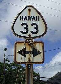
- State Route 33 - Kahekili Highway (now HI 340)
- State Route 34 - Lower Main St, Kahului Beach Rd (now HI 3400)
- State Route 35 - Puunene Avenue, Mokulele Highway (now HI 3500 and HI 311)
- State Route 38 - Dairy Road (now HI 380 and CR 390)
- State Route 40 - Waiko Road (now CR 365)
- State Route 44 - Kaumalapau Highway, Keomuku Highway (now HI 440)
- State Route 45 - Kamehameha V Highway (now HI 450 and CR 450)
- State Route 46 - Maunaloa Highway (now HI 460)
- State Route 47 - Kalae Highway (now HI 470)
- State Route 48 - Farrington Avenue (now HI 480)
- State Route 62 - Waiakamilo Street
- State Route 66 - Lagoon Drive (now HI 7310)
- State Route 67 - Camp Catlin Road/Arizona Road, Salt Lake Boulevard (formerly CR 670)
- State Route 68 - Rodgers Boulevard
- State Route 69 - Elliott Street
- State Route 71 - Hale Street
- State Route 73 - Waimano Home Road (formerly CR 730)
- State Route 78 - Moanalua Freeway (now H-201)
- State Route 82 - Waialua Beach Road
- State Route 90 - Farrington Highway, Kamehameha Highway (now HI 93, HI 7101, HI 7110)
- State Route 151 - Pikake Street, Wood Valley Road
- State Route 211 - Honolii Place
- State Route 226 - Chin Chuck Road
- State Route 232 - Old Māmahaloa Hwy, ʻOʻōkala
- State Route 271 - ʻUpolu Point Road
- State Route 341 - Waiehu Beach Road (now HI 3400)
- State Route 441 - Manele Road (now HI 440)
- State Route 481 - Puupeelua Avenue (now HI 480)
- State Route 482 - Puu Kapele Avenue, Lihi Pali Avenue (now CR 475)
- County Route 637 - Kaneohe Bay Drive (formerly part of HI 63 and HI 630)
- County Route 638 - North Kalaheo Aenue
- State Route 742 - Waipio Point Access Road
- State Route 760 - Old Fort Weaver Road
- State Route 764 - Iroquois Road (now HI 7141, HI 8940)
- State Route 782 - Haleihi Road, Waianae Valley Road
- County Route 801 - Kaukonahua Road (formerly part of HI 80)
- County Route 803 - Kaukonahua Road, Wilikina Drive (formerly part of HI 99)
- State Route 804 - Whitmore Avenue (now HI 7012)
- State Route 821 - Haleiwa Road
- State Route 835 - Pupukea Road
- County Route 836 - Kamehameha Highway (formerly part of HI 83)
“US Highways” on O‘ahu
Though marked with U.S. Route shields, these routes were not actual U.S. Routes. They were used to assist military personnel not accustomed to the Hawaiian street names during the time of Martial law in the Territory of Hawai‘i from 1941 to 1945.


- South Vineyard Boulevard » Wai‘alae Avenue » Kalaniana‘ole Highway » Kailua Road » Oneawa Street » Mōkapu Boulevard » Kāne‘ohe Bay Drive » Kamehameha Highway.
- Nimitz Highway » Kamehameha Highway.

- Bishop Street » Pali Highway.

- Farrington Highway.
- Farrington Highway (road permanently closed at Ka‘ena Point).

- Kailua Road » Oneawa Street » Mōkapu Boulevard » Kāne‘ohe Bay Drive.
See also

References
- ↑
- ↑ "2018 Lava Event Public". Hawaii County GIS Maps. Hawaii County GIS. Retrieved 22 September 2018.