Sweetwater, Oklahoma
| Sweetwater, Oklahoma | |
|---|---|
| Town | |
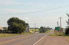 Looking east on Oklahoma State Highway 152. | |
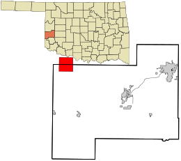 Location in Beckham County and the state of Oklahoma. | |
| Coordinates: 35°25′20″N 99°54′41″W / 35.42222°N 99.91139°WCoordinates: 35°25′20″N 99°54′41″W / 35.42222°N 99.91139°W | |
| Country | United States |
| State | Oklahoma |
| County | Beckham (also in Rodger Mills) |
| Area | |
| • Total | 15.87 sq mi (41.11 km2) |
| • Land | 15.85 sq mi (41.06 km2) |
| • Water | 0.02 sq mi (0.04 km2) |
| Elevation | 2,172 ft (662 m) |
| Population (2010) | |
| • Total | 87 |
| • Density | 5/sq mi (2.1/km2) |
| Time zone | UTC-6 (Central (CST)) |
| • Summer (DST) | UTC-5 (CDT) |
| ZIP codes | 73666 |
| FIPS code | 40-71900 |
| GNIS feature ID | 1098690 |
Sweetwater is a town in Beckham and Roger Mills counties in the U.S. state of Oklahoma. It was incorporated in 1998.[1] As of the 2010 census it had a population of 87.[2]
Named for nearby Sweetwater Creek, the town is at the junction of State Highway 30 and State Highway 152. The post office (zip code 73666), was established September 27, 1894.
On May 5, 2007, a tornado, rated on the Enhanced Fujita Scale (EF scale) as EF3, traveled on a path around 100 to 150 yards (91 to 137 m) wide and 7.5 miles (12.1 km) long. It began about 2.5 miles (4.0 km) south of Sweetwater and ended approximately 5 miles (8 km) north of Sweetwater, following State Highway 30. EF3 wind speeds range from 136 to 165 miles per hour (219 to 266 km/h). It severely damaged several buildings in the town, including the church and high school, and destroyed eight homes.[3][4]
Demographics
| Historical population | |||
|---|---|---|---|
| Census | Pop. | %± | |
| 1990 | 238 | — | |
| 2000 | 226 | −5.0% | |
| 2010 | 87 | −61.5% | |
| Est. 2015 | 91 | [5] | 4.6% |
| U.S. Decennial Census[6] | |||
Education
The Sweetwater Public School District is one of the smallest public school districts in the state of Oklahoma. For the most recent data available, it tied with Boley for the smallest high school with 15 students. For a combined district, K-12, Sweetwater finished third behind Boley (51) and Clarita (58), with 60 students.[7]
References
- ↑ "Boundary Changes". Geographic Change Notes: Oklahoma. Population Division, United States Census Bureau. 2006-05-19. Archived from the original on 2010-08-06. Retrieved 2008-07-02.
- ↑ "Geographic Identifiers: 2010 Demographic Profile Data (G001): Sweetwater town, Oklahoma". U.S. Census Bureau, American Factfinder. Retrieved February 24, 2014.
- ↑ May 5, 2007 Sweetwater, Oklahoma Tornado Rated As EF3 at the National Weather Center (NOAA)
- ↑ Second wave of tornadoes rakes Plains - CNN
- ↑ "Annual Estimates of the Resident Population for Incorporated Places: April 1, 2010 to July 1, 2015". Archived from the original on June 2, 2016. Retrieved July 2, 2016.
- ↑ "Census of Population and Housing". Census.gov. Retrieved June 4, 2015.
- ↑ School District Database at the Oklahoma State Department of Education (OSDE) Archived 2007-08-02 at the Wayback Machine.
External links
Municipalities and communities of Beckham County, Oklahoma, United States | ||
|---|---|---|
| Cities | 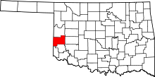 | |
| Towns | ||
| Unincorporated communities | ||
| Footnotes | ‡This populated place also has portions in an adjacent county or counties | |
Municipalities and communities of Roger Mills County, Oklahoma, United States | ||
|---|---|---|
| Towns | 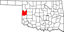 | |
| Unincorporated communities | ||
| Footnotes | ‡This populated place also has portions in an adjacent county or counties | |