Dustin, Oklahoma
| Dustin, Oklahoma | |
|---|---|
| Town | |
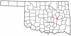 Location of Dustin, Oklahoma | |
| Coordinates: 35°16′21″N 96°1′58″W / 35.27250°N 96.03278°WCoordinates: 35°16′21″N 96°1′58″W / 35.27250°N 96.03278°W | |
| Country | United States |
| State | Oklahoma |
| County | Hughes |
| Area | |
| • Total | 0.60 sq mi (1.55 km2) |
| • Land | 0.59 sq mi (1.53 km2) |
| • Water | 0.008 sq mi (0.02 km2) |
| Elevation | 715 ft (218 m) |
| Population (2010) | |
| • Total | 395 |
| • Density | 668/sq mi (257.8/km2) |
| Time zone | UTC-6 (Central (CST)) |
| • Summer (DST) | UTC-5 (CDT) |
| ZIP code | 74839 |
| Area code(s) | 539/918 |
| FIPS code | 40-22200[1] |
| GNIS feature ID | 1092315[2] |
Dustin is a town in Hughes County, Oklahoma, United States. The population was 395 at the 2010 census,[3] down from 452 at the 2000 census.
Geography
Dustin is located in northeastern Hughes County at 35°16′21″N 96°1′58″W / 35.27250°N 96.03278°W (35.272609, -96.032855).[4] Oklahoma State Highway 9 passes through the center of town, leading east 6 miles (10 km) to the Indian Nation Turnpike and west 13 miles (21 km) to Wetumka. Oklahoma State Highway 84 departs OK-9 in the center of Dustin, leading north and west 10 miles (16 km) to Weleetka.
According to the United States Census Bureau, Dustin has a total area of 0.60 square miles (1.55 km2), of which 0.01 square miles (0.02 km2), or 1.12%, are water.[3] Fish Creek flows through the southeast corner of the town, running northeast to the North Canadian River.
Demographics
| Historical population | |||
|---|---|---|---|
| Census | Pop. | %± | |
| 1910 | 579 | — | |
| 1920 | 713 | 23.1% | |
| 1930 | 537 | −24.7% | |
| 1940 | 652 | 21.4% | |
| 1950 | 524 | −19.6% | |
| 1960 | 457 | −12.8% | |
| 1970 | 502 | 9.8% | |
| 1980 | 498 | −0.8% | |
| 1990 | 429 | −13.9% | |
| 2000 | 452 | 5.4% | |
| 2010 | 395 | −12.6% | |
| Est. 2015 | 379 | [5] | −4.1% |
| U.S. Decennial Census[6] | |||
As of the census[1] of 2000, there were 452 people, 164 households, and 120 families residing in the town. The population density was 753.1 people per square mile (290.9/km²). There were 186 housing units at an average density of 309.9 per square mile (119.7/km²). The racial makeup of the town was 53.76% White, 0.44% African American, 34.29% Native American, 0.22% Pacific Islander, 0.44% from other races, and 10.84% from two or more races. Hispanic or Latino of any race were 1.99% of the population.
There were 164 households, 31.1% had children under the age of 18 living with them, 54.3% were married couples living together, 12.8% had a female householder with no husband present, and 26.8% were non-families. A total of 25.6% of all households were made up of individuals and 12.2% had someone living alone who was 65 years of age or older. The average household size was 2.76 and the average family size was 3.34.
The population distribution for the town was 28.1% under the age of 18, 7.5% from 18 to 24, 26.1% from 25 to 44, 22.1% from 45 to 64, and 16.2% who were 65 years of age or older. The median age of the residents was 38 years old. For every 100 females, there were 97.4 males. For every 100 females age 18 and over, there were 99.4 males.
The median income for a household in the town was $20,625, and the median income for a family was $24,375. Males had a median income of $24,167 versus $19,063 for females. The per capita income for the town was $8,767. About 28.3% of the families and 35.9% of the population were below the poverty line, including 38.9% of those under age 18 and 34.6% of those age 65 or over.
Notable residents
- Phyllis Fife, painter, born near Dustin in 1948[7]
See also
References
- 1 2 "American FactFinder". United States Census Bureau. Archived from the original on 2013-09-11. Retrieved 2008-01-31.
- ↑ "US Board on Geographic Names". United States Geological Survey. 2007-10-25. Retrieved 2008-01-31.
- 1 2 "Geographic Identifiers: 2010 Census Summary File 1 (G001): Dustin town, Oklahoma". American Factfinder. U.S. Census Bureau. Retrieved January 17, 2018.
- ↑ "US Gazetteer files: 2010, 2000, and 1990". United States Census Bureau. 2011-02-12. Retrieved 2011-04-23.
- ↑ "Annual Estimates of the Resident Population for Incorporated Places: April 1, 2010 to July 1, 2015". Retrieved July 2, 2016.
- ↑ "Census of Population and Housing". Census.gov. Archived from the original on May 12, 2015. Retrieved June 4, 2015.
- ↑ Jules Heller; Nancy G. Heller (19 December 2013). North American Women Artists of the Twentieth Century: A Biographical Dictionary. Routledge. ISBN 978-1-135-63882-5.
External links
Municipalities and communities of Hughes County, Oklahoma, United States | ||
|---|---|---|
| Cities | 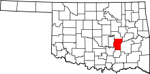 | |
| Towns | ||
| Footnotes | ‡This populated place also has portions in an adjacent county or counties | |