Tonkawa, Oklahoma
| Tonkawa, Oklahoma | |
|---|---|
| City | |
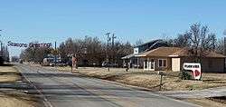 Tonkawa in late 2013. | |
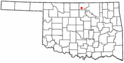 Location of Tonkawa, Oklahoma | |
| Coordinates: 36°40′49″N 97°18′33″W / 36.68028°N 97.30917°WCoordinates: 36°40′49″N 97°18′33″W / 36.68028°N 97.30917°W | |
| Country | United States |
| State | Oklahoma |
| County | Kay |
| Area | |
| • Total | 5.6 sq mi (14.5 km2) |
| • Land | 5.6 sq mi (14.5 km2) |
| • Water | 0.1 sq mi (0.1 km2) |
| Elevation | 984 ft (300 m) |
| Population (2010) | |
| • Total | 3,216 |
| • Density | 591.3/sq mi (228.3/km2) |
| Time zone | UTC-6 (Central (CST)) |
| • Summer (DST) | UTC-5 (CDT) |
| ZIP code | 74653 |
| Area code(s) | 580 |
| FIPS code | 40-74150[1] |
| GNIS feature ID | 1098940[2] |
Tonkawa is a city in Kay County, Oklahoma, United States, along the Salt Fork Arkansas River. The population was 3,216 at the 2010 census, a decline of 2.5 percent from 3,299 at the 2000 census.[3]
History
Named after the Tonkawa tribe, the city of Tonkawa was founded in March 1894, by Eli V. Blake and Wiley William Gregory. Blake and Gregory, originally from Kansas, claimed the land that would become Tonkawa in the Land Run of 1893. Prior to the land run, from 1879 to 1885, this area was known as Fort Oakland, home to the Nez Perce. In 1885, the remnants of the Tonkawa tribe, who had fled Indian Territory after the 1862 Tonkawa Massacre, returned to settle in the Fort Oakland area. The Blackwell and Southern Railway (later bought by the Atchison, Topeka and Santa Fe Railway) built a line through Tonkawa, which stimulated growth of the town. In 1901, the Oklahoma Territory Legislature established the University Preparatory School (now Northern Oklahoma College) here. By statehood, the population was 1,238. The discovery of oil caused a boom in the 1920s, and the population was 3,311 in 1930.[4]
Camp Tonkawa
During World War II, Tonkawa was home to Camp Tonkawa, a Prisoner of War camp. Camp Tonkawa remained in operation from August 30, 1943 to September 1, 1945.[5] Built between October and December 1942, the 160-acre (0.65 km2) site contained more than 180 wooden structures for 3,000 German POW's as well as 500 U.S. Army guard troops, service personnel and civilian employees.[6] The first prisoners, consisting of German troops from the Afrika Corps, arrived in August 1943. During their internment, prisoners labored at local farms and ranches. In November 1943, a prison riot caused the death of a German soldier, Johannes Kunze. Eight prisoners briefly escaped, only to be recaptured.
Geography
Tonkawa is located at 36°40′49″N 97°18′33″W / 36.68028°N 97.30917°W (36.680362, -97.309219).[7] It is on the Salt Fork of the Arkansas River, 14 miles (23 km) west of Ponca City. According to the United States Census Bureau, the city has a total area of 5.6 square miles (15 km2), of which 5.6 square miles (15 km2) is land and 0.04 square miles (0.10 km2) (0.36%) is water.
Demographics
| Historical population | |||
|---|---|---|---|
| Census | Pop. | %± | |
| 1900 | 707 | — | |
| 1910 | 1,776 | 151.2% | |
| 1920 | 1,448 | −18.5% | |
| 1930 | 3,311 | 128.7% | |
| 1940 | 3,197 | −3.4% | |
| 1950 | 3,643 | 14.0% | |
| 1960 | 3,415 | −6.3% | |
| 1970 | 3,337 | −2.3% | |
| 1980 | 3,524 | 5.6% | |
| 1990 | 3,127 | −11.3% | |
| 2000 | 3,162 | 1.1% | |
| 2010 | 3,216 | 1.7% | |
| Est. 2014 | 3,143 | [8] | −2.3% |
| U.S. Decennial Census[9] | |||
As of the census[1] of 2000, there were 3,299 people, 1,197 households, and 801 families residing in the city. The population density was 591.3 people per square mile (228.3/km²). There were 1,417 housing units at an average density of 254.0 per square mile (98.0/km²). The racial makeup of the city was 86.39% White, 0.85% African American, 5.55% Native American, 0.33% Asian, 3.06% from other races, and 3.82% from two or more races. Hispanic or Latino of any race were 6.64% of the population.
There were 1,197 households out of which 32.0% had children under the age of 18 living with them, 53.8% were married couples living together, 8.9% had a female householder with no husband present, and 33.0% were non-families. 29.1% of all households were made up of individuals and 13.4% had someone living alone who was 65 years of age or older. The average household size was 2.47 and the average family size was 3.06.
In the city, the population was spread out with 24.9% under the age of 18, 17.3% from 18 to 24, 23.6% from 25 to 44, 19.0% from 45 to 64, and 15.3% who were 65 years of age or older. The median age was 33 years. For every 100 females, there were 98.1 males. For every 100 females age 18 and over, there were 95.2 males.
The median income for a household in the city was $29,387, and the median income for a family was $35,912. Males had a median income of $27,222 versus $20,128 for females. The per capita income for the city was $14,245. About 12.5% of families and 17.6% of the population were below the poverty line, including 23.9% of those under age 18 and 9.0% of those age 65 or over.
Education
Tonkawa is covered by the Tonkawa Public Schools district which includes Tonkawa Elementary, Tonkawa Middle School, and Tonkawa High School. Tonkawa is also home to Northern Oklahoma College which provides Associates level education.
Points of interest
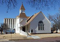
Courtesy of Jeffrey Beall.
December 27, 2013
Museums
- North Oklahoma Botanical Garden and Arboretum
- A. D. Buck Museum of Science and History
- Tonkawa Historical Museum
- Tonkawa Tribal Museum
- Eleanor Hays Art Gallery
NRHP sites
The following sites in Tonkawa are listed on the National Register of Historic Places:
Notable people
- Henry Bellmon, first Republican Governor of Oklahoma (1963–1967, 1991–1995) and U.S. Senator (1969–1981)from Billings, OK
- Bo Bowling, Montreal Alouettes player
See also
References
- 1 2 "American FactFinder". United States Census Bureau. Retrieved 2008-01-31.
- ↑ "US Board on Geographic Names". United States Geological Survey. 2007-10-25. Retrieved 2008-01-31.
- ↑ CensusViewer: Population of the City of Tonkawa, Oklahoma
- ↑ Wilson, Linda D. "Tonkawa". Encyclopedia of Oklahoma History and Culture. Oklahoma Historical Society. Archived from the original on 2010-06-02. Retrieved 2010-03-15.
- ↑ http://rebelcherokee.labdiva.com/ctypowcamps.html
- ↑ "Camp Tonkawa - World War II German POW Camp ~ Tonkawa, OK - Oklahoma Historical Markers on Waymarking.com". Retrieved 2010-03-15.
- ↑ "US Gazetteer files: 2010, 2000, and 1990". United States Census Bureau. 2011-02-12. Retrieved 2011-04-23.
- ↑ "Annual Estimates of the Resident Population for Incorporated Places: April 1, 2010 to July 1, 2014". Archived from the original on May 23, 2015. Retrieved June 4, 2015.
- ↑ "Census of Population and Housing". Census.gov. Retrieved June 4, 2015.
External links
| Wikimedia Commons has media related to Tonkawa, Oklahoma. |
Municipalities and communities of Kay County, Oklahoma, United States | ||
|---|---|---|
| Cities | 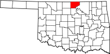 | |
| Towns | ||
| CDP | ||
| Unincorporated communities |
| |
| Ghost towns | ||
| Footnotes | ‡This populated place also has portions in an adjacent county or counties | |