Waynoka, Oklahoma
| Waynoka, Oklahoma | |
|---|---|
| City | |
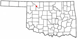 Location of Waynoka, Oklahoma | |
| Coordinates: 36°35′05″N 98°52′43″W / 36.5846437°N 98.8785312°WCoordinates: 36°35′05″N 98°52′43″W / 36.5846437°N 98.8785312°W | |
| Country | United States |
| State | Oklahoma |
| County | Woods |
| Area | |
| • Total | 0.989141 sq mi (2.561864 km2) |
| • Land | 0.989141 sq mi (2.561864 km2) |
| • Water | 0.0 sq mi (0.0 km2) |
| Elevation | 1,476 ft (450 m) |
| Population (2010) | |
| • Total | 927 |
| • Density | 940/sq mi (360/km2) |
| Time zone | UTC-6 (Central (CST)) |
| • Summer (DST) | UTC-5 (CDT) |
| ZIP code | 73860 |
| Area code(s) | 580 |
| FIPS code | 40-79350[1] |
| GNIS feature ID | 1099446[2] |
Waynoka is a city in Woods County, Oklahoma, United States. The population was 927 at the 2010 census. It is located on U.S. Highway 281 and State Highway 14, seventy miles west of Enid.
History
Founding years
Founded in what was then known as Indian Territory, Waynoka was established in 1887 when the Southern Kansas Railroad, a subsidiary of the Atchison, Topeka and Santa Fe Railway, built a line through the area. A post office was established on April 10, 1888, having the distinction of being the first to be established in the Cherokee Outlet. Its economy was based on the railroad and the large ranches in the area. When the Cherokee Outlet opened up for non-Indian settlement in the land run of September 16, 1893, Waynoka became the area's agricultural trade center.[3]
Railroad Center
The Santa Fe Railway made Waynoka a major railroad center when it built Oklahoma's largest rail yard in Waynoka. Ultimatately employing a thousand machinists, boilermakers, sheet metal mechanics, fire builders, car men, switchmen, and engineers, it operated twenty-four hours a day. One of the nation's largest ice plants was built to supply ice for refrigerator cars hauling perishables on Santa Fe's main line from Chicago to Los Angeles. In addition, a roundhouse, maintenance and repair shops, a reading room, a depot, and a Harvey House were built by the railroad. Although the railroad eventually moved its maintenance operations from Waynoka, it continued train crew changes there until 1986. At the turn of the twenty-first century, between fifty and one hundred trains still passed daily through Waynoka on Oklahoma's fastest and busiest rail line.[3]
Geography
Waynoka is located at 36°35′3″N 98°52′47″W / 36.58417°N 98.87972°W (36.584060, -98.879714).[4] According to the United States Census Bureau, the city has a total area of 1.0 square mile (2.6 km2), all of it land.
Little Sahara State Park is 4 miles (6.4 km) south of the city. The park offers over 1,600 acres (6.5 km2) of rideable sand dunes ranging in height from 25 to 75 feet (23 m).
Demographics
| Historical population | |||
|---|---|---|---|
| Census | Pop. | %± | |
| 1910 | 1,160 | — | |
| 1920 | 1,500 | 29.3% | |
| 1930 | 1,840 | 22.7% | |
| 1940 | 1,584 | −13.9% | |
| 1950 | 2,018 | 27.4% | |
| 1960 | 1,794 | −11.1% | |
| 1970 | 1,444 | −19.5% | |
| 1980 | 1,377 | −4.6% | |
| 1990 | 947 | −31.2% | |
| 2000 | 993 | 4.9% | |
| 2010 | 927 | −6.6% | |
| Est. 2015 | 966 | [5] | 4.2% |
| U.S. Decennial Census[6] | |||
As of the census[1] of 2000, there were 993 people, 453 households, and 252 families residing in the city. The population density was 1,034.0 people per square mile (399.4/km²). There were 582 housing units at an average density of 606.0 per square mile (234.1/km²). The racial makeup of the city was 92.65% White, 2.32% African American, 1.51% Native American, 1.01% from other races, and 2.52% from two or more races. Hispanic or Latino of any race were 5.14% of the population.
There were 453 households out of which 22.1% had children under the age of 18 living with them, 44.6% were married couples living together, 8.8% had a female householder with no husband present, and 44.2% were non-families. 42.6% of all households were made up of individuals and 24.3% had someone living alone who was 65 years of age or older. The average household size was 2.07 and the average family size was 2.84.
In the city, the population was spread out with 22.6% under the age of 18, 7.5% from 18 to 24, 22.4% from 25 to 44, 22.2% from 45 to 64, and 25.5% who were 65 years of age or older. The median age was 43 years. For every 100 females, there were 84.2 males. For every 100 females age 18 and over, there were 79.3 males.
The median income for a household in the city was $20,708, and the median income for a family was $28,833. Males had a median income of $24,063 versus $16,731 for females. The per capita income for the city was $12,493. About 13.5% of families and 16.6% of the population were below the poverty line, including 26.8% of those under age 18 and 9.5% of those age 65 or over.
Notable events
Waynoka was an important stop on the pioneering route of Transcontinental Air Transport ("TAT"). Starting in 1929, TAT offered 48-hour coast-to-coast passenger transport utilizing not only its own Ford Trimotor aircraft, but also the sleeper services of the Pennsylvania Railroad and the Santa Fe Railroad for the two overnight segments of the long trip. Waynoka was the point at which passengers transferred from the TAT plane to the Santa Fe train (going westbound), or from the Santa Fe train to the TAT plane (going eastbound).[7]Amelia Earhart also came to Waynoka by the TAT.[8]
Waynoka is the home to the Cimarron River Stampede, a rodeo held annually since 1936. It is held on the 2nd weekend of August. [9]
References
- 1 2 "American FactFinder". United States Census Bureau. Retrieved 2008-01-31.
- ↑ "US Board on Geographic Names". United States Geological Survey. 2007-10-25. Retrieved 2008-01-31.
- 1 2 Barker Olson, Sandra. "Encyclopedia of Oklahoma History and Culture - Waynoka". Encyclopedia of Oklahoma History and Culture. Oklahoma Historical Society. Retrieved October 7, 2018.
- ↑ "US Gazetteer files: 2010, 2000, and 1990". United States Census Bureau. 2011-02-12. Retrieved 2011-04-23.
- ↑ "Annual Estimates of the Resident Population for Incorporated Places: April 1, 2010 to July 1, 2015". Retrieved July 2, 2016.
- ↑ "Census of Population and Housing". Census.gov. Retrieved June 4, 2015.
- ↑ "Illustrated Map of the Route of the Transcontinental Air Transport, Inc. in the David Rumsey Map Collection".
- ↑ http://www.okhistory.org/publications/enc/entry.php?entry=TR005
- ↑ "Meet the Committee Cimarron River Stampede". The Rodeo News. Retrieved October 7, 2018.
External links
| Wikimedia Commons has media related to Waynoka, Oklahoma. |
Waynoka History
- Little Sahara State Park
- Oklahoma Digital Maps: Digital Collections of Oklahoma and Indian Territory
Municipalities and communities of Woods County, Oklahoma, United States | ||
|---|---|---|
| Cities | 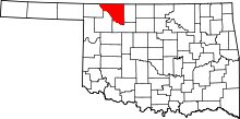 | |
| Towns | ||
| Unincorporated communities | ||