Smithville, Oklahoma
| Smithville, Oklahoma | |
|---|---|
| Town | |
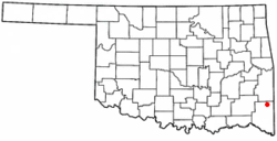 Location of Smithville, Oklahoma | |
| Coordinates: 34°28′8″N 94°38′37″W / 34.46889°N 94.64361°WCoordinates: 34°28′8″N 94°38′37″W / 34.46889°N 94.64361°W[1] | |
| Country | United States |
| State | Oklahoma |
| County | McCurtain |
| Area | |
| • Total | 1.1 sq mi (2.9 km2) |
| • Land | 1.1 sq mi (2.9 km2) |
| • Water | 0.0 sq mi (0.0 km2) |
| Elevation[1] | 696 ft (212 m) |
| Population (2010)[2] | |
| • Total | 113 |
| • Density | 111/sq mi (39/km2) |
| Time zone | UTC-6 (Central (CST)) |
| • Summer (DST) | UTC-5 (CDT) |
| ZIP code | 74957 |
| Area code(s) | 580 |
| FIPS code | 40-68250[3] |
| GNIS feature ID | 1100115[4] |
Smithville is a town in McCurtain County, Oklahoma, United States. The population was 113 at the 2010 census.[2]
Geography
Smithville lies in McCurtain County, just east of US Route 259 on Oklahoma Route 4. The town is just north of Mountain Fork Little River and about ten miles north of Broken Bow Lake.[5] The town is among a handful of towns in the southeastern corner of Oklahoma, in an area known as Little Dixie.
According to the United States Census Bureau, the town has a total area of 1.1 square miles (2.8 km2), all of it land.
Demographics
As of the census of 2010, there were 113 people, 53 households, and 28 families residing in the town. The population density was 111 people per square mile (39/km²). There were 65 housing units at an average density of 60 per square mile (23/km²). The racial makeup of the town was 58.4% White, 34.5% Native American, and 7.1% from two or more races. Hispanic or Latino of any race were 2.7% of the population.
There were 53 households, out of which 32% included children under the age of 18, 34% were married couples living together, 17% had a female householder with no husband present, and 47% were non-families. Individuals living alone accounted for 47% of households and those individuals 65 years of age or older living alone accounted for 21% of households. The average household size was 2.13 and the average family size was 3.07.
In the town, the population was had a varied spread with 31% under the age of 18, 7% from 18 to 24, 22% from 25 to 44, 25% from 45 to 64, and 15% who were 65 years of age or older. The median age was 32 years. For every 100 females, there were X males. For every 100 females age 18 and over, there were X males.
The median income for a household in the town was $21,136, and the median income for a family was $16,083. Males had a median income of X versus X for females. The per capita income for the town was $15,674. There were 61.9% of families and 45.2% of the population living below the poverty line.
Notable people
- Curtis McDaniel is a former school superintendent and member of the Oklahoma House of Representatives.
- Will Lawson Burkhart is the founder of "new" Smithville. He was a young journalist and land developer who moved here from Chicago, Illinois in 1902. He married Mary McClure, a daughter of a prominent Choctaw citizen named Preeman McClure. Burkhart's life came to a tragic end in the morning hours of September 28, 1917. He and another co-developer, A.C. Blake, were riding their way to do some hunting when Burkhart's horse threw him off. When Burkhart landed, he broke his neck thus killing him instantly, even though he was still in the seated position. This was the beginning of the end of "New" Smithville's first boom era.[6]
See also
References
- 1 2 [ U.S. Geological Survey Geographic Names Information System: Smithville, Oklahoma
- 1 2 United States Census 2010 Demographic Profile
- ↑ "American FactFinder". United States Census Bureau. Retrieved 2008-01-31.
- ↑ "US Board on Geographic Names". United States Geological Survey. 2007-10-25. Retrieved 2008-01-31.
- ↑ Oklahoma Atlas & Gazeteer, DeLorme, 1st ed., 1998, p. 67 ISBN 0899332838
- ↑ Oct/Nov 2008 Oklahoma Edge Magazine
Municipalities and communities of McCurtain County, Oklahoma, United States | ||
|---|---|---|
| Cities | 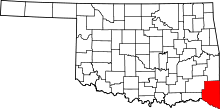 | |
| Towns | ||
| CDP | ||
| Other unincorporated communities |
| |
| Ghost towns | ||