Kunda, India
| Kunda Thakur Town | |
|---|---|
| Town | |
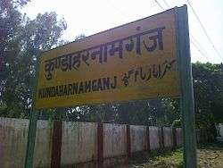 Kunda Railway Station | |
| Nickname(s): Kunda | |
 Kunda Location in Uttar Pradesh, India  Kunda Kunda (India) | |
| Coordinates: 25°43′N 81°31′E / 25.72°N 81.52°ECoordinates: 25°43′N 81°31′E / 25.72°N 81.52°E | |
| Country |
|
| State | Uttar Pradesh |
| District | Pratapgarh |
| Government | |
| • Body | Gram panchayat |
| • MLA | Raja Bhaiya |
| Area | |
| • Total | 10.000 km2 (3.861 sq mi) |
| Elevation291 | 89 m (292 ft) |
| Population (2011) | |
| • Total | 910,447 |
| • Rank | 1st in pratapgarh 45th in UP |
| • Density | 2,719.9/km2 (7,045/sq mi) |
| Languages | |
| • Official | Hindi language, Awadhi |
| Time zone | UTC+5:30 (IST) |
| PIN | 230204 |
| Telephone code | 05341 |
| Vehicle registration | UP |
| Website |
pratapgarh |
Kunda is a town and a Tahsil in Pratapgarh district in the Indian state of Uttar Pradesh.
Geography
Kunda is located at 25°43′N 81°31′E / 25.72°N 81.52°E.[1] It has an average elevation of 9 metres (291 feet). Kunda is not a very old town and probably was founded during the British Raj. Kunda is Located on Allahabad-Lucknow National Highway 24B.[2] Place is developing as main commercial location in the region.
About 12 km away from Kunda there is a great temple known as Haudeswar Naath. There lies a natural shivling which is worshiped by Hindus all over India.
Just 2 km away from Haudeswar Naath Dhaam is Raja Bhaiya's Dr. Ambedkar Bird sanctuary, which is located in Benti village.
5 km north there is Mangarh Dham, where is newly built Bhakti Mandir is one of the most beautiful constructions in Uttar Pradesh. Kunda is 50 Kilometre away from Pratapgarh district[3] and is a Taluka or Tahsil of Pratapgarh. Kunda is also known for its mangoes locally known as"Dasahari aam".
2017 Assembly Elections
Raghuraj Pratap Singh, more commonly known as Raja Bhaiya (born 1968) is an Indian politician and currently an Independent Member of Legislative Assembly (MLA), having been elected sixth time in a row from Kunda in the Uttar Pradesh legislative assembly election, 2017.[4] He is a descendant of the Bhadri Family belonging to Bhadri estate of United provinces of Agra and Oudh India.
Demographics
As of the 2011 Census of India,[5] Kunda had a population of 910,447. Males constitute 50% of the population and females 50%.72%of the whole population are from general caste 27% are from scheduled caste and 0%from scheduled tribe. Kunda has an average literacy rate of 66%, greater than the national average of 59.5%: male literacy is 59%, and female literacy is 41%. In Kunda, 14% of the population is under 6 years of age.
Places of interest
Jagadguru Kripalu Maharaj (Bhakti Mandir Mangarh) at Mangarh in Kunda.
References
- ↑ Falling Rain Genomics, Inc - Kunda
- ↑ - Kunda
- ↑ http://www.roaddistance.in/uttar-pradesh/pratapgarh-uttar-pradesh-to-kunda-distance/by-road/
- ↑ Nistula Hebbar (20 March 2012). "The long rule of Raja Bhaiya".
- ↑ "Census of India 2001: Data from the 2001 Census, including cities, villages and towns (Provisional)". Census Commission of India. Archived from the original on 2004-06-16. Retrieved 2008-11-01.