Kittitas County, Washington
| Kittitas County, Washington | |
|---|---|
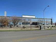 Kittitas County Courthouse in Ellensburg | |
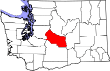 Location in the U.S. state of Washington | |
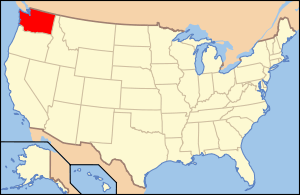 Washington's location in the U.S. | |
| Founded | 24 November, 1883 |
| Seat | Ellensburg |
| Largest city | Ellensburg |
| Area | |
| • Total | 2,333 sq mi (6,042 km2) |
| • Land | 2,297 sq mi (5,949 km2) |
| • Water | 36 sq mi (93 km2), 1.5% |
| Population (est.) | |
| • (2017) | 46,205 |
| • Density | 20/sq mi (8/km2) |
| Congressional district | 8th |
| Time zone | Pacific: UTC−8/−7 |
| Website |
www |
Kittitas County /ˈkɪtɪtæs/ is a county located in the U.S. state of Washington. The population was 46,205 in a 2017 census estimate. Its county seat and largest city is Ellensburg.[1] The county was created in November 1883 when it was carved out of Yakima County.[2] Kittitas County comprises the Ellensburg, Washington, Micropolitan Statistical Area.
There are numerous interpretations of the county's name, which is from the language of the Yakama Nation. According to one source, it "has been said to mean everything from 'white chalk' to 'shale rock' to 'shoal people' to 'land of plenty'". Most anthropologists and historians concede that each interpretation has some validity depending upon the particular dialect spoken.[3]
History
The county was organized in November 1883 by the Washington Territorial Legislature, carved from the northern part of Yakima County.
Indigenous peoples known as Kittitas (or Upper Yakima) occupied the lands along the Yakima River for hundreds of years before the present era. The Kittitas Valley was a traditional gathering place for tribes east of the Cascades.
White settlers began pouring into the Kittitas Valley in the late 1850s. Their arrival forced dislocation and displacement of the native inhabitants, who were eventually forced into the Yakama Indian Reservation. White settlers introduced livestock raising, crop farming, dairying, logging, lumber processing, and mining. The abundant grassland and the generally-favorable terrain made beef and cattle production become the county's mainstay. That was assisted by the introduction of railways into the area and the large-scale irrigation systems introduced in the 1930s.
Wheat planting in Kittitas Valley began in 1868. The county's first flour mill was established near Ellensburg in 1873. Production of alfalfa was also seen from the county's early days.
Lumber extraction was an important county activity from its early days, mostly in the west end. Logging camps were established near the county's three largest lakes (Cle Elum, Kachess, Keechelus).
Mining for coal and minerals was established by the mid-1880s.[4]
Geography
According to the U.S. Census Bureau, the county has a total area of 2,333 square miles (6,040 km2), of which 2,297 square miles (5,950 km2) is land and 36 square miles (93 km2) (1.5%) is water.[5] The highest point in the county is Mount Daniel at 7,959 feet (2,426 m) above mean sea level.
Geographic features
Major highways
Adjacent counties
- Chelan County - north
- Douglas County - northeast
- Grant County - east
- Yakima County - south
- Pierce County - west
- King County - northwest
National protected areas
- Snoqualmie National Forest (part)
- Wenatchee National Forest (part)
Demographics
| Historical population | |||
|---|---|---|---|
| Census | Pop. | %± | |
| 1890 | 8,777 | — | |
| 1900 | 9,704 | 10.6% | |
| 1910 | 18,561 | 91.3% | |
| 1920 | 17,737 | −4.4% | |
| 1930 | 18,154 | 2.4% | |
| 1940 | 20,230 | 11.4% | |
| 1950 | 22,235 | 9.9% | |
| 1960 | 20,467 | −8.0% | |
| 1970 | 25,039 | 22.3% | |
| 1980 | 24,877 | −0.6% | |
| 1990 | 26,725 | 7.4% | |
| 2000 | 33,362 | 24.8% | |
| 2010 | 40,915 | 22.6% | |
| Est. 2017 | 46,205 | 12.9% | |
| U.S. Decennial Census[6] 1790–1960[7] 1900–1990[8] 1990–2000[9] 2010–2016[10] 2017 Estimate[11] | |||
2000 census
As of the census[12] of 2000, there were 33,362 people, 13,382 households, and 7,788 families residing in the county. The population density was 14 people per square mile (6/km²). There were 16,475 housing units at an average density of 7 per square mile (3/km²). The racial makeup of the county was 91.77% White, 0.71% Black or African American, 0.91% Native American, 2.19% Asian, 0.15% Pacific Islander, 2.30% from other races, and 1.97% from two or more races. 5.00% of the population were Hispanic or Latino of any race. 19.4% were of German, 11.7% English, 9.0% Irish, 7.8% United States or American and 6.6% Norwegian ancestry. 93.2% spoke English and 4.5% Spanish as their first language.
There were 13,382 households out of which 26.20% had children under the age of 18 living with them, 47.80% were married couples living together, 7.20% had a female householder with no husband present, and 41.80% were non-families. 28.40% of all households were made up of individuals and 8.60% had someone living alone who was 65 years of age or older. The average household size was 2.33 and the average family size was 2.90.
In the county, the population was spread out with 20.60% under the age of 18, 21.60% from 18 to 24, 24.60% from 25 to 44, 21.60% from 45 to 64, and 11.60% who were 65 years of age or older. The median age was 31 years. For every 100 females there were 98.70 males. For every 100 females age 18 and over, there were 97.20 males.
The median income for a household in the county was $32,546, and the median income for a family was $46,057. Males had a median income of $36,257 versus $25,640 for females. The per capita income for the county was $18,928. About 10.50% of families and 19.60% of the population were below the poverty line, including 15.60% of those under age 18 and 8.20% of those age 65 or over.
2010 census
As of the 2010 United States Census, there were 40,915 people, 16,595 households, and 9,225 families residing in the county.[13] The population density was 17.8 inhabitants per square mile (6.9/km2). There were 21,900 housing units at an average density of 9.5 per square mile (3.7/km2).[14] The racial makeup of the county was 89.3% white, 2.0% Asian, 1.0% American Indian, 0.9% black or African American, 0.1% Pacific islander, 3.7% from other races, and 3.0% from two or more races. Those of Hispanic or Latino origin made up 7.6% of the population.[13] In terms of ancestry, 26.2% were German, 15.4% were Irish, 12.7% were English, 8.2% were Norwegian, 5.1% were Italian, 5.0% were Swedish, and 3.4% were American.[15]
Of the 16,595 households, 24.1% had children under the age of 18 living with them, 44.7% were married couples living together, 7.3% had a female householder with no husband present, 44.4% were non-families, and 28.7% of all households were made up of individuals. The average household size was 2.32 and the average family size was 2.87. The median age was 31.9 years.[13]
The median income for a household in the county was $41,232 and the median income for a family was $61,276. Males had a median income of $45,916 versus $35,380 for females. The per capita income for the county was $23,467. About 10.3% of families and 21.2% of the population were below the poverty line, including 19.8% of those under age 18 and 7.0% of those age 65 or over.[16]
Flora and fauna
There are a variety of species represented within Kittitas County. These include a diversity of grasses, herbs, trees, birds, mammals and amphibians. The genus of ricegrass known as Oryzopsis was one of the earliest grasses classified within the county.[17] Among the amphibian species found are the Cascades frog and the rough-skinned newt, the latter being a common far western USA taxon; in fact, examples of neoteny have been found in individual newts of this species within the county.[18]
Communities
Cities
- Cle Elum
- Ellensburg (county seat)
- Kittitas
- Roslyn
- South Cle Elum
Census-designated places
Unincorporated communities
Events
- The Kittitas County Fair and Ellensburg Rodeo occur every Labor Day Weekend. The Kittitas County Fair began in 1885, and moved to its current location (North Maple and East 8th Avenue in Ellensburg)[19] in 1923.[20]
Politics
Kittitas County is directed by a three-member Board of Commissioners.
Kittitas County has a slight Republican lean, although it has voted for Democrats in the past.
| Year | Republican | Democratic | Third parties |
|---|---|---|---|
| 2016 | 51.5% 10,100 | 38.2% 7,489 | 10.3% 2,026 |
| 2012 | 53.5% 9,782 | 43.5% 7,949 | 3.1% 562 |
| 2008 | 52.7% 9,471 | 44.7% 8,030 | 2.7% 476 |
| 2004 | 56.2% 9,052 | 41.8% 6,731 | 2.1% 331 |
| 2000 | 54.9% 7,727 | 39.2% 5,516 | 6.0% 843 |
| 1996 | 41.6% 5,224 | 45.4% 5,707 | 13.0% 1,633 |
| 1992 | 32.9% 4,078 | 43.9% 5,432 | 23.2% 2,875 |
| 1988 | 48.1% 5,048 | 50.7% 5,318 | 1.2% 130 |
| 1984 | 57.1% 6,580 | 41.9% 4,830 | 1.1% 121 |
| 1980 | 49.9% 5,359 | 37.9% 4,075 | 12.2% 1,314 |
| 1976 | 47.6% 4,765 | 48.5% 4,858 | 3.9% 394 |
| 1972 | 54.0% 5,464 | 42.5% 4,299 | 3.6% 363 |
| 1968 | 48.3% 4,212 | 44.9% 3,921 | 6.8% 596 |
| 1964 | 37.2% 3,200 | 62.7% 5,383 | 0.1% 9 |
| 1960 | 51.8% 4,640 | 48.1% 4,303 | 0.1% 10 |
| 1956 | 57.7% 5,097 | 42.2% 3,726 | 0.1% 7 |
| 1952 | 56.7% 5,201 | 42.9% 3,937 | 0.4% 36 |
| 1948 | 41.3% 3,446 | 55.0% 4,588 | 3.8% 314 |
| 1944 | 44.5% 3,423 | 55.0% 4,227 | 0.5% 36 |
| 1940 | 39.3% 3,401 | 60.1% 5,203 | 0.7% 56 |
| 1936 | 26.9% 1,941 | 69.9% 5,044 | 3.2% 233 |
| 1932 | 29.4% 1,963 | 63.8% 4,266 | 6.8% 455 |
| 1928 | 59.5% 3,207 | 39.6% 2,136 | 0.9% 49 |
| 1924 | 47.2% 2,360 | 9.1% 455 | 43.7% 2,183 |
| 1920 | 54.5% 2,837 | 21.5% 1,119 | 24.0% 1,246 |
| 1916 | 43.7% 2,310 | 49.4% 2,609 | 6.9% 362 |
| 1912 | 22.4% 1,157 | 27.3% 1,407 | 50.3% 2,592 |
| 1908 | 56.2% 1,752 | 31.6% 985 | 12.2% 379 |
| 1904 | 64.9% 1,787 | 19.0% 523 | 16.2% 445 |
| 1900 | 52.9% 1,139 | 43.4% 934 | 3.8% 81 |
| 1896 | 43.4% 1,044 | 55.5% 1,336 | 1.1% 26 |
| 1892 | 37.8% 855 | 35.4% 800 | 26.8% 605 |
See also
References
- ↑ "Find a County". National Association of Counties. Archived from the original on 31 May 2011. Retrieved 7 June 2011.
- ↑ Illustrated History of Klickitat, Yakima, & Kittitas Counties, with an outline of the early history of the state of Washington. Interstate Publishing Company. 1904. p. 244.
- ↑ Cochran, Jennifer (2007). "Kittitas County - About the County". Archived from the original on 13 October 2010.
- ↑ History of Kittitas County
- ↑ "2010 Census Gazetteer Files". United States Census Bureau. 22 August 2012. Retrieved 7 July 2015.
- ↑ "U.S. Decennial Census". United States Census Bureau. Archived from the original on 12 May 2015. Retrieved 7 January 2014.
- ↑ "Historical Census Browser". University of Virginia Library. Retrieved 7 January 2014.
- ↑ "Population of Counties by Decennial Census: 1900 to 1990". United States Census Bureau. Retrieved 7 January 2014.
- ↑ "Census 2000 PHC-T-4. Ranking Tables for Counties: 1990 and 2000" (PDF). United States Census Bureau. Retrieved 7 January 2014.
- ↑ "State & County QuickFacts". United States Census Bureau. Archived from the original on 13 July 2011. Retrieved 7 January 2014.
- ↑ "County Population Totals and Components of Change: 2010-2017". United States Census Bureau. Retrieved 1 June 2018.
- ↑ "American FactFinder". United States Census Bureau. Retrieved 14 May 2011.
- 1 2 3 "Profile of General Population and Housing Characteristics: 2010 Demographic Profile Data". United States Census Bureau. Retrieved 6 March 2016.
- ↑ "Population, Housing Units, Area, and Density: 2010 - County". United States Census Bureau. Retrieved 6 March 2016.
- ↑ "Selected Social Characteristics in the United States – 2006-2010 American Community Survey 5-Year Estimates". United States Census Bureau. Retrieved 6 March 2016.
- ↑ "Selected Economic Characteristics – 2006-2010 American Community Survey 5-Year Estimates". United States Census Bureau. Retrieved 6 March 2016.
- ↑ Charles Vancouver Piper (1906) Flora of the State of Washington, Smithsonian Institution, U.S. Government Printing Office, Washington DC
- ↑ C. Michael Hogan (2008) Rough-skinned Newt ("Taricha granulosa"), GlobalTwitcher, ed. N. Stromberg "Archived copy". Archived from the original on 27 May 2009. Retrieved 6 April 2009.
- ↑ Kittitas County Fair - Directions
- ↑ "Archived copy". Archived from the original on 13 May 2011. Retrieved 21 June 2011.
- ↑ Leip, David. "Dave Leip's Atlas of U.S. Presidential Elections". uselectionatlas.org. Retrieved 6 April 2018.
Further reading
External links
| Wikimedia Commons has media related to Kittitas County. |
- Kittitas County Chamber of Commerce
- Kittitas County official website
- Thorp Mill Town Historical Preservation Society
- The CWU Brooks Library Frederick Krueger Photograph Collection The Frederick Krueger Collection contains images of the Upper Kittitas Valley of Washington State from the 1880s to the 1960s. The images, scanned from photographic prints, glass negatives and rare publications, visually document the communities of Cle Elum, Roslyn and other towns and villages in western Kittitas County. The collection also focuses upon mining, logging and fur trapping in the region during the late 19th Century and early 20th Century.
Places adjacent to Kittitas County, Washington | ||||||||||
|---|---|---|---|---|---|---|---|---|---|---|
| ||||||||||
Municipalities and communities of Kittitas County, Washington, United States | ||
|---|---|---|
| Cities | | |
| Town | ||
| CDPs | ||
| Unincorporated communities | ||
| Indian reservation | ||
| Ghost towns | ||
| Footnotes | ‡This populated place also has portions in an adjacent county or counties | |
