Juab County, Utah
| Juab County, Utah | |
|---|---|
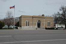 U.S. Post Office in Nephi, April 2010 | |
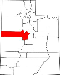 Location in the U.S. state of Utah | |
 Utah's location in the U.S. | |
| 39°43′N 112°48′W / 39.71°N 112.80°WCoordinates: 39°43′N 112°48′W / 39.71°N 112.80°W | |
| Founded | 1852 |
| Named for | Native American word for valley |
| Seat | Nephi |
| Largest city | Nephi |
| Area | |
| • Total | 3,406 sq mi (8,821 km2) |
| • Land | 3,392 sq mi (8,785 km2) |
| • Water | 14 sq mi (36 km2), 0.4% |
| Population (est.) | |
| • (2017) | 11,250[1] |
| • Density | 3.3/sq mi (1.3/km2) |
| Congressional district | 2nd |
| Time zone | Mountain: UTC−7/−6 |
| Website |
www |
Juab County (/ˈdʒuːæb/ JOO-ab) is a county in western Utah, United States. As of the 2010 census, the population of the county was 10,246.[2] Its county seat and largest city is Nephi.[3] The county was named from a Native American word meaning thirsty valley, or possibly only valley.
Juab County is part of the Provo–Orem, Utah Metropolitan Statistical Area, which is also included in the Salt Lake City–Provo–Orem, Utah Combined Statistical Area.
Geography
According to the U.S. Census Bureau, the county has a total area of 3,406 square miles (8,820 km2), of which 3,392 square miles (8,790 km2) is land and 14 square miles (36 km2) (0.4%) is water.[4]

Adjacent counties
- Tooele County (north)
- Utah County (northeast)
- Millard County (south)
- Sanpete County (east)
- White Pine County, Nevada (west)
National protected areas
State protected areas
| Historical population | |||
|---|---|---|---|
| Census | Pop. | %± | |
| 1860 | 672 | — | |
| 1870 | 2,034 | 202.7% | |
| 1880 | 3,474 | 70.8% | |
| 1890 | 5,582 | 60.7% | |
| 1900 | 10,082 | 80.6% | |
| 1910 | 10,702 | 6.1% | |
| 1920 | 9,871 | −7.8% | |
| 1930 | 8,605 | −12.8% | |
| 1940 | 7,392 | −14.1% | |
| 1950 | 5,981 | −19.1% | |
| 1960 | 4,597 | −23.1% | |
| 1970 | 4,574 | −0.5% | |
| 1980 | 5,530 | 20.9% | |
| 1990 | 5,817 | 5.2% | |
| 2000 | 8,238 | 41.6% | |
| 2010 | 10,246 | 24.4% | |
| Est. 2017 | 11,250 | [5] | 9.8% |
| U.S. Decennial Census[6] 1790–1960[7] 1900–1990[8] 1990–2000[9] 2010–2014[2] | |||
Demographics
As of July 1, 2015,[10] the US Census Bureau estimates that there were 10,594 people and 3,557 housing units in the county. The population density was 3 people per square mile (1/km²).[11] There were 3,066 households. The racial makeup of the county was 96.4% White, 0.4% Black or African American, 1.0% Native American, 0.4% Asian, 0.2% Pacific Islander, and 1.5% from two or more races. 4.7% of the population were Hispanic or Latino of any race.
In 2010,[12] there were 3,093 households out of which 47.8% had children under the age of 18 living with them, 68.50% were married couples living together, 8.80% had a female householder with no husband present, and 19.40% were non-families. 17.30% of all households the householder lived alone. The average household size was 3.27 and the average family size was 3.74.
In the county, the population was spread out with 40.1% 19 and younger, 5.0% from 20 to 24, 24.80% from 25 to 44, 20.1% from 45 to 64, and 10.2% who were 65 years of age or older. The median age was 29.3 years. 51% of the population was male and 49% was female.
The median income for a household in the county was $56,976. The per capita income for the county was $18,503 and 11.4% of the population were below the poverty line.
Transportation
In addition to the Nephi Municipal Airport, the county ia served by the following major transportation routes (all of which are on the eastern end of the county):[13]
Politics
| Year | Republican | Democratic | Third parties |
|---|---|---|---|
| 2016 | 67.0% 2,827 | 10.5% 442 | 22.6% 952 |
| 2012 | 86.0% 3,448 | 11.3% 451 | 2.8% 111 |
| 2008 | 73.2% 2,683 | 20.2% 741 | 6.6% 242 |
| 2004 | 78.5% 2,681 | 17.7% 605 | 3.8% 131 |
| 2000 | 72.6% 2,023 | 22.2% 619 | 5.1% 143 |
| 1996 | 49.1% 1,290 | 35.3% 928 | 15.5% 408 |
| 1992 | 42.7% 1,237 | 28.4% 823 | 28.8% 835 |
| 1988 | 59.7% 1,505 | 38.6% 974 | 1.7% 44 |
| 1984 | 67.2% 1,902 | 32.4% 917 | 0.4% 10 |
| 1980 | 69.3% 1,872 | 26.7% 720 | 4.0% 109 |
| 1976 | 51.6% 1,290 | 43.6% 1,091 | 4.8% 120 |
| 1972 | 67.1% 1,629 | 28.5% 691 | 4.5% 109 |
| 1968 | 54.0% 1,201 | 40.8% 907 | 5.3% 118 |
| 1964 | 41.3% 926 | 58.8% 1,319 | |
| 1960 | 51.0% 1,203 | 49.1% 1,158 | |
| 1956 | 59.6% 1,512 | 40.4% 1,025 | |
| 1952 | 58.7% 1,711 | 41.3% 1,203 | |
| 1948 | 47.9% 1,396 | 51.6% 1,501 | 0.5% 15 |
| 1944 | 44.5% 1,192 | 55.3% 1,483 | 0.2% 5 |
| 1940 | 39.7% 1,412 | 60.1% 2,136 | 0.1% 5 |
| 1936 | 30.4% 1,027 | 68.7% 2,319 | 0.9% 31 |
| 1932 | 37.6% 1,220 | 60.7% 1,969 | 1.7% 56 |
| 1928 | 47.5% 1,557 | 52.3% 1,714 | 0.2% 8 |
| 1924 | 43.6% 1,325 | 40.8% 1,241 | 15.6% 475 |
| 1920 | 53.1% 1,692 | 41.1% 1,308 | 5.8% 185 |
| 1916 | 34.5% 1,248 | 61.3% 2,221 | 4.3% 154 |
| 1912 | 35.4% 1,171 | 29.8% 985 | 34.9% 1,154 |
| 1908 | 48.4% 1,615 | 42.6% 1,421 | 9.0% 301 |
| 1904 | 48.3% 1,493 | 39.0% 1,206 | 12.7% 391 |
| 1900 | 42.5% 1,532 | 55.0% 1,986 | 2.5% 90 |
| 1896 | 15.7% 439 | 84.3% 2,360 |
Education
The county is served by two school districts:
- Juab School District, serving the Juab Valley area on the eastern end of the county
- Tintic School District, serving the remaining western part of the county
Communities
Currently populated communities in Juab County:
- Callao
- Eureka
- Levan
- Mills
- Mona
- Nephi (county seat)
- Partoun
- Rocky Ridge
- Santaquin (part)
- Trout Creek
See also
References
- ↑ https://www.census.gov/quickfacts/fact/table/juabcountyutah/PST045216
- 1 2 "State & County QuickFacts". United States Census Bureau. Archived from the original on July 12, 2011. Retrieved December 29, 2013 – via Wayback Machine.
- ↑ "Find a County". National Association of Counties. Archived from the original on May 31, 2011. Retrieved June 7, 2011.
- ↑ "2010 Census Gazetteer Files". census.gov. United States Census Bureau. August 22, 2012. Retrieved June 25, 2015.
- ↑ "Population and Housing Unit Estimates". Retrieved June 9, 2017.
- ↑ "U.S. Decennial Census". census.gov. United States Census Bureau. Archived from the original on 12 May 2015. Retrieved June 25, 2015.
- ↑ "Historical Census Browser". lib.virginia.edu. University of Virginia Library. Retrieved June 25, 2015.
- ↑ Forstall, Richard L., ed. (June 25, 1995). "Population of Counties by Decennial Census: 1900 to 1990". census.gov. United States Census Bureau. Retrieved March 27, 2015.
- ↑ "Census 2000 PHC-T-4. Ranking Tables for Counties: 1990 and 2000" (PDF). census.gov. United States Census Bureau. April 2, 2001. Retrieved June 25, 2015.
- ↑ "Bachelor's degree or higher, percent of persons age 25 years+, 2010–2014". census.gov. United States Census Bureau. Retrieved April 21, 2016.
- ↑ "Juab County UT Demographics data". towncharts.com. Retrieved April 21, 2016.
- ↑ Bureau, U.S. Census. "American FactFinder - Results". factfinder.census.gov. Archived from the original on November 29, 2014. Retrieved April 22, 2016 – via Wayback Machine.
- ↑ Google (March 25, 2018). "Juab County, Utah" (Map). Google Maps. Google. Retrieved March 25, 2018.
- ↑ Leip, David. "Dave Leip's Atlas of U.S. Presidential Elections". uselectionatlas.org. Retrieved 2018-03-31.
External links
- Official website
- Juab County Fair (official website)
- Juab County Sheriff's Office (official website)
- Juab Travel Council (official website)
- Ghost Towns of Juab County (on ghosttowns.com)
Places adjacent to Juab County, Utah | |
|---|---|
Municipalities and communities of Juab County, Utah, United States | ||
|---|---|---|
| Cities | | |
| Towns | ||
| Unincorporated communities | ||
| Ghost towns | ||
| Indian reservation | ||
| Footnotes | ‡This populated place also has portions in an adjacent county or counties | |