Mona, Utah
| Mona, Utah | |
|---|---|
| City | |
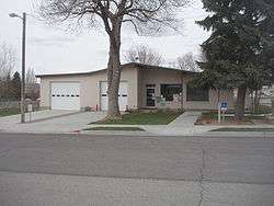 Mona city office | |
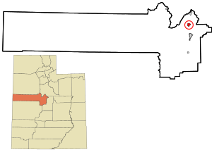 Location in Juab County and state of Utah. | |
| Coordinates: 39°48′55″N 111°51′23″W / 39.81528°N 111.85639°WCoordinates: 39°48′55″N 111°51′23″W / 39.81528°N 111.85639°W | |
| Country | United States |
| State | Utah |
| County | Juab |
| Settled | 1852 |
| Incorporated | 1924 |
| Became a city | April 1, 2001 |
| Named for | Isle of Man |
| Area | |
| • Total | 1.4 sq mi (3.7 km2) |
| • Land | 1.4 sq mi (3.6 km2) |
| • Water | 0.0 sq mi (0.1 km2) |
| Elevation | 4,970 ft (1,515 m) |
| Population (2012) | |
| • Total | 1,558 |
| • Density | 614.1/sq mi (237.8/km2) |
| Time zone | UTC-7 (Mountain (MST)) |
| • Summer (DST) | UTC-6 (MDT) |
| ZIP code | 84645 |
| Area code(s) | 435 |
| FIPS code | 49-51140[1] |
| GNIS feature ID | 1443548[2] |
| Website |
www |
Mona is a city near the northeastern edge of Juab County in Utah, United States.
Description
The city is about halfway between Santaquin and Nephi, about 1 mile (1.6 km) west of Interstate 15 and is part of the Provo–Orem Metropolitan Statistical Area. The population was 850 at the 2000 census. At the time this was sufficient under Utah state law for Mona to become a city,[3] which it did in 2001.
One of the unique things about Mona is a lavender farm (owned by Young Living); 200 acres (0.81 km2) of lavender are planted on the north side of town.[4] Mona also has an annual Lavender Festival.
History
Mona, one of the early settlements along the Old Mormon Road, was originally settled in 1852. First named Clover Creek for patches of wild clover that grew along the creek in the area. It was later renamed Willow Creek for its water source, then Starr for a local settler, before receiving its present name.
Burl Ives was once jailed in Mona for singing "Foggy Foggy Dew", because it was considered bawdy by the authorities.
Geography
Mona is located at 39°48′55″N 111°51′23″W / 39.81528°N 111.85639°W (39.815392, -111.856354).[5]
According to the United States Census Bureau, the city has a total area of 1.4 square miles (3.6 km2)2), of which, 1.4 square miles (3.6 km2)2) of it is land and 0.04 square miles (0.10 km2)2) of it (2.82%) is water.
Mona is at the foot of Mount Nebo, which is both the southernmost and highest mountain in the Wasatch Range.
| Historical population | |||
|---|---|---|---|
| Census | Pop. | %± | |
| 1870 | 315 | — | |
| 1880 | 503 | 59.7% | |
| 1890 | 469 | −6.8% | |
| 1900 | 469 | 0.0% | |
| 1910 | 467 | −0.4% | |
| 1920 | 408 | −12.6% | |
| 1930 | 338 | −17.2% | |
| 1940 | 357 | 5.6% | |
| 1950 | 328 | −8.1% | |
| 1960 | 347 | 5.8% | |
| 1970 | 309 | −11.0% | |
| 1980 | 536 | 73.5% | |
| 1990 | 584 | 9.0% | |
| 2000 | 850 | 45.5% | |
| 2010 | 1,547 | 82.0% | |
| Est. 2016 | 1,662 | [6] | 7.4% |
| U.S. Decennial Census[7] | |||
Demographics
As of the census[1] of 2000, there were 850 people, 232 households, and 203 families residing in the town. The population density was 614.1 people per square mile (237.8/km2). There were 243 housing units at an average density of 175.5 per square mile (68.0/km2). The racial makeup of the town was 98.24% White, 0.35% Native American, 0.12% Asian, 0.12% from other races, and 1.18% from two or more races. Hispanic or Latino of any race were 1.41% of the population.
There were 232 households out of which 53.0% had children under the age of 18 living with them, 77.2% were married couples living together, 6.9% had a female householder with no husband present, and 12.1% were non-families. 9.9% of all households were made up of individuals and 6.0% had someone living alone who was 65 years of age or older. The average household size was 3.66 and the average family size was 3.97.
In the town the population was spread out with 40.7% under the age of 18, 10.2% from 18 to 24, 25.4% from 25 to 44, 16.6% from 45 to 64, and 7.1% who were 65 years of age or older. The median age was 24 years. For every 100 females, there were 95.0 males. For every 100 females age 18 and over, there were 96.1 males.
The median income for a household in the town was $49,464, and the median income for a family was $50,625. Males had a median income of $35,982 versus $22,222 for females. The per capita income for the town was $14,474. About 0.5% of families and 2.4% of the population were below the poverty line, including 2.3% of those under age 18 and none of those age 65 or over.
See also
References
- 1 2 "American FactFinder". United States Census Bureau. Retrieved 2008-01-31.
- ↑ "US Board on Geographic Names". United States Geological Survey. 2007-10-25. Retrieved 2008-01-31.
- ↑ Trauntvein, Myrna (December 9, 2000). "Mona is now a third-class city". Deseret News. p. A18. Retrieved June 17, 2009.
- ↑ Young Living Farms Lavender Farm
- ↑ "US Gazetteer files: 2010, 2000, and 1990". United States Census Bureau. 2011-02-12. Retrieved 2011-04-23.
- ↑ "Population and Housing Unit Estimates". Retrieved June 9, 2017.
- ↑ "Census of Population and Housing". Census.gov. Retrieved June 4, 2015.
External links
| Wikimedia Commons has media related to Mona, Utah. |
Places adjacent to Mona, Utah | |
|---|---|
Municipalities and communities of Juab County, Utah, United States | ||
|---|---|---|
| Cities | 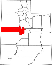 | |
| Towns | ||
| Unincorporated communities | ||
| Ghost towns | ||
| Indian reservation | ||
| Footnotes | ‡This populated place also has portions in an adjacent county or counties | |