Irinjalakuda
| Irinjalakuda ഇരിങ്ങാലക്കുട | |
|---|---|
| Municipality and town | |
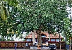 Payammal Shathrugna Temple | |
| Nickname(s): Varadanangalude Nadu (വരദാനങ്ങളുടെ നാട്) | |
 Irinjalakuda Location in Kerala, India  Irinjalakuda Irinjalakuda (India) | |
| Coordinates: 10°20′N 76°14′E / 10.33°N 76.23°ECoordinates: 10°20′N 76°14′E / 10.33°N 76.23°E | |
| Country |
|
| State | Kerala |
| District | Thrissur |
| Government | |
| • Type | Municipality |
| • Body | Irinjalakuda Municipal Council |
| Area | |
| • Total | 33.57 km2 (12.96 sq mi) |
| Elevation | 39 m (128 ft) |
| Population (2011) | |
| • Total | 51,585 |
| • Density | 1,500/km2 (4,000/sq mi) |
| Languages | |
| • Official | Malayalam, Hindi, English |
| Time zone | UTC+5:30 (IST) |
| Telephone code | 0480 |
| Vehicle registration | KL-45 |
| Website |
www |
Irinjalakuda is a Municipal town in Thrissur district, Kerala, India. Irinjalakuda is the headquarters of Mukundapuram Taluk. Irinjalakuda is known for the Koodalmanikyam Temple and the Thachudaya Kaimals [1] who had princely status until 1971.[2]
Etymology
The name Irinjalakuda has been derived from "Iru" and "Chaal", meaning two streams. According to another legend, the origin of the name Irinjalakuda came from 'Irinjalikoodal'. 'Koodal' simply means merge, merging of two rivers.So it shows that Irinjalakuda may have gradually developed, from 'Irinjalikoodal', that derived from 'Inangikoodal', means merge. At present there is no river in Irinjalakuda, only the myth of river.[3]
Irinjalakuda can be derived from 'iru njyaala koda' ( ഇരുഞാലകൊട) i.e., donation of two worlds, which is what Mahabali is said to have done in the story of the Vaamanaavataaram.
Mythological history and legends
According to Hindu mythology, Irinjalakuda was created by sage Parasurama. According to Keralolpatthi, out of the 64 gramas (villages) established in Kerala (Out of these 32 Malayala Gramas & half Thulu grama viz.Manjeswaram are in the present Kerala and 31 1/2 Thulu gramas in the coastal Karnataka.), Irinjalakuda was the head of some of them. Irinjalakuda was one of the most prominent among these Gramas (village societies). Boundaries of this grama extends up to Aloor in the east and Kakkathuruthi in the west and later extended to Koodapuzha in the east. Like the other Gramas this 'Grama' also followed Sankara Smruthi(a modified form of the 'Chathurvarnia' system of society with some Kerala model variations which lay upon caste system based on the 'Manusmruthi').[3][4][5]
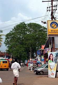
Another legend suggests that the origin of the name Irinjalakuda were heard, "Irunnu Salayil Koodai", and "Virinja Alu Kuda". There is a huge Banyan tree still standing in the centre of the Irinjalakuda spreading the branches to the sky like an umbrella.
The Thachudaya Kaimal is a spiritual dignitary of Kerala Hindus and the temporal ruler of the Koodalmanikyam Temple and its Estates. The line goes back into antiquity and is mentioned in the Skanda Purana. The Arms of the Kaimal and that of the temple bear the insignia of a coiled conch-shell with the words 'Manikkam Keralar'. [6] With the 26th amendment of the Indian constitution in 1971, the Princely order in India was abolished and the Thachudaya Kaimals lost their position in the temple and its estates.[7] It is now managed by a Trust managed by the District Collector although a vestige of former power lies in his being the chief trustee of the temple. [8][9] The Devaswom was allotted land to accommodate institutions such as the Christ College, and for public use to facilitate development activities in the region. Much land that belonged to Koodalmanikyam was subjected to encroachment.[10]
History
In 1762 Maharaja Kingdom of Cochin formed Mukundapuram taluk by adding Mapranam nadu and parts of Nandilathu nadu to Mukundapuram nadu(Muriyanadu). In the last decade of the 18th Century the last Naduvazhi Nambiar of Mukundapuram nadu(Murija nadu) died and Sakthan Thampuran confiscated all the powers and properties of Mukundapuram Nambiar and Mapranam Nambiar. Sakthan Thampuran divided old Mukundapuram Taluk into six Proverties viz.1) Thazhekkad 2) Areepalam, 3)Mukundapuram (Nadavarambu) 4) Mapranam 5)Palathungal (Nandikkara) 6)Pudukkad for administrative and revenue purposes. Five more proverties were added to Mukundapuram Taluk afterwards: Kodassery (Chalakudy), Thirumukkulam (Kuzhur)), Koratty(Adur), Pathinettarayalam (Edavilangu) and Malayattur. Tipu Sultan's Army was based at Thazhekkad Proverty of Mukundapuram Taluk on 24 December 1789 to attack the Nedumkotta which is situated in the middle of Kochi Kingdom and was known as Travancore lines and attacked KonurKottavathil in January 1790.
When new Chalakudy taluk was formed in 2013 by bifrurcating Mukundapuram taluk it lost more than 50% of its territory.
Population
Demographics
As of 2011 India census,[11] Irinjalakuda had a population of 51,585. Males constitute 48% of the population and females 52%. Irinjalakuda has an average literacy rate of 96% which is much higher than the national average of 74.65%. While male literacy stands at 97.12%, female literacy is 94.56%. 10% of the population is under 6 years of age.
Religion
Its St. Thomas Cathedral is the episcopal see of the Syro-Malabar Catholic Eparchy of Irinjalakuda (Chaldean = Syro-Oriental Rite).
Before the arrival of Tipu Sulthan to Mukundapuram Taluk in December 1789 the headquarters of Padruado Archbishops of Cranganore (Kodungallur) of Nazranis (Padruado faction of Syro Malabar Catholic Church ) was at Pookkatt(Aripalam) .(See Varthamanapusthakam of Paremmakkal Thoma Kathanar, Gobernador and ArchaDeacon of late eighteenth century). Sakthan Thampuran brought four Christian families for improving commerce and trade to the place known as ‘Chanthappura’. When they struck gold in this field, more of this community migrated from Kombara chantha and settled in the area and now it became one of the strongholds of this community. Besides Hindu and Christian communities this area consists of Muslims.[3][4] Karukulangara Narasimhaswamy Temple, Irinjalakuda, north west side, about 1.5 km from the Irinjalakuda municipal bus stand, a famous and oldest temple of Irinjalakuda
Celebrities
A prominent Kerala mathematician-astronomer Madhava (Mādhava) who founded the Kerala school of astronomy and mathematics was from(Irinjalappilly, Aloor) Sangamagrama (Saṅgamagrāma), a town in medieval Kerala believed to be the town of Irinjalakuda.[12] Nagapattinam Chandrashekhara Vasanthakokilam a carnatic singer and actress, was born as Kamakshi in Irinjalakkuda, Cochin State of British India, the present Kerala
Tovino Thomas actor and a great humanitarian. He saved Irinjalakkuda during the 2018 Kerala Floods.
Economy
In the 18th century, the ruler of Kingdom of Cochin, Sakthan Thampuran, brought four Christian families for improving commerce and trade to the place known as 'Chanthappura' (in between Nada& Tana) in Irinjalakuda. Economic development took place and Kochi Divan Shanmughan Chetty constructed a canal link known as 'Shanmugham Canal' to Cochin which improved the water transport of goods and hence the business. The canal still exists even it has lost the past glory.[13]
Some of the famous brands from Irinjalakuda are
- Another company which had made it big is Bombay Stock Exchange listed is Kerala Solvent Extractions Ltd. The company manufacture cattle feed, edible oils and dairy products.[14]
- KLF Nirmal Industries P Ltd, with their brand KLF Coconad endorsed by Padmasree Mohanlal, is one of the biggest brands in coconut cooking oil.[15]
- KPL Shudhi Coconut Oil.
- Champion Fireworks
- Pilotsmith
- Keralafeeds
Government

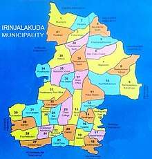
Irinjalakuda is governed by Irinjalakuda Municipality. The Municipality was formed on 8 February 1936 with an area of 11.24 square kilometres. K.I. Varunny was the first municipal chairman and the municipality was divided into 22 electoral wards. Now, the Municipality has 41 wards. [16] Irinjalakuda is the headquarters of the Mukundapuram Taluk and is a Grade-I municipality.[5]
Irinjalakuda Revenue Divisional Office was formed in May 2018. It is headed by a Revenue Divisional Officer(RDO). The office is situated at Mini Civil Station Annexe building. There is a court complex inside the Civil Station that houses the Judicial First Class Magistrate Court, Additional Sub Court, Munsif Courts and Motor Accidents Claims Tribunal. (M.A.C.T.). Irinjalakuda also has a family court.[17] There is a special sub jail in Irinjalakuda .[18] .[19]
The MLA of the Irinjalakuda legislative constituency is Prof. K.U Arunan. Irinjalakuda assembly constituency was a part of Mukundapuram (Lok Sabha constituency) till 2009 Lonappan Nambadan was the last Loksabha MP of Mukundapuram. From 2009, Irinjalakuda is now a part of Thrissur (Lok Sabha constituency). The MP of Thrissur Lok Sabha constituency is C.N.Jayadevan.
The Chairperson of Irinjalakuda Municipality is Smt.Nimya Shiju.

Transportation
Road
Irinjalakuda is located on State Highway 22 (Kerala), which links to major national highways NH 47 and NH 66 in the State. Two main roads State Highway 22 (Kerala) (Kodungallur-Shornur) Road and State Highway 61 (Kerala) (Potta-Moonupeedika) criss-crosses Irinjalakuda town. KSRTC bus station is situated behind the Koodalmanikyam temple.
[20] KSRTC operates services to Trivandrum, Eranakulam, Kottayam, Kozhikode, Palakkad and Mananthavady.
There is a private bus station in Irinjalakuda which serves local and inter-district travellers.
Railways
The nearest railway station is the Irinjalakuda Railway Station which is about 8 km East of the town heart at Kallettumkara and Aloor Villages. Irinjalakuda Railway Station is managed by the Southern Railways of Indian Railways. Most express trains stop at this station. Thrissur Railway Station is the nearest major railhead with STOP for all trains, which is just 22 km from Irinjalakuda.[20]
Air
The nearest airport is the Cochin International Airport at Nedumbassery, which is 38 km away. The airport is well connected to all major airports in India and also connected to many foreign cities. Direct flights are available to Chennai, New Delhi, Mumbai, Bangalore and Kolkata.[20]
Healthcare
Irinjalakuda has several hospitals and health clinics, including Ayurvedha, Eyecare are situated in the heart of Irinjalakuda.
- Govt. General Hospital, Tana, Irinjalakuda.
- Irinjalakuda Co-operative Hospital, Nadavarambu.
- Marina Hospital, Tana.
- Sacred Heart Hospital, Pullur.
- Lal Memorial Hospital, Mapranam.
- ESI Dispensary.
- Govt. Ayurveda Hospital.
- Kandamkulathy Ayurveda Hospital.
- Nethra Eye Care Centre.
- Ahalya Eye Hospital, Kattungachira.
- Metro Hospital, Nada.
Educational Organizations
Between the 14th and 16th Century, it was a center of learning. Kerala school of astronomy and mathematics which was believed to be founded here, made major contributions in Algebra, Arithmetic, Astronomy, Calculus, Geometry, Infinite Series and Linguistics.
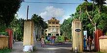
Arts & Science Colleges
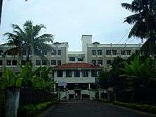
Engineering Colleges
- Christ Engineering College
- PNS College of Engineering & KTES Industrial Training Centre
Schools
STATE
- Don Bosco Higher Secondary School
- L. F. C. H. S. S., Irinjalakuda
- S. N. H. S. S., Irinjalakuda
- Mukundapuram Public School Nadavaramba
- Sangameswara NSS EMHS
- St.Marys High School
- National Higher Secondary School
- Government Model Boys Higher Secondary School
- Government Model Girls Higher Secondary School
CBSE
- Bhavan's Vidya Mandir, Irinjalakuda
- St.Xavier's School, Pullur
- St.Joesph's School, Anandapuram
- Vimala Central School
- Santhiniketan Public School
- Lisieux School, Kattungachira
ICSE/ISC
- Christ Vidyaniketan
- Don Bosco Central School.
Special Schools
- Prateeksha Bhavan (School for the mentally struggling children - near Christ College)
Other prominent Institutions
- Student's P.G.Centre, Tana, Irinjalakuda.
- Snehodaya Nursing college, Vallakkunnu.
- Sacred Heart Nursing College, Pullur.
- Namboodiris Institute of Higher Education.
- Jyothis College Irinjalakuda
- Lisieux Convent & Home Science College
- Chemmanur Academy Irinjalakuda
- Dreamzone Irinjalakuda
- Tharanellur College
Notable residents
Irinjalakuda has been the home of many notable people, including:
- Madhava of Sangamagrama (Sangamagrama believed to include parts of Irinjalakuda)
- K. Radhakrishnan
- P. Jayachandran
- Tovino Thomas
- Idavela Babu
- Anupama Parameswaran
- Thomas Unniyadan from Vaikkom
- Anand
- Dr. James Pazhayatil
- Innocent
See also
References
- ↑ http://www.godubai.com/gulftoday/articlearc.asp?aid=113418§ion=asia
- ↑ http://clr.kerala.gov.in/pdf/actsrules/KOODALMANICKAM_DEVASWOM_ACT.pdf
- 1 2 3 "The Legend". Koodalmanikyam Temple. Retrieved 2010-12-07.
- 1 2 "A Short History". AEO Irinjalakuda. Retrieved 2010-12-07.
- 1 2 "Irinjalakuda". Janasevana Kendram. Retrieved 2010-12-05.
- ↑ Who's Who in Madras 1934
- ↑ http://www.godubai.com/gulftoday/articlearc.asp?aid=113418§ion=asia
- ↑ http://www.godubai.com/gulftoday/articlearc.asp?aid=113418§ion=asia
- ↑ http://clr.kerala.gov.in/pdf/actsrules/KOODALMANICKAM_DEVASWOM_ACT.pdf
- ↑ Girish Menon (2010-04-05). "Recovery of temple lands bogged down". The Hindu. Retrieved 2014-01-18.
- ↑ "Census of India 2001: Data from the 2001 Census, including cities, villages and towns (Provisional)". Census Commission of India. Archived from the original on 2004-06-16. Retrieved 2008-11-01.
- ↑ C T Rajagopal and M S Rangachari (June 1978). "On an untapped source of medieval Keralese mathematics". Archive for History of Exact Sciences. 18 (2): 89–102. doi:10.1007/BF00348142.
- ↑ "A Short History". AEO Irinjalakuda. Retrieved 2010-12-08.
- ↑ "Company". Google Finance. Retrieved 2010-04-24.
- ↑ "KLF Nirmal Industries launches Hair oil in the city". Afro Asian Business Chronicle. Retrieved 2010-12-08.
- ↑ "History". Irinjalakuda Municipality. Retrieved 2010-12-07.
- ↑ "Video Conferencing between Courts and Jails launched". Kerala State IT Mission. Archived from the original on 2011-01-22. Retrieved 2010-12-11.
- ↑ "Ripper Surendran escapes again". The Hindu. Retrieved 2010-12-11.
- ↑ "Assembly Constituencies - Corresponding Districts and Parliamentary Constituencies" (PDF). Kerala. Election Commission of India. Archived from the original (PDF) on 2009-03-04. Retrieved 2008-10-19.
- 1 2 3 "How to reach". Koodalmanikyam Temple. Archived from the original on 2012-02-06. Retrieved 2010-12-07.
External links
| Wikimedia Commons has media related to Irinjalakuda. |