Feroke
| Feroke ഫറോക്ക് | |
|---|---|
| Municipality | |
 Mammini Kadavu | |
| Nickname(s): frk | |
 Feroke Location in Kerala, India | |
| Coordinates: 11°11′0″N 75°51′0″E / 11.18333°N 75.85000°ECoordinates: 11°11′0″N 75°51′0″E / 11.18333°N 75.85000°E | |
| Country |
|
| State | Kerala |
| District | Kozhikode |
| Founded by | Tipu sulthan |
| Population (2001) | |
| • Total | 29,504 |
| Languages | |
| • Official | Malayalam, English |
| Time zone | UTC+5:30 (IST) |
Feroke is a Municipality and a part of Kozhikode metropolitan area under Kozhikode Development Authority (K.D.A) in the Kozhikode district of the Indian state of Kerala.

Name
The village was originally named Farookhabad by Tippu Sultan. Later, this was changed to Feroke by the British. It is also assumed that Tipu Sulthan used Feroke as his capital in Malabar. The remains of a fort built by Tipu Sultan still stands in Feroke with a long tunnel to the river. Authorities are trying to preserve the fort remains as a site of historical importance. The old bridge at Feroke was built by the British in 1883.
Demographics
As of the 2001 India census,[1] Feroke had a population of 29,504. Males constitute 49% of the population and females 51%. In Feroke, 13% of the population is under 6 years of age.
As of the 2011 India census,[2] The Feroke Census Town has population of 32,122 of which 15,596 are males while 16,526 are females.
Population of Children with age of 0-6 is 3979 which is 12.39% of total population of Feroke (CT). In Feroke Census Town, Female Sex Ratio is of 1060 against state average of 1084. Moreover Child Sex Ratio in Feroke is around 969 compared to Kerala state average of 964. Literacy rate of Feroke city is 95.99% higher than state average of 94.00%. In Feroke, Male literacy is around 97.67% while female literacy rate is 94.42%.
Industry
Feroke is the cradle of the tile industry in Kerala. The rapid rivers from the Western Ghats after passing through forests carry the clay which is the raw-material for tiles, pottery and ceramic wares. There are more than a dozen tile factories in Feroke. Feroke is also well known for its wood and Timber industries.
Cheruvannur and Feroke are predominant industrial areas of Kozhikode. A number of tile factories, match factories, Timber industries, Automobile dealerships, Footwear industries, steel factories, etc. are located here, providing employment to thousands of workers. The Steel Complex is also located here.
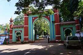
Farook College
Farook College is the biggest educational organization of Feroke area. The college was started in 1948 and enjoys autonomous status from 2015. It is the largest residential post-graduate institution affiliated with the University of Calicut. The college is located on a hillock originally called 'Irumooli Paramba' 5 km from Feroke Railway Station and 16 km from the city of Calicut and at a distance of 16 km from the Calicut Airport. The entire campus comprising the college, its hostels, the staff quarters and its sister concerns covers an area of 70 acres. The entire village is popularly called 'Farook College' and has a post office called Farook College.
Temples and kavu
- Nallur Shiva Kshethram
- Mullassery Kavu, Chulliparamba
- Pallithara Shri Kurumba Bhagavathi Kshethram
- Valakkada Kshethram
- Kizhakke Kavu
- Padinjare Kavu
- Cheruvannur Subhramanya Swami kshethram
- Parambath kavu Temple
- Karayi Temple
- Pottathil Sree Bhagavathi temple
- Odayalathodi Bhagavathi temple
- Madathodi Kavu
- Pareekatu Kavu
Hospitals
- Koyas Hospital
- Employees' State Insurance Hospital, Feroke
- Red Crescent Hospital, Chungam.
- Shifa hospital, kallampara
Places of Interest near Feroke
Edavannappara
Edavannappara is a very scenic village near Feroke and there is a lot of tourist potential here. The undulating hills in the neighbouring villages can be utilized to make it a world class picnic location. Three kilometres away lies the even more attractive Elamaram village on the Chaliyar river. There is a ferry service here that can take you to the northern side of the Chaliyar river. The ticket is Rs.5.00 and the motor boat service is available every half an hour between 6.40 a.m. and 8.40 p.m. including Sundays.ShoppingEven though this a tiny village, the shopping facilities available are quite surprisingly elaborate. The MC Mall in the heart of the town looks like an upmarket city facility. There are also many theme restaurants here. It appears that the villagers here have a flarir for good living.
Beypore (5 km)
Beypore town is about 6 miles (9.7 km) from Kozhikode, at the mouth of the Beypore river. The place was formerly known as Vaypura and Vadaparappanad. Tippu Sultan named the town "Sultan Pattanam". It is one of the important ports of Kerala and an important trading centre.
Beypore is known for its boat building yard where mammoth crafts known as urus are built. It is a major fishing harbour of Kerala. There are two man made extensions to the sea to facilitate easy access for fishing boats.
Chaliyam (4 km)
Chaliyam is an island in Kadalundi Amsom formed by the Beypore and Kadalundi rivers, and it was formerly the terminus of the Madras Railway. The bridge at Feroke which extended the railway up to Kozhikode in 1888, reduced the importance of Chaliyam.
Karuvanthuruthy
Karuvanthuruthy is a fishing village near Feroke. This villa ge is located on the western side of Feroke railway station. The underbridge from Feroke town goes to Karuvanthuruthy town and the Karuvanthuruthy bridge connects the town to Chaliyam beach and seawalk.
 Bafaki School
 Kadavath Masjidh
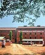 Commonwealth factory
 Karuvanthuruthy Kadavu
Kadalundi (6 km)
Kadalundi is one of the oldest towns in Kerala and is an example of the old ports called "thundies". The tidal/mangrove forest on the banks of the Kadalundi river make it a picturesque area. The deltas formed by the Kadalundi river add to the beauty of the place. The town is divided into two by the river— Kadalundi in the Kozhikode district and Kadalundi Nagaram in Malappuram district. Thousands of migratory birds from all over the world gather here starting in November.

Major Landmarks
- University of Calicut, 9 km
- Farook College, 3 km
- Alfarook College, 3 km
- Kinfra Industrial Park, 7 km
- Red Crescent Hospital, 3 km
- Medical collage Kozhikode, 17 km
- Calicut Airport, 17 km
- Kadalundi Bird Sanctuary 7.4 km
Villages and Suburbs
- Chandakkadavu, Pettah and Chungam
- Karuvanthuruthi, Thirichilangadi and Kokkivalavu
- Adivaram, Melevaram and Irumoolipparamba
- Perumugham and Pullikkadavu.
- Kallampara
- Nallur
- Puttekadu
Location
Areas Of Calicut | ||||||||||
|---|---|---|---|---|---|---|---|---|---|---|
| ||||||||||
Image gallery
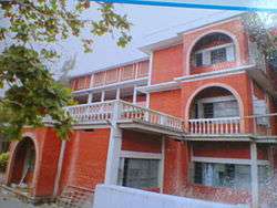
- Orphanage School
- Kadavath Masjidh
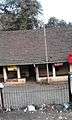 Feroke Post Office
See also
References
| Wikimedia Commons has media related to Feroke. |
| Wikivoyage has a travel guide for Feroke. |
- ↑ "Census of India 2001: Data from the 2001 Census, including cities, villages and towns (Provisional)". Census Commission of India. Archived from the original on 2004-06-16. Retrieved 2008-11-01.
- ↑ http://www.census2011.co.in/data/town/627439-feroke-kerala.html. Retrieved 2015-09-25. Missing or empty
|title=(help)