Mananthavady
| Mananthavady | |
|---|---|
| City | |
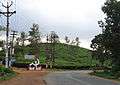
 Mananthavady Location in Kerala, India  Mananthavady Mananthavady (India) | |
| Coordinates: 11°48′N 76°0′E / 11.800°N 76.000°ECoordinates: 11°48′N 76°0′E / 11.800°N 76.000°E | |
| Country |
|
| State | Kerala |
| District | Wayanad |
| Government | |
| • Body | Municipality |
| Elevation | 760 m (2,490 ft) |
| Population (2001) | |
| • Total | 37,836 |
| • Density | 472/km2 (1,220/sq mi) |
| Languages | |
| • Official | Malayalam, English |
| Time zone | UTC+5:30 (IST) |
| PIN | 670645 Mananthavady town, 670643 Kaniyaram |
| Telephone code | 04935 |
| ISO 3166 code | IN-KL |
| Vehicle registration | KL-72 |
| Sex ratio | 983 ♂/♀ |
| Literacy | 85.77% |
Mananthavady is a municipality and taluk in the Wayanad district of Kerala, India.The town is located on the banks of Mananthavady Puzha, a tributary of the Kabini River. Mananthavady has been referred to as "Hosenkadi" in a dictum scribbled under a copper artifact found at the Ananthanathaswamy Temple at Varadoor. The dominant view on the etymology is that the word is derived from "Mane Eytha Vady (The place where an arrow was shot at the deer)". This view is strengthened by the existence of a place called Ambukuthy, literally the location where the arrow pierced, on the outskirts of the town.[1] This area was once ruled by the Pazhassi dynasty and the tomb of Pazhassi Raja is an important heritage site located in the heart of the town. Mananthavady was a major army camp for the British during their campaign against Pazhassi. One can still see the vestiges of the colonial period - canteen, club, barracks, rest house, cemetery - around Mananthavady. This is also the headquarters of the Adivasi Gothra Mahasabha. The District Hospital in Mananthavady is the only major treatment facility for the service of the tribal communities and other less privileged sections of Wayanad.
Location
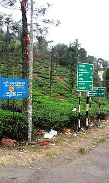
Mananthavady is located 28 km north-east of the district headquarters Kalpetta,38 km to sultan Bathery, 80 km east of Thalassery and 92 km north-east of Kozhikode(via.kutyady) Thalassery-Bavali Road is the major road passing through Mananthavady, which is well connected with both Mysore and Kodagu.Mananthavady is the nearest municipality in Kerala to Mysore. Mananthavady is connected with Mysore (105 km away), via Kartikulam, Bavali and H D Kote through Nagarhole National Park. This road is parallel to Kabini River and closed during the night time to protect wild animals. This road has been recently declared as a National Highway by the central government. The proposed highway starts from Kainatty(Junction of NH 212(766)) till Mysore via Bavali, Jayapura.[2] Another road goes to Gonikoppal(60 km away) in Kodagu, via Kartikulam, Tholpetty forest, Kutta and Ponnampet.[3]
Education
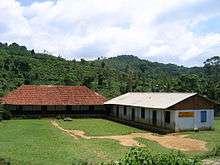
- The Government College Mananthavady was established in 1981. It was the only centre for higher learning in North Wayanad for a long time.
- In 1995 Mary Matha Arts & Science College was started in the Government aided sector. Govt. College of Engineering was started in 1999, the first engineering college in Wayanad.
- In the unaided sector there are two colleges - P.K.K.M. College of Applied Science and W.M.O Imam Gazzali Arts & Science College. All the colleges are affiliated to Kannur University. *The university also has a centre in Mananthavady with three departments (Teacher Education, Zoology and Rural & Tribal Sociology).
- Government Engineering College, Mananthavady was inaugurated in 1999. It is one of the 9 Government Engineering Colleges in Kerala and is affiliated to Kerala Technological University. There are 4 B.Tech courses (CSE, ECE, EEE, ME) and 2 M.Tech courses (Computer Networks & Security, Communication and Signal Processing).
- Govt. UP School, Mananthavady (Estd in 1865) is the First School in the District
Schools
- MGM HSS, Mananthavady
- Mananthavady GVHSS, Mananthavady
- Thalappuzha GHSS, Thalappuzha
- Fr. G. K. M. High School, Kaniyaram
- Sacred Heart HSS, Dwaraka
- Amrita Vidyalayam, Mananthavady
- St' Patrick's ICSE ISC
- S.C.H.S.S Payyampalli
- St' Joseph HSS, Kallody
- Hill Blooms CBSE School, Mananthavady
Places of interest
Post office road
Post office road or Thazhe angadi is a suburb of Mananthavady filled with temples, rivers, bridges and other attractions.
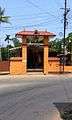 Mariamman Kovil
 Muthappan Temple
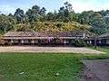 Newmans College
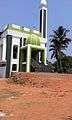 Sunni Mosque
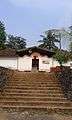 Hanuman Kovil
Boys Town
Boys town (15 km north of Mananthavady): Herbal garden, nature care centre, sericulture unit, perma-culture centre etc., established by the Wayanad Social Service Society and Gene Park (the Indo-Danish project for promoting herbal gardening) are situated here

Kuruva Islands
Kuruvadweep (17 km east of Mananthavady ): 950-acre (3.8 km2) protected river delta system.
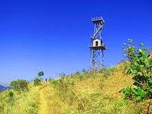
Pakshi Pathalam
Pakshi Pathalam is a trekking site some seven kilometers from Thirunelli temple near Kattikkkulam. There is an ancient cave on the hillock with plenty of birds.
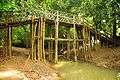
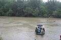
.jpg)
.jpg)
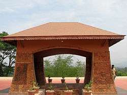
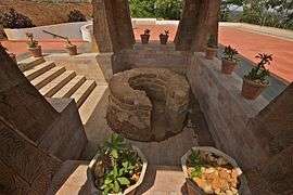
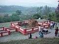
Pazhashi Memorial
Pazhassi kudeeram: Tomb of Pazhassi Raja who fought the British to his death. This museum is located half a kilometer from the bus station.
Wildlife Sanctuaries
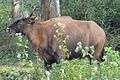
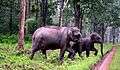
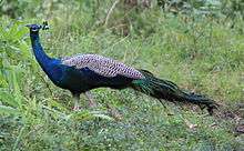
Tholpetty Wild Life Sanctuary : It is 24 km on the way to Coorg. Wayanad Wildlife Sanctuary: Established in 1973, the Wayanad Wildlife Sanctuary is contiguous to the protected area network of Nagarhole and Bandipur of Karnataka on the northeast and Mudumalai of Tamil Nadu on the southeast. Rich in bio-diversity, the sanctuary is an integral part of the Nilgiri Biosphere Reserve, which has been established with the specific objective of conserving the biological heritage of the region. The sanctuary is very rich in flora and fauna.
Valliyoorkavu Temple
Valliyoorkavu (3 km from the town): This Temple is dedicated to Mother Goddess and is worshipped in three principal forms of Vana Durga, Bhadrakali and Jala Durga. It is the most important place of worship for the tribal communities. The annual 15-day festival is in March and is the grandest of all festivals in the district. It is still the largest congregation of all tribals of Wayanad.

Minor Attractions
Art Gallery: The Kerala Lalithakala Akademi Art Gallery is located on the Mysore Road. The Gallery regularly hosts exhibitions of various Indian artists and organizes cultural events.
Latin Church : Situated at the heart of the town. It is a reminder of the towns colonial past.
Paalamandhapam Devi Temple & Malakkari Temple Koolivayal (12 km from Mananthavady, 6 km from Panamaram town)
Thrissilery Siva Temple: One of the famous shrines in Wayanad situated in Thrissilery. There is a Jala Durga temple in the same complex.
Muthireri kavu: A temple associated with Kottiyoor Vysakha Mahotsavam . The temple is situated in small village Muthireri, about 8 km from Mananthavady
Holy Trinity CSI Church MANANTHAVADY one of the old church in Wayanad built in 18th century. Located near by Municipal bus stand.
Public Libraries
- Pazhassi Smaraka Granthalayam, Mananthavady
- Solidarity Library
- Anjukunnu Pothujana Grandhalayam
- Tagore Smaraka Grandhalayam Kommayad
- Kaniyaram Prabhath Reading room and Library.
Getting there
- Rail- Nearest railway station is at Vatakara, 65 km away .
- Road- Thalassery-80 km, Kozhikode-92 km,(via. Kutyadi,) Mysore-98 km. Frequent buses are available to Thalassery, Kozhikode, Kannur, Kodagu & Mysore
- Air-Nearest airport is Kozhikode International Airport-120 km, Mysore Airport-109 km, Bengaluru International Airport-290 km, Kannur International Airport(under construction at Mattannur) is at a distance of 58 km.
- A new Railway Line Thalassery - Mananthavady - Mysore is being planned
Image gallery
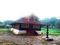
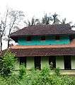 300 year old Panamaram Srambia
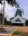 Latin Church
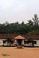 VHSE School
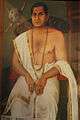 King of Pazhashi
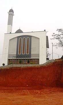 Sunni Mosque on Mysore Road
Climate
| Climate data for Mananthavady, Kerala | |||||||||||||
|---|---|---|---|---|---|---|---|---|---|---|---|---|---|
| Month | Jan | Feb | Mar | Apr | May | Jun | Jul | Aug | Sep | Oct | Nov | Dec | Year |
| Average high °C (°F) | 27.2 (81) |
29.0 (84.2) |
30.6 (87.1) |
30.4 (86.7) |
29.4 (84.9) |
25.8 (78.4) |
24.4 (75.9) |
24.9 (76.8) |
25.9 (78.6) |
26.7 (80.1) |
26.6 (79.9) |
26.5 (79.7) |
27.3 (81.1) |
| Average low °C (°F) | 16.7 (62.1) |
18.0 (64.4) |
19.6 (67.3) |
20.7 (69.3) |
20.9 (69.6) |
19.8 (67.6) |
19.4 (66.9) |
19.4 (66.9) |
19.3 (66.7) |
19.4 (66.9) |
18.6 (65.5) |
17.0 (62.6) |
19.1 (66.3) |
| Average precipitation mm (inches) | 3 (0.12) |
9 (0.35) |
20 (0.79) |
101 (3.98) |
186 (7.32) |
515 (20.28) |
1,096 (43.15) |
565 (22.24) |
211 (8.31) |
203 (7.99) |
82 (3.23) |
19 (0.75) |
3,010 (118.51) |
| Source: Climate-Data.org[4] | |||||||||||||
See also
References
- ↑ http://lsgkerala.in/mananthavadypanchayat/
- ↑ "Centre Agrees to Upgrade 1,656km of State and National Highways". The New Indian Express. Archived from the original on 2018-03-11. Retrieved 2018-03-11.
- ↑ P. P.Chandran (April 2003). "Wayanad District" (PDF). District Handbooks of Kerala. Thiruvananthapuram: Department of Information and Public Relations, Government of Kerala. Retrieved 2012-02-16.
- ↑ "CLIMATE: MANANTHAVADY", Climate-Data.org. Web: .
External links
| Wikimedia Commons has media related to Mananthavady. |
