Areekode
| Areekode അരീക്കോട് Areacode | |
|---|---|
| Town | |
| Nickname(s): Makkah of Football | |
| Coordinates: 11°14′16″N 76°03′00″E / 11.237716°N 76.050088°ECoordinates: 11°14′16″N 76°03′00″E / 11.237716°N 76.050088°E | |
| Country |
|
| State | Kerala |
| District | Malappuram |
| Government | |
| • Type | Block Panchayath |
| • Body | UDF |
| Languages | |
| • Official | Malayalam, English |
| Time zone | UTC+5:30 (IST) |
| PIN | 673639 |
| Telephone code | 0483 |
| Vehicle registration | KL-10 |
Areekode (formerly known as Areacode) is a town on the banks of the Chaliyar River in Malappuram district India. Areekode is famous for football. Many famous Indian players are from here, and therefore Areekode is also known as the Makkah of football. It is 17 km from Manjeri and 33 km from Calicut. Also, Areekode is famous for its oft-visited Areekode beach.
Etymology
It is believed that the name 'Areekode' was derived from 'Aruvikkode', which in Malayalam means 'river side'.
Culture
Areekode is a predominantly Muslim populated area. Hindus exist in comparatively smaller numbers. So the culture of the locality is based upon Muslim traditions. Duff Muttu, Kolkali and Aravanamuttu are common folk arts of this locality. It has a developed culture and is advanced in education, especially women's education. There are many libraries attached to mosques providing a rich source for Islamic studies. Some of the books are written in Arabi-Malayalam which is a version of the Malayalam language written in Arabic script. People gather in mosques for the evening prayer and continue to sit there after the prayers discussing social and cultural issues. Business and family issues are also sorted out during these evening meetings. The Hindu minority of this area maintains their rich traditions by celebrating various festivals in their temples. Hindu rituals are done here with a regular devotion as in other parts of Kerala.[1]
Transportation
Areekode connects to other parts of India through Calicut town on the west, Nilambur town on the east, and Manjeri town on the south. National highway 66 passes through Calicut and the northern stretch connects to Goa and Mumbai. The southern stretch connects to Cochin and Trivandrum. State Highway 28 starts from Nilambur and connects to Ooty, Mysore and Bangalore through Highways 12, 29 and 181. The nearest airport is at Kozhikode CCJ. The nearest major railway station is at Calicut CLT.
Important landmarks
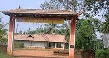
- Methalangadi Juma Masjid
- Puthalam Sunni Masjid
- Police Station
- Malabar Special Police Camp(MSP)
- 250KV Power Grid
- Synthetic Football stadium
- Thazhathangadi Juma Masjid
- Sree Saligrama Temple,Puthalam
- Kurumathur Sree Vishnu Temple
- Nadukkavungl Sree Mahadeva Temple
- Kadungalloor Bridge
- Chekkunni mala
- Kolamkolli Waterfalls
- Odakkayam Waterfalls
- Potti Hanging Bridge
- Therattammel ground
Educational institutions
- Sullamussalam Science college
- Sullamussalam Arabic college
- Sullamussalam Training College
- Govt. ITI Areekode
- Sullamussalam Private ITI
- Eminent Academy
- Co-operative College
- PG Academy
- Government Higher Secondary School
- Sullamussalam Oriental Higher Secondary School
- Mices Public School (CBSE)
- Majmau English School
- Majmau Da'wa College
- Madar Women's Academy
Hospitals
- Govt. Taluk Hospital
- Alnas Hospital
- Melepurakkal Hospital Kadungallur
Banking Services
- State Bank of India
- The Federal Bank Limited
- South Indian Bank
- Canara Bank
- Kerala Gramin Bank
- Malappuram District Co-operative Bank
- Manjeri Co-operative Urban BANK
- Areekode Co-operative Bank
Travel Agency
- Eranad Online Tours and Travels
- Alhind Tours and Travels
- Akbar Travels
- Good Hope Enterprises
Suburbs of Areekode
On Thamarassery Road
- Pathanapuram, Kuttooli, Valillapuzha, Kuniyil
On Othayi Road
- Pallippadi Junction, Terattammal, Moorkkanad, Thachanna, Chaly, Thachamparambu, Anakkallu
- Poovathikkal, Kurikkalampad, Verupalam
On Edavanna Route
- Jamalangadi, Palepetta and Pannippara
- Pottiyil, V.K.Pady and Vadashery
- Moozhippadam, Puthalam and Vakkalor
- Kakkod, Kollanpady and Vadasherry
- Pannippara, Kallidumbu and Pothilad
On Kondotty Route
- Muthuvalloor, Kadungalloor and Kizhisseri
- Velleri, Chemrakkattoor and Pookkattuchola
- Kozhakkottoor and Puthalam
On Vazhakkad Route
- Ugrapuram, Poonkudi and Vavoor
- Edasserikkadavu and Kizhuparamba
- Vettupara, Edavannappara
Location
Geographic Location
|title = Areas of |Northwest = Kozhikode |North = Mukkam |Northeast = Nilambur |West = Vazhakkad |Centre = Areekode Town |East = Edavanna |Southwest = Kondotty |South = Malappuram |Southeast = Manjeri
References
- ↑ "Archived copy". Archived from the original on 2016-04-01. Retrieved 2016-07-14.
External links
| Wikimedia Commons has media related to Areekode. |