Manjeshwar
| Manjeshwar | |
|---|---|
| Town | |
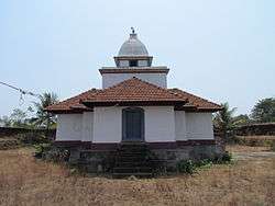 Jain Temple Manjeshwar | |
| Nickname(s): Manju nath kshetram | |
 Manjeshwar Location in Kerala, India | |
| Coordinates: 12°43′27″N 74°52′27″E / 12.7243°N 74.8743°ECoordinates: 12°43′27″N 74°52′27″E / 12.7243°N 74.8743°E | |
| Country |
|
| State | Kerala |
| District | Kasaragod |
| Named for | Manjula Kshetra |
| Government | |
| • Body | Block Panchayath |
| Area | |
| • Total | 24.4 km2 (9.4 sq mi) |
| Population (2011) | |
| • Total | 8,742 |
| • Density | 360/km2 (930/sq mi) |
| Languages | |
| • Official | Malayalam & Tulu |
| • Speaking | Malayalam, Tulu, Kannada |
| Languages | |
| Time zone | UTC+5:30 (IST) |
| PIN | 671323 |
| Telephone code | 4998 |
| Vehicle registration | KL-14 |
Manjeshwar, also known as Manjeshwaram is a town at the northern tip of the India state of Kerala. It is situated at a distance of 584 kilometres (360 mi) from the state capital Thiruvanathapuram, 610 Km from Parassala, 670 Km from Kanyakumari (Agasteeshwaram) and 27 kilometres (20 mi) south of Mangalore city in neighboring Karnataka. It is a coastal town in Kasaragod district.
Demographics
The Manjeshwar Census Town has population of 8,742 of which 4,178 are males while 4,564 are females as per report released by Census India 2011.
Population of Children with age of 0-6 is 1149 which is 13.14% of total population of Manjeshwar (CT). In Manjeshwar Census Town, Female Sex Ratio is of 1092 against state average of 1084. Moreover, Child Sex Ratio in Manjeshwar is around 995 compared to Kerala state average of 964. Literacy rate of Manjeshwar city is 92.91% lower than state average of 94.00%. In Manjeshwar, Male literacy is around 97.53% while female literacy rate is 88.75%.[1]
Education
- Kanila Shree Bhagavathi English Medium School
- Sirajul Huda English Medium High School, Manjeshwar
- Govt. High School, Bangra Manjeshwar
- Govinda Pai College, Manjeshwar
- Al Saqaf English Medium School , Udayawar , Manjeshwar
Politics
Manjeswaram assembly constituency is part of Kasaragod (Lok Sabha constituency).[2]
Health
Manjeshwar is one of the areas with large number of HIV patients. 970 HIV cases were registered in Kasaragod district. Ten HIV deaths were reported from Kasaragod district within a short period of two months in 2016. There is no special facility or doctors for HIV patients in this area. HIV affected areas in Kasaragod include Dharmathadka, Nileshwaram, Manjeshwar, Bhandiyod, Vellarikundu, Kasaragod town and Padannakkad.[3]
See also
References
- ↑ "India 2011 census". Retrieved 25 September 2015.
- ↑ "Assembly Constituencies - Corresponding Districts and Parliamentary Constituencies" (PDF). Kerala. Election Commission of India. Archived from the original (PDF) on 2009-03-04. Retrieved 2008-10-18.
- ↑ http://english.mathrubhumi.com/health/health-news/10-hiv-deaths-reported-in-kasargod-dist-within-2-months-english-news-1.1315218
External links
| Wikimedia Commons has media related to Manjeshwar. |
- Birds eye view maps of Manjeshwar. (Courtesy: Wikimapia)