Everett, Washington
| Everett, Washington Lushootseed: dᶻəɫigʷəd[1] | ||
|---|---|---|
| City | ||
| City of Everett | ||
 | ||
| ||
 Location of Everett, Washington | ||
 Everett, Washington Location in the United States | ||
| Coordinates: 47°57′48″N 122°12′2″W / 47.96333°N 122.20056°WCoordinates: 47°57′48″N 122°12′2″W / 47.96333°N 122.20056°W | ||
| Country |
| |
| State |
| |
| County | Snohomish | |
| Incorporated | May 4, 1893 | |
| Government | ||
| • Type | Mayor–council | |
| • Mayor | Cassie Franklin | |
| Area[2] | ||
| • City | 49.9 sq mi (129 km2) | |
| • Land | 33.45 sq mi (86.6 km2) | |
| • Water | 15.04 sq mi (39.0 km2) | |
| Population (2010)[3] | ||
| • City | 103,019 | |
| • Estimate (2015)[4] | 108,010 | |
| • Rank | US: 272nd | |
| • Density | 2,100/sq mi (800/km2) | |
| • Metro | 3,733,580 (US: 15th) | |
| Time zone | UTC−8 (PST) | |
| • Summer (DST) | UTC−7 (PDT) | |
| Zip codes | 98201, 98203, 98204, 98206, 98207, 98208, 98213[5] | |
| Area code(s) | 425 | |
| FIPS code | 53-22640 | |
| GNIS feature ID | 1512198[6] | |
| Website |
everettwa | |
Everett is the county seat of and the largest city in Snohomish County, Washington, United States. It is located 25 miles (40 km) north of Seattle and is one of the main cities in the metropolitan area and Puget Sound region. Everett is the seventh-largest city in Washington state and had a total population of 103,019 at the 2010 census. The city is located at the mouth of the Snohomish River along Port Gardner Bay, an inlet of Possession Sound (itself part of Puget Sound).
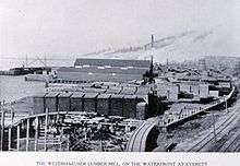
American settlement on the Everett peninsula began in the 1860s, with several sawmills built to serve the area's growing timber industry. Everett was platted by a group of investors seeking to build an industrial city and named for the son of co-founder Charles L. Colby. The city was incorporated in 1893, shortly after the arrival of the Great Northern Railway, and prospered as a major industrial center. Everett's economy transitioned away from lumber and towards aviation after World War II, with the construction of Boeing's aircraft assembly plant at Paine Field in 1967. Boeing remains the city's largest employer, alongside the U.S. Navy, which has operated Naval Station Everett since 1992. Everett received an All-America City Award in 2002.
Everett remains a major employment center for Snohomish County, but has also become a bedroom community for Seattle in recent decades. It is connected to Seattle by Interstate 5 and various public transit services at Everett Station, including the Sounder commuter train, Amtrak, and commuter buses.
History
The Port Gardner peninsula was originally inhabited by local Coast Salish tribes, including the Snohomish, who maintained a winter village at Hibulb (also called Hebolb) at the mouth of the Snohomish River.[7] The area was explored by the Vancouver Expedition of 1792, which landed on a beach on the modern Everett waterfront on June 4 and claimed the land for England.[8] The Snohomish and other tribes signed the Treaty of Point Elliott in 1855, relocating to the nearby Tulalip Indian Reservation and relinquishing its lands to the territorial government, opening the region to American settlement.[9]
The first permanent American settler to arrive on the peninsula was Dennis Brigham, a carpenter from Worcester, Massachusetts, who claimed a 160-acre (0.6 km2) homestead on Port Gardner Bay in 1861 and built a cabin for himself. He was joined by several other families on their own homesteads, which included the establishment of a general store and a sawmill that quickly went out of business.[10] Over the next several years a handful of settlers moved to the area, but it wasn't until 1890 that plans for platting a town were conceived.
On July 17, 1890, The steamship Queen of the Pacific left Tacoma for an Alaskan cruise with Henry Hewitt, Jr. and Charles L. Colby aboard. During this "Fateful voyage" initial plans for an industrial city on the peninsula along the banks of the Snohomish river were formulated. On August 22, 1890, The Rucker Brothers filed their plat at Port Gardner, a 50-acre (200,000 m2) townsite on the bayfront side of what is now the city of Everett. This plat was later withdrawn to accommodate the plans of the Hewitt-Colby group.
On September 1, 1890, Henry Hewitt filed a bond on the Davis tract at the north end of what was to become the Everett town site, beginning the process of acquisition that would become the Everett Land Company later along with Charles L. Colby and Colgate Hoyt. In October 1890, the Hewitt-Colby syndicate decided to name their industrial city after Everett Colby, the fifteen-year-old son of investor Charles L. Colby, who had displayed a prodigious appetite at dinner. Everett Colby in turn was named for orator Edward Everett.
On November 19, 1890, the Articles of Incorporation for the Everett Land Company were filed, with Henry Hewitt Jr. as president. On November 26, 1890, the Rucker Brothers transferred 434.15 acres (1.7569 km2) of property on the Everett peninsula to Hewitt. Three days later, "The Remarkable Document" was drafted, setting the terms by which the Rucker Brothers would donate half their remaining holdings to Hewitt in exchange for promises of specific development.
The Company bought much of the Ruckers' land, taking them in as junior partners. Everett was officially incorporated on May 4, 1893, the year the Great Northern Railway came to the town. Both Hewitt and the Ruckers had speculated that James J. Hill would make the town the terminus of his railroad. However Hill continued the railroad along the shore of Puget Sound to Seattle. Although it succeeded in building the city, the Everett Land Company was a failure for its investors. The outside investors withdrew, and the Company's holdings were transferred to a new company controlled by Hill. The Ruckers, who helped broker the deal, stayed in Everett and became leading citizens of the young city.
Railroads and mines played a part in Everett's future. The mining community of Monte Cristo depended on a railway for supplies. It was hoped that the railroad would cross the mountains and bring in traffic. For a while ore was smelted in Everett, then sawmilling and port activity commenced. A dozen steam riverboats were built in Everett for the Yukon gold rush.
Several survivors of the Bellingham riots settled in Everett for two months, until they were beaten and forcefully evicted by a mob on November 5, 1907. Everett also was the site of the Everett Massacre of 1916 in which a posse led by local Sheriff Donald McRae shot and killed five Industrial Workers of the World members. The IWW members on the steamer Verona travelled from Seattle to support strikers in Everett and sought to land, but McRae and his posse of deputized civilians blocked the harbor. Shooting broke out and at least five IWW members were killed, along with two in the posse who were deemed to have been killed by friendly fire.
Everett streets are named after each of the three founders. Adjacent streets Colby Avenue and Hoyt Avenue run north and south and are intersected by Hewitt Avenue running east and west just south of the BNSF Railway tracks cutting across Everett. There are several other streets named for their associates such as Bond Street named for Judge Hiram Bond, President of the Everett & Monte Cristo Railroad. Parallel to Colby and Hoyt are avenues named for other investors, John D. Rockefeller, railroad executive T.F. Oakes, shipbuilder Alexander McDougall, and McDougall's associate Charles W. Wetmore.
Geography
Topography
Everett is located at 47°" West (47.963434, -122.200527).[11] The city is one of the core cities comprising the Seattle-Tacoma-Olympia CMSA.
The core of Everett sits on the Port Gardner Peninsula, formed by Port Gardner Bay on the west and the Snohomish River to the north and east. Newer portions of the city generally extend southward from this point for a distance of approximately 8 miles (13 km).
According to the United States Census Bureau, the city has a total area of 48.49 square miles (125.59 km2), of which, 33.45 square miles (86.64 km2) is land and 15.04 square miles (38.95 km2) is water.[2]
Climate
The climate of Everett is heavily influenced by marine air masses, which tend to moderate temperatures with seasonal variations much less pronounced than inland areas. Everett has an oceanic climate (Cfb) due to all months having precipitation levels greater than 1 inch (254mm), though the drying trend in summer resembles the rainfall distribution of a warm-summer Mediterranean climate (Csb) according to the Köppen climate classification system.
| Climate data for Everett | |||||||||||||
|---|---|---|---|---|---|---|---|---|---|---|---|---|---|
| Month | Jan | Feb | Mar | Apr | May | Jun | Jul | Aug | Sep | Oct | Nov | Dec | Year |
| Record high °F (°C) | 72 (22) |
74 (23) |
82 (28) |
85 (29) |
93 (34) |
98 (37) |
93 (34) |
94 (34) |
89 (32) |
83 (28) |
74 (23) |
66 (19) |
98 (37) |
| Average high °F (°C) | 44.9 (7.2) |
48.8 (9.3) |
52.8 (11.6) |
58.1 (14.5) |
63.6 (17.6) |
68.3 (20.2) |
72.6 (22.6) |
72.7 (22.6) |
67.8 (19.9) |
59.5 (15.3) |
50.9 (10.5) |
45.7 (7.6) |
58.8 (14.9) |
| Average low °F (°C) | 33.1 (0.6) |
34.4 (1.3) |
36.8 (2.7) |
40.4 (4.7) |
45.3 (7.4) |
50.2 (10.1) |
52.9 (11.6) |
52.8 (11.6) |
48.3 (9.1) |
43 (6) |
37.6 (3.1) |
34.3 (1.3) |
42.4 (5.8) |
| Record low °F (°C) | 1 (−17) |
2 (−17) |
10 (−12) |
23 (−5) |
29 (−2) |
36 (2) |
37 (3) |
38 (3) |
30 (−1) |
22 (−6) |
0 (−18) |
5 (−15) |
0 (−18) |
| Average precipitation inches (mm) | 4.51 (114.6) |
3.25 (82.6) |
3.57 (90.7) |
2.7 (69) |
2.34 (59.4) |
2.12 (53.8) |
1.04 (26.4) |
1.2 (30) |
1.98 (50.3) |
3.39 (86.1) |
4.65 (118.1) |
4.96 (126) |
35.71 (907) |
| Average snowfall inches (cm) | 3.3 (8.4) |
1.2 (3) |
0.6 (1.5) |
0.2 (0.5) |
0 (0) |
0 (0) |
0 (0) |
0 (0) |
0 (0) |
0 (0) |
0.6 (1.5) |
1.4 (3.6) |
7.3 (18.5) |
| Average precipitation days | 19 | 16 | 18 | 15 | 12 | 10 | 6 | 6 | 9 | 15 | 18 | 19 | 163 |
| Source: [12] | |||||||||||||
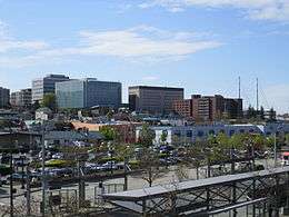
Cityscape
Downtown
.jpg)
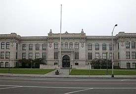
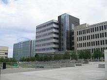
Downtown Everett is generally defined by the area north of Pacific Avenue, east of West Marine View Drive, south of Everett Avenue, and west of Broadway.[13]:4 Downtown is home to the government campuses of Snohomish County and the City of Everett, multiple high-rise office and residential buildings, as well as the Angel of the Winds Arena, Everett Public Library and other city amenities.
The tallest building in Everett, Key Bank Tower, is located in Downtown.
Historic district
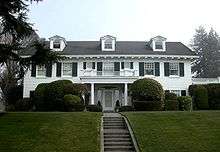
The Everett historic district runs from around 8th Street to 25th Street, north to south and from Broadway to Grand Avenue, east to west. The district contains many old and stately homes, including the home of the former U.S. Senator Henry M. Jackson on Grand Avenue.
The city also has 35 properties on its register of historic places.[14]
Waterfront

Situated at the mouth of the Snohomish River on Possession Sound, the Everett waterfront is home to Naval Station Everett and the Port of Everett (est. 1918). The Port of Everett includes both a deep-water commercial seaport and a marina with over 2,000 slips, which it claims to be the largest on the west coast of the United States.[15] Ambitious redevelopment began in 2006 to convert the north end of the waterfront into a community of maritime businesses, retail shops and condominiums, beginning with the Port of Everett's Port Gardner Wharf. In 2006, the seaport received 119 ships and 59 barges, totaling some 192,000 short tons of cargo.[16]
The waterfront is also home to the Everett Yacht Club, which was founded in 1907, although it existed in some form as early as 1895.[17] During summer months, the marina is home to the Everett Farmer's Market (Sundays) and the Waterfront Concert Series (Thursday nights), part of a citywide free concert series which, in 2006, attracted over 26,000 visitors.[18] Each September, Tenth Street Park on the waterfront is home to the annual Everett Coho Derby,[19] while each August the marina promenade is gowned in local art during the Fresh Paint Festival of Artists.[20]
Parks and gardens

Everett is home to 40 parks. The biggest parks are Walter E. Hall Park at 137 acres (0.6 km2), Forest Park at 111 acres (0.4 km2), Langus Riverfront Park at 96 acres (0.39 km2), Kasch Park at 60 acres (0.24 km2), Howarth Park at 28 acres (0.11 km2), and Thornton A. Sullivan Park at 27 acres (0.11 km2).[21] Walter E. Hall Park, near the Boeing plant, sports a golf course and a skate park; Forest Park, a swimming pool, hockey, horseshoes, miles of trails and an animal farm; Langus Park, a boat launch; Kasch Park, four softball fields; Howarth Park, a sandy beach on Puget Sound; and Thornton A. Sullivan Park hosts a sandy swimming beach on Silver Lake as well as public docks for fishing.
Forest Park
Forest Park is the oldest public park in Everett. As its name suggests, the park is heavily wooded. It is home to miles of trails, a playground, and a popular public swimming pool.
Jetty Island
Jetty Island is a man-made island and park located in the Puget Sound, just off the Everett, Washington waterfront. The island is two miles long and half a mile wide, approximately 1,800 acres. The island has no plumbing, electricity or structures. During the summer months, a ferry becomes operational, allowing transportation to and from the island. A floating restroom also becomes operational off the island's shore. Jetty Island's unique features provide excellent habitat for birds and juvenile salmon. The island is home to more than 45 bird species including osprey, shorebirds, hawks, eagles, cormorants and ducks. Visitors may see seals surfacing or lounging near the water's edge, or even witness gray whales swimming past during spring migration.[22][23]
Nishiyama Garden
Nishiyama Garden is a traditional Japanese garden located at the Nippon Business Institute at Everett Community College. It features Sukiya-style wooden gates, gravel paths, stones, trees, a small stream and a portion of the famous Kintai Bridge from Iwakuni, Japan, one of Everett's sister cities.[24]
Evergreen Arboretum and Gardens
Evergreen Arboretum and Gardens (2.4 acres (9,700 m2)) is an arboretum and park located at the south end of Legion Park, at the intersection of Alverson and Marine View Drive.[25] Gardens include sculpture and vistas of Puget Sound, as well as:
- Conifer garden – includes Chamaecyparis lawsoniana, Chamaecyparis nootkatensis, Pfitzeriana Aurea, Picea glauca, and Strobus 'Nana'.
- Dahlia garden – a variety of dahlias.
- Japanese Maple grove – 17 varieties of maples, with ferns and hydrangeas.
- Perennial border – includes artichoke (Cynara scolymus), Japanese forest grass (Hakonechloa macra), giant hyssop (Hyssopus officinalis), dwarf waterlily (Nymphaea), and New Zealand flax (Phormium cookianum).
- Small Urban Tree Walk
- White border – flowers and foliage in white, silver, and blue.
- Woodland garden – grotto with Knadhill and Exbury azaleas, lace-cap hydrangeas (Hydrangea macrophylla), and Pieris japonica.
Neighborhoods
The city of Everett maintains an Office of Neighborhoods which facilitate communication between the city and the 19 established neighborhood associations. Each of the officially recognized neighborhood associations operate independently to better their established geographic areas within the city.[26] The neighborhoods are:
- Bayside – comprising much of the central business district, the waterfront, and the surrounding residential areas.
- Boulevard Bluffs – primarily residential area of the city bordering Mukilteo.
- Cascade View – residential area in South Everett, north of Everett Mall
- Delta – primarily residential area north of downtown Everett
- Evergreen – primarily residential area in South Everett.
- Glacier View – older residential area south of downtown.
- Harborview-Seahurst-Glenhaven – older residential areas south of downtown.
- Holly – a mix of residential, commercial, and industrial areas on the southern edge of the city.
- Lowell – formerly an independent town, Lowell is a primarily residential area southeast of downtown.
- Northwest – older residential areas northwest of downtown.
- Pinehurst-Beverly Park – mix of residential and commercial developments in South Everett.
- Port Gardner – residential neighborhoods south of downtown.
- Riverside – areas just northeast of downtown.
- Silver Lake – residential and commercial areas surrounding Silver Lake in the extreme southeastern part of the city.
- South Forest Park – residential neighborhood near downtown.
- Twin Creeks – the area surrounding Everett Mall, a mix of residential and commercial areas.
- Valley View-Sylvan Crest-Larimer Ridge – residential areas in southeast Everett.
- View Ridge-Madison – residential areas west and southwest of Forest Park.
- Westmont – primarily multi-family housing in the southwestern part of the city.
Economy
Everett's early economy was tied to the lumber trade. The city's 2006 labor workforce comprised more than 80,000, predominantly employed in technology, aerospace, and service-based industries.[27]
Airplane manufacturer Boeing has a significant presence in Everett, including a large manufacturing plant that is the world's largest building by volume.[28] Toymaker Funko is also headquartered in Everett.[29]
Top employers
According to the City's 2012 Comprehensive Annual Financial Report,[30] the top employers in the city are:
| # | Employer | # of Employees |
|---|---|---|
| 1 | Boeing | 39,000 |
| 2 | Naval Station Everett | 6,000 |
| 3 | State of Washington | 6,000 |
| 4 | Providence Regional Medical Center Everett | 3,500 |
| 5 | Snohomish County | 2,500 |
| 6 | The Everett Clinic | 2,100 |
| 7 | Everett School District | 1,900 |
| 8 | Frontier Communications Northwest | 1,500 (2009) |
| 9 | Zumiez | 1,400 (2009) |
| 10 | City of Everett | 1,200 |
| 11 | Fluke Corporation | 1,100 |
| 12 | Aviation Technical Services | 1,000 |
Demographics
| Historical population | |||
|---|---|---|---|
| Census | Pop. | %± | |
| 1900 | 7,838 | — | |
| 1910 | 24,814 | 216.6% | |
| 1920 | 27,644 | 11.4% | |
| 1930 | 30,567 | 10.6% | |
| 1940 | 30,224 | −1.1% | |
| 1950 | 33,849 | 12.0% | |
| 1960 | 40,304 | 19.1% | |
| 1970 | 53,622 | 33.0% | |
| 1980 | 54,413 | 1.5% | |
| 1990 | 69,961 | 28.6% | |
| 2000 | 91,488 | 30.8% | |
| 2010 | 103,019 | 12.6% | |
| Est. 2016 | 109,043 | [31] | 5.8% |
| Source:[32] 2015 Estimate[4] | |||
2000 census
As of the census of 2000, there were 91,488 people, 36,325 households and 21,613 families residing in the city. The population density is 2,814.6 people per square mile (1,086.9/km²). There are 38,512 housing units at an average density of 1,184.8 per square mile (457.5/km²). The racial makeup of the city is 56% White, 9% African American, 1.56% Native American, 10% Asian, 4% Pacific Islander, 3.13% from other races and 4.25% from two or more races. Hispanic or Latino of any race were 13% of the population.
There are 36,325 households, out of which 31.9% had children under the age of 18 living with them, 42.1% were married couples living together, 12.5% had a female householder with no husband present, and 40.5% were non-families. 31.7% of all households were made up of individuals and 8.5% had someone living alone who was 65 years of age or older. The average household size was 2.40 and the average family size was 3.04.
In the city, the population was spread out with 25.1% under the age of 18, 12.3% from 18 to 24, 33.3% from 25 to 44, 18.9% from 45 to 64, and 10.3% who were 65 years of age or older. The median age was 32 years. For every 100 females, there were 103.5 males. For every 100 females age 18 and over, there were 102.8 males.
The median income for a household in the city was $40,100 and the median income for a family was $46,743. Males had a median income of $35,852 versus $28,841 for females. The per capita income for the city was $20,577. About 10.1% of families and 19.5% of the population were below the poverty line, including 16% of those under the age of 18 and 12.1% of those ages 65 and older.
2010 census
As of the census[3] of 2010, there were 103,019 people, 41,312 households, and 23,282 families residing in the city. The population density was 3,079.8 inhabitants per square mile (1,189.1/km2). There were 44,609 housing units at an average density of 1,333.6 per square mile (514.9/km2). The racial makeup of the city was 74.6% White, 4.1% African American, 1.4% Native American, 7.8% Asian, 0.7% Pacific Islander, 6.1% from other races, and 5.3% from two or more races. Hispanic or Latino of any race were 14.2% of the population.
There were 41,312 households of which 30.5% had children under the age of 18 living with them, 38.2% were married couples living together, 12.5% had a female householder with no husband present, 5.7% had a male householder with no wife present, and 43.6% were non-families. 34.1% of all households were made up of individuals and 9.3% had someone living alone who was 65 years of age or older. The average household size was 2.39 and the average family size was 3.09.
The median age in the city was 34.4 years. 22.7% of residents were under the age of 18; 11.3% were between the ages of 18 and 24; 30.6% were from 25 to 44; 25% were from 45 to 64; and 10.3% were 65 years of age or older. The gender makeup of the city was 50.9% male and 49.1% female.
Crime
| Everett | |
|---|---|
| Crime rates* (2015) | |
| Violent crimes | |
| Robbery | 140 |
| Aggravated assault | 214 |
| Property crimes | |
| Burglary | 924 |
| Larceny-theft | 4096 |
| Motor vehicle theft | 862 |
| Arson | 31 |
|
Notes *Number of reported crimes per 100,000 population. 2013 population: 105,370 Source: 2015 FBI Crime Statistics | |
While in 2012, Everett was ranked with the 104th highest crime rate in the United States,[34] it has since seen significant improvement in several key areas. For example, between 2012 and 2015, Everett's robbery rate decreased from 182 to 148 (-18.7%). Aggravated assault decreased from 252 to 225 (-10.7%), and burglary from 4,281 to 974 (-77.2%).[35] It should be noted however that Everett's burglary rate in 2012 was unusually high, and that a more fair comparison would have been the decrease from 2013's burglary rate of 1,129 to 2015's 974 (-13.7%).[36]
In January 2017, Everett, with a high rate of opioid abuse, sued Purdue Pharma, claiming that the company's gross negligence in the distribution of OxyContin harmed its citizens. One aspect of the complex suit is Los Angeles gang, who employed corrupt doctors issuing huge prescriptions to homeless people, diverting the drug to Washington and other states.[37][38][39]
Culture
Media
The Everett Daily Herald newspaper has been published in print continuously since February 11, 1901 and online since January 5, 1997, providing local and international news for Everett and the greater Snohomish County area. It was purchased by The Washington Post Company in 1978 and sold to Black Press subsidiary Sound Publishing. The Herald also publishes the monthly Herald Business Journal and has a sister publication, La Raza del Noroeste, which is a weekly Spanish-language newspaper founded in 2006 to serve the greater Puget Sound area.
Everett is home to five radio stations. KRKO and KKXA are jointly operated along with the EverettPost.com from facilities in downtown Everett. KRKO 1380 AM (est. 1922) is a locally owned 50,000 Watt sports radio station affiliated with FOX Sports Radio and it is the broadcast home for the Seattle Mariner's affiliate Everett AquaSox,the Western Hockey League Everett Silvertips and NCAA Division I Football and Basketball. KKXA 1520 AM (est. 2011) is also a locally owned 50,000 Watt radio station. The KKXA format is classic country. KSER 90.7 FM (est. 1991) is an independent public radio station broadcasting a wide range of music, as well as Democracy Now!, BBC News, The Takeaway, and other nationally syndicated programming. KSER also provides north Puget Sound regionally focused news and information. KXIR 89.9 FM (est. 2013) is the sister station to KSER and is produced in Everett, but licensed in Freeland, WA. KWYZ 1230 AM (est. 1940s) is a Korean language station.
KONG-TV, which broadcasts from Seattle, is licensed to Everett.
Arts
In 2003, Angel of the Winds Arena (then known as Everett Events Center) opened. The arena's "Twin Masts" are a signature of the Everett skyline. The $83 million arena hosts events such as concerts, trade shows, hockey (Everett Silvertips), and high school graduations.[40] However, as of June 28, 2016 the arena may be taken over by the City of Everett since the arena has continued to operate in the red since 2011, thus possibly moving up the takeover date by the city from 2026 to a sooner date.[41]
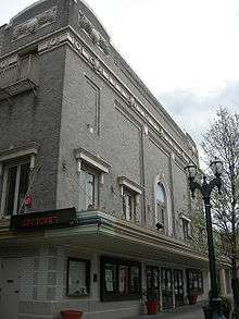
Downtown Everett is also home to the Everett Performing Arts Center (home to the Village Theatre theatre company), The Historic Everett Theatre[42] (built in 1901 and is one of the oldest active theatre West of the Rockies), the Imagine Children's Museum, the Arts Council of Snohomish County, and an array of street sculptures. The Everett Symphony (established 1935) performs at the Everett Civic Auditorium. The city is also home to the Everett Chorale, which holds their concerts at the Everett Performing Arts Center.
Founded as the Arts Council of Snohomish County, the Schack Art Center opened in downtown Everett in April 2011 and was named for John and Idamae Schack, in honor of their steadfast support of Everett's cultural institutions.[43] It is the place to look at, learn about, and create art in the region. Village Theatre has produced musical theatre since 1979. Through its Village Originals program, Village Theatre contributes to the development of new musicals, having launched over 145 new works to date. Its youth education programs, Pied Piper and KIDSTAGE, serving over 55,000 young people, families, and schools annually.[44]
Since the end of the Great Recession (2009), Seattle has seen its cost of living rise exponentially, largely due to large-scale economic development and the growth of the tech industry.[45] As its perception as a working class community has diminished,[46] many musicians and artists have found it increasingly difficult to live within Seattle proper.[47] This has led to an "artistic flight" toward neighboring communities, most notably Everett which is often cited as possessing the "true grit and soul of the 90's." [48][49]
Libraries
The historically and architecturally significant Everett Public Library is a cornerstone of Everett's downtown and a beacon to its citizens. Additionally, the Evergreen Branch, situated on busy Evergreen Way in south Everett, serves an ever-increasing, ethnically diverse neighborhood.
Sports teams
| Club | Sport | Founded | League | Venue | Championships |
|---|---|---|---|---|---|
| Everett AquaSox | Baseball | 1984 | Northwest League | Everett Memorial Stadium | 1985, 2010 |
| Everett Silvertips | Hockey | 2003 | Western Hockey League | Angel of The Winds Arena |
Education
Everett has received recognition for student achievement, boasting a four-year graduation rate of 90 percent, and a five-year graduation rate of 94.5 percent. Additionally, the Everett school district has the highest graduation rate for English-language learners in the state of Washington.[50]
Higher education
High schools
Most of the city is served by the Everett School District (which also services areas south of the Everett, including the city of Mill Creek), however portions of southwestern Everett lie within the Mukilteo School District.
- ACES High School – (MSD: Alternative School)
- Archbishop Thomas J. Murphy High School (Private School)
- Everett High School
- Cascade High School
- Cedar Park Christian School
- Mariner High School
- Henry M. Jackson High School
- Montessori Schools of Snohomish County
- Sequoia High School – (ESD: Alternative School)
- Valley View Christian School
Middle schools
- Eisenhower Middle School
- Everett Christian School
- Evergreen Middle School
- Explorer Middle School
- Forest Park Adventist Christian School
- Gateway Middle School
- Heatherwood Middle School
- Immaculate Conception & Our Lady of Perpetual Help School
- Montessori Schools of Snohomish County
- North Middle School
- Northshore Christian Academy
- St. Mary Magdalen Catholic School
- Valley View Christian School
- Voyager Middle School
- Zion Lutheran School
Elementary schools
- Cedar Park Christian School
- Cedar Wood Elementary
- Discovery Elementary
- Emerson Elementary
- Everett Christian School
- Forest Park Adventist Christian School
- Forest View Elementary
- Garfield Elementary
- Hawthorne Elementary
- Horizon Elementary
- Immaculate Conception & Our Lady of Perpetual Help School
- Jackson Elementary
- James Monroe Elementary
- Jefferson Elementary
- Lowell Elementary
- Madison Elementary
- Mill Creek Elementary
- Montessori Schools of Snohomish County
- Northshore Christian Academy
- Olivia Park Elementary
- Penny Creek Elementary
- Silver Firs Elementary
- Silver Lake Elementary
- St. Mary Magdalen Elementary School
- Valley View Christian School
- View Ridge Elementary
- Whittier Elementary
- Woodside Elementary
- Zion Lutheran School
Infrastructure

Transportation
Everett is well-connected, consisting of an array of different transport options.
Freeway access is via Interstate 5 which passes by the city. Many highways also connect in Everett including US Highway 2 which begins in Everett.
Public transit service has operated in Everett since 1893. From 1910-1939 Everett was connected with Seattle by the Seattle-Everett Interurban Railway. Today Everett Transit (est. 1969) provides bus service within the city, operating 46 buses and 18 ParaTransit vehicles with daily ridership of 6,800.[51] Sound Transit provides commuter train and bus service to Seattle and bus service to Bellevue. Community Transit connects Everett with the remainder of Snohomish County. Amtrak provides inter-city train service via its Empire Builder and Cascades lines while Sound Transit provides commuter rail connections to Seattle via its Sounder trains. Inter-city bus service is also provided by Greyhound. All of these bus and train connections can be made at Everett Station, the hub of Everett's transportation network.
The closest international airports are Boeing Field and Seattle-Tacoma International Airport, and Snohomish County operates Paine Field for private aviation. Paine Field, also used by three cargo airlines, has been proposed service from passenger airlines, including Allegiant Air. As of 2017, there are plans to build a small terminal at the airport, pending disputes from the neighboring city of Mukilteo.
Health systems
General Hospital was founded in 1894 by the Women's Book Club of Everett. The Sisters of Providence in the Pacific Northwest established Providence Hospital in 1905. Both hospitals merged on March 1, 1994 to form what is now called Providence Regional Medical Center Everett.[52] In 2005 it was named one of America's 100 top hospitals for the third time in thirteen years.[53]
Providence Regional Medical Center Everett statistics for 2009:[54]
- Licensed Beds: 372
- Deliveries: 3,900
- Emergency Department Visits: 111,000
- Inpatient Admissions: 26,000
- Surgeries: 13,000
- Providence Physician Group Visits: 276,000
- Employees: 3,200
- Medical Staff: 884
- Providence Physician Group Providers: 110
- Volunteers: 950
The Everett Clinic was established in 1924 by four Everett physicians and has evolved into a regional healthcare provider with sixteen locations throughout Snohomish County. It serves more than 2,300 patients each day.[55]
Utilities
The city of Everett's water originates in the Spada reservoir in the Sultan Basin Watershed of the Cascade Mountains. The city's water system provides drinking water not only to the city but roughly half a million people in Snohomish County. It is treated at the Everett Water Filtration Plant near Sultan. Electricity is provided by Snohomish County PUD. Natural gas is provided by Puget Sound Energy. Telecommunications providers include Frontier Communications which acquired FIOS TV and Internet service in many areas when they purchased the Verizon service area, Clearwire mobile WiMax system as well as the four major cellular providers. Satellite providers include Dish Network and DirecTV, though trees can obstruct views in areas.
Notable people
- Arts
- Donna Barr, comic book author
- Linda Lee Cadwell, teacher, wife of Bruce Lee
- Chuck Close, painter and photographer
- Nancy Coleman, actress
- Patrick Duffy, actor
- David Eddings, fantasy author
- Daniel E. Freeman, musicologist
- Carol Kaye, bass player
- Mary Lambert, singer-songwriter
- Kenny Loggins, singer-songwriter
- Peg Phillips, actress
- Curtis Salgado, singer-songwriter
- Mark P. Shea, Catholic author
- Jason Webley, singer-songwriter
- Michael Shamus Wiles, actor
- Cherie Witter, model and actress
- Mark L. Young, actor
- Criminal
- Ryan G. Anderson, convicted al-Qaeda enabler
- Military
- James E. Kyes, Navy Cross recipient Commander (O-5)
- Political and business
- Glenn Beck, conservative author and radio/TV host
- Jean Berkey, Washington state legislator
- David Marston Clough, former Minnesota Governor and politician
- Henry M. Jackson, Congressman and Senator
- J. H. Smith, politician and pioneer
- Elmer R. Tapper, former member of Louisiana House of Representatives, retired to Everett
- Larry Vognild, politician
- Jack Westland, U.S. Representative, also U.S. Amateur golf champion
- Sports
- Rick Anderson, MLB pitching coach
- Tom Cable, football coach
- Chris Chandler, NFL quarterback
- Larry Christenson, MLB pitcher
- Randy Couture, mixed martial artist[56]
- Dennis Erickson, football coach
- Jim Lambright, football coach
- Brent Lillibridge, MLB infielder
- Chuck Nelson, NFL kicker
- T. J. Oshie, NHL forward for Washington Capitals
- Mike Price, football coach
- Grady Sizemore, MLB outfielder
- Travis Snider, MLB outfielder
- Steven Souza, MLB outfielder
- Earl Torgeson, MLB first baseman
Sister cities
Everett has the following sister city relationships:[57]


Gallery
 Snohomish County Government Campus
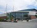 Everett Events Centre (now Xfinity Arena)
 Downtown
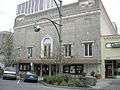 Historic Everett Theatre
 Everett Public Library
 Everett Public Library
 Bethel Baptist Church
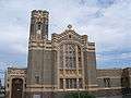 Trinity Episcopal Church (1920)
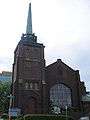 First Presbyterian Church
 First Presbyterian Church
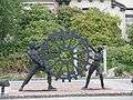 Public Art
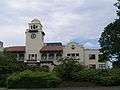 Old County Courthouse
 War Memorial
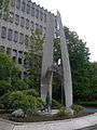 Armed Forces Memorial
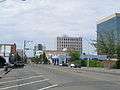 Downtown
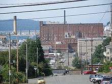 Kimberly-Clark Paper Plant
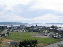 Naval Station Everett
 Everett Marina
See also
References
- ↑ Dawn Bates; Thom Hess; Hilbert, Vi (1994). dᶻəɫigʷəd. Lushootseed Dictionary. University of Washington Press. p. 90. ISBN 0-295-97323-4.
- 1 2 "US Gazetteer files 2010". United States Census Bureau. Archived from the original on 2012-01-24. Retrieved 2012-12-19.
- 1 2 "American FactFinder". United States Census Bureau. Retrieved 2012-12-19.
- 1 2 "Population Estimates". United States Census Bureau. Archived from the original on October 19, 2016. Retrieved June 13, 2016.
- ↑ "ZIP code lookup". United States Postal Service. Archived from the original on 2010-11-23. Retrieved 2008-12-23.
- ↑ "US Board on Geographic Names". United States Geological Survey. 2007-10-25. Retrieved 2008-01-31.
- ↑ Whitely, Peyton (March 16, 2005). "Aerial photos show 2 very different cities". The Seattle Times. Retrieved June 30, 2018.
- ↑ Federal Writers' Project (1941). The WPA Guide to Washington: The Evergreen State. American Guide Series. Works Progress Administration. pp. 186–200. OCLC 881468746. Retrieved June 30, 2018 – via Google Books.
- ↑ Muhlstein, Julie (May 9, 2018). "City of Everett to celebrate 125th birthday with big party". The Everett Herald. Retrieved June 30, 2018.
- ↑ Oakley, Janet (July 26, 2005). "Everett — Thumbnail History". HistoryLink. Retrieved June 30, 2018.
- ↑ "US Gazetteer files: 2010, 2000, and 1990". United States Census Bureau. 2011-02-12. Retrieved 2011-04-23.
- ↑ "DAYTON, WASHINGTON (452675)". Western Regional Climate Center. Retrieved November 16, 2015.
- ↑ "Everett Downtown Plan". City of Everett. July 2006. Retrieved February 2, 2017.
- ↑ "Groups work to preserve Everett's rich history". The Everett Herald. April 7, 2017. Retrieved June 29, 2018.
- ↑ Port of Everett - Marina Archived 2007-06-29 at the Wayback Machine.
- ↑ "Port of Everett - Cargo Statistics". Retrieved 19 February 2018.
- ↑ "Home – Everett Yacht Club".
- ↑ "Sunday Afternoon Waterfront Series in Everett". Retrieved 19 February 2018.
- ↑ Administrator. "Home".
- ↑ "FRESH PAINT".
- ↑ "Everett Parks in Everett". Retrieved 19 February 2018.
- ↑ "Port of Everett : Jetty Island".
- ↑ Everett. "Jetty Island – Everett Waterfront Historical Interpretive Program".
- ↑ Nishiyama Japanese Garden
- ↑ "Evergreen Arboretum and Gardens".
- ↑ "Neighborhood associations in Everett". Retrieved 19 February 2018.
- ↑ "Archived copy". Archived from the original on 2007-09-28. Retrieved 2007-07-14.
- ↑ "Boeing in Everett". Boeing. Retrieved September 27, 2016.
- ↑ Catchpole, Dan (September 9, 2016). "Toymaker Funko moving to downtown Everett". The Everett Herald. Retrieved September 27, 2016.
- ↑ "Comprehensive Annual Financial Report". Retrieved 2014-06-12.
- ↑ "Population and Housing Unit Estimates". Retrieved June 9, 2017.
- ↑ Moffatt, Riley. Population History of Western U.S. Cities & Towns, 1850-1990. Lanham: Scarecrow, 1996, 320.
- ↑ "U.S. Decennial Census". Census.gov. Archived from the original on May 12, 2015. Retrieved June 6, 2013.
- ↑ "2012 City Crime Rate Rankings*" (PDF). CQ Press.
- ↑ "FBI Releases 2015 Crime Statistics for Washington State".
- ↑ "FBI Releases 2013 Crime Statistics for Washington State".
- ↑ Harriet Ryan (January 19, 2017), "City devastated by OxyContin use sues Purdue Pharma, claims drugmaker put profits over citizens' welfare", The Los Angeles Times
- ↑ Scott North (February 20, 2017), "Everett's suit against OxyContin maker moves to federal court", Everett Herald
- ↑ "U.S. City Sues OxyContin Maker For Contributing To Opioid Crisis", Morning Edition, NPR, February 3, 2017
- ↑ Tuinstra, Rachel (September 24, 2003). "A $71.5 million Venue Represents a Big Leap of Faith' for the City". The Seattle Times. Retrieved March 25, 2012.
- ↑ "State Still Concerned Over Xfinity Arena Finances – MYEVERETTNEWS.com".
- ↑ "Home".
- ↑ "Welcome".
- ↑ "Village Theatre – About Us".
- ↑ "What Is the True Cost of Living in Seattle?".
- ↑ "In Seattle, the rent is too damn high".
- ↑ "Seattle Is Too Expensive For Artists Who Help It Boom".
- ↑ "Everett Today".
- ↑ "Seattle Transit Blog – Our Improbable Growth Targets".
- ↑ "Everett schools chief honored as state Superintendent of Year". The Seattle Times.
- ↑ http://www.soundtransit.org/x5907.xml
- ↑ "Providence Washington – Providence Washington".
- ↑ http://www.providence.org/everett/news/solucient.htm
- ↑ "Providence Washington – Providence Washington".
- ↑ "About Us – The Everett Clinic".
- ↑ Randy Couture on IMDb
- ↑ Sister Cities, States, Counties & Ports Archived November 5, 2012, at the Wayback Machine.
Archives
- Everett Education Association Records. 1937-2002. 28.06 cubic feet. At the Labor Archives of Washington, University of Washington Libraries Special Collections.
External links
| Wikimedia Commons has media related to Everett, Washington. |

- City of Everett Official Website
- Everett Public Library Website
- Port of Everett
- Everett, Washington at Curlie (based on DMOZ)
Municipalities and communities of Snohomish County, Washington, United States | ||
|---|---|---|
| Cities | 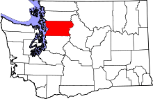 | |
| Towns | ||
| CDPs |
| |
| Other unincorporated communities | ||
| Indian reservation | ||
| Military bases | ||
| Ghost town | ||
| Footnotes | ‡This populated place also has portions in an adjacent county or counties | |

Places adjacent to Everett, Washington | |
|---|---|
Mayors of cities with populations exceeding 100,000 in Washington | ||
|---|---|---|
State capital: Stephen Buxbaum (Olympia) | ||
| ||