Picnic Point, Washington
| Picnic Point, Washington | |
|---|---|
| CDP | |
 Picnic Point, Washington | |
| Coordinates: 47°51′37″N 122°17′40″W / 47.86028°N 122.29444°WCoordinates: 47°51′37″N 122°17′40″W / 47.86028°N 122.29444°W | |
| Country |
|
| State |
|
| County | Snohomish |
| Area | |
| • Total | 10.4 km2 (4.01 sq mi) |
| • Land | 7.9 km2 (3.04 sq mi) |
| • Water | 0.2 km2 (0.07 sq mi) |
| Elevation | 24 m (79 ft) |
| Population (2010) | |
| • Total | 8,809 |
| • Density | 850/km2 (2,200/sq mi) |
| Time zone | Pacific |
| Area code(s) | 360 |
Picnic Point is a CDP located in Snohomish County, Washington. The population was 8,809 at the 2010 census. It was formerly part of the Picnic Point-North Lynnwood CDP.
Geography
Picnic Point is located at coordinates 47°51'37"N 122°17'40"W. The elevation is 79 feet.[1]
Picnic Point Park, located on the Puget Sound coastline, offers access to the beach as well as views of the sound, Whidbey Island, and the Olympic Mountains.
References
- ↑ "Picnic Point, Washington". Retrieved 19 August 2014.
Municipalities and communities of Snohomish County, Washington, United States | ||
|---|---|---|
| Cities | 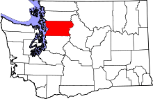 | |
| Towns | ||
| CDPs |
| |
| Other unincorporated communities | ||
| Indian reservation | ||
| Military bases | ||
| Ghost town | ||
| Footnotes | ‡This populated place also has portions in an adjacent county or counties | |
This article is issued from
Wikipedia.
The text is licensed under Creative Commons - Attribution - Sharealike.
Additional terms may apply for the media files.