Mountlake Terrace, Washington
| Mountlake Terrace, Washington | |
|---|---|
| City | |
 Welcome sign at Interstate 5 and 236th Street Southwest | |
 Location of Mountlake Terrace, Washington | |
| Coordinates: 47°47′27″N 122°18′24″W / 47.79083°N 122.30667°WCoordinates: 47°47′27″N 122°18′24″W / 47.79083°N 122.30667°W | |
| Country | United States |
| State | Washington |
| County | Snohomish |
| Incorporated | November 30, 1954 |
| Government | |
| • Type | Council–manager |
| • Mayor | Jerry Smith |
| • Manager | Scott Hugill |
| Area[1] | |
| • Total | 4.17 sq mi (10.80 km2) |
| • Land | 4.06 sq mi (10.52 km2) |
| • Water | 0.11 sq mi (0.28 km2) |
| Elevation | 456 ft (139 m) |
| Population (2010)[2] | |
| • Total | 19,909 |
| • Estimate (2015)[3] | 20,989 |
| • Density | 4,903.7/sq mi (1,893.3/km2) |
| Time zone | UTC-8 (Pacific Time Zone) |
| • Summer (DST) | UTC-7 (PDT) |
| ZIP code | 98043 |
| Area code(s) | 425 |
| FIPS code | 53-47490 |
| GNIS feature ID | 1512488[4] |
| Website |
cityofmlt |
Mountlake Terrace is a suburban city in Snohomish County, Washington, United States. It lies on the southern border of the county, adjacent to Shoreline and Lynnwood, and is 13 miles (21 km) to the north of Seattle. As of the 2010 census, the city had a population of 19,909 people.
Mountlake Terrace was founded in 1949 by suburban developers on the site of a disused airfield. Within five years, the community had grown to over 5,000 people and was incorporated as a city in 1954 to provide municipal services. In recent decades, Mountlake Terrace has begun development of its own downtown with mixed-use buildings and large employers in lieu of remaining a bedroom community for Seattle commuters. Interstate 5 runs north–south through the city and connects Mountlake Terrace to Seattle and Everett.
History
The site of Mountlake Terrace was thickly forested in the mid-Nineteenth Century and formed part of the traditional hunting-gathering areas of the Snohomish people. The area was obtained by the Puget Mill Company in 1862. By 1900, most of the land in south Snohomish County had been logged. Pope & Talbot Company, the successor entity of the Puget Mill Company, subdivided the cut area into 10-acre plots, which were sold as "chicken ranches." These plots were sold with moderate success to ranchers raising poultry, mink, and chinchilla. An interurban rail line between Tacoma, Washington and Everett, Washington was built in 1910, allowing easier access to the farms from throughout the region. Many of them failed during the Great Depression, however, and the railroad was abandoned in 1939.[5]
A portion of the area was used by the United States government during World War II as a landing field. At the end of the war, the government ceased operation of the airfield. In 1949, developers Albert LaPierre and Jack Peterson.[5][lower-alpha 1] bought the abandoned airstrip and began constructing cinder-block houses. They named their development "Mountlake Terrace" because from some parts of the property they could see both Mount Rainier and Lake Washington, and the old runway looked a little like a terrace.
Incorporation
In 1954, over 5,000 people lived in the area between 244th and 216th Streets SW, and 48th and 68th Avenues W.[6] The existing infrastructure was overwhelmed by this unplanned growth. Some people waited a year for a party-line telephone, streets were unpaved, and household sanitation was provided by individual septic systems. The nearest police department was in Everett, 15 miles away. One resident, Patrick McMahan, became frustrated by these conditions, and organized the Mountlake Terrace Study Committee, which led a campaign to incorporate the community. The election held November 23, 1954 supported incorporation, 517 to 483. Voters chose a five-person city council in the same election. The council had its first meeting on November 24 and selected Gilbert "Gil" Geiser, a 35-year-old hardware store owner, as Mountlake Terrace's first mayor. Geiser had to lend the new city $5 so the incorporation papers could be filed. With the filing, on November 29, Mountlake Terrace officially became a third-class city.[5][6]
Early growth
Mountlake Terrace's population doubled between 1950 and 1960 and then nearly doubled again by 1970. Small businesses flourished in two strip-mall-type shopping centers in the middle of the area, on land provided by the developers. The developers also donated land for several churches, including the parish of St. Pius X, which celebrated its first mass on June 22, 1955. The John Fluke Corporation moved its electronics center from Seattle to Mountlake Terrace in 1959. In 1961 a bond issue was approved in a special election; it was used to build a City Hall.[5][7]
Slowing of development
The city had been first envisioned as an automobile-based bedroom community, but subsequent leaders began to envision it as a "stand-alone" development with an economically vital downtown area. This effort was aided by the arrival of Fluke and the construction of the two strip malls and the City Hall.[6] However, this development halted in the 1980s. Boeing suffered a significant business downturn, in which about 75% of plant workers in Everett lost their jobs; Alderwood Mall was opened in Lynnwood which drew much of the area's business away from downtown; and in 1990 two arson fires in the city center caused significant destruction.[6][lower-alpha 2] In 1981, Fluke moved its facility to Everett. The 1980 census showed that Mountlake Terrace's population had dropped by almost 5 percent in 10 years. The city budget was repeatedly trimmed, but Mountlake Terrace entered 1989 with a $1.3 million deficit.[5]
Recent history

The mid-2000s saw new construction on 56th Avenue, and in 2006 the city created a plan to revitalize the downtown area and encourage economic activity.[5][6][lower-alpha 3] As of 2013 the town's largest employer was Premera Blue Cross, which employs some 3,000 people.[8]
A city-center plan adopted in February 2007 allows mixed-use buildings of up to seven stories in the central block and up to five stories in surrounding blocks. The previous limit was three stories.[5]
Geography
Mountlake Terrace is located at 47°47′27″N 122°18′24″W / 47.790969°N 122.306636°W (47.790969, -122.306636).[9] The city's elevation above sea level ranges between 262 and 530 feet (160 m), with an average altitude of 440 feet (130 m).
According to the United States Census Bureau, the city has a total area of 4.17 square miles (10.80 km2), of which, 4.06 square miles (10.52 km2) is land and 0.11 square miles (0.28 km2) is water.[1] The total area is 2.65% water.
The southwestern portion of the city includes Lake Ballinger Park, which offers access to Lake Ballinger and contains a boat launch and a fishing pier. The lake itself is located partially in Mountlake Terrace and partially in neighboring Edmonds.[10]
Economy
Top employers
According to Mountlake Terrace's 2013 Comprehensive Annual Financial Report,[8] the top employers in the city are:
| Rank | Employer | Number of employees | Percentage of total city employment |
|---|---|---|---|
| 1 | Premera Blue Cross | 2,293 | 45.72% |
| 2 | Edmonds School District | 360 | 7.18% |
| 3 | City of Mountlake Terrace | 167 | 3.33% |
| 4 | Sterling Bank | 165 | 3.29% |
| 5 | Crazy Moose Casino | 99 | 1.97% |
| 6 | Camelot Society | 70 | 1.40% |
| =7 | Albertsons | 64 | 1.28% |
| =7 | Red Dragon Casino | 64 | 1.28% |
| =7 | 1st Security Bank of Washington | 64 | 1.28% |
| 10 | AA Party Rental | 51 | 1.02% |
Demographics
| Historical population | |||
|---|---|---|---|
| Census | Pop. | %± | |
| 1960 | 9,122 | — | |
| 1970 | 16,600 | 82.0% | |
| 1980 | 16,534 | −0.4% | |
| 1990 | 19,320 | 16.9% | |
| 2000 | 20,362 | 5.4% | |
| 2010 | 19,909 | −2.2% | |
| Est. 2016 | 21,182 | [11] | 6.4% |
| U.S. Decennial Census[12] 2015 Estimate[3] | |||
2010 census
As of the census[2] of 2010, there were 19,909 people, 8,192 households, and 4,891 families residing in the city. The population density was 4,903.7 inhabitants per square mile (1,893.3/km2). There were 8,602 housing units at an average density of 2,118.7 per square mile (818.0/km2). The racial makeup of the city was 71.7% White, 4.3% African American, 1.1% Native American, 11.2% Asian, 0.8% Pacific Islander, 4.9% from other races, and 6.1% from two or more races. Hispanic or Latino of any race were 10.5% of the population.
There were 8,192 households of which 30.8% had children under the age of 18 living with them, 41.2% were married couples living together, 12.8% had a female householder with no husband present, 5.7% had a male householder with no wife present, and 40.3% were non-families. 30.3% of all households were made up of individuals and 7.7% had someone living alone who was 65 years of age or older. The average household size was 2.42 and the average family size was 3.04.
The median age in the city was 36.6 years. 21.6% of residents were under the age of 18; 9.4% were between the ages of 18 and 24; 31.4% were from 25 to 44; 27.4% were from 45 to 64; and 10.3% were 65 years of age or older. The gender makeup of the city was 48.9% male and 51.1% female.
2000 census
As of the 2000 census, there were 20,362 people, 7,962 households, and 5,016 families residing in the city. The population density was 5,036.7 people per square mile (1,946.0/km2). There were 8,217 housing units at an average density of 2,032.6 per square mile (785.3/km2). The racial makeup of the city was 77.70% White, 2.52% Black, 1.08% Native American, 10.64% Asian, 0.58% Pacific Islander, 2.61% from other races, and 4.87% from two or more races. Hispanic or Latino of any race were 5.65% of the population.
There were 7,962 households out of which 32.8% had children under the age of 18 living with them, 46.2% were married couples living together, 11.8% had a female householder with no husband present, and 37.0% were non-families. 26.2% of all households were made up of individuals and 6.4% had someone living alone who was 65 years of age or older. The average household size was 2.54 and the average family size was 3.11.
In the city, the age distribution of the population shows 25.3% under the age of 18, 9.8% from 18 to 24, 35.6% from 25 to 44, 20.2% from 45 to 64, and 9.2% who were 65 years of age or older. The median age was 34 years. For every 100 females, there were 98.0 males. For every 100 females, age 18 and over, there were 95.6 males.
The median income for a household in the city was $47,238, and the median income for a family was $52,117. Males had a median income of $37,421 versus $28,796 for females. The per capita income for the city was $21,566. About 5.8% of families and 8.0% of the population were below the poverty line, including 11.3% of those under the age of 18 and 7.6% of those aged 65 and older.
Transportation
Mountlake Terrace is located 13 miles (21 km) north of Seattle on Interstate 5. The city is also served by Community Transit and Sound Transit Express buses. Mountlake Terrace Transit Center serves as a hub and is planned to be upgraded to a light rail station in 2024.[13]
See also
Notes
- ↑ Jack Peterson (1904-1996, Saskatchewan) arrived in Seattle in the late 1930s. Albert L. LaPierre (1907-1989) was an imaginative developer and organizer. In 1949, they bought land north of 244th Street SW and east of I-5, named it, platted it, and began building two-bedroom houses on (20'x30') concrete slabs. The houses were built on a type of assembly line; interior painting and landscaping were left to the purchasers. With demand for housing soaring, the houses sold faster than they could be built. Peterson-LaPierre bought more land and built larger houses, but kept their prices reasonable.
- ↑ A local resident, James Schmitt, confessed to setting a total of 13 fires, two in the 56th Avenue/232nd Street area. West Plaza was out of business for 20 months; East Plaza was permanently shut down, replaced with a gymnastics center.
- ↑ The council approved design standards requiring that new developments be built with wide sidewalks, lots of windows, awnings, and interesting architectural details.
References
- 1 2 "US Gazetteer files 2010". United States Census Bureau. Archived from the original on 2012-01-24. Retrieved 2012-12-19.
- 1 2 "American FactFinder". United States Census Bureau. Retrieved 2012-12-19.
- 1 2 "Population Estimates". United States Census Bureau. Archived from the original on October 19, 2016. Retrieved June 22, 2016.
- ↑ "US Board on Geographic Names". United States Geological Survey. 2007-10-25. Retrieved 2008-01-31.
- 1 2 3 4 5 6 7 "Mountlake Terrace -- Thumbnail History". HistoryLink.
- 1 2 3 4 5 "Mountlake Terrace History". City of Mountlake Terrace.
- ↑ "Mountlake Terrace Looking Back 60 Years & Beyond". City Happenings. City of Mountlake Terrace. December 2014. Retrieved March 9, 2018.
- 1 2 City of Mountlake Terrace CAFR 2013 Archived 2014-08-26 at the Wayback Machine.
- ↑ "US Gazetteer files: 2010, 2000, and 1990". United States Census Bureau. 2011-02-12. Retrieved 2011-04-23.
- ↑ "Lake Ballinger". Surface Water Management Division. Snohomish County Public Works. Retrieved 2010-12-16.
- ↑ "Population and Housing Unit Estimates". Retrieved June 9, 2017.
- ↑ United States Census Bureau. "Census of Population and Housing". Retrieved July 26, 2013.
- ↑ "Transportation". City of Mountlake Terrace. Retrieved July 1, 2018.
External links
- City of Mountlake Terrace
- Mountlake Terrace, Washington at Curlie (based on DMOZ)
Municipalities and communities of Snohomish County, Washington, United States | ||
|---|---|---|
| Cities | 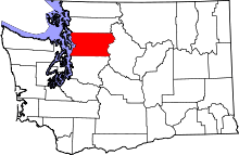 | |
| Towns | ||
| CDPs |
| |
| Other unincorporated communities | ||
| Indian reservation | ||
| Military bases | ||
| Ghost town | ||
| Footnotes | ‡This populated place also has portions in an adjacent county or counties | |
