Elm Hill Archaeological Site
|
Elm Hill Archaeological Site | |
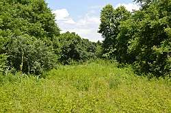 Meadow at the site | |
  | |
| Location | near Castle Heights, Virginia |
|---|---|
| Coordinates | 36°36′41″N 78°16′9″W / 36.61139°N 78.26917°WCoordinates: 36°36′41″N 78°16′9″W / 36.61139°N 78.26917°W |
| Area | 12 acres (4.9 ha) |
| NRHP reference # | 85000569[1] |
| VLR # | 058-0005 |
| Significant dates | |
| Added to NRHP | March 14, 1985 |
| Designated VLR | December 3, 1997[2] |
Elm Hill Archaeological Site is a historic archaeological site located on the north bank of the Roanoke River near Castle Heights, Mecklenburg County, Virginia. It is a large, Late Woodland period palisaded village site with evidence of occupation reaching back to the Late Archaic Period.[3] The district is included within the Tobacco Heritage Trail.
It was listed on the National Register of Historic Places in 1985.[1]
References
- 1 2 National Park Service (2010-07-09). "National Register Information System". National Register of Historic Places. National Park Service.
- ↑ "Virginia Landmarks Register". Virginia Department of Historic Resources. Retrieved 5 June 2013.
- ↑ Land Planning & Design Associates, Inc. (June 2008). "Tobacco Heritage Trail Overall Master Plan: Appendix A: Historic Resources Inventory, p. 17" (PDF). Tobacco Heritage Trail. Archived from the original (PDF) on 2013-01-24.


This article is issued from
Wikipedia.
The text is licensed under Creative Commons - Attribution - Sharealike.
Additional terms may apply for the media files.