Chandpur District
| Chandpur District চাঁদপুর জেলা | |
|---|---|
| District | |
| Nickname(s): The Gateway Of Eastern Bengal | |
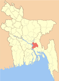 Location of Chandpur District in Bangladesh | |
| Coordinates: 23°12′50″N 90°38′10″E / 23.2139°N 90.6361°ECoordinates: 23°12′50″N 90°38′10″E / 23.2139°N 90.6361°E | |
| Country |
|
| Division | Chittagong Division |
| Parliamentary seat | 5 |
| Area | |
| • Total | 1,704.06 km2 (657.94 sq mi) |
| Population (2011 census) | |
| • Total | 2,416,018 |
| • Density | 1,400/km2 (3,700/sq mi) |
| Time zone | UTC+6 (BST) |
| Postal code | 3600 |
Chandpur (চাঁদপুর জেলা) is a district in the Chittagong Division of Bangladesh. It is a part of the Chittagong Division.[1] It was part of greater Comilla District until 1984.[2].
Demographics
The population of the district as of the 2011 census was 2,416,018.[3]
Administrative subdivisions
Upazilas
Chandpur District is divided into the following sub-districts (upazilas):[1]
Education
See also
References
- 1 2 Khan, Abul Khaer (2012). "Chandpur District". In Islam, Sirajul; Jamal, Ahmed A. Banglapedia: National Encyclopedia of Bangladesh (Second ed.). Asiatic Society of Bangladesh.
- ↑ Musa, Muhammad. Brahmanbariar Itibrittyo, Shetu Prokashoni, Brahmanbaria,1998.
- ↑ "Chandpur (District (Zila), Bangladesh) - Population, Map & Location". citypopulation.de.
| Barishal Division | 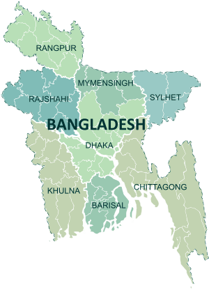 | |
|---|---|---|
| Chattagram Division | ||
| Dhaka Division | ||
| Khulna Division | ||
| Mymensingh Division | ||
| Rajshahi Division | ||
| Rangpur Division | ||
| Sylhet Division | ||
| Upazila/Thana: | ||
|---|---|---|
| Upazila/Thana: | ||
|---|---|---|

| Wikimedia Commons has media related to Chandpur District. |
| Wikivoyage has a travel guide for চাঁদপুর জেলা. |
This article is issued from
Wikipedia.
The text is licensed under Creative Commons - Attribution - Sharealike.
Additional terms may apply for the media files.