Satkania Upazila
| Satkania সাতকানিয়া | |
|---|---|
| Upazila | |
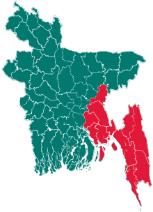
 Satkania Location in Bangladesh | |
| Coordinates: 22°06′12″N 92°04′50″E / 22.10333°N 92.08056°ECoordinates: 22°06′12″N 92°04′50″E / 22.10333°N 92.08056°E | |
| Country |
|
| Division | Chittagong Division |
| District | Chittagong District |
| Area | |
| • Total | 280.99 km2 (108.49 sq mi) |
| Population (2011)[1] | |
| • Total | 384,806 |
| • Density | 1,067/km2 (2,760/sq mi) |
| Time zone | UTC+6 (BST) |
| Post code | 4386(Satkania Post Office) |
| Website | Official Map of Satkania |
Satkania (Bengali: সাতকানিয়া) is an Upazila of Chittagong District in the Division of Chittagong, Bangladesh.With an area of 280.99 km2, is bounded by Chandanaish Upazila on the north, Lohagara Upazila on the south, Bandarban Sadar upazila on the east, Banshkhali and Anwara Upazilas on the west. Main river is Sangu,Dalu & Hangor; Main depressions are Goribarjheel, Mahalia.
Geography
Satkania has 50,656 households and total area 280.99 km².
Demographics
According to the 1991 Bangladesh census, Satkania had a population of 299,762, of whom 139,511 were aged 18 or over. Males constituted 50.1% of the population, and females 49.9%.[2]
Muslim 86.75%, Hindu 11.89%, Buddhist 1.32%, Christian and others 0.04%. all the Community co-operate each other. they observe many religious festivals across the year.
Points of interest
- Sangu River
- Katakhali Lake
- Baitul Izzat Area
- Baitarani-Shilghata Forest Area by the river Sangu
- Razar Pahar Charati
- Shahi Eid Gah of Churamani
- Charati and pukuria Belgao Tea Garden
- Amilaish Bill and Charanchal
- Mahaliya Bill(Natural Lake)
- Satyapirer darga(Baitul Ijjat)
- Forestry area of churamani
- Prantik Lake Holodia
- Thakur Dighi
- Daroga Mosque
- Jangli Pir Mazar, Kanchana
- Ahzgor Shah Ara (Mazar),Sairtali, Sonakania Union
- Al-Monsur Jame Masjid, Samader para, nazu seth barri
- Basar-Mar Pokur, samader para, nazu seth barri
- Madarsha Union play ground.
- Dowlat shah Mosjid (DowlatShah para) Alinagor
- Mirzakhil Darbar Sharif
- Sonakania Manziler Dargah
- Kazi Bari Jame Masjid, Kanchana
Administration
Satkania thana was established in 1917 and was turned into an upazila in 1983. The upazila consists of 1 Municipality, 71 Mouzas & 100 villages. 17 union parishads. The Unions are:
- Amilaish Union
- Bazalia Union
- Charati Union
- Dharmapur Union
- Dhemsa Union
- Eochia Union
- Kaliaish Union
- Kanchana Union
- Keochia Union
- Khagaria Union
- Madarsha Union
- Nalua Union
- Paschim Dhemsa Union
- Puranagar Union
- Sadaha Union
- Satkania Union
- Sonakania Union
Notable residents
- Abul Fazal, writer and former vice-chancellor of Chittagong University, was born at Keochia village in 1903.[4]
- Bimal Guha (born 1952), poet
- Shahidul Zahir (1955–2008), writer
See also
References
- ↑
- ↑ "Population Census Wing, BBS". Archived from the original on 2005-03-27. Retrieved November 10, 2006.
- ↑ http://shodhganga.inflibnet.ac.in/bitstream/10603/49832/6/06_chapter%201.pdf
- ↑ Banu, Sayeda (2012). "Fazal, Abul". In Islam, Sirajul; Jamal, Ahmed A. Banglapedia: National Encyclopedia of Bangladesh (Second ed.). Asiatic Society of Bangladesh.