Meherpur District
| Meherpur মেহেরপুর | |
|---|---|
| District | |
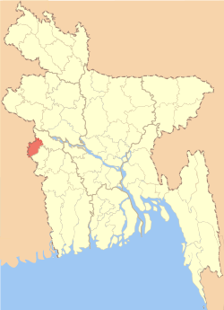 Location of Meherpur in Bangladesh | |
| Coordinates: 23°45′N 88°42′E / 23.75°N 88.70°ECoordinates: 23°45′N 88°42′E / 23.75°N 88.70°E | |
| Country |
|
| Division | Khulna Division |
| Area | |
| • Total | 716.08 km2 (276.48 sq mi) |
| Population (2011 census) | |
| • Total | 655,392 |
| • Density | 920/km2 (2,400/sq mi) |
| Demonym(s) | Meherpuri |
| Time zone | UTC+6 (BST) |
| Postal code | 7100 |
Meherpur (Bengali: মেহেরপুর জেলা, pron: meɦeɾpuɾ) is a district in South-western Bangladesh.[1]
Location
Meherpur District has an area of 716.08 sq km and its one of the smaller district in Bangladesh just after Narayanganj (683 sq km) and Jhalokati. It is bounded by Kushtia District and West Bengal of India on the north, Chuadanga District and West Bengal on the south, Chuadanga and Kushtia districts on the east, and West Bengal on the west.
History
Meherpur is a historical district of Bangladesh where the official Proclamation of the Provincial government of Bangladesh was formed and solemnly sworned in at the village Baidyanathtola, on 17 April 1971 of this district. The entire Proclamation ceremony was organized by local leaders under the supervision of Momeen Chowdhury and MM Rustom Ali. [2] The first provisional government of Bangladesh was formed here under the leadership of Tajuddin Ahmed & Syed Nazrul Islam. After that day on 18 April 1971, the Pak army killed 8 persons at village Amjhupi. Meherpur was a Sub-Division in Kushtia District and in the year 1983 (1984) it was declared as a District by Ershad Government. The Meherpur Municipality is one of the oldest Municipality in Bangladesh which was established on 1859 when Meherpur was a part of District Nadia.[1]
Literacy rate and educational institutions Average literacy 37.8%; male 39.9%, female 35.6%. Educational institutions: college 7, vocational institute 3, secondary school 60, primary school 200, madrasa 11. Noted educational institutions: Meherpur Government College (1962), Mujibnagar Degree College (1983), Gangni Degree College (1983), Meherpur Government Mohila College (1984), Gangni Mohila College (1995), Meherpur Government High School (1854), Meherpur Model High School (1859), Mujibnagar Secondary School (1937), Meherpur government girls' High School (1940), Gangni Secondary School (1945).
Main sources of income Agriculture 68.95%, non-agricultural labourer 3.24%, industry 0.87%, commerce 13.83%, transport and communication 2.21%, service 3.81%, construction 1.03%, religious service 0.14%, rent and remittance 0.59% and others 5.33%.[3]
Points of interest
- Bhatpara Neelkuthi is a ruined indigo factory built in 1778.[4]
- Mujibnagar the place where Bangladesh's first government was created.
Administration
Meherpur district is divided into three upazilas, Gangni Upazila, Meherpur Sadar Upazila and Mujibnagar Upazila.
See also
References
| Wikimedia Commons has media related to Meherpur District. |
- 1 2 Md Abu Hasan Farooque (2012). "Meherpur District". In Sirajul Islam and Ahmed A. Jamal. Banglapedia: National Encyclopedia of Bangladesh (Second ed.). Asiatic Society of Bangladesh.
- ↑ Sajahan Miah (2012). "Proclamation of Independence". In Sirajul Islam and Ahmed A. Jamal. Banglapedia: National Encyclopedia of Bangladesh (Second ed.). Asiatic Society of Bangladesh.
- ↑ "Meherpur District - Banglapedia". en.banglapedia.org. Retrieved 2018-03-24.
- ↑ Alam, M. R. (15 October 2016). "Lack of renovation puts Bhatpara Neelkuthi on verge of ruination". The Daily Observer. Dhaka.
| Upazila/Thana: | ||
|---|---|---|
| Barishal Division | 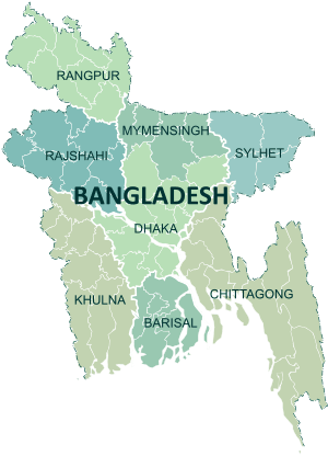 | |
|---|---|---|
| Chattagram Division | ||
| Dhaka Division | ||
| Khulna Division | ||
| Mymensingh Division | ||
| Rajshahi Division | ||
| Rangpur Division | ||
| Sylhet Division | ||