Magura District
| Magura মাগুরা | |
|---|---|
| District | |
 Location of Magura in Bangladesh | |
| Coordinates: 23°24′N 89°24′E / 23.40°N 89.40°ECoordinates: 23°24′N 89°24′E / 23.40°N 89.40°E | |
| Country |
|
| Division | Khulna Division |
| Area | |
| • Total | 1,048.61 km2 (404.87 sq mi) |
| Population (2011 census) | |
| • Total | 918,419 |
| • Density | 880/km2 (2,300/sq mi) |
| Literacy rate | |
| • Total | 50.6%[1] |
| Time zone | UTC+6 (BST) |
| Postal code | 7600 |
Magura (Bengali: মাগুরা pron:maguɾa) is a district in south-western Bangladesh. It is a part of the Khulna Division.[2] Magura is far from Dhaka by 176 kilometers. The main Transport is bus. From Magura to Dhaka it takes five hours by bus. There is no train transport in Magura.
Geography
Magura District (Khulna Division) with an area of 1048 km2, is bounded by Rajbari district to the north, Jessore and Narail districts to the south, Faridpur district to the east and Jhenaidaha district to the west.
Climate
| Climate data for Magura | |||||||||||||
|---|---|---|---|---|---|---|---|---|---|---|---|---|---|
| Month | Jan | Feb | Mar | Apr | May | Jun | Jul | Aug | Sep | Oct | Nov | Dec | Year |
| Average high °C (°F) | 23.4 (74.1) |
27.7 (81.9) |
33.3 (91.9) |
35.6 (96.1) |
34.8 (94.6) |
32.4 (90.3) |
31.4 (88.5) |
31.4 (88.5) |
32.2 (90) |
31.4 (88.5) |
28.9 (84) |
25.5 (77.9) |
30.7 (87.2) |
| Daily mean °C (°F) | 16.4 (61.5) |
20.2 (68.4) |
26.0 (78.8) |
29.2 (84.6) |
29.6 (85.3) |
28.9 (84) |
28.4 (83.1) |
28.6 (83.5) |
28.8 (83.8) |
27.3 (81.1) |
23.2 (73.8) |
18.7 (65.7) |
25.4 (77.8) |
| Average low °C (°F) | 9.4 (48.9) |
12.8 (55) |
18.7 (65.7) |
22.9 (73.2) |
24.5 (76.1) |
25.5 (77.9) |
25.5 (77.9) |
25.8 (78.4) |
25.6 (78.1) |
23.3 (73.9) |
17.5 (63.5) |
12.0 (53.6) |
20.3 (68.5) |
| Average precipitation mm (inches) | 11 (0.43) |
19 (0.75) |
40 (1.57) |
85 (3.35) |
183 (7.2) |
323 (12.72) |
302 (11.89) |
288 (11.34) |
242 (9.53) |
156 (6.14) |
25 (0.98) |
7 (0.28) |
1,681 (66.18) |
| Average relative humidity (%) | 45 | 35 | 32 | 48 | 66 | 74 | 75 | 74 | 71 | 66 | 47 | 44 | 56 |
| Source: National newspapers | |||||||||||||
Administration
Magura district has 4 upazilas. They are:
Notable residents
- Muhammad Sohrab Hossain, one of the founding fathers of Bangladesh and President of the first ever meeting in the Jessore District after the Liberation of Bangladesh.
- Farrukh Ahmed, poet
- Mohammad Lutfur Rahman, author
- Syed Ali Ahsan, poet
- Kazi Kader Newaj, poet
- Shakib Al Hasan, cricketer
- Kamrul Laila Jolly, Member of Parliament
- Gangadhar Sen Roy, Ayurveda physician and Sanskrit scholar
References
| Wikimedia Commons has media related to Magura District. |
- ↑ "Community Report: Magura" (PDF). Population & Housing Census 2011. Bangladesh Bureau of Statistics. p. 19. Retrieved 10 June 2017.
- ↑ Abu Naser Majnu (2012). "Magura District". In Sirajul Islam and Ahmed A. Jamal. Banglapedia: National Encyclopedia of Bangladesh (Second ed.). Asiatic Society of Bangladesh.
| Upazila/Thana: | ||
|---|---|---|
| Barishal Division | 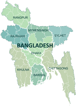 | |
|---|---|---|
| Chattagram Division | ||
| Dhaka Division | ||
| Khulna Division | ||
| Mymensingh Division | ||
| Rajshahi Division | ||
| Rangpur Division | ||
| Sylhet Division | ||
This article is issued from
Wikipedia.
The text is licensed under Creative Commons - Attribution - Sharealike.
Additional terms may apply for the media files.