Sherpur District
| Sherpur শেরপুর | |
|---|---|
| District | |
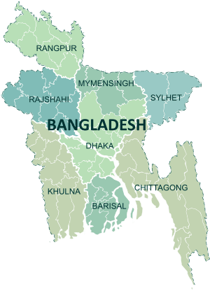
 Location of Sherpur in Bangladesh | |
| Coordinates: 25°00′N 90°00′E / 25.00°N 90.00°ECoordinates: 25°00′N 90°00′E / 25.00°N 90.00°E | |
| Country |
|
| Division | Mymensingh Division |
| Area | |
| • Total | 1,364.67 km2 (526.90 sq mi) |
| Population (BBS census 2011) | |
| • Total | 1,358,325 |
| • Density | 1,000/km2 (2,600/sq mi) |
| Demonym(s) | Sherpuri |
| Time zone | UTC+6 (BST) |
| Postal code | 2100 |
Sherpur (Bengali: শেরপুর জেলা, Sherpur Jela also Sherpur Zila) is a district in central Bangladesh. It is a part of Mymensingh Division. Sherpur district was a sub-division of Jamalpur district. It was upgraded to a district on February 22, 1984. Sherpur city is located about 198 km (123.03 mi) north of Dhaka which is the capital of the country.[1][2][3]
Geographic Area and Location
Sherpur district is bounded on the north by India, on the east by Mymensingh district, on the south and west by Jamalpur district.
Historical Events

Sherpur region was a part of the kingdom of the Kamarupa in the ancient time. During the reign of the Mughal Emperor Akbar this area was called "Dashkahania Baju". During the first part of the seventeenth century the Gazis of Bhawal occupied Dashkahania area from the descendants of Isa Khan. Doshkahania Pargana was named Sherpur after Sher Ali Gazi, the last jaghirdar of the Gazi dynasty. Fakir-Sannyasi Revolts were held against the East India Company and the local zamindars from the time of warren hastings to lord cornowalis; Tipu Shah, leader of the Fakir Movement, declared sovereignty in the area and established his capital at Gajripa. Peasant conferences were held in 1906, 1914 and 1917 at Kamarer Char of Sherpur under the leadership of Khos Muhammad Chowdhury. The communists revolted against the systems of Nankar, Tonk, Bhawali, Mahajani, Ijaradari during 1838-48 in Sherpur. In 1897 a devastating earth quack changed the course of the Brahmaputra towards the west and forced to merge it with the Jamuna; it also caused serious damages to many old buildings.
Annual Average Temperature
The annual average temperature of this district varies from maximum 33.3 °C to minimum 12 °C.The annual rainfall is 2174 mm.
Main Rivers
The Old Brahmaputra, Mrigi, Malijee, Bhogai, Chellashali and Maharashi.
Administration
- Administrator of Zila Porishod: Md. Humayun Kabir Ruman [4]
- Deputy Commissioner (DC): Dr. Mallick Anwar Hossain [5]
The district consists of 5 upazilas(sub-district), 52 unions, 458 mauzas, 695 villages, 4 paurashavas, 36 wards and 99 mahallas.The upazilas are:[6]
Points of interest
Archaeological Heritage and Relics include: Madhutila Ecopark in Nalitabari,[6] Ghagra Laskar Bari Mosque (1808),[7] Baraduari Mosque at Garhjaripar, Garh Jaripar Fort (1486-91AD),[8] Tomb of Darvish Jarip Shah, Tomb of Shah Kamal (1644 AD), Tomb of Sher Ali Gazi, Mughal Mosque at Kasba, Maisaheba Mosque, and Residences of Nay Ani, Arai Ani and Pouney Tin Ani Zamindars.
Marks of War of Liberation
Mass killing site: Ahmednagar (Jhenaihati), Jhaughara (Sherpur), Bidhaba Para (Nalitabari), Kayari Road (Jhenaigati) are the testimony of War of Liberation of this district.
Ethnic Nationals
Garo, Koch, Hajong, Banai and Rajbanshi are the ethnic nationals of this district. These ethnic nationals have their own languages.
Religious Institutions
Mosque 1904, temple 112, church 33, tomb 15, sacred place 1.
Educational Institutions
The numbers of educational institutions of this district are Government college 3, non-government college 16, government high school 3, non-government high school 146, junior high school 27, government primary school 358, non-government primary school l46, madrasah 292, agricultural training institute 1, nursing training institute 1, vocational training institute 1.
Cultural Organizations
The numbers of cultural organizations of this district are club 93, public library 4, drama stage 3, theatre group 15, literary society 5, women's organisation 30, cinema hall 13, shilpakala academy 1 and shishu academy 1.
Main Crops
Paddy, jute, wheat, mustard seed, potato, peanut, sugarcane and vegetables are the main crops of this district.
Main Fruits
Mango, jackfruit and black berry are main fruits of this district.
Health Centres
The numbers of health centers of this district are district sadar hospital 1, upazila health complex 5, health and family planning centre 52, diabetic centre 1, maternity and child welfare centre 1, tuberculosis satellite centre 1, leprosy satellite centre 1, mission hospital 1, Gana sastha centre 2, safe community programme 1, satellite clinic 17, TB clinic 1, non-government clinic 2.
Economic Situation
The economy of Sherpur is mainly agro based, although non-farm economic activities performing a substantial share in the development oriented program of the district. Out of total 335,460 holdings of the district, 60.12% holdings are farms that produce varieties of crops namely local and HYV rice, wheat, jute, mustard, potato, pulses, different kinds of vegetables, tobacco and others. Various fruits like banana, mango, black berry, coconut, betel nut, date, jackfruit, palm, jambura, bel, papaya, boroi, kamranga, ataphal etc. are grown. Fish of different varieties are abound in this district and as in other parts of the country. Varieties of fish are caught from rivers, tributary channels and creeks. The popular fresh water fishes comprise ruhi, catla, mrigel, kalbaus, chital, boal, airh, pangas, gazar, shoul, pabda, koi, shing, phali, bele, tengra etc. Besides, newly introduced exotic varieties of fishers are tilapia, nilotica, silver carp, grass carp etc. Besides crops, livestock and fishery are the main source of household income. Non-agricultural activities also play an important role in the economy of the district.
Media
Weekly Sherpur,Shamolbangla24.com, Sherpur News 24, Weekly Dashkahania, Weekly Chalti Khabar, Sahityaloka, Barshati, Ra, etc.; extinct: Biddaunnati Sadhini (1865), Weekly Biggapani (1865), Weekly Charybarta (1881), Bangasuridh (1881), Samskriti Sanjibini, fortnightly Kishore (1957–58), Monthly Daxina (1967), Probaha, Angan, Muktangan, Ganabarta, Aunnesa, Uccharan, Sancharan.
See also
References
| Wikimedia Commons has media related to Sherpur District. |
- ↑ Sherpur District Statistics 2011
- ↑ বাংলাদেশ জাতীয় তথ্য বাতায়ন
- ↑ Bangladesher Lokojo Sonskriti Gronthamala : Sherpur, Bangla Academy
- ↑ "বাংলাদেশ জাতীয় তথ্য বাতায়ন".
- ↑ http://pmis.mopa.gov.bd/pmis/Forms/dclist.php
- 1 2 AKM Reazul Hasan (2012). "Sherpur District". In Sirajul Islam and Ahmed A. Jamal. Banglapedia: National Encyclopedia of Bangladesh (Second ed.). Asiatic Society of Bangladesh.
- ↑ "Laskar Mosque in Sherpur : A unique Mughal architectural site". The New Nation. Dhaka. June 25, 2014.
- ↑ গড়জরিপার বারোদুয়ারী মসজিদ [Garajaripara 'Baraduari' mosque]. The Daily Sangram (in Bengali). Dhaka.