Lalmonirhat District
| Lalmonirhat লালমনিরহাট | |
|---|---|
| District | |
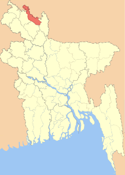 Location of Lalmonirhat in Bangladesh | |
| Coordinates: 26°00′N 89°15′E / 26.00°N 89.25°ECoordinates: 26°00′N 89°15′E / 26.00°N 89.25°E | |
| Country |
|
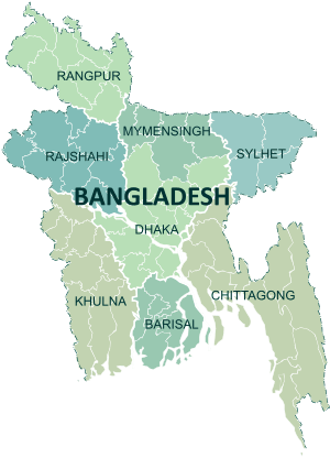
| Division | Rangpur Division |
| Area | |
| • Total | 1,247.37 km2 (481.61 sq mi) |
| Population (2011 census) | |
| • Total | 1,256,099 |
| • Density | 1,000/km2 (2,600/sq mi) |
| Time zone | UTC+6 (BST) |
| Postal code | 5500 |
Lalmonirhat (Bengali: লালমনিরহাট জেলা, Lalmonirhat Jela also Lalmonirhat Zila) is a district, situated at the northern border of Bangladesh. It is a part of the Rangpur Division.[1] Lalmonirhat includes 5 upazilas. They are Patgram, Hatibandha, Aditmari, Kaliganj and Lalmonirhat Sadar. Among them Hatibandha is largest and Aditmari is smallest. Lalmonirhat was a part of sector-6 during the liberation war. The main rivers are: Tista, Dharla, Rotnai
Education
Lalmonirhat has 27 colleges, 200 secondary schools, 597 primary schools and 269 madrasas. Lalmonirhat is one of the 7 illiteracy free districts in Bangladesh.[2]
Economy
Agriculture is the major income source. 72.78% people are farmers, 10.49% are businessmen, 3.46% are labours, 4.45% are employees.[2]
References
- ↑ Tanzimul Nayan (2012). "Lalmonirhat District". In Sirajul Islam and Ahmed A. Jamal. Banglapedia: National Encyclopedia of Bangladesh (Second ed.). Asiatic Society of Bangladesh.
- 1 2 "BBS".
External links
| Wikimedia Commons has media related to Lalmonirhat District. |
This article is issued from
Wikipedia.
The text is licensed under Creative Commons - Attribution - Sharealike.
Additional terms may apply for the media files.