Pirojpur District
| Pirojpur পিরোজপুর | |
|---|---|
| District | |
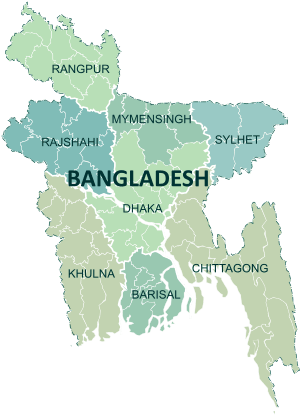
 Location of Pirojpur in Bangladesh | |
| Coordinates: 22°35′N 89°58′E / 22.58°N 89.97°ECoordinates: 22°35′N 89°58′E / 22.58°N 89.97°E | |
| Country |
|
| Division | Barisal Division |
| Area | |
| • Total | 1,399.39 km2 (540.31 sq mi) |
| Population (2011 census) | |
| • Total | 1,113,257 |
| • Density | 800/km2 (2,100/sq mi) |
| Demonym(s) | Pirojpuri, Firozpuri |
| Time zone | UTC+6 (BST) |
| Postal code | 8500 |
Pirojpur (Bengali: পিরোজপুর) is a district (zila) in south-western Bangladesh. It is part of Barisal Division.[1]
Name
According to myth, the second son of Shah Shuja, Firoz Shah, died in this area, and the area became known subsequently as 'Firozpur'. In time, the pronunciation 'Firozpur' slowly muted to 'Pirozpur'.[2]
Demographics
Pirojpur District had a population of 1,113,257 at the 2011 Census (provisional).
Geography
Most of the land is low-lying and the soil is fertile. There are small forests.
Nesarabad is known for its business centre and also for the Sundori tree (a kind of mangrove) that grows there.
Launches, steamers and boats are used for travelling on the rivers. The local port is called Hoolarhaat Launch Station (ghaat). Buses, autorickshaws and rickshaws are also used for transport.puraton bus station is one of the most popular place of this district.
Borders
Pirojpur District is bordered by Barisal and Gopalganj districts to the north, Barguna district to the south, Jhalokati and Barguna districts to the east, Bagerhat district and the Sundarban, the largest mangrove forest to the west.
Administration
The subdivision (then, a mohokooma, now a zila) of Pirojpur was created in 1866. Pirojpur district was formed in 1984 and the municipality was formed in 1886. The area of Pirojpur is 1399.39 km2. It is under Barisal Division. There are four municipalities in Pirojpur named Pirojpur, Bhandaria, Nesarabad and Mathbaria. There are seven upazilas (sub districts) in Pirojpur district: Pirojpur Sadar, Bhandaria, Mathbaria, Zianagor, Nazirpur, Sharupkathi and Kaukhali. Of these, Mathbaria is the largest (353.25 km2; it occupies 27.01% of the total area of the district). Kawkhali is the smallest (79.65 km2). It also contains 51 unions, 390 mauzas and 648 villages.
- Administrator of Zila Porishod: Mohammad Akram Hossain [3]
- Deputy Commissioner (DC): Anol Chandra Das[4]
Upazilas
Pirojpur district is divided into seven upazilas:
| Upazila | population |
|---|---|
| Bhandaria | 145233 |
| Kawkhali | 70364 |
| Mathbaria | 253915 |
| Nazirpur | 166014 |
| Nesarabad | 202520 |
| Pirojpur Sadar | 225156 |
| Zianagar | 98451 |
Rivers
Gabkhan, Baleshwar, Damodar, Kocha, Pona, Kochakhali, Kaliganga, Sandha.
The Baleshwar, the river that situated to the east of Sunder Bans splits into two parts. One is known as Doratana which flows through Bagerhat and the other and mighty one is known as Kacha which flows through Bhandaria. Then it has an offshoot Baleshwar which later meets with Doratana and falls into Kaliganga near Mativanga, Najirpur. And Kocha splits into two river Kaliganga and Sandha. Kaliganga flows to the north meets with Baleshwar and flow to further north. and Sandha flows to the east. Later Sandha coalesce with Arial Khan and falls into the Meghna
Transportation
Buses
There are two bus terminals in Pirojpur, Pirojpur Bus terminal and Pirojpur Old Bus Terminal. Many Bus company connect Pirojpur to other districts.
River port
Hularhat is the river port of Pirojpur. It is situated some 5 km east to the Pirojpur town and the river port stands on Kaligana. Beside it is the steamer wharf. Launches destined to Dhaka an other parts of the country starts from here regularly
Main sources of income
Agriculture 50.82%, non-agricultural labourer 5.75%, industry 0.78%, commerce 18.71%, transport and communication 2.16%, service 7.69%, construction 1.36%, religious service 1.61%, rent and remittance 0.95% and others 10.17%.
Religion
There are 3,934 mosques, 15 temples and two churches in the district of Pirojpur.
Agricultural products
Paddy, jute, sugar cane, wheat, guava, banana, coconut, hog-plum, betel leaf, betel nuts.
Tourist attractions

Media
- Prothom Alo (national)
- Kaler Kantho (national)
- Samakal (national)
- Dainik Janakantha (national)
- Jugantor (national)
Sports
Cricket and football are the two most popular sports in Pirojpur. Kabaddi is also popular.
Notable people
- Ahsan Habib
- Anwar Hossain Manju
- Delwar Hossain Sayeedi
- Tofazzal Hossain Manik Miah
- Jewel Aich
- Nahid Hasan Raju
- Moinul Ahsan Saber
- Nazrul Islam Khan
- Mashiur Rahman Milton
- Khalid Hasan Milu
See also
References
| Wikimedia Commons has media related to Pirojpur District. |
- ↑ Nupu, Ranjan Baksi (2012). "Pirojpur District". In Islam, Sirajul; Jamal, Ahmed A. Banglapedia: National Encyclopedia of Bangladesh (Second ed.). Asiatic Society of Bangladesh.
- ↑ "The Daily Ittefaq" (in Bengali).
- ↑ http://www.thedailystar.net/newDesign/news-details.php?nid=214399
- ↑ "10 districts get new DCs". bdnews24.com. 16 January 2012.
| Upazila/Thana: | ||
|---|---|---|