Chittagong District
| Chittagong District চট্টগ্রাম জেলা | |
|---|---|
| District | |
| Chattogram District | |
| Coordinates: 22°20′15″N 91°50′20″E / 22.3375°N 91.8389°ECoordinates: 22°20′15″N 91°50′20″E / 22.3375°N 91.8389°E | |
| Country |
|
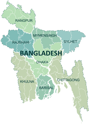
| Division | Chittagong Division |
| Area | |
| • Total | 5,282.92 km2 (2,039.75 sq mi) |
| Population (2011 census) | |
| • Total | 7,616,352 |
| • Rank | 2 |
| • Density | 1,400/km2 (3,700/sq mi) |
| Literacy rate | |
| • Total | 43.2% |
| Time zone | UTC+6 (BST) |
| Website |
chittagong |
Chittagong District , officially known as Chattogram District,[1] is a district located in the south-eastern region of Bangladesh. It is a part of the Chittagong Division. The port city of Chittagong, second largest city in Bangladesh, is located in this district.
History
Because of the natural harbour, Chittagong had been an important location for trade, drawing Arab traders as early as the 9th century CE. The region fell under the rule of kings from Arakan in the 16th and 17th centuries, but later, the Mughal Army under Shaista Khan conquered Chittagong. During the 17th century, the region also faced a lot of attacks by Portuguese pirates. The Mughals established Chittagong as a district in 1666. The Chittagong Hill Tracts were separated from Chittagong in 1860.In 1947, Chittagong came under Pakistan and became part a district of East Pakistan. Port of Chittagong was a big spot for exports and imports of Pakistan. After the liberation of Bangladesh, Cox's Bazar District was separated in 1984.[2]
Administration
Subdivisions
There are 15 upazilas[5] and 15 thanas[6] (the latter under Chittagong Municipal area) within Chittagong District.
The upazilas are:
The thanas are:
Religion
Chittagong District has 13148 mosques, 1025 Hindu temples, 535 Buddhist temples and 192 churches. Fakira Mosque in Hathazari, Musa Khan Mosque, Kura Katni Mosque, the 16th century Kala Mosques, Chhuti Khan Mosque, Kadam Mobara Mosque, Andar Killah Mosque, Bakshi Hamid Mosque of Bashkhali, and East Gomdandi Chowdhury Para Old Mosque of Boalkhali are famous mosques in Chittagong. Also Badar Awlia Dargah is a tomb in Chittagong.
Education
Colleges:
- Chittagong Cantonment Public College
- Chittagong College
- Govt. Hazi Mohammad Mohsin College
- Govt. City College
- Govt. Commerce College
- Nasirabad Govt. Woman College
- Faujdarhat Cadet College
- Chittagong Polytechnic Institute
- Chittagong Mohila Polytechnic Institute
Universities:
- Chittagong University (CU)
- Chittagong University of Engineering & Technology (CUET)
- BGC Trust University Bangladesh (BGCTUB)
- International Islamic University Chittagong (IIUC)
- Chittagong Veterinary and Animal Sciences University (CVASU)
Medical colleges
Chittagonians
- Mahbubul Alam (author)
- Mohit Ul Alam
- Ayub Bachchu
- Shyam Sundar Baishnab
- Partha Barua
- Abdul Karim Sahitya Bisharad
- Sri Chinmoy
- Mehazabien Chowdhury
- Rony Chowdhury
- Salahuddin Quader Chowdhury
- Sarat Chandra Das
- Maitreyi Devi
- Syed Gulamur Rahman Maizbhandari
- Charles John Stanley Gough
- Ehsanul Haque
- Enamul Haque (cricketer, born 1966)
- Enamul Haque (writer)
- Chandra Kalindi Roy Henriksen
- Rabiul Hoque
- Somnath Hore
- Ashraful Hossain
- Tamim Iqbal
- Mamunul Islam
- Nurul Islam (physician)
- Mirza Ahmad Ispahani
- Rubayyat Jahan
- Binoy Bashi Joldas
- Abul Kashem Khan
- Akram Khan (cricketer)
- Allauddin Khan
- Dawlat Ujir Bahram Khan
- Morshed Khan
- Dipa Ma
- Anandamayi Ma
- Abdul Mannan (educator)
- Nusrat Faria Mazhar
- Adolph Medlycott
- Minhajul Abedin
- A. B. M. Mohiuddin Chowdhury
- Moniruzzaman (Chittagong Division cricketer)
- Anagarika Munindra
- Masuma Rahman Nabila
- Wasfia Nazreen
- Nurul Abedin
- Ayub Quadri
- Mojibur Rahman
- Mihir Rakshit
- Ramesh Shil
- Tridev Roy
- Bibi Russell
- Iftekhar Sajjad
- Blanaid Salkeld
- Anupam Sen
- Nabinchandra Sen
- Surya Sen
- Jatindra Mohan Sengupta
- Pramod Ranjan Choudhury
- Nikhil Baran Sengupta
- Jiban Ghoshal
- Tarakeswar Dastidar
- Ahmed Sharif
- Lokman Khan Sherwani
- L. K. Siddiqi
- Shahidul Yousuf Sohel
- Jack Stephens (set decorator)
- Suddhananda Mahathero
- Sukomal Barua
- Pritilata Waddedar
- Yasir Ali (Bangladeshi cricketer)
- Monica Yunus
- Muhammad Yunus
- Zamor
- Rajat Sen
- Minar Rahman
See also
References
- ↑ Mahadi Al Hasnat (2 April 2018). "Mixed reactions as govt changes English spellings of 5 district names". Dhaka Tribune. Retrieved 8 April 2018.
- ↑ Mohammad Mahibbullah Siddiqi (2012). "Cox's Bazar District". In Sirajul Islam and Ahmed A. Jamal. Banglapedia: National Encyclopedia of Bangladesh (Second ed.). Asiatic Society of Bangladesh.
- ↑ "AL men appointed administrators". thedailystar.net.
- ↑ http://pmis.mopa.gov.bd/pmis/Forms/dclist.php
- ↑ Jasim Uddin Harun (2012). "Chittagong District". In Sirajul Islam and Ahmed A. Jamal. Banglapedia: National Encyclopedia of Bangladesh (Second ed.). Asiatic Society of Bangladesh.
- ↑ "Home Minister to launch 4 new thanas in Ctg tomorrow". The Financial Express. 29 May 2013.
- ↑ "Karnaphuli becomes Bangladesh's 490th Upazila". bdnews24.com. 9 May 2016.