Golapganj Upazila
| Golapganj গোলাপগঞ্জ | |
|---|---|
 | |
| Division | Sylhet Division |
| District | Sylhet District |
| Government | |
| • MP (Sylhet-6) | Nurul Islam Nahid (Awami League) |
| Area | |
| • Total | 278.34 km2 (107.47 sq mi) |
| Demonym(s) | Golapganji, Gulafgonji |
| Time zone | UTC+6 (BST) |
| Postal code | 3160 |
| Website |
golapganj |
Golapganj (Bengali: গোলাপগঞ্জ), or Golapganj, is an Upazila of Sylhet District in the Division of Sylhet, Bangladesh.[1]
Demographics
According to the census 2011, Golapganj has a population of 3,16,149. Males constitute 50.29% of the population, and females 49.71%. 48.17% of the population is age eighteen or older. Average Household size 6.23 person and population density is 1136 person per km2. Golapganj has an average literacy rate of 57.0% (7+ years), and the national average of 32.4% literate.[2]
Climate
| Climate data for Golapganj | |||||||||||||
|---|---|---|---|---|---|---|---|---|---|---|---|---|---|
| Month | Jan | Feb | Mar | Apr | May | Jun | Jul | Aug | Sep | Oct | Nov | Dec | Year |
| Average high °C (°F) | 25.1 (77.2) |
27.2 (81) |
30.8 (87.4) |
31.4 (88.5) |
31.1 (88) |
30.9 (87.6) |
31.1 (88) |
31.5 (88.7) |
31.4 (88.5) |
30.7 (87.3) |
28.9 (84) |
26.2 (79.2) |
29.7 (85.5) |
| Average low °C (°F) | 11.8 (53.2) |
13.5 (56.3) |
17.6 (63.7) |
21.0 (69.8) |
22.6 (72.7) |
24.5 (76.1) |
25.0 (77) |
25.1 (77.2) |
24.5 (76.1) |
22.2 (72) |
17.5 (63.5) |
13.3 (55.9) |
19.9 (67.8) |
| Average precipitation mm (inches) | 14 (0.55) |
31 (1.22) |
119 (4.69) |
322 (12.68) |
566 (22.28) |
752 (29.61) |
694 (27.32) |
556 (21.89) |
440 (17.32) |
231 (9.09) |
36 (1.42) |
7 (0.28) |
3,768 (148.35) |
| Source: Climate-data.org | |||||||||||||
See also
References
- ↑ Parvez, Azizul (2012). "Golapganj Upazila". In Islam, Sirajul; Jamal, Ahmed A. Banglapedia: National Encyclopedia of Bangladesh (Second ed.). Asiatic Society of Bangladesh.
- ↑ "Population Census Wing, BBS". Archived from the original on 27 March 2005. Retrieved 10 November 2006.
External links
Capital: Sylhet | ||
| Habiganj District | 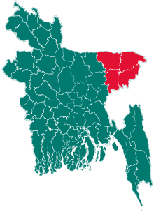 | |
| Moulvibazar District | ||
| Sunamganj District | ||
| Sylhet District | ||
This article is issued from
Wikipedia.
The text is licensed under Creative Commons - Attribution - Sharealike.
Additional terms may apply for the media files.