Chuadanga District
| Chuadanga চুয়াডাঙ্গা | |
|---|---|
| District | |
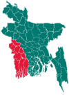
 Location of Chuadanga in Bangladesh | |
| Coordinates: 23°36′N 88°42′E / 23.60°N 88.70°ECoordinates: 23°36′N 88°42′E / 23.60°N 88.70°E | |
| Country |
|
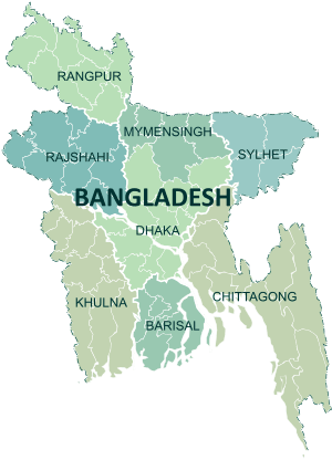
| Division | Khulna Division |
| Area | |
| • Total | 1,174.10 km2 (453.32 sq mi) |
| Population (2011 census) | |
| • Total | 1,129,015 |
| • Density | 960/km2 (2,500/sq mi) |
| Time zone | UTC+6 (BST) |
Chuadanga (Bengali: চুয়াডাঙ্গা;, pron: tʃuaɖaŋga), Chuadanga district or Chuadanga Zilla (চুয়াডাঙ্গা জেলা) is the name of a Western district (zilla) of Bangladesh. It is a part of the Khulna administrative division that covers most districts in the south-west of the country.
History
Chuadanga witnessed a number of uprisings during the British rule of India. The uprisings included Wahabi Movement (1831), Faraizi Movement(1838–47), Sepoy Rebellion (1857), Indigo Rebellion (1859–60), Khilafat Movement (1920), Swadeshi Movement (1906), Non-cooperation movement, Violation of Law and Salt Satyagraha (1920–40), Quit India Movement or August Revolt (1942).[1]
Under British rule, Chuadanga was a sub-division within Nadia District. During partition, in 1947, excepting Krishnanagar thana (still under Nadia in West Bengal). History of Chuadanga can be found in Nadia District Gazetteer during British rule.[2] During Bangladesh Liberation War of 1971, Chuadanga was the location of more than 100 battles between the Pakistan Army and the pro-independence Mukti Bahini.[1] There is a mass graveyard of the victims of the Bangladesh genocide during the Bangladesh Liberation war behind the Chuadanga Central Hospital.[1]
The district had an outbreak of bird flu and two thousand chickens were culled.[3] In April 2016, a government investigation found the building of Biological Research Centre and Lab under the Department of Agricultural Extension was being built with bombos instead of steel rods. The two story building was being constructed by Joy Construction Ltd based in Dhaka for a 24 million dollar contract.[4][5] The District has seen some Islamist attacks in the early 2000s, in April 2015, a police camp was attacked by Madrassa students and villagers after Police arrested Lakmipur Darus Sunnah Cadet Madrasa students extorting money from the highway. Five police officers and 35 attackers were injured in the attack led by Islami Chhatra Shibir activists.[6] In 8 February 2016, Sacred Heart Catholic Church was attacked by 15 armed men.[7] Bauls, traditional Bengali singers, were attacked in July 2016.[8]
Geography
Chuadanga district has an area of 1,157.42 km². It shares domestic borders with the Kushtia District on the northeast, Meherpur on the northwest,[9] and Jhenaidah on the south and southeast. On its southwest lies the Nadia District (in the state of West Bengal in India).[1] In January 2018, the district had the lowest temperature in Bangladesh.[10]

Administration
Until the Partition of India in 1947 Chuadanga sub-division was within Nadia district.
Administrator of Zila Porishod: Major (Rtd.) Alimuzzaman Zoarder[11]
Deputy Commissioner (DC): Begum Sayma Younus[12]
Subdivisions
Chuadanga district is divided into four Upazilas.
Demographics
The population of the district was 987,382 during the 2001 national survey with 50.82% male and female 49.18% compositions.[1]
Education
Notable educational institutions according to Banglapedia include the Victoria Jubilee Government High School (est. 1880), Damurhuda Pilot High School ( est. 1913 ), Alamdanga Pilot High School (est. 1914), Natudaôho High School (est. 1906), Carew's High School (1947), Gokulkhali High School (1947), Sarojgonj High School (1948), Jibonnôgor Pilot High School (1957), SSV High School (Dingadha, 1968) and Hajar Duari School.[1]
Economy
Most of this small district is dedicated to agriculture. Occupational distributions clearly show this with agriculture employing 68% of the labour force, while only 12% are involved in commerce. Total cultivable land amounts to 894.20 km², of which 57% is under some sort of irrigation.[1] Cotton is a cash crop grown in the district and in 2013, cotton was cultivated in 4149 hectares.[13]

Besides agriculture the district is now experiencing industrial growth. Major industries include Zaman Group of Industries, Bangas bread and biscuit, Tallu Spinning mills Ltd,Khatun Plastic Limited (KPL), and Carew & Company Bangladesh Limited etc. Carew & Co (Bangladesh) Ltd(1933), which is situated at Darshana of Damurhuda Upazila of Chuadanga district. Sugar cranes are cultivated in Darshana.[14] Carew & Company has a distillery also which is the lone spirit producing plant of Bangladesh, Carew & Company Bangladesh Limited is an enterprise of Bangladesh Sugar & Food Industries Corporation (BSFIC). BSFIC is an autonomous body of Ministry Of Industries.[15][16]
Transportation
Chuadanga is connected to four of its neighbouring districts (Kushtia; Jessore; Jhenidah and Meherpur) through inter-district highways and connected to Jessore and Kushtia through Railway. The district is connected to the rest of the country by three highways and railway. There are 203 km of finished road, 211 km herring-bone and 132 km mud road. Total length of railway tracks is just over 50 km that connect the three railway stations inside the district with the country's railway network. By 2013, five out of the ten stations in the district were shut down due to a lack of manpower. Some of stations were turned into markets by Bangladesh Jubo League men.[17]
See also
References
- 1 2 3 4 5 6 7 Ahmed, Rajib (2012). "Chuadanga District". In Islam, Sirajul; Jamal, Ahmed A. Banglapedia: National Encyclopedia of Bangladesh (Second ed.). Asiatic Society of Bangladesh.
- ↑ Nadia District Gazetteer.
- ↑ "Bird flu: 2,000 fowls culled". The Daily Star. 2013-02-14. Retrieved 2018-03-13.
- ↑ "Officials confirm use of bamboo in Chuadanga building". The Daily Star. 2016-04-11. Retrieved 2018-03-13.
- ↑ "Accused held over using bamboo in Chuadanga building". The Daily Star. 2016-05-06. Retrieved 2018-03-13.
- ↑ "Villagers attack police camp in Chuadanga, 40 injured". The Daily Star. 2015-04-05. Retrieved 2018-03-13.
- ↑ "Bangladesh Catholic church, convent attacked, desecrated - ucanews.com". ucanews.com. Retrieved 2018-03-13.
- ↑ "Baul singers including couple attacked in Chuadanga". bdnews24.com. Retrieved 2018-03-13.
- ↑ "Meherpur women becoming solvent by rearing black Bengal goats | Dhaka Tribune". www.dhakatribune.com. Retrieved 2018-03-13.
- ↑ "Mercury may dip further". The Daily Star. 2018-01-06. Retrieved 2018-03-13.
- ↑ "AL men appointed administrators". The Daily Star. 2011-12-16. Retrieved 2018-03-13.
- ↑ "20 districts get new DCs". The Daily Star. UNB. 11 June 2015.
- ↑ "10 districts likely to have bumper cotton output". The Daily Star. 2013-04-07. Retrieved 2018-03-13.
- ↑ "Sugarcane acreage falling on lower returns". The Daily Star. 2016-12-21. Retrieved 2018-03-13.
- ↑ Alam, Niloy. "Carew: Serving liquor since 1897". dhakatribune.com. Dhaka Tribune. Retrieved 24 December 2017.
- ↑ Siddique, Abu. "Carew: The discreet distillery". dhakatribune.com. Dhaka Tribune. Retrieved 24 December 2017.
- ↑ "Half of Chuadanga rail stations shut down". The Daily Star. 2013-08-05. Retrieved 2018-03-13.
| Wikimedia Commons has media related to Chuadanga District. |
| Upazila/Thana: | ||
|---|---|---|