Haluaghat Upazila
| Haluaghat হালুয়াঘাট | |
|---|---|
| Upazila | |
 Haluaghat Location in Bangladesh | |
| Coordinates: 25°7.5′N 90°21′E / 25.1250°N 90.350°ECoordinates: 25°7.5′N 90°21′E / 25.1250°N 90.350°E | |
| Country |
|
| Division | Mymensingh Division |
| District | Mymensingh District |
| Area | |
| • Total | 356.07 km2 (137.48 sq mi) |
| Population (1991) | |
| • Total | 242,339 |
| • Density | 680/km2 (1,800/sq mi) |
| Time zone | UTC+6 (BST) |
| Website | Official Map of Haluaghat |
Haluaghat (Bengali: হালুয়াঘাট) is an Upazila of Mymensingh District in the Division of Mymensingh, Bangladesh.[1]
Geography
Haluaghat is located at 25°07′30″N 90°21′00″E / 25.1250°N 90.3500°E . It has 49520 households and total area 356.07 km². Present voter of Haluaghat Upazila is 190570
Demographics
As of the 1991 Bangladesh census, Haluaghat has a population of 242339. Males constitute 50.68% of the population, and females 49.32%. This Upazila's eighteen up population is 122863. Haluaghat has an average literacy rate of 22.8% (7+ years), and the national average of 32.4% literate.[2]
Administration
Haluaghat has 12 Unions/Wards, 147 Mauzas/Mahallas, and 205 villages.
List of Unions:
- Bhubankura
- Jugli
- Kaichapur
- Haluaghat Sadar
- Gazirvita
- Bildora
- Shakuai
- Norail
- Dhara
- Dhurail
- Amtoil
- Swadeshi
See also
References
- ↑ Jalal Uddin Ahmed (2012), "Haluaghat Upazila", in Sirajul Islam and Ahmed A. Jamal, Banglapedia: National Encyclopedia of Bangladesh (Second ed.), Asiatic Society of Bangladesh
- ↑ "Population Census Wing, BBS". Archived from the original on 2005-03-27. Retrieved November 10, 2006.
| Upazila/Thana: | ||
|---|---|---|
Headquarters: Mymensingh | ||
| Jamalpur District | 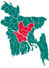 | |
| Mymensingh District | ||
| Netrokona District | ||
| Sherpur District | ||
This article is issued from
Wikipedia.
The text is licensed under Creative Commons - Attribution - Sharealike.
Additional terms may apply for the media files.