Burren (townland)
Burren is a townland in the civil parish of Templeport, County Cavan, Ireland. It lies in the Roman Catholic parish of Templeport and barony of Tullyhaw.
Geography
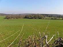
Burren is bounded on the north by Derrycassan and Coologe townlands, on the west by Killydrum and Derryniggan townlands in County Leitrim, on the south by Raleagh townland in Kildallan parish and Lugnagon townland in County Leitrim and on the east by Kiltynaskellan and Doogary townlands in Kildallan parish. Its chief geographical features are Derrycassan Lake, the Shannon–Erne Waterway and several stone quarries. Burren is traversed by a public road (which was made in 1913 by Father Peter Brady) and several rural lanes. The townland covers 944 statute acres.[1]
History
The earliest surviving mention of the townland name is in a poem (Poem 31, verse 18) composed about 1344 A.D. in the Book of Magauran which gives the name as Boireann-
Thomas's own son (Niall McGovern, Chief of the clan 1343-1362)
succeeded him in his castle as was the will of God the creator;
The heir he secured meant that he himself, Burren's Pillar, did not really die.
(Do sduaigh Bhoirne nocher bhás
An t-oighre do thuair Tomás).[2]
The 1609 Baronial Map depicts the townland as Burrin.[3][4] The 1652 Commonwealth Survey lists the townland as Burren. The 1665 Down Survey map depicts it as Burrin.[5]
In the Plantation of Ulster by grant dated 4 June 1611, along with other lands, King James I granted the two polls of Burrin to Donill Backagh McShane O'Reyly, Gentleman. The said Domhnall O'Reilly was the nephew of two chiefs of the O'Reilly clan- Aodh Connallach mac Maolmhordha who was chief from 1565–1583 and Eamonn mac Maolmhordha who was chief from 1596–1601. He was also a first cousin of Cathal O'Reilly who was simultaneously granted lands in Bellaleenan townland and of Cathaoir O'Reilly who received lands in Kildoagh townland. Domhnall O'Reilly then sold the townland to Walter Talbott, the owner of Ballyconnell who then by deed dated 11 February 1614 sold the two polls of Barrin to Sir Stephen Butler of Belturbet.
In the Hearth Money Rolls of 1662 there was one person paying the Hearth Tax in Murren- Tirlagh O'Relly.
The 1652 Commonwealth Survey lists the townland as belonging to Colonel Thomas Coote and the tenant was Philipp O'Backaghan. A further confirming grant dated 3 June 1667 from King Charles II to the aforementioned Thomas Coote, Esquire included 640 acres in Burrin at an annual rent of £8-12-9 1/2d.
In the Templeport Poll Book of 1761 there was only one person registered to vote in Burren in the Irish general election, 1761[6] - George Ellis, who lived in the townland of Bellaheady in Kildallan parish but owned a freehold in Burren and so was entitled to cast two votes. The four election candidates were Charles Coote, 1st Earl of Bellomont and Lord Newtownbutler (later Brinsley Butler, 2nd Earl of Lanesborough), both of whom were then elected Member of Parliament for Cavan County. The losing candidates were George Montgomery (MP) of Ballyconnell and Barry Maxwell, 1st Earl of Farnham. Ellis voted for Coote and Montgomery. Absence from the poll book either meant a resident did not vote or more likely was not a freeholder entitled to vote, which would mean most of the inhabitants of Burren.
The 1790 Cavan Carvaghs list spells the name as Burrin.[7]
The Tithe Applotment Books for 1827 list forty three tithepayers in the townland.[8]
In 1833 one person in Burren was registered as a keeper of weapons- Robert Hassard.[9]
The Ordnance Survey Namebooks of 1836 describe the townland as- a light soil intermixed with lime stone (which is burned and used for manure)...The whole of the North and part of the West side of the townland is bounded by a large lake.
In 1841 the population of the townland was 174, being 93 males and 81 females. There were thirty-one houses in the townland, all of which were inhabited.[10]
In 1851 the population of the townland was 173, being 79 males and 94 females, the reduction being due to the Great Famine (Ireland). There were twenty-nine houses in the townland, all of which were inhabited.[11]
Griffith's Valuation of 1857 lists thirty seven landholders in the townland.[12]
In 1861 the population of the townland was 168, being 86 males and 82 females. There were thirty-three houses in the townland, one of which was uninhabited.[13]
In 1871 the population of the townland was 155, being 72 males and 83 females. There were thirty houses in the townland, all were inhabited.[14]
In 1881 the population of the townland was 186, being 86 males and 100 females. There were thirty houses in the townland, all were inhabited.[15]
In 1891 the population of the townland was 133, being 67 males and 66 females. There were twenty-seven houses in the townland, of which two were uninhabited.[16]
In the 1901 census of Ireland, there are thirty six families listed in the townland.[17]
In the 1911 census of Ireland, there are thirty two families listed in the townland.[18]
Antiquities
The chief structures of historical interest in the townland are two earthen ringforts.[19] In fort number 273 there are the remains of a limekiln and, according to local tradition, a spa.
References
- ↑ "IreAtlas". Retrieved 29 February 2012.
- ↑ L. McKenna (1947), The Book of Magauran
- ↑ National Archives Dublin
- ↑
- ↑ Trinity College Dublin: The Down Survey of Ireland.
- ↑
- ↑
- ↑ and Tithe Applotment Books 1827
- ↑
- ↑
- ↑
- ↑ - Burren
- ↑
- ↑
- ↑
- ↑
- ↑ Census of Ireland 1901
- ↑ Census of Ireland 1911
- ↑ Site numbers 272 and 273 in “Archaeological Inventory of County Cavan”, Patrick O’Donovan, 1995
