Porturlan

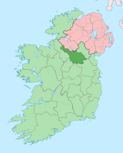
Porturlan (from Irish: either Port Úrlainn meaning 'Bank or Landing Place of the Spear-shaft' or Port Turlainn meaning "Port of the Beach" or Port na Leath Inse meaning the 'Landing Place of the Half-Island or Peninsula' or Port-na-h-Urlaidhe-h-Innsi meaning "The slaughter-bank of the island") (Likeliest meaning is the departure beach for St. Mogue's Island in Templeport Lough) is a townland in the civil parish of Templeport, County Cavan, Ireland. It lies in the Roman Catholic parish of Templeport and barony of Tullyhaw.
Geography
Porturlan is bounded on the north by Ray, Templeport townland, on the west by Killymoriarty and Killywillin townlands, on the south by Derryragh townland and on the east by Camagh and Rosehill, Templeport townlands. Its chief geographical features are a spring well and pasturelands. Porturlan is traversed by the regional R205 road (Ireland), minor roads and rural lanes.
The townland covers 68 statute acres.[1]
History
In medieval times Porturlan stretched northward up to Templeport Lough and included the modern townland of Ray, together with other subdivisions called Killcroghan (from Irish: either Cill Cruachán or Coill Cruachán meaning 'The Wood of the Round Hill' or "The Church of the Round Hill") and Alico.
The 1609 Baronial Map depicts the townland as Kilcrooghan.[2] [3]
The 1652 Commonwealth Survey lists it as Killecrooghan.
The 1665 Down Survey map depicts it as Killerachan.[4]
William Petty's 1685 map depicts it as Killraran.
In the Plantation of Ulster by grant dated 29 April 1611, along with other lands, King James VI and I granted the two polls of Killcroghan and one poll of Porturilinchy to the McGovern Chief, Phelim Magawran, but it is probable that the lands had been in the possession of the McGovern clan for several hundred years before this and it was just a Surrender and regrant confirming the existing title to the McGoverns.
An Inquisition of King Charles I of England held in Cavan town on 4 October 1626 stated that the aforesaid Phelim Magawrane died on 20 January 1622 and his lands, including two polls of Kilcroghan and one poll of Portnerilinchy, went to his son Brian who was aged 30 (born 1592) and married.
The McGovern lands in Porturlan were confiscated in the Cromwellian Act for the Settlement of Ireland 1652 and were distributed as follows-
The 1652 Commonwealth Survey lists the proprietor of Killecrooghan as John Boyd.
In the Hearth Money Rolls of 1662 there were two people paying the Hearth Tax in Killecrohean- John Bride and Robert Grige.
A grant dated 30 January 1668 was made from King Charles II of England to Mary Boyd for the 34 acres and 6 perches in the parts of ye cartron of Kilcrohan at an annual rent of nine shillings and twopence farthing. A grant dated 30 January 1668 was made from King Charles II of England to William Chambers for 20 acres 2 roods and 27 perches in Porturlan alias Killcroghan at an annual rent of fourteen shillings and sixpence. A grant dated 9 September 1669 was made from King Charles II of England to Arthur Annesley, 1st Earl of Anglesey, for 27 acres in the south part of Killerachan at an annual rent of seven shillings and threepence halfpenny and for 17 acres and 3 perches in the northwest part of Killerachan at an annual rent of four shillings and seven pence.
The 1790 Cavan Carvaghs list spells the name as Porturlin.[5]
The Tithe Applotment Books for 1827 list seven tithepayers in the townland.[6]
In the early 1800s a Sunday school was kept in the townland, funded by the Hibernian Sunday School Society. In June 1819 it had an attendance of 100 scholars.[7]
A rental with a list of tenants of the Thornton estate in Porturlan dated 1843 is held in The County Cavan Archives (ref P016/005)
In 1841 the population of the townland was 13, being 7 males and 6 females. There were three houses in the townland, all were inhabited.[8]
In 1851 the population of the townland was 16, being 9 males and 7 females. There were five houses in the townland, of which one was in the course of erection.[9]
Griffith's Valuation of 1857 lists five landholders in the townland.[10]
In 1861 the population of the townland was 31, being 18 males and 13 females. There were seven houses in the townland and all were inhabited.[11]
In 1871 the population of the townland was 32, being 18 males and 14 females. There were six houses in the townland, of which one was uninhabited.(page 296 of census)[12]
In 1881 the population of the townland was 24, being 13 males and 11 females. There were five houses in the townland, all were inhabited.[13]
In 1891 the population of the townland was 32, being 16 males and 16 females. There were five houses in the townland, all were inhabited.[14]
In the 1901 census of Ireland, there are seven families listed in the townland,[15] and in the 1911 census of Ireland, there are only six families listed in the townland.[16]
Porturlan School
The book Bawnboy and Templeport History Heritage Folklore by Chris Maguire gives the following description of the school-
Porturlan National School. Built 1890. Principal Teachers- Michael Heery (1899- ); James Wrynn (circa 1926); Patrick Kelly ( ); Mr. Fleming (-1937-); Mrs. E. Tiernan (1937-'50); Séamus Maguire (1950-'54); Máirtín McGowan (1954-'68). Assistants Teachers- Kate Beatty; Rose Maguire; Nuala Waldron; Lily Flanagan; Margaret Mulligan; Betty Reynolds. Porturlan school closed 1st October 1968 and pupils transferred to Corran school.
Antiquities
There don't seem to be any structures of historical interest in the townland apart from a limekiln.
References
External links
