Curraghabweehan
Curraghabweehan (from Irish: Currach an Bhuíochain, meaning "Moor of the Muddy Yellow Place") is a townland in the civil parish of Templeport, County Cavan, Ireland. It lies in the Roman Catholic parish of Corlough and barony of Tullyhaw.[1]
Geography
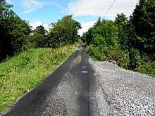
Curraghabweehan is bounded on the west by Corraclassy townland, on the south by Garvary (Corlough) townland, on the north by Drumbeagh townland and on the east by Derryvahan townland. Its chief geographical features are the Owensallagh river (A source of the River Blackwater, County Cavan) and dug wells. Curraghabweehan is traversed by minor public roads and rural lanes. The townland covers 55 statute acres.[2]
History
The 1652 Commonwealth Survey lists the name as Curraghabeghan and lists the proprietor as Lieutenant-Colonel Tristram Beresford. By grant dated 11 September 1670 from King Charles II of England to aforesaid Sir Tristram Beresford, 1st Baronet, the lands of Curraghbegan were included in the creation of a new Manor of Beresford.
The 1790 Cavan Carvaghs list spells the name as Curraghbuhan.[3]
An 1813 map depicts the townland as Curraghboghan and Curraghoghan.
The Tithe Applotment Books for 1827 list seven tithepayers in the townland.[4]
The 1836 Ordnance Survey Namebooks describe the townland as- The soil is of a clayey nature...The townland is bounded on the north side by a large stream.
In 1841 the population of the townland was 32, being 15 males and 17 females. There were seven houses in the townland, all of which were inhabited.[5]
In 1851 the population of the townland was 26, being 12 males and 14 females, the reduction being due to the Great Famine (Ireland). There were six houses in the townland, all were inhabited.[6]
Griffith's Valuation of 1857 lists five landholders in the townland.[7]
In 1861 the population of the townland was 25, being 11 males and 14 females. There were five houses in the townland and all were inhabited.[8]
In the 1901 census of Ireland, there are three families listed in the townland, [9] and in the 1911 census of Ireland, there are three families listed in the townland.[10]
Antiquities
- Stepping Stones across the river
