Moher
Moher is a townland in the Parish of Tomregan, Barony of Tullyhaw, County Cavan, Ireland.
Etymology
The townland name is an anglicisation of the Gaelic placename "Mothar" which means ‘A cluster of trees’. In the 17th century it formed part of Carrowmore townland.
Geography
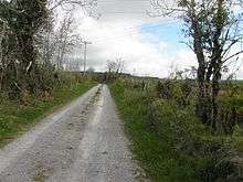
It is bounded on the north by Sralahan townland, on the east by Mullanacre Lower townland, on the south by Bofealan townland and on the west by Clontycarnaghan townland. Its chief geographical features are the Crooked River (Ireland) and Slieve Rushen mountain, on whose southern slope it lies, reaching an altitude of 600 feet above sea-level. The townland is traversed by the N87 road (Ireland), the Bawnboy Road and other minor lanes. The townland covers an area of 218 statute acres.
History
It formed part of the Manor of Calva which was granted to Walter Talbot in 1610 as part of the Plantation of Ulster.
The Tithe Applotment Books for 1827 list the following tithepayers in the townland- McCanly, Reilly, Gaffney, Griffith, McGauran, Henderson, Curry.[1]
The Ordnance Survey Name Books for 1836 give the following description of the townland- Mothar, 'a cluster of trees'. Property of Montgomery. 45 acres of bog and mountain pasture. Gravelly soil on limestone. Old and new roads to Ballyconnell. Produces oats, flax and potatoes.
The 1841 Census of Ireland gives a population of 96 in Moher, of which 46 were males and 50 were females, with 21 houses, of which 1 was uninhabited.
The 1851 Census of Ireland gives a population of 73, a decrease of 26 on the 1841 figure, due to the intervening Irish Famine of 1845–47, of which 39 were males and 34 were females, with 16 houses. The decrease was larger in the female population.
Griffiths Valuation of 1857 lists the following tenants in the townland- Baxter, Henderson, Kelliher, Kellett, McGovern, Murray, Reilly, Rudden.[2]
In 1861 the population of the townland was 59, being 35 males and 24 females. There were twelve houses in the townland, all were inhabited.[3]
In 1871 the population of the townland was 47, being 29 males and 18 females. There were ten houses in the townland, all were inhabited (page 297 of census).[4]
In 1881 the population of the townland was 42, being 19 males and 23 females. There were eleven houses in the townland, all were inhabited.[5]
In 1891 the population of the townland was 41, being 17 males and 24 females. There were nine houses in the townland, all were inhabited.[6]
In the 1901 census of Ireland, there are thirteen families listed in the townland.[7]
In the 1911 census of Ireland, there are nine families listed in the townland.[8]
Antiquities
There are no known historic sites in the townland.
References
External links