Agharaskilly
| Agharaskilly | |
|---|---|
| transcription(s) | |
| • Derivation: | Uncertain |
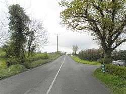 Agharaskilly townland, Ballyconnell, county Cavan, Ireland. looking east south-east. | |
 Agharaskilly Agharaskilly shown within Ireland | |
| Coordinates: 54°06′00″N 7°35′32″W / 54.100036°N 7.592187°WCoordinates: 54°06′00″N 7°35′32″W / 54.100036°N 7.592187°W | |
| Country | Ireland |
| County | County Cavan |
| Barony | Loughtee Lower |
| Civil parish | Tomregan |
| Area | |
| • Total | 220 ha (550 acres) |
Agharaskilly (from Irish: Achadh Ros Cille, meaning "Field of the Church's Wood") is a townland in the civil parish of Tomregan, County Cavan, Ireland. It lies within the former barony of Loughtee Lower.[1]
Etymology
The derivation of Agharaskilly is uncertain but the likeliest explanation is that it is an Anglicization of the Irish placename Achadh Ros Cille meaning the Field of the Church's Wood, as the land belonged to Tomregan Church and was wooded. It has also been suggested that it may come from an anglicisation of the Irish placename Achadh chroise coille meaning "field of the cross of the wood"[1] or Achadh Ros Choille which means "Field of the Grove of Trees". Alternative meanings which have been suggested are "Cattlefield of the Cross of the Church", "Field of the Boar's Wood" and "Field of the Crossroads in the Wood". The local pronunciation is Awr-sa-cullia.
The earliest surviving mention of the townland is in a grant dated 10 August 1607 from King James I to Sir Garret Moore, 1st Viscount Moore of Mellifont where it is spelled Aghcrossekille. On the 1609 Plantation of Ulster map of the barony of Loughtee, it is spelt Reskellew.[2] A 1627 grant spells it as Aghocrossekeillie.[3] The 1641 Rebellion Depositions spell it variously as Aghroskilly, Agheraskilly and Aighroskillow.[4] The 1652 Commonwealth Survey spells it as Aghowraskillow. The will of Terence Donocky dated 1735 spells it as Augharaskillane. A deed dated 1767 spells it as Agharisakella and Agharassakella.[5]
Geography
A sub-division of the townland is Derryliffe which is an anglicisation of the Gaelic placename Doire Life, meaning "The Oak-Wood of Liffey".
Agharaskilly is bounded on the north by Cullyleenan townland, on the east by Cavanagh (townland) and Mullaghduff townland, on the south by Cloncollow, Slievebrickan, Fartrin and Killarah townlands and on the west by Cormeen and Lecharrownahone townlands.
Its chief geographical features are the Shannon–Erne Waterway, which flows north along the western boundary of the townland, and several small drumlin hills reaching to 200 feet (61 m) above sea-level.[6] Agharaskilly is traversed by the Killeshandra road and some minor lanes. The townland covers 550 acres (2.2 km2),[7] including 8 acres (32,000 m2) of water.[6]
History
In the aforementioned grant dated 10 August 1607 from King James I to Sir Garret Moore, 1st Viscount Moore of Mellifont, the townland was described as the farm, termon or hospital of Aghcrossekille containing 2 polls at an annual rent of 6 ½ shillings. The two polls now form the two modern townlands of Agharaskilly and Fartrin.
On the death of Thomas Moigne, the Church of Ireland Bishop of Kilmore, on 1 January 1629, Sir Edward Bagshawe of Finglas—County Dublin owner of the Manor of Castle Bagshawe, Belturbet—took adverse possession of Agharaskilly. William Bedell, who succeeded Moigne as Bishop of Kilmore disputed this act of Bagshaw’s. Bedell petitioned Lord Viscount Falkland, the Lord Deputy of Ireland in August 1629 as follows:
- "Sir Edward Bagshaw, Knight, since the death of the late bishop, in the vacancy of the said sees hath entered upon two poles of land called Agarosikilly, parcel of the Termon of the see of Kilmore, whereof your petitioner's predecessor died seised. Your Petitioner humbly prayeth that he may be restored to the possession of the said lands enjoyed by his predecessor, and kept in the same, till the said Sir Edward Bagshaw shall show reason to the contrary to this Board."[8]
On 28 May 1654 Sir Edward Bagshaw gave the townland to his daughter Anne as part of her dowry on her marriage to Thomas Richardson of Dublin, son of John Richardson, bishop of Ardagh. By a deed dated 30 April 1661 Thomas Richardson granted Aghacrossikilley alias Aghacrussacully to Captain Thomas Gwyllym, the landlord of Ballyconnell and has been part of the Ballyconnell estate since.[9]
The 1641 Rebellion Depositions give the names of Irish rebels living in Agharaskilly as: Conor Realy of Aighroskillow in the parish of kildallen gentleman, Torlough Manahan Rely of same gentleman, Edmond Rely of same gentleman, Owen Rely of same gentleman, Hugh Rely of same gentleman, Cahyre Rely of same gentleman, Phillip Rely of same gentleman, Bryan Rely of same gentleman.[10] On 19 September 1643, James Gardiner of Aghabane gave the following deposition about the Irish Rebellion of 1641 in Cavan- James Gardiner late of Taghabane in the parrish of Kildallan in the County of Cavan, gent and tanner, sworne and examined sayth that in the begining of the present Rebellion he this deponent at Taghabane aforesaid and alsoe at Correnery in the Parrish of Killasandra & County of Cavan was deprived robbed or otherwise dispoyled of his goodes & chattells consisting of horses, Mares a Coult beasts, Cattle, sheepe, corne, Malt, howshold goods provition, his stock in his tannhowse in Killisandra & of the possession Rents and proffitts of 2 farmes. All of the value & to his present losse of five hundred & twenty powndes sterling. And this deponent is like to be deprived of and lose the future profits of his said farmes (worth £20 per annum) until a peace be established: And further saith that the persons that so deprived & despoiled him of his said goods were actors in the present Rebellion and are named as followeth vizt.- Connor O’Rely of Aghroskilly in the same County gentleman, John mcMulmore Rely of Killicrannah in the same County, gent, Gillernew McGaverran of Talloghagh, gente, and Charles Mc Gaverran of the same, gent, Keire O’Rourke of - in the County of Leitrim, gent, Myles O’Rely then high sherriff of the said County of Cavan, Ferrall mc Call O’Rely of Cashell in the same County of Cavan, gent, & divers others whose names he knows not, being their souldjers, Complicees and assistants.[11]
The Tithe Applotment Books for 1827 list the following tithepayers in the townland- Reilly, Kernan, Donahey, Fitzpatrick, McKernan, Benison, Taylor, Browne, Jones, Hurdey, Cox.[12]
The Ordnance Survey Name Books for 1836 give the following description of the townland- Achadh chroise coille, 'field of the cross of the wood'. It sits in the west of the parish. The property of Montgomery Esq. The land agent is Mr. Whitely of Ballyconnell. The property is in care of the Chancery Court. The land is held by a lease of lives or for 21 years. The rent per arable acre is 16 shillings to 21 shillings. It is then sublet at rents of 30 shillings to 38 shillings per arable acre. The county cess rate is 2s/6d per acre. The tithe is 9d an acre. The soil is light and produces oats, rye and potatoes. The houses are mostly of stone. The inhabitants are farmers and comfortable.
In 1841 the population of the townland was 95, being 45 males and 50 females. There were nineteen houses in the townland, all were inhabited.[13]
In 1851 the population of the townland was 103, being 53 males and 50 females. There were twenty houses in the townland, one of which was uninhabited.[14]
Griffith's Valuation of 1857 lists the landlords of the townland as representatives of William Enery: Seaton, McAdam, Donohoe, Cox and Jones and the tenants as Benson: Enery, Kiernan, Reilly, Fitzpatrick, McAdam, Donohoe, Cox, Hunt, Flanagan, Maguire, Kane, Reilly, Gregory, Latimer and Jones.[15]
In 1861 the population of the townland was 89, being 41 males and 48 females. There were nineteen houses in the townland, of which one was uninhabited.[16]
In 1871 the population of the townland was 90, being 43 males and 47 females. There were eighteen houses in the townland, of which one was uninhabited (page 278 of census).[17]
In 1881 the population of the townland was 84, being 46 males and 38 females. There were seventeen houses in the townland, all were inhabited.[18]
In 1891 the population of the townland was 68, being 38 males and 30 females. There were seventeen houses in the townland, of which two were uninhabited.[19]
In the 1901 census of Ireland, there are twenty-one families listed in the townland.[20]
In the 1911 census of Ireland, there are nineteen families listed in the townland.[21]
In the Dúchas Schools' Collection at [22] is a description of Agharaskilly in 1938 by James Reilly and another one by Philip Fitzsimons at [23].
Antiquities
The only historic site in the townland is a medieval ringfort situate in the south-east corner near the boundary with Cavanagh.[24]
References
- 1 2 "Placenames Database of Ireland". Retrieved 29 February 2012.
- ↑
- ↑
- ↑
- ↑
- 1 2 Ordnance Survey of Ireland maps
- ↑ "IreAtlas". Retrieved 29 February 2012.
- ↑ "Memoir of the Life of Bishop Bedell" by Alexander Clogy, page 40
- ↑ "The Plantation in Ulster" by George Hill
- ↑ Trinity College Dublin - 1641 Depositions
- ↑
- ↑ Tithe Applotment Books 1827
- ↑
- ↑
- ↑ Griffith’s Valuation 1857 - Agharaskilly
- ↑
- ↑
- ↑
- ↑
- ↑ Census of Ireland 1901
- ↑ Census of Ireland 1911 - Agharaskilly
- ↑
- ↑
- ↑ Site number 201, Agharaskilly townland, page 39 in Archaeological Inventory of County Cavan, Patrick O’Donovan, 1995.
