Derrynacreeve
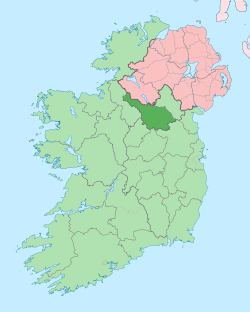
Derrynacreeve (from Irish: Doire na Criadh meaning – The Oakwood of the Clay or Doire na Craoibhe meaning – The Oakwood of the Large Branching Tree) is a townland in the civil parish of Templeport, County Cavan, Ireland. It lies in the Roman Catholic parish of Corlough and barony of Tullyhaw.
Geography
Derrynacreeve is bounded on the north by Drumcanon and Drumcar townlands, on the south by Tawnagh townland, on the west by Derryvahan townland and on the east by Gortullaghan and Dunglave townlands. Its chief geographical features are the Owensallagh river (A source of the River Blackwater, County Cavan), a stream, forestry plantations and dug wells. Derrynacreeve is traversed by the R202 road (Ireland), the R200 road (Ireland), the N87 road (Ireland) and rural lanes. The townland covers 122 statute acres.[1]
History
The 1652 Commonwealth Survey lists the townland as Dirrenacrew and the proprietor as Lieutenant-Colonel Tristram Beresford.
The Hearth Money Rolls of 29 September 1663 list one taxpayer in the townland- Edmond McGawran of Dirincre.
A map of the townland drawn in 1813 is in the National Archives of Ireland, Beresford Estate Maps, depicts the townland as Derrynacreeve.[2]
The Tithe Applotment Books for 1827 list five tithepayers in the townland. [3][4]
The 1836 Ordnance Survey Namebooks state- The soil inclines to clay...a river likewise bounds it on the north.
In 1841 the population of the townland was 60, being 29 males and 31 females. There were eleven houses in the townland, of which two were uninhabited.[5]
In 1851 the population of the townland was 45, being 19 males and 26 females, the reduction being due to the Great Famine (Ireland). There were nine houses in the townland, all were inhabited.[6]
Griffith's Valuation of 1857 lists nine landholders in the townland.[7]
In 1861 the population of the townland was 54, being 23 males and 31 females. There were eight houses in the townland and all were inhabited.[8]
In the 1901 census of Ireland, there are twelve families listed in the townland,[9] and in the 1911 census of Ireland, there are thirteen families listed in the townland.[10]
Antiquities
- A ford
- Stepping Stones across the stream
References
- ↑ "IreAtlas". Retrieved 29 February 2012.
- ↑ "Search Results - tullyhaw". catalogue.nli.ie. Retrieved 2018-02-19.
- ↑ "The Tithe Applotment Books, 1823-37". titheapplotmentbooks.nationalarchives.ie. Retrieved 2018-02-19.
- ↑ "The Tithe Applotment Books, 1823-37". titheapplotmentbooks.nationalarchives.ie. Retrieved 2018-02-19.
- ↑
- ↑
- ↑ "Griffith's Valuation". www.askaboutireland.ie. Retrieved 2018-02-19.
- ↑
- ↑ "National Archives: Census of Ireland 1901". www.census.nationalarchives.ie. Retrieved 2018-02-19.
- ↑ "National Archives: Census of Ireland 1911". www.census.nationalarchives.ie. Retrieved 2018-02-19.
