Derryvella (Corlough)
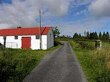
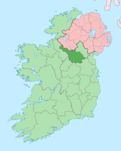
Derryvella (from Irish: Doire an Bhile meaning – The Oakwood of the Ancient Tree) is a townland in the civil parish of Templeport, County Cavan, Ireland. It lies in the Roman Catholic parish of Corlough and barony of Tullyhaw.

Geography
Derryvella is bounded on the north by Gubnagree townland, on the west by Corracholia Beg and Clarbally townlands and on the east by Derrynaslieve and Tonlegee townlands. Its chief geographical features are a stream, a spring well and dug wells. Derryvella is traversed by minor public roads and rural lanes. The townland covers 113 statute acres.[1]
History
The 1652 Commonwealth Survey lists the townland as Dirrevily and the proprietor as Lieutenant-Colonel Tristram Beresford.
Deeds, tenant lists etc. relating to Derryvella from 1650 onwards are available at-
The 1790 Cavan Carvaghs list spells the name as Dirryvilla.[2]
A map of the townland drawn in 1813 is in the National Archives of Ireland, Beresford Estate Maps, depicts the townland as Derryvullagh Bog.[3]
The Tithe Applotment Books for 1827 list twenty-five tithepayers in the townland.[4]
In 1841 the population of the townland was 41, being 19 males and 22 females. There were six houses in the townland, all of which were inhabited.[5]
In 1851 the population of the townland was 44, being 19 males and 25 females. There were six houses in the townland, all were inhabited.[6]
Griffith's Valuation of 1857 lists six landholders in the townland.[7]
In 1861 the population of the townland was 24, being 12 males and 12 females. There were four houses in the townland and all were inhabited.[8]
In the 1901 census of Ireland, there are five families listed in the townland, [9] and in the 1911 census of Ireland, there are four families listed in the townland.[10]
A 1930s folklore store about the Banshee in Derryvella is available at-[11]
Antiquities
There are no known antiquities in the townland
References
- ↑ "IreAtlas". Retrieved 29 February 2012.
- ↑
- ↑ "Search Results - tullyhaw". catalogue.nli.ie.
- ↑ and and
- ↑
- ↑
- ↑ "Griffith's Valuation". www.askaboutireland.ie.
- ↑
- ↑ "National Archives: Census of Ireland 1901". www.census.nationalarchives.ie.
- ↑ "National Archives: Census of Ireland 1911". www.census.nationalarchives.ie.
- ↑ "Tullybrack - The Schools' Collection". dúchas.ie.
